-
 Duration
13 Days
Duration
13 Days
-
 Difficulty
Easy to Moderate
Difficulty
Easy to Moderate
-
 Max Elevation
3800m
Max Elevation
3800m
-
 Group Size
1 to 10 People Person
Group Size
1 to 10 People Person
-
 Accommodation
Teahouse/Lodge
Accommodation
Teahouse/Lodge
-
 Start/End
Kathmandu Airport/Kathmandu
Start/End
Kathmandu Airport/Kathmandu
-
 Destination
Annapurna Region
Destination
Annapurna Region
-
 Best Season
March-May and Sep-Nov
Best Season
March-May and Sep-Nov
The Jomsom Muktinath Trek is one of the most interesting classic routes in Nepal because it brings together two very different trekking experiences in a single journey.
The first part of the route feels like a traditional Annapurna foothills trek, with forest trails, village walking, stone steps, and the wide mountain views of Poon Hill.
Whereas, the second part follows the Kali Gandaki valley into the dry, landscape of Mustang, where the scenery becomes more open.
Moreover, the villages feel older and more distinct, and the cultural atmosphere changes noticeably as you move north toward Muktinath.
This is also a combination of sprituality and trekking in the same journey through the Himalayan villages.
What makes this trek appealing is the variety it offers in a relatively short time.
You begin in Kathmandu, travel to Pokhara, and then enter the trail through Nayapul and Tikhedhunga before climbing to Ghorepani.
This early section gives the trek a familiar Annapurna rhythm and helps you adapt to trekking life faster.
You walk through farmland, terraced hillsides, rhododendron forest, and busy mountain villages where daily life continues alongside the trekking route.
It is a good way to begin because the walking feels progressive rather than sudden, and the scenery changes in a way that keeps the trek engaging from the start.
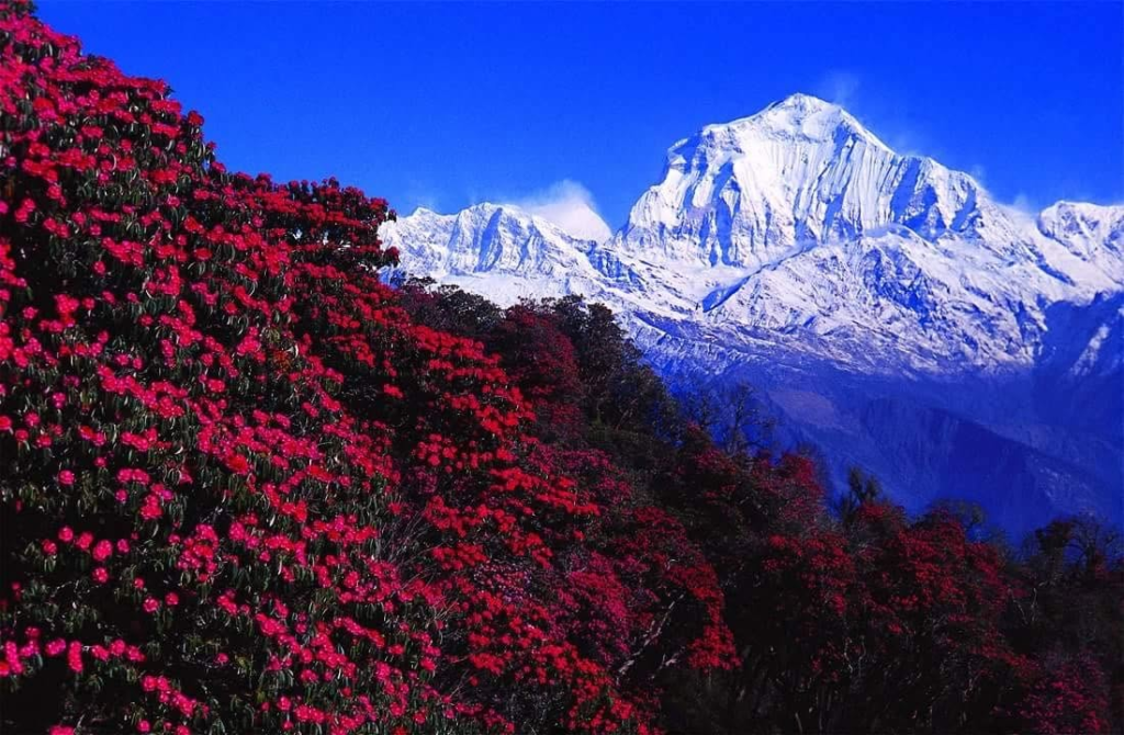
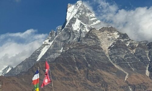
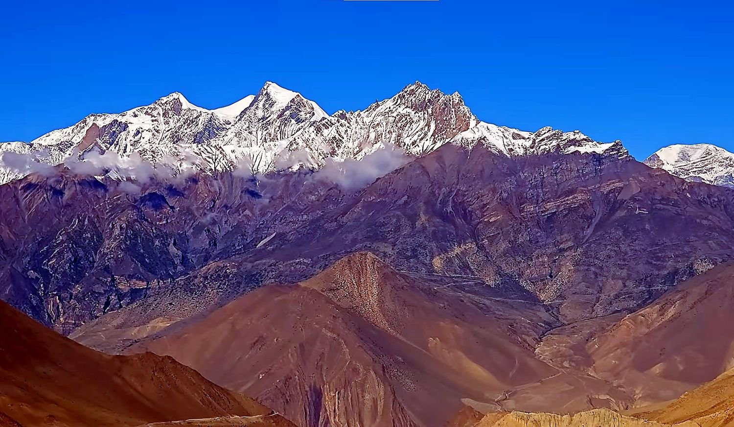
Ghorepani and Poon Hill remain one of the major highlights of the route. The early morning hike to Poon Hill gives you a wide sunrise view over Dhaulagiri, Annapurna South, Hiunchuli, Machhapuchhre, and Nilgiri.
Even though many trekkers know Poon Hill as a classic viewpoint, it still feels special because the mountain panorama is broad and easy to appreciate.
This Jomsom Muktinath trek not just a single peak view. It is a full Himalayan scene that opens up in front of you before the day begins.
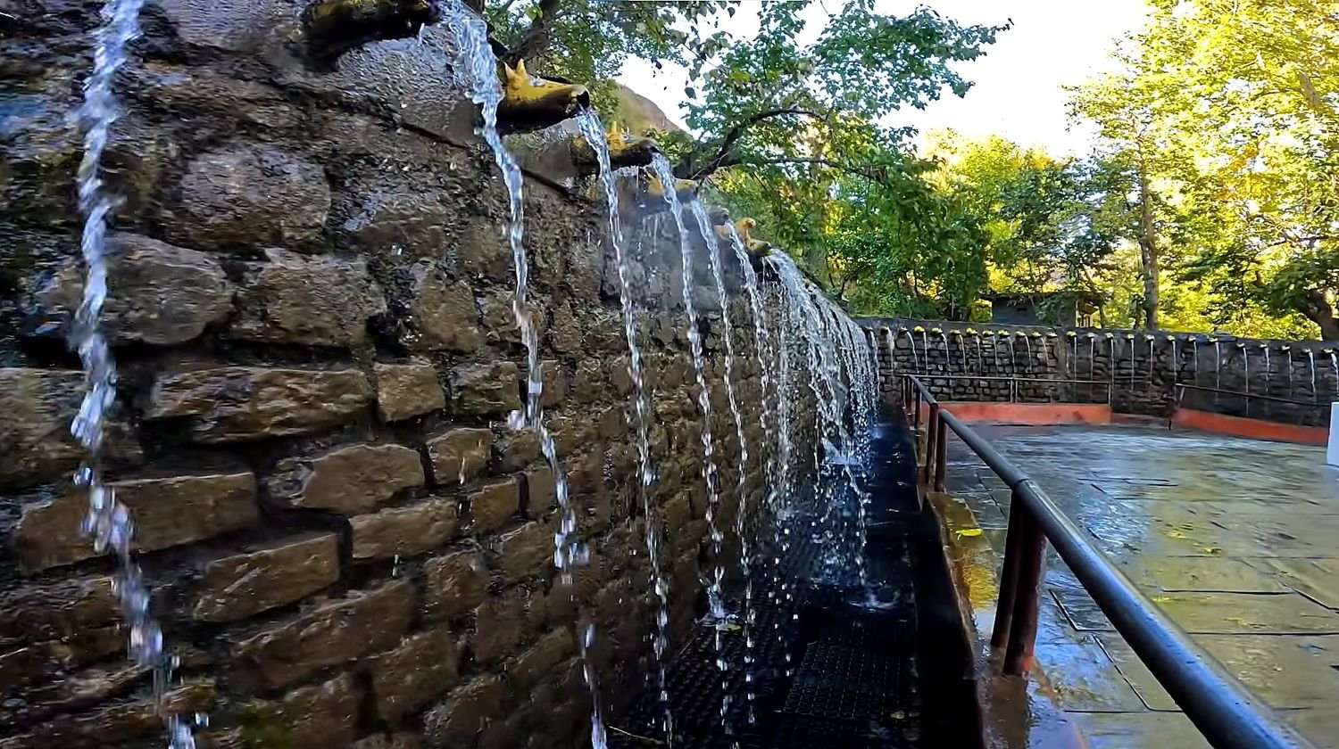
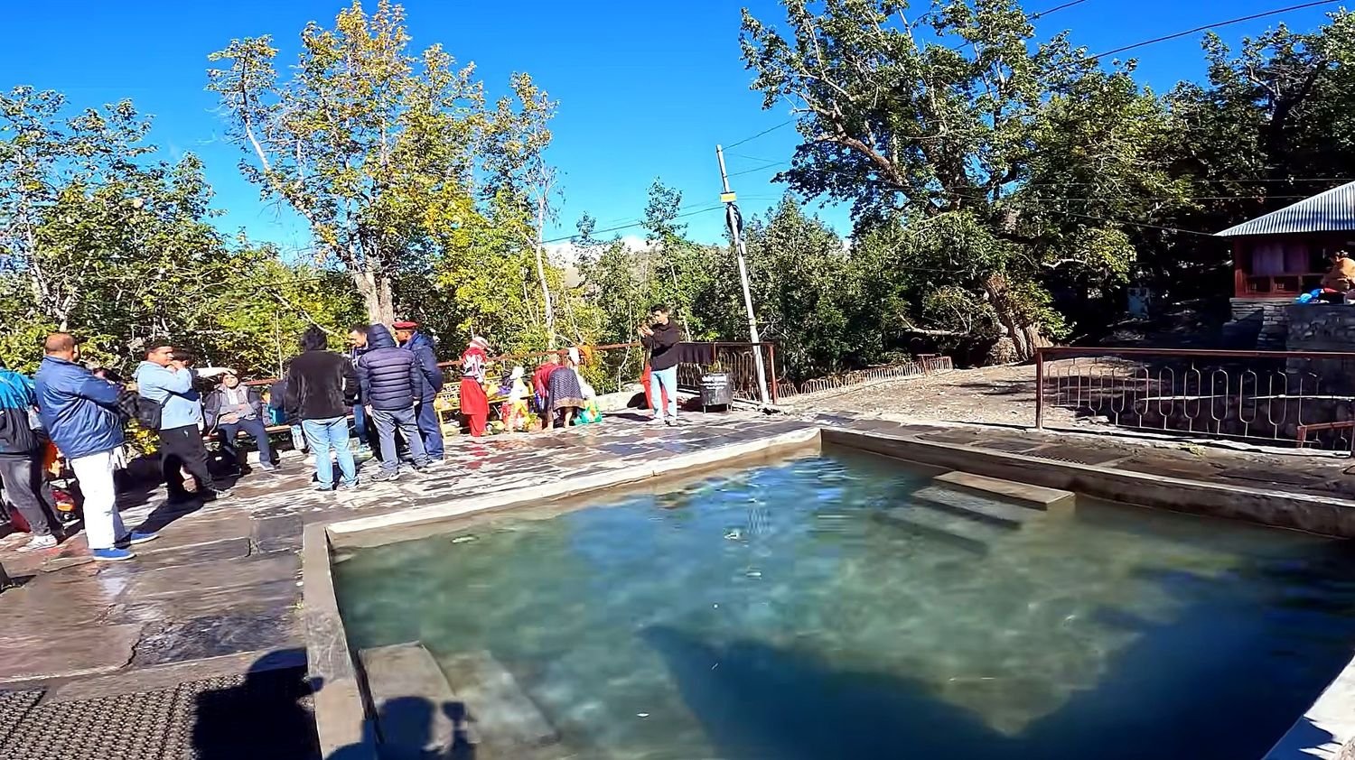
After that, the descent toward Tatopani changes the mood of the trek again, moving you away from the cool mountain ridge into a lower, warmer valley.
Tatopani is known for its natural hot springs and its location beside the Kali Gandaki River, which gives the area a more relaxed feel after the long descent from Ghorepani.
This part of the trek is especially enjoyable because the landscape begins to open up and the route feels less steep than the earlier climbing days.
Walking along the river, passing smaller settlements, and staying in a village known for its spring waters creates a gentle break in the middle of the trek before the trail continues northward into Mustang territory.
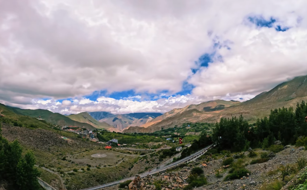
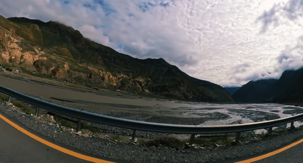
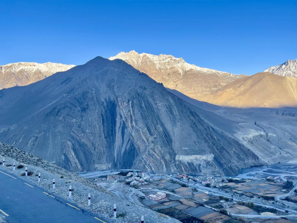
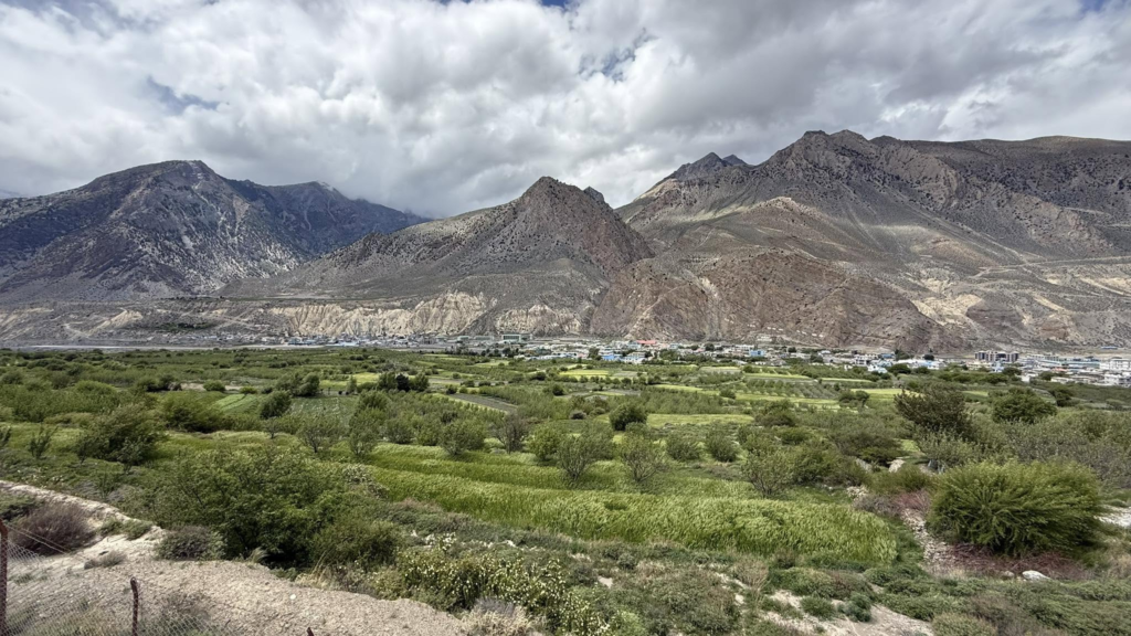
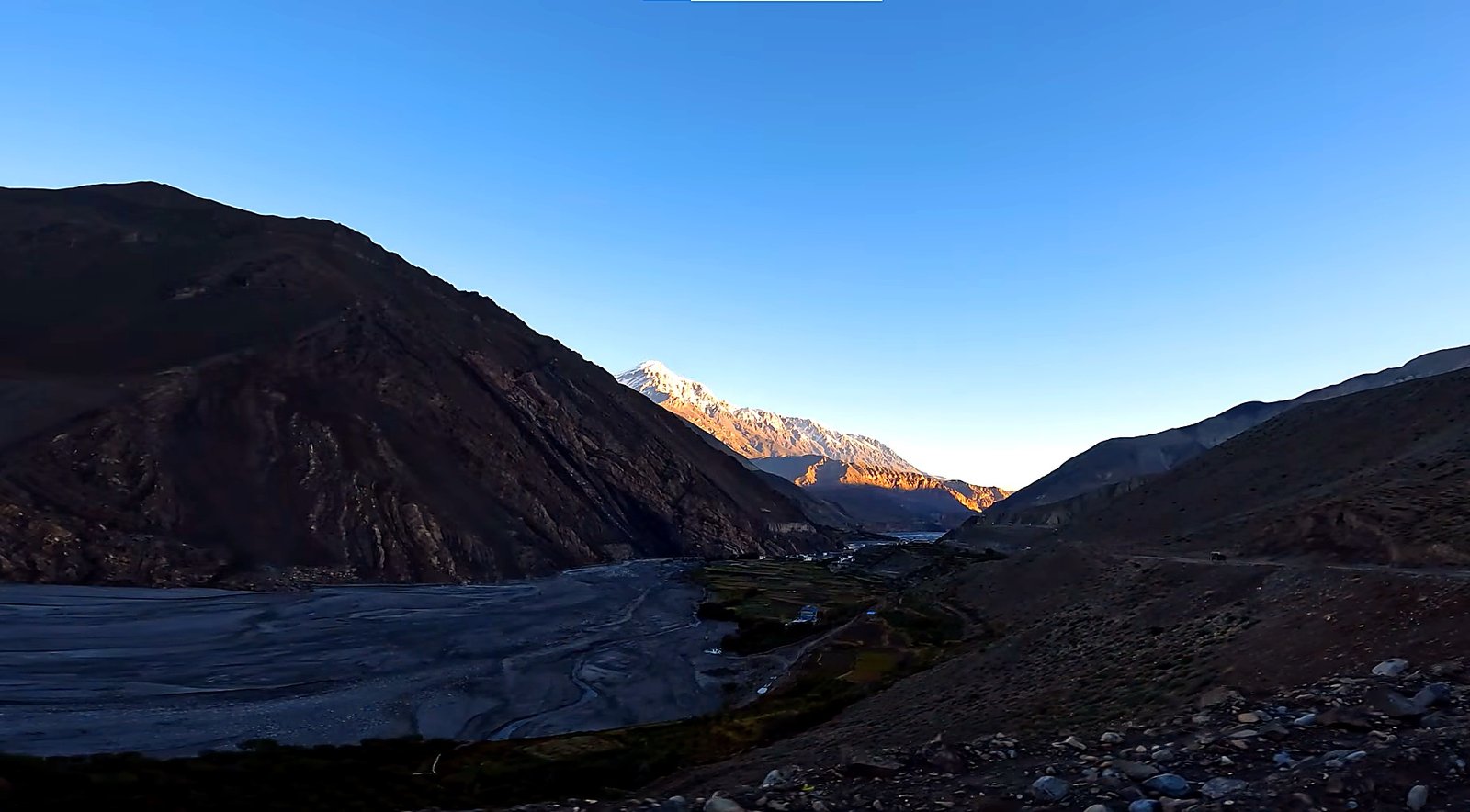
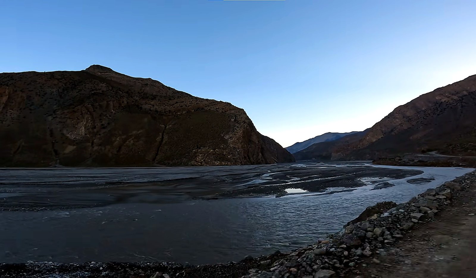
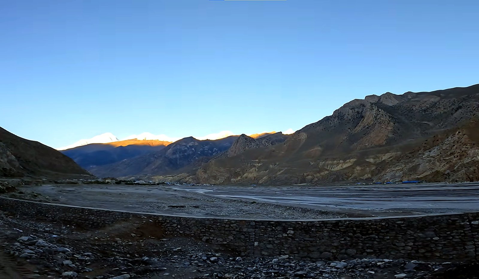
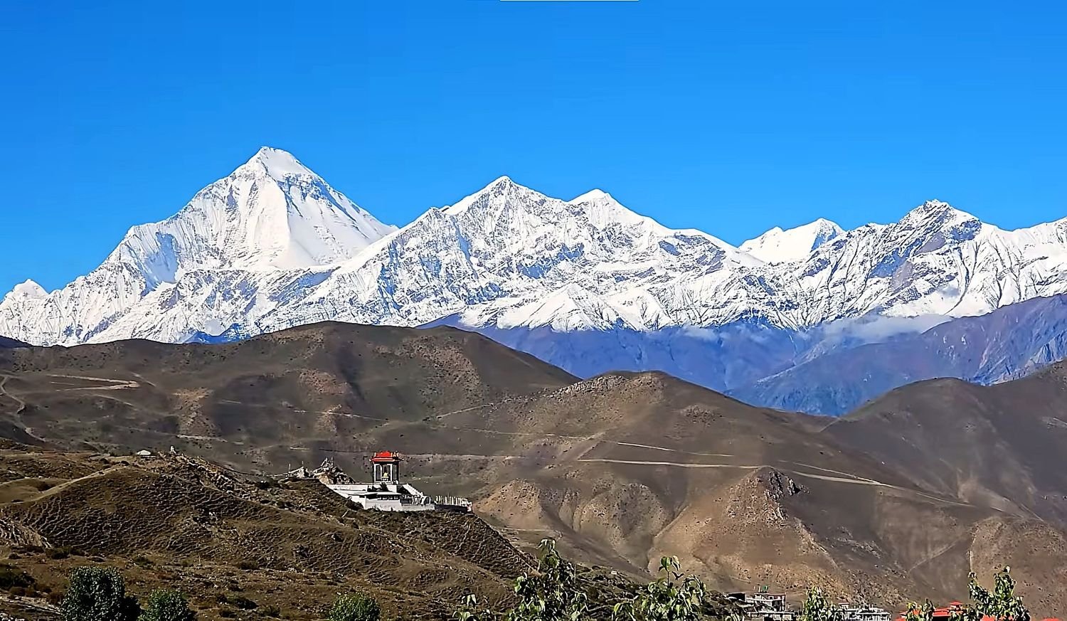
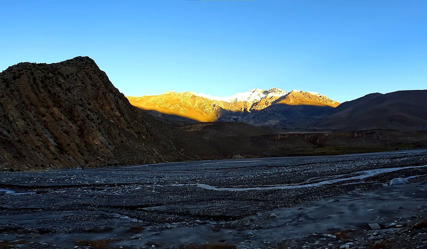
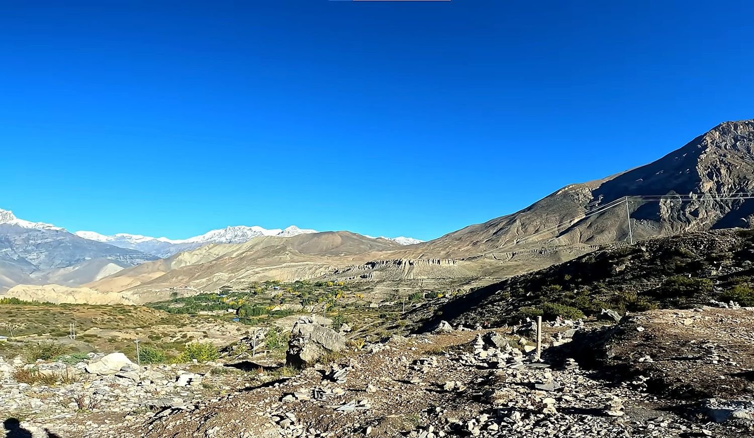
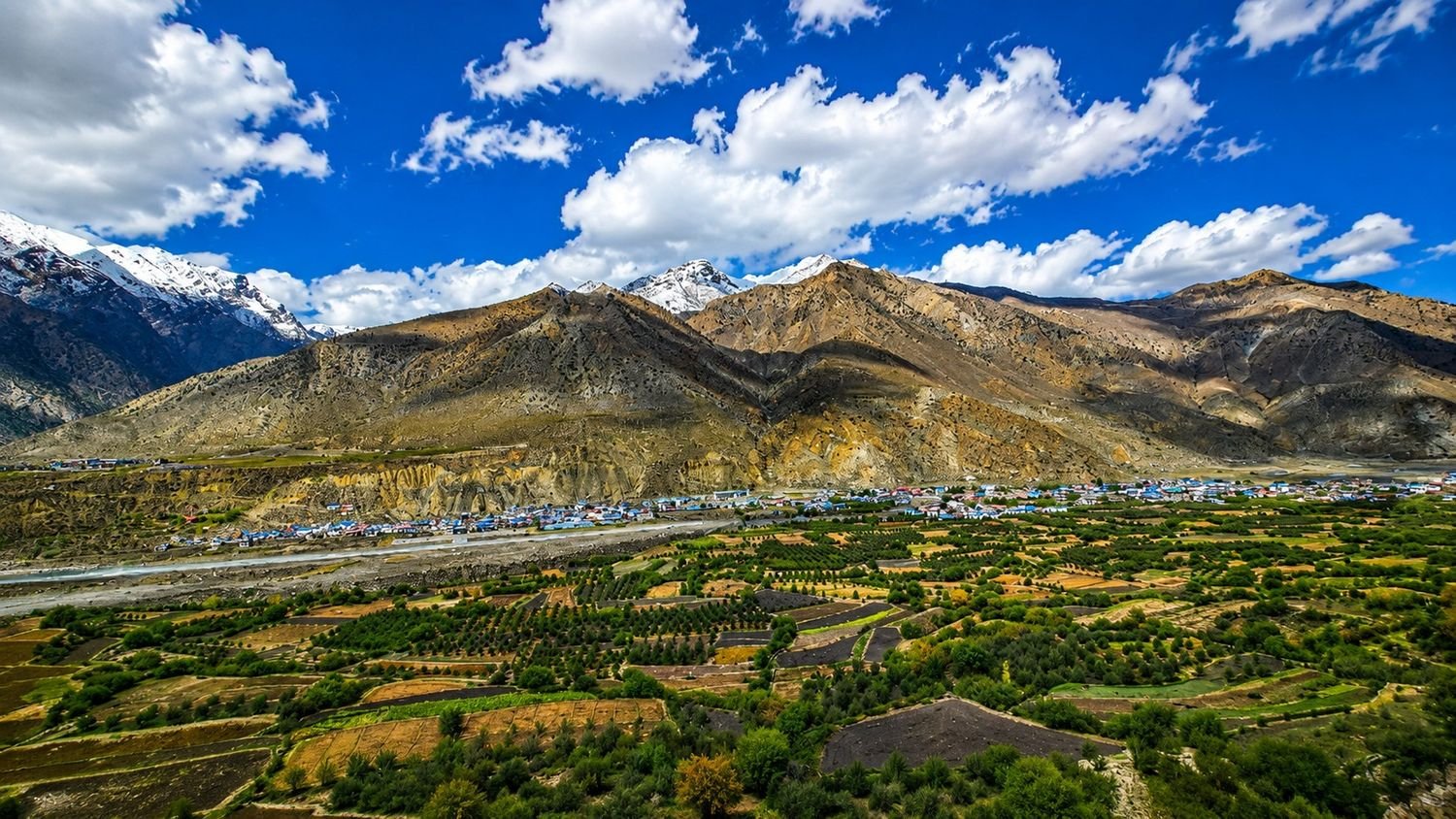
From Tatopani to Ghasa, Marpha, Kagbeni, and Muktinath, the route follows the Kali Gandaki valley, one of the most dramatic river corridors in Nepal.
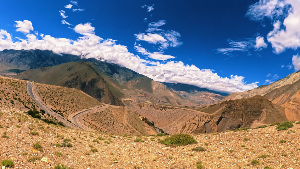
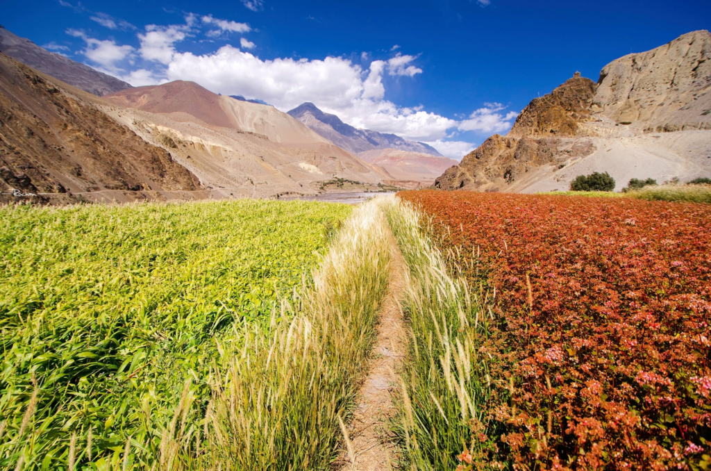
This is a key part of the trek because the landscape becomes much drier and more exposed.
The hills lose their thick green cover, the trail begins to feel more open, and the strong valley winds remind you that you are moving into a different climatic zone.
The contrast between the lower Annapurna forests and the upper Kali Gandaki valley is one of the most memorable features of the trek.
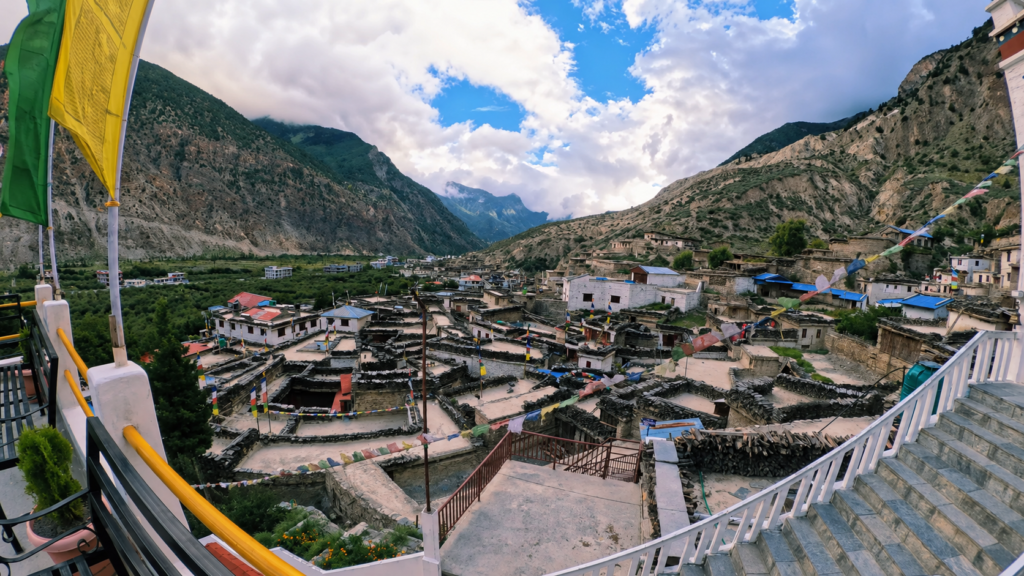
Marpha is one of the most attractive stops on the route. It has a strong Thakali identity, with whitewashed houses, clean stone lanes, apple orchards, and a more settled village atmosphere.
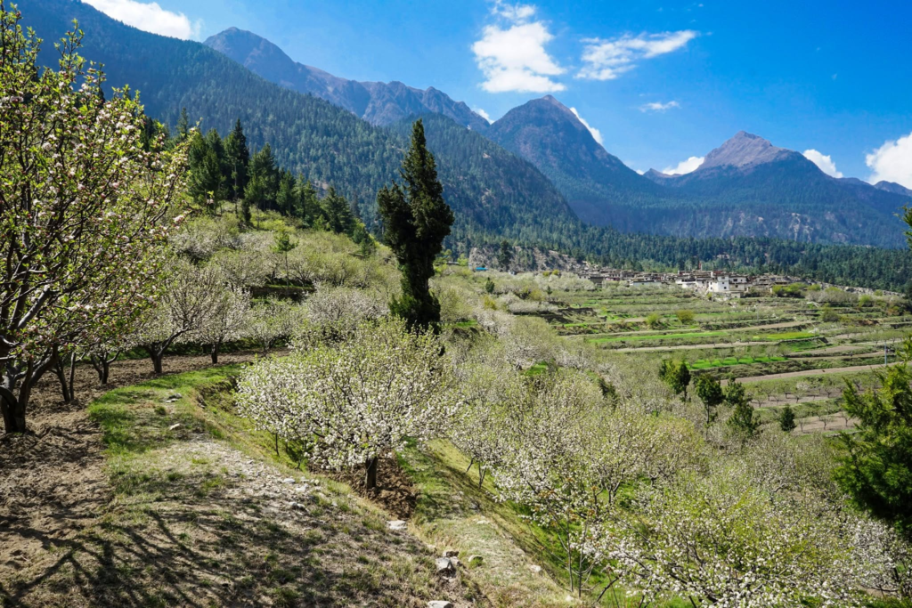
The place is full of trade, agriculture, and mountain life all at once. Staying here gives the trek a cultural depth that goes beyond the scenery.
You are not only walking through landscapes, but are moving through communities with distinct traditions and ways of living that have developed in this region for generations.
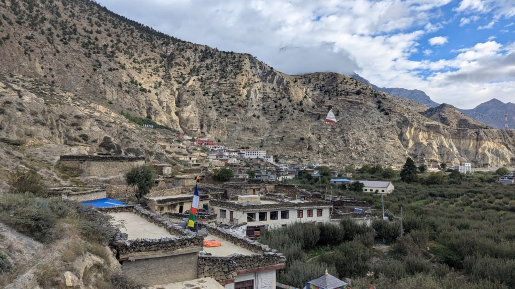
Kagbeni changes the mood once again for the trekkers. The village feels older, narrower, and more closely tied to the upper Mustang landscape.
The mud houses, chortens, prayer wheels, and tight lanes give the village a strong Tibetan-influenced character.
This is one of the most interesting parts of the route because it feels like a combination of greener Annapurna region and the drier, more barren high country beyond.
Kagbeni adds atmosphere and depth to the journey, and for many trekkers it becomes one of the most memorable villages of the trek.
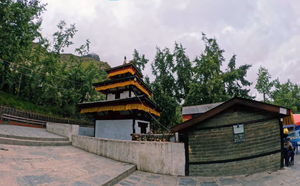
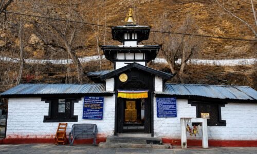
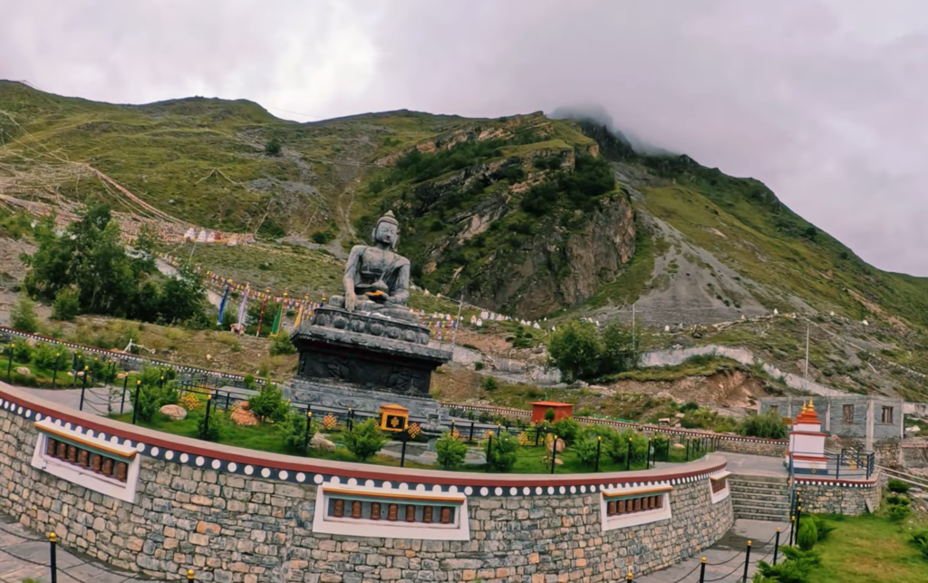
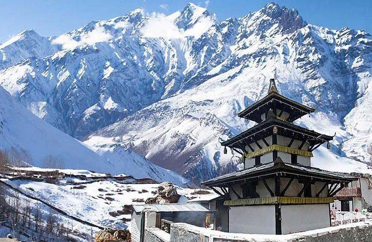
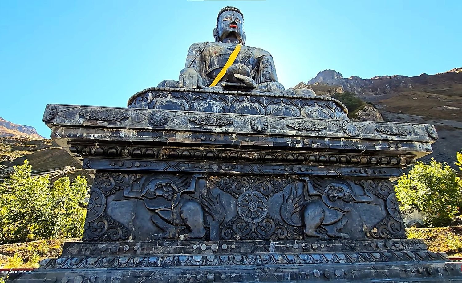
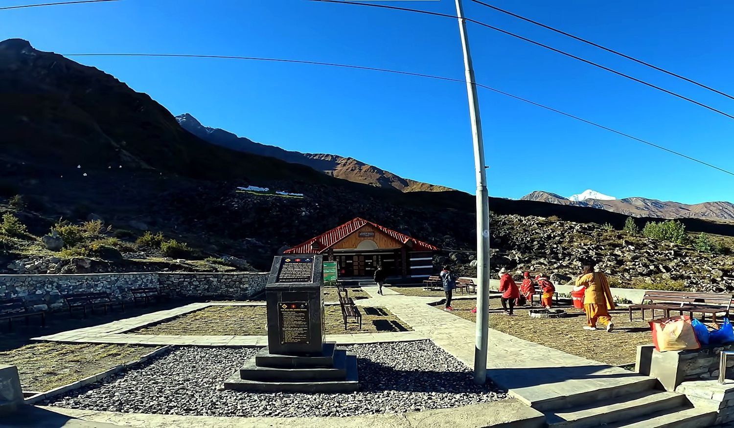
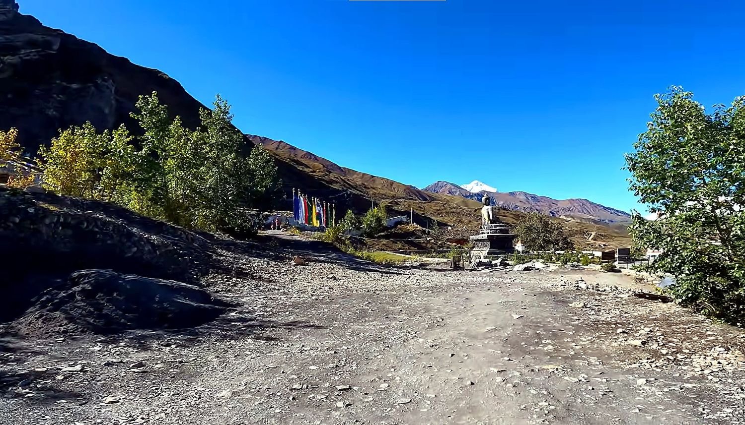
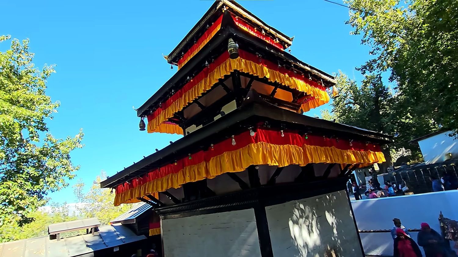
Muktinath is the spiritual high point of the journey. Reaching the temple area at 3,710 metres gives the trek a different kind of meaning, because the destination is important not only for its location but also for its religious significance.
It is a sacred site for both Hindus and Buddhists, and that makes the visit feel more than just scenic.
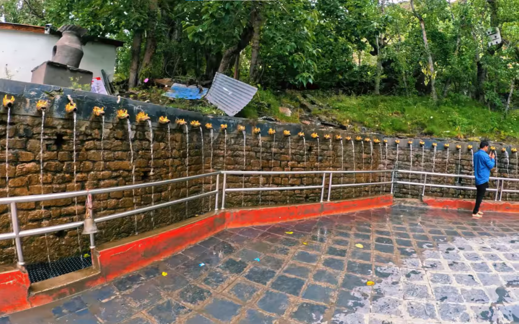
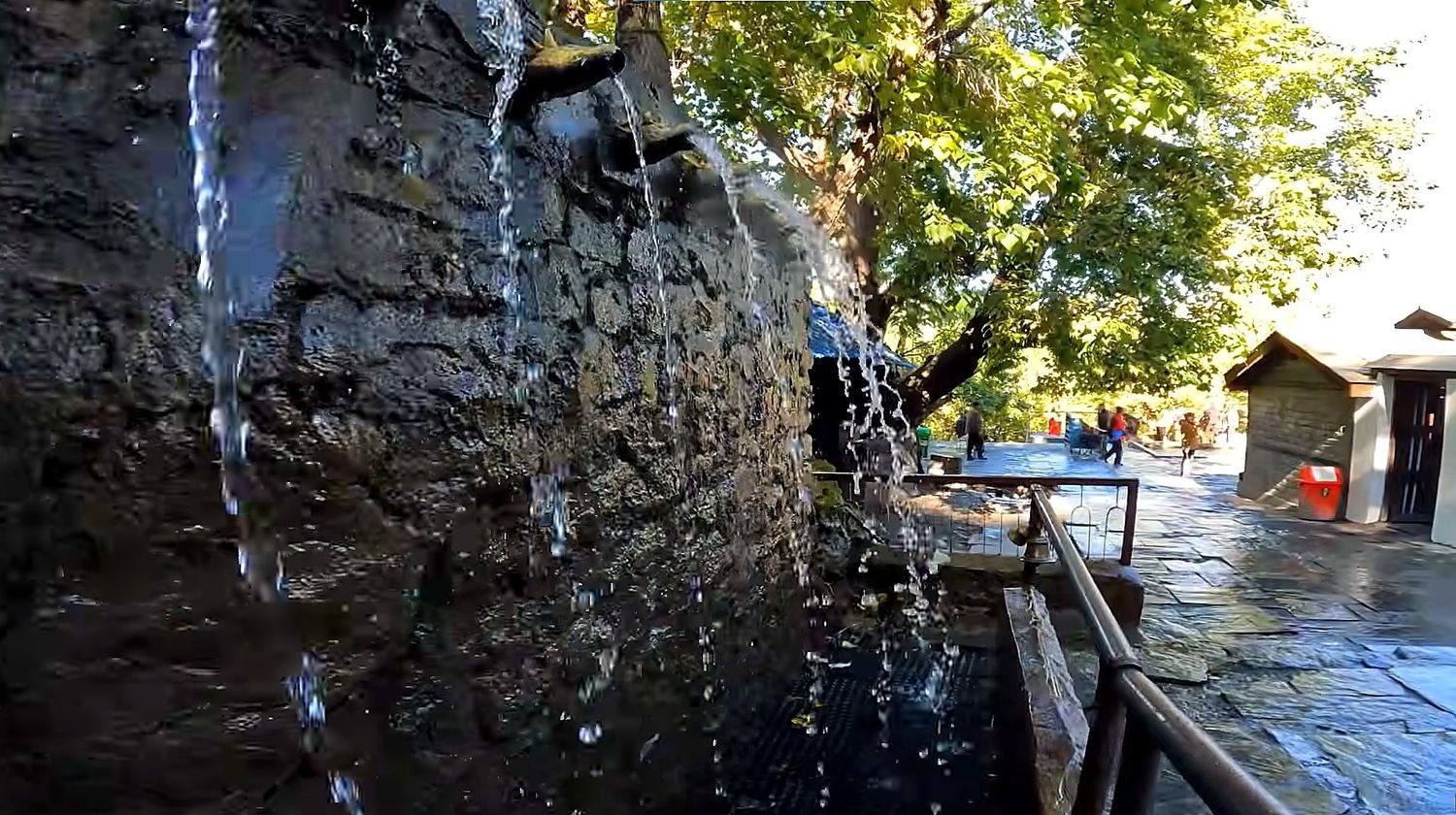
The open setting, the 108 water spouts, the eternal flame, and the quiet mountain air all contribute to a sense of place that is calm and respected by pilgrims and trekkers alike.
The walk up to Muktinath also shows how much the landscape has changed by this point. The trail is dry, exposed, and shaped by wind and altitude rather than forest and moisture.
The return toward Jomsom completes the trekking part of the journey. By the time you descend back into the valley, the route feels familiar but still distinct because the views are different in the opposite direction.
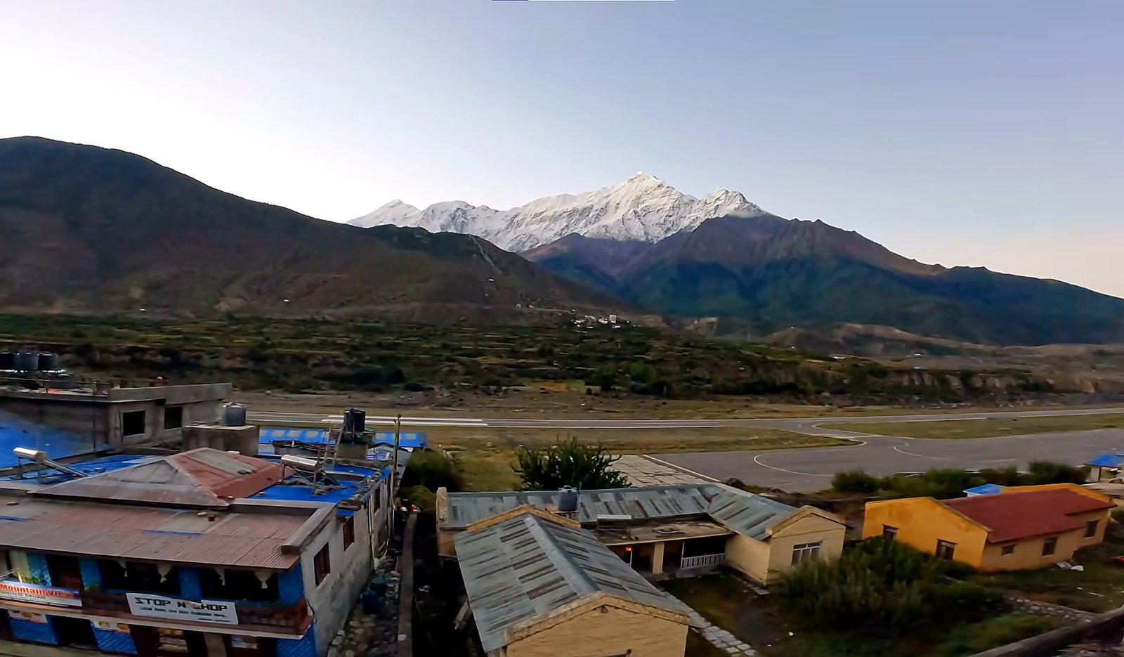
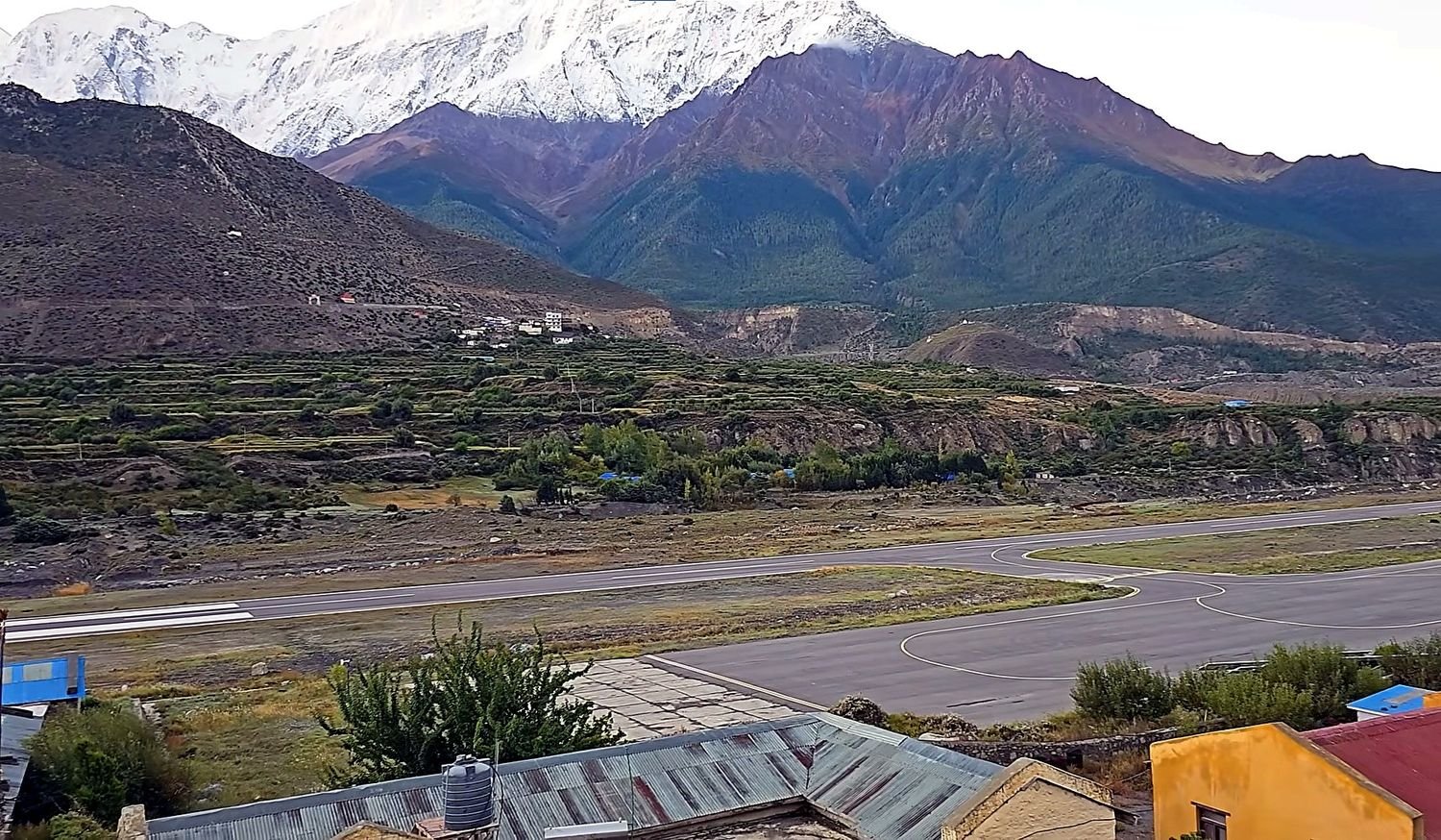
Jomsom is the main town of lower Mustang and acts as the practical end point of the walking route.
From there, the drive back to Pokhara takes you through the same river corridor and mountain settlements in a way that allows one final look at the changing landscape.
It is a long drive, but it fits the style of this trek because the route is grounded in overland travel rather than flights.
This trek is a good choice for trekkers who want a route that is scenic, culturally varied, and not too extreme in technical terms.
It does involve several long walking days and a significant amount of altitude change, so it is not a walk in the park, but it is very manageable for fit trekkers who are comfortable with daily mountain hiking.
The pace is gradual enough to allow proper adjustment, especially with the overnight stops spread across the Annapurna foothills and the Kali Gandaki valley.
Another strength of the Jomsom Muktinath Trek is that it feels complete even without a domestic flight.
The road journey makes the experience more grounded and lets you see the way the landscape transforms from the lush lower hills to the dry upper Mustang zone.
This is one of the reasons many trekkers appreciate the route. It does not feel rushed, and it allows the natural transition of the terrain to become part of the story of the trek.
Overall, the Jomsom Muktinath Trek is a route of contrasts.
The trek It begins with green hills, forests, and sunrise viewpoints, and ends in a dry valley with pilgrimage sites, old villages, and a different mountain atmosphere. That shift is what gives the trek its identity.
It is not only about one destination. It is about the journey between very different mountain worlds, and that is what makes it such a rewarding trek to write about and to experience.
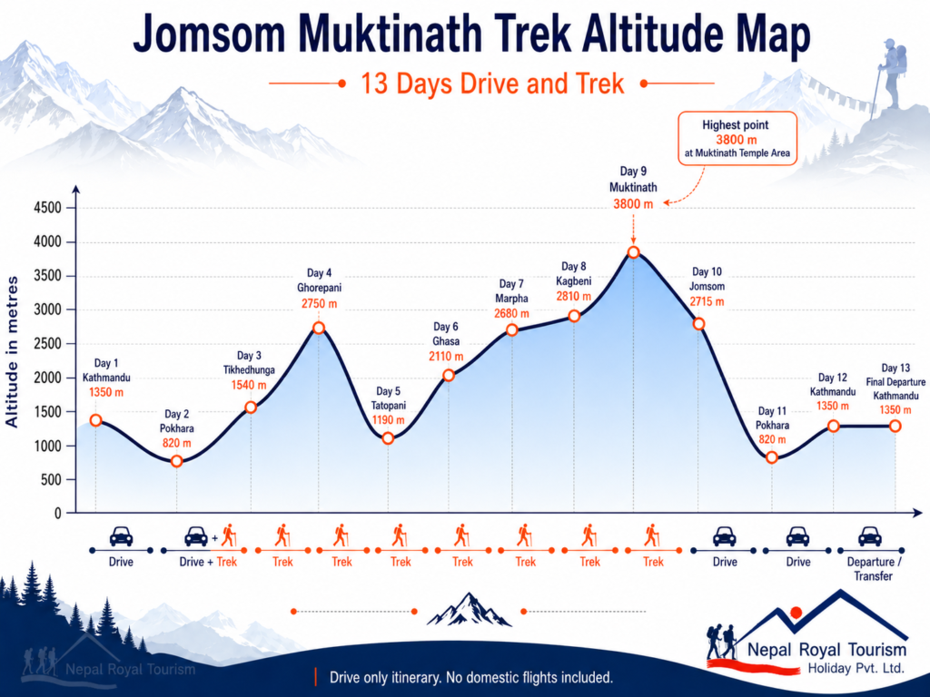
Altitude Range and Character
| Section | Altitude Range | Terrain Character |
|---|---|---|
| Kathmandu and Pokhara | 820 to 1,350 m | City stay, road travel, final trek preparation |
| Lower foothill trail | 1,190 to 2,000 m | River valleys, villages, terraced hillside, warm walking conditions |
| Ghorepani and forest section | 2,000 to 2,750 m | Stone steps, rhododendron forest, ridge trail, mountain viewpoints |
| Kali Gandaki corridor | 1,190 to 2,810 m | River gorge, waterfalls, Thakali villages, dry open valley |
| Mustang and Muktinath section | 2,810 to 3,800 m | Windy Mustang landscape, pilgrimage trail, dry hills, high mountain desert |
Difficulty Overview
| Factor | Level | Notes |
|---|---|---|
| Physical demand | Moderate | 4 to 7 hours walking on most trekking days |
| Maximum altitude | Moderate | 3,800 m at Muktinath Temple area |
| Technical difficulty | Low | No climbing, ropes, or technical equipment required |
| Endurance requirement | Moderate | Long descents, stone steps, and steady uphill walking on consecutive days |
| Weather exposure | Moderate | Warm lower valleys, cold mornings, and windy conditions in Mustang |
| Road travel demand | Moderate | Long drive days between Kathmandu, Pokhara, Jomsom, and Pokhara |
Packing List: Clothing Layers
| Layer | Items |
|---|---|
| Base layer | Moisture wicking T shirts, thermal top for colder mornings and nights |
| Mid layer | Fleece jacket, light insulated layer |
| Outer layer | Waterproof jacket, windproof shell, rain cover |
| Lower body | Trekking pants, thermal leggings, quick dry innerwear |
| Warm layer | Down jacket for Ghorepani, Kagbeni, Muktinath, and cold evenings |
| Accessories | Warm gloves, wool hat, buff or neck gaiter, sun hat |
Essential Gear
| Category | Items |
|---|---|
| Footwear | Well broken in trekking boots, sandals or slippers for teahouses |
| Backpack | Daypack 25 to 35 litres, duffel bag for porter |
| Sleeping | Sleeping bag rated to 0°C or below |
| Hydration | Reusable water bottles, purification tablets or water filter |
| Safety | Sunscreen, high UV sunglasses, personal first aid kit, blister care |
| Extras | Trekking poles, headlamp with spare batteries, power bank, camera, quick dry towel |
Documents and Personal Items
| Category | Items |
|---|---|
| Travel documents | Passport, Nepal visa, travel insurance, flight details |
| Trekking documents | Annapurna Conservation Area Permit and TIMS card if required |
| Money | Nepali cash for drinks, snacks, hot showers, charging, and tips |
| Health items | Personal medicines, altitude medicine if prescribed, basic pain relief |
| Personal care | Toiletries, towel, lip balm, wet wipes, hand sanitizer |
| Electronics | Phone, charger, power bank, adapter, memory card |
Trip Highlights
- Enjoy beautiful views of Annapurna, Dhaulagiri, Nilgiri, Tukuche Peak, and surrounding Himalayan ranges.
- Walk through the classic Annapurna foothill trail from Nayapul to Ghorepani and Tatopani.
- Experience the famous sunrise view from Poon Hill with a wide mountain panorama.
- Relax around Tatopani, a village known for its natural hot spring area beside the Kali Gandaki River.
- Follow the Kali Gandaki valley, one of the most dramatic river corridors in the Annapurna region.
- Visit Marpha, a beautiful Thakali village known for whitewashed houses, stone lanes, apple orchards, and local culture.
- Explore Kagbeni, an ancient Mustang village with narrow alleys, mud houses, chortens, and Tibetan-influenced traditions.
- Reach Muktinath at 3,710 metres, one of Nepal’s most sacred pilgrimage destinations for Hindus and Buddhists.
- See the changing landscapes from green hills and rhododendron forests to the dry and windy valleys of Mustang.
- Complete the journey by road and on foot without using domestic flights, making the trek more scenic and grounded.
Jomsom Muktinath Trek – 13 Days ~ Itinerary
Day 1
Arrival in Kathmandu
- Altitude: 1350 m
- Accommodation: Standard three-star hotel in Thamel
Your journey begins with your arrival at Tribhuvan International Airport in Kathmandu. After completing airport formalities, our representative will receive you and transfer you to your hotel. The rest of the day is kept free for rest, trek preparation, and a short briefing with your guide about the route, road journey, trekking days, altitude, meals, accommodation, and safety points.
Day 2
Drive Kathmandu to Pokhara
- Altitude: 820 m
- Travel Duration: 7 to 8 hours
- Travel Distance: 200 km
- Meal: Breakfast and Lunch
- Accommodation: Standard three-Star Hotel in Pokhara
After breakfast, you drive from Kathmandu to Pokhara by private tourist vehicle. The journey follows the Prithvi Highway through river valleys, roadside towns, terraced hillsides, and small settlements. Pokhara is the main gateway to the Annapurna region and offers beautiful views of Machhapuchhre, Annapurna, and Dhaulagiri on clear days. After arrival, you can rest at the hotel or walk around Lakeside.
Day 3
Drive Pokhara to Nayapul and Trek to Tikhedhunga
- Altitude: 1540 m
- Travel Duration: 1.5 to 2 hours
- Travel Distance: 45 km
- Trek Duration: 3 to 4 hours
- Trek Distance: 8 to 9 km
- Meal: Breakfast, Lunch and Dinner
- Accommodation: Teahouse in Tikhedhunga
After breakfast, you drive from Pokhara to Nayapul and begin the trek. The trail follows the Modi Khola valley and passes through Birethanti, small villages, farmland, and riverside sections before reaching Tikhedhunga. This is a gentle first trekking day and helps you adjust to the walking rhythm before the trail becomes steeper the next day.
Day 4
Trek Tikhedhunga to Ghorepani
- Altitude: 2750 m
- Trek Duration: 6 to 7 hours
- Trek Distance: 12 to 13 km
- Meal: Breakfast, Lunch and Dinner
- Accommodation: Teahouse in Ghorepani
Today is a steady uphill trekking day. The trail climbs through stone steps toward Ulleri, a large Magar village with views of the surrounding hills and farmland. After Ulleri, the route continues through oak and rhododendron forest before reaching Ghorepani. Ghorepani is a well-known mountain village famous for its access to Poon Hill and panoramic views of Annapurna and Dhaulagiri.
Day 5
Hike to Poon Hill and Trek to Tatopani
- Altitude: 1190 m
- Trek Duration: 7 to 8 hours
- Trek Distance: 16 to 18 km
- Meal: Breakfast, Lunch and Dinner
- Accommodation: Teahouse in Tatopani
Early in the morning, you hike to Poon Hill for sunrise views over Dhaulagiri, Annapurna South, Hiunchuli, Machhapuchhre, and Nilgiri. After breakfast in Ghorepani, the trail descends toward Tatopani through forest, hillside villages, and terraced farmland. Tatopani is known for its natural hot spring area near the Kali Gandaki River, making it a relaxing stop after a long descent.
Day 6
Trek Tatopani to Ghasa
- Altitude: 2110 m
- Trek Duration: 5 to 6 km
- Trek Distance: 13 to 15 km
- Meal: Breakfast, Lunch and Dinner
- Accommodation: Teahouse in Ghasa
After breakfast, the route follows the Kali Gandaki valley northward. The trail passes small villages, river crossings, waterfalls, and forested sections as the climate slowly becomes cooler. This area gives a strong sense of the deep Kali Gandaki corridor, which separates the Annapurna and Dhaulagiri ranges. You continue gradually uphill and spend the night in Ghasa.
Day 7
Trek Ghasa to Marpha
- Altitude: 2680 m
- Trek Duration: 6 to 8 hours
- Trek Distance: 20 to 22 km
- Meal: Breakfast, Lunch and Dinner
- Accommodation: Teahouse in Marpha
Today you continue through the Kali Gandaki valley toward Marpha. The trail passes through settlements such as Lete, Kalopani, and Larjung, with views of Nilgiri, Dhaulagiri, and Tukuche Peak on clear days. Marpha is one of the most beautiful villages on the route, known for its whitewashed houses, narrow stone lanes, apple orchards, and strong Thakali culture.
Day 8
Trek Marpha to Kagbeni
- Altitude: 2810 m
- Trek Duration: 5 to 6 hours
- Trek Distance: 15 to 16 km
- Meal: Breakfast, Lunch and Dinner
- Accommodation: Teahouse in Kagbeni
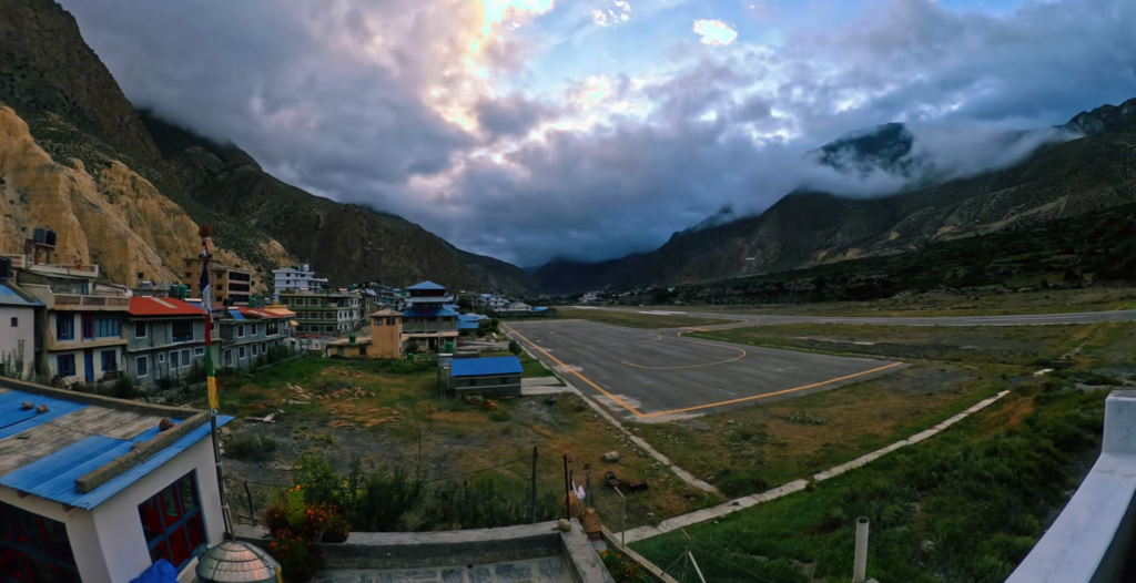
After breakfast, you trek north through the wide Kali Gandaki valley. The trail passes through Jomsom, the main town of lower Mustang, before continuing toward Ekle Bhatti and Kagbeni. The landscape becomes dry, open, and wind-shaped. Kagbeni is an old village with narrow lanes, mud-brick houses, chortens, prayer wheels, and a strong Tibetan-influenced atmosphere.
Day 9
Trek Kagbeni to Muktinath
- Altitude: 3710 m, Highest: Muktinath Temple area (3800 m)
- Trek Duration: 4 to 5 hours
- Trek Distance: 10 to 12 km
- Meal: Breakfast, Lunch and Dinner
- Accommodation: Teahouse in Muktinath
Today you trek from Kagbeni to Muktinath through the dry Mustang landscape. The trail climbs gradually with views of barren hills, cliffs, traditional villages, and distant snow peaks. Muktinath is one of Nepal’s most sacred pilgrimage sites for both Hindus and Buddhists. The temple area is known for its 108 water spouts, eternal flame, and peaceful mountain setting.
Day 10
Trek Muktinath to Jomsom
- Altitude: 2715 m
- Trek Duration: 5 to 6 hours
- Trek Distance: 18 to 20 km
- Meal: Breakfast, Lunch and Dinner
- Accommodation: Teahouse in Jomsom
After visiting the Muktinath Temple area, you descend toward Jomsom. The route passes through villages such as Jharkot, Khinga, Kagbeni, and Ekle Bhatti before joining the wide Kali Gandaki valley. This section can be windy, especially later in the day, so an early start is recommended. Jomsom is the main town of lower Mustang and marks the end of the main trekking section.
Day 11
Drive Jomsom to Pokhara
- Altitude: 820 m
- Travel Duration: 8 to 10 hours
- Travel Distance: 165 km
- Meal: Breakfast and Lunch
- Accommodation: Standard three-Star Hotel in Pokhara
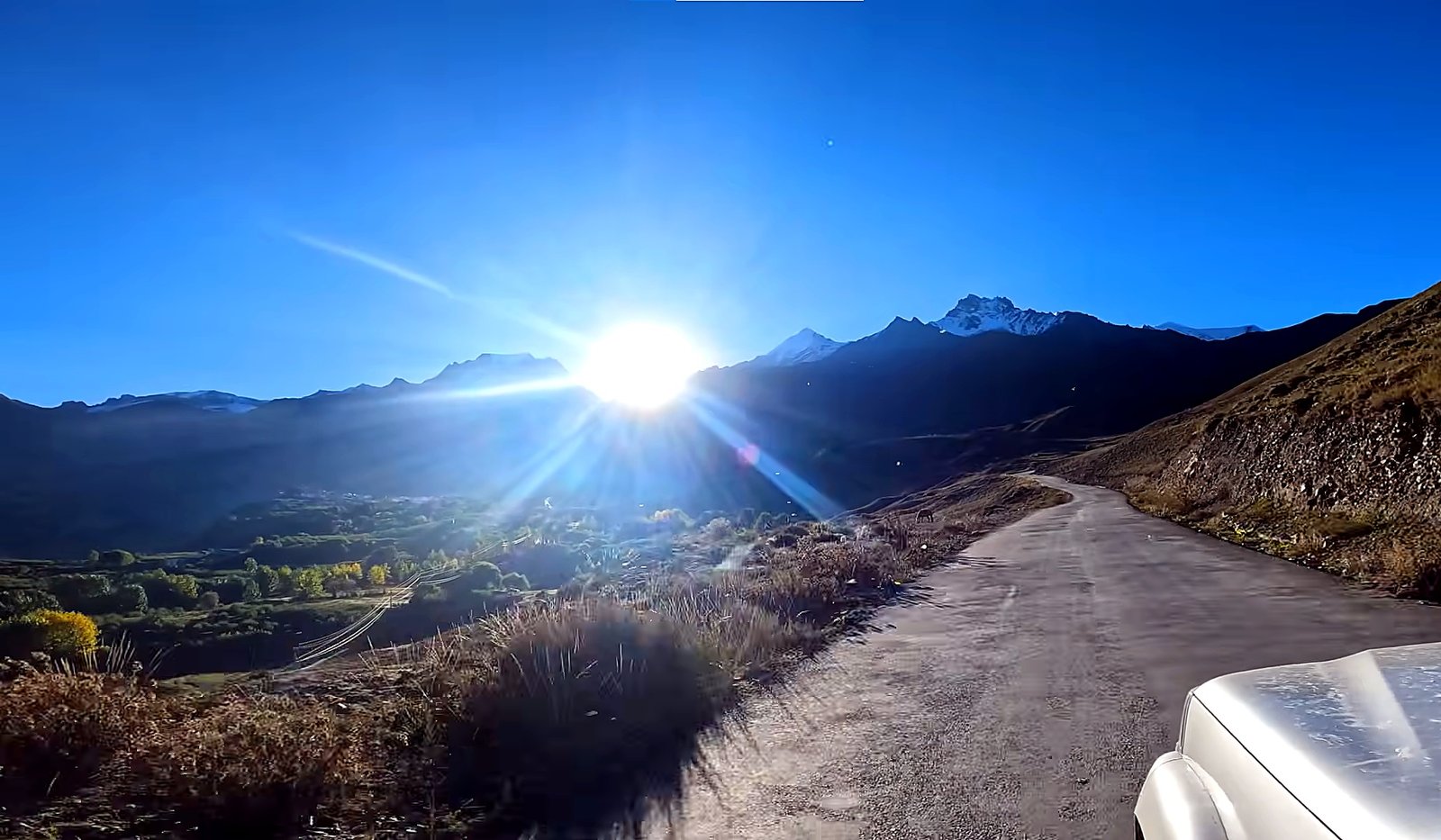
You drive from Jomsom to Pokhara by road. The journey follows the Kali Gandaki corridor through Marpha, Tukuche, Kalopani, Ghasa, Tatopani, Beni, and onward to Pokhara. The road condition can change depending on weather and seasonal maintenance, but the drive offers a final look at the changing landscape from dry Mustang valleys to the greener hills around Pokhara.
Day 12
Drive Pokhara to Kathmandu
- Altitude: 1350 m
- Travel Duration: 7 to 8 hours
- Travel Distance: 200 km
- Meal: Breakfast and Lunch
- Accommodation: Standard three-Star Hotel in Kathmandu
After breakfast, you drive from Pokhara back to Kathmandu by private tourist vehicle. The route follows river valleys, highway towns, terraced farmland, and rural settlements before reaching the capital. After arrival, you can rest at the hotel or do last-minute shopping around Thamel. This evening marks the completion of the Jomsom Muktinath Trek by road and on foot, without using any domestic flight.
Day 13
Final Departure
- Meal: Breakfast
Your Jomsom Muktinath Trek ends today. A representative will transfer you to Tribhuvan International Airport according to your international flight schedule. You leave Nepal with memories of the Kali Gandaki valley, Marpha’s apple village, Kagbeni’s old Mustang culture, the sacred Muktinath Temple, and the mountain landscapes of Annapurna and Dhaulagiri.
Jomsom Muktinath Trek – 13 Days Fixed Departures Dates
Trip Cost Includes/Excludes
Cost Includes
- Airport pick-up and final drop-off in Kathmandu by private vehicle
- 2 night Three Star Hotel accommodation in Kathmandu on a twin-sharing basis with daily breakfast
- 2 nights Four Star Hotel accommodation in Pokhara on a twin-sharing basis with daily breakfast
- Kathmandu to Pokhara and Pokhara to Kathmandu ground transportation by comfortable tourist vehicle
- Pokhara to Nayapul transfer by private vehicle as per the itinerary
- Jomsom to Pokhara drive by comfortable jeep or tourist vehicle as per road conditions
- Mountain teahouse accommodation throughout the trekking days
- Required trekking permits, including Annapurna Conservation Area Permit and TIMS card if applicable
- Three meals a day during the trek, including breakfast, lunch, and dinner and a cup of tea/coffee
- Porter support during the trek with 1 porter for every 2 trekkers
- Experienced, government-licensed, English-speaking trekking guide
- Nepal Royal Tourism Holidays company T-shirt as a trekking souvenir
- All applicable government taxes and official service charges
Cost Excludes
- International airfare to and from Nepal
- Nepal entry visa fee
- Lunch and dinner while staying in Kathmandu and Pokhara
- Travel and medical insurance, including emergency rescue and evacuation coverage
- Personal trekking equipment such as trekking boots, warm clothing, gloves, down jacket, backpack, and personal accessories
- Personal expenses such as bottled water, soft drinks, alcoholic drinks, snacks, laundry, toiletries, and phone calls
- Hot showers, battery charging, Wi-Fi, and other extra services at teahouses
- Extra costs caused by weather conditions, itinerary changes, or other situations beyond company control
- Tips for guide, porter, driver, and trekking staff, which are not mandatory but highly appreciated.
- Any service, meal, transport, or expense not clearly mentioned in the Cost Includes section.
Trip Photo/Video Gallery
Route Map for Jomsom Muktinath Trek – 13 Days
Frequently Asked Questions
The Jomsom Muktinath Trek is an easy/moderate trek. Most walking days are around 4 to 7 hours, and the trail includes uphill climbs, downhill sections, stone steps, river valleys, and dry Mustang terrain. Good fitness is helpful, but technical climbing experience is not required.
The highest point of the trek is the Muktinath Temple area at around 3,800 metres. The overnight stop is usually around Muktinath or Ranipauwa at about 3,710 metres.
Previous trekking experience is not compulsory. This trek is suitable for beginners with reasonable fitness, but you should be ready for long walking days and changing trail conditions.
You need the Annapurna Conservation Area Permit for this trek. A TIMS card may also be arranged if required by the current trekking rule and route condition. Nepal Royal Tourism Holidays will help arrange the necessary permits.
Altitude sickness is possible but less common than on higher treks because the maximum altitude is around 3,800 metres. Walking at a steady pace, drinking enough water, and avoiding rushing will help reduce the risk.
You will stay in comfortable hotels in Kathmandu and Pokhara with breakfast included. During the trekking days, accommodation will be in mountain teahouses with basic rooms, warm dining areas, and simple facilities.
Breakfast, lunch, and dinner are included during the trekking days. Common meals include dal bhat, noodles, soup, fried rice, pasta, potatoes, eggs, pancakes, tea, coffee, and seasonal local food depending on the teahouse.
Spring and autumn are the best seasons for this trek. Spring offers warmer weather and rhododendron flowers in the lower forest sections, while autumn usually gives clearer mountain views and more stable trekking conditions.
This itinerary is planned as a drive-only and trekking package. The journey uses road transportation between Kathmandu, Pokhara, Nayapul, Jomsom, and Pokhara instead of domestic flights.
Yes, the itinerary can be customized based on your time, fitness level, hotel preference, transport preference, and travel date. Extra nights in Kathmandu, Pokhara, Jomsom, or nearby villages can also be arranged if needed.
You may also like