-
 Duration
16 Days
Duration
16 Days
-
 Difficulty
Challenging
Difficulty
Challenging
-
 Max Elevation
5,416m
Max Elevation
5,416m
-
 Group Size
1 to 10 People Person
Group Size
1 to 10 People Person
-
 Accommodation
Teahouse/Lodge
Accommodation
Teahouse/Lodge
-
 Start/End
Kathmandu Airport/Kathmandu
Start/End
Kathmandu Airport/Kathmandu
-
 Destination
Annapurna Region
Destination
Annapurna Region
-
 Best Season
March-May and Sep-Nov
Best Season
March-May and Sep-Nov
The Annapurna Circuit is one of the most renouned trekking routes on the planet, and its reputation has been earned honestly across decades of delivering landscapes, cultures, and altitude experiences that very few routes anywhere can match in a single journey.
Adding the Tilicho Lake diversion to that circuit turns an already exceptional trek into something more complete, more varied, and more demanding than the standard route manages on its own.

Although the trek which can take over two weeks is a serious commitment, what comes back with you at the end of it justifies every one of them.
The journey opens not on foot but in a vehicle, heading northwest from Kathmandu along the Prithvi Highway and then north into the Marsyangdi river valley toward Dharapani at 1,960 metres.
The drive is long, seven to eight hours across some of the most dramatic road terrain in Nepal, and the canyon sections of the Marsyangdi gorge in the middle portion of the drive are worth watching closely.
The valley walls close in and the river runs loud and green in the gorge below while the first high peaks appear intermittently above the ridgelines ahead.
By the time the vehicle reaches Dharapani, the mountain world has already begun to announce itself.
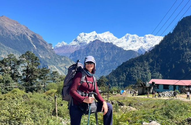
The first trekking day from Dharapani to Chame follows the Marsyangdi upstream through a valley that changes character steadily as it climbs.
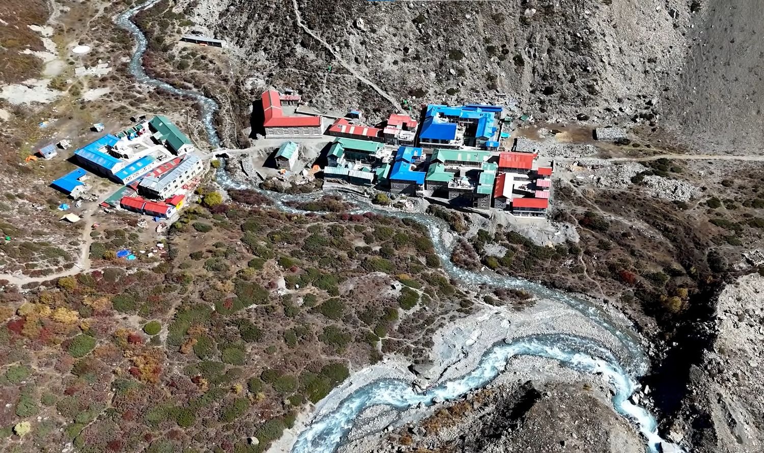
Chame at 2,710 metres is the administrative centre of Manang district, a genuine mountain town with a proper range of lodges and teahouses.
It follows a daily rhythm that is still primarily about the valley it sits in rather than the trekkers passing through it.
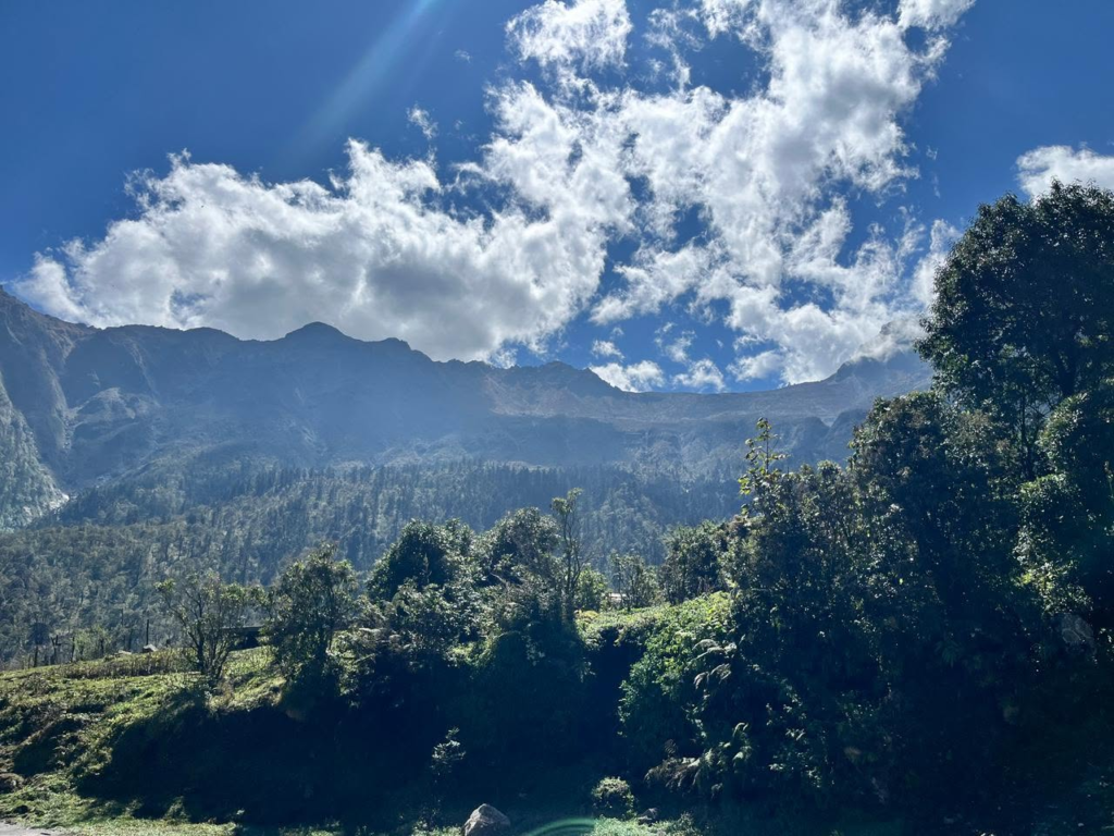
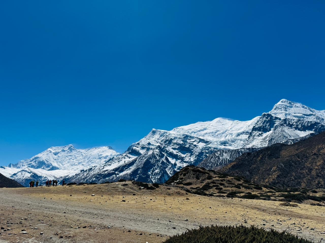
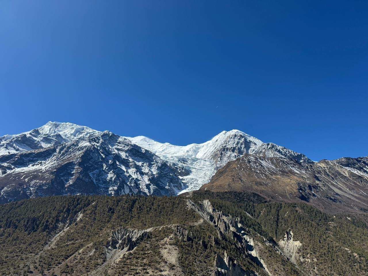
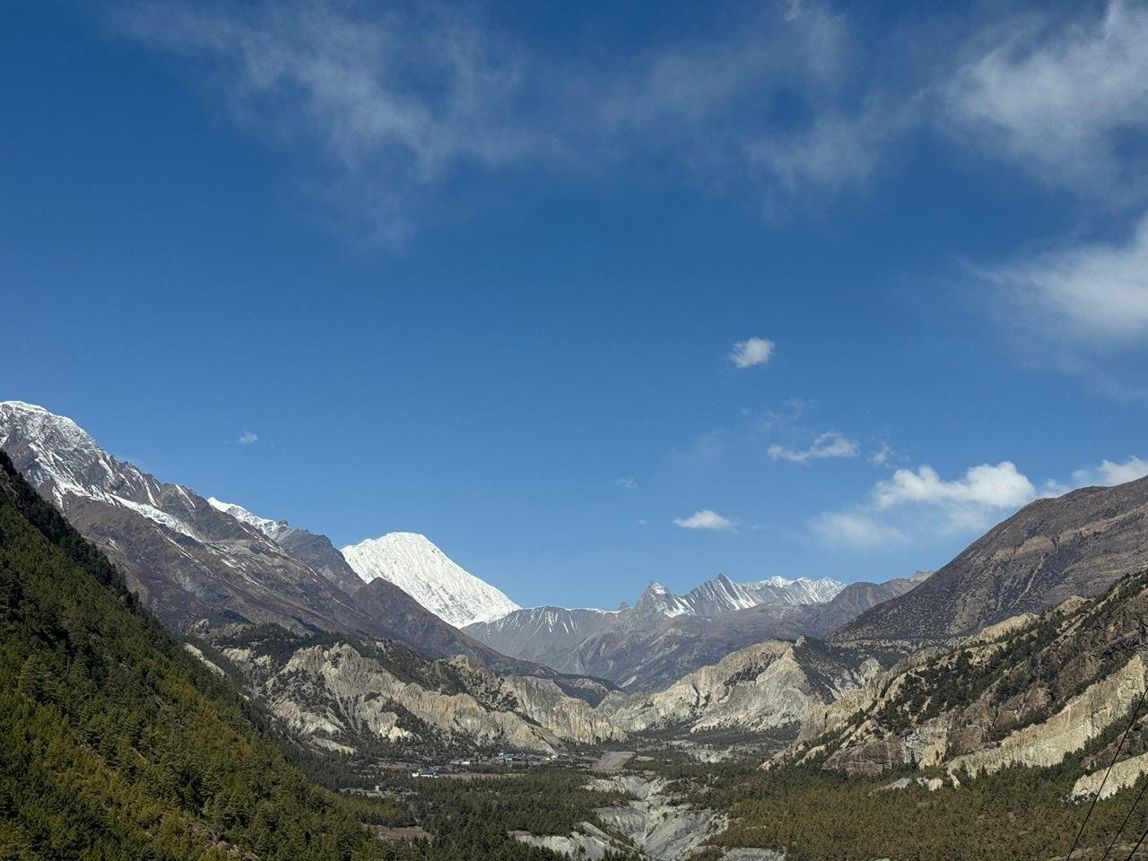
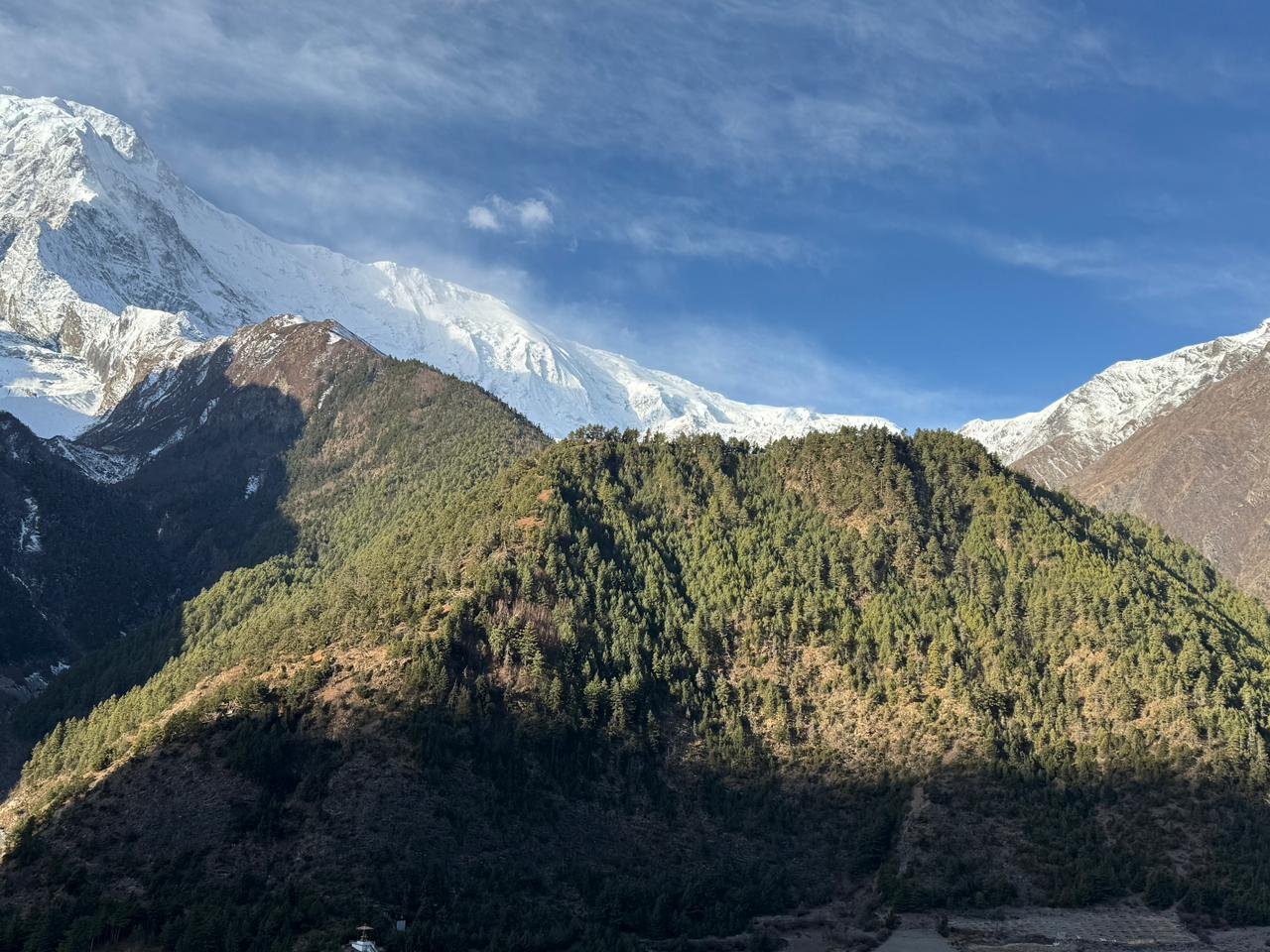
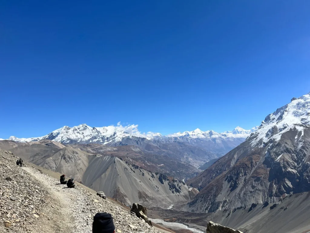
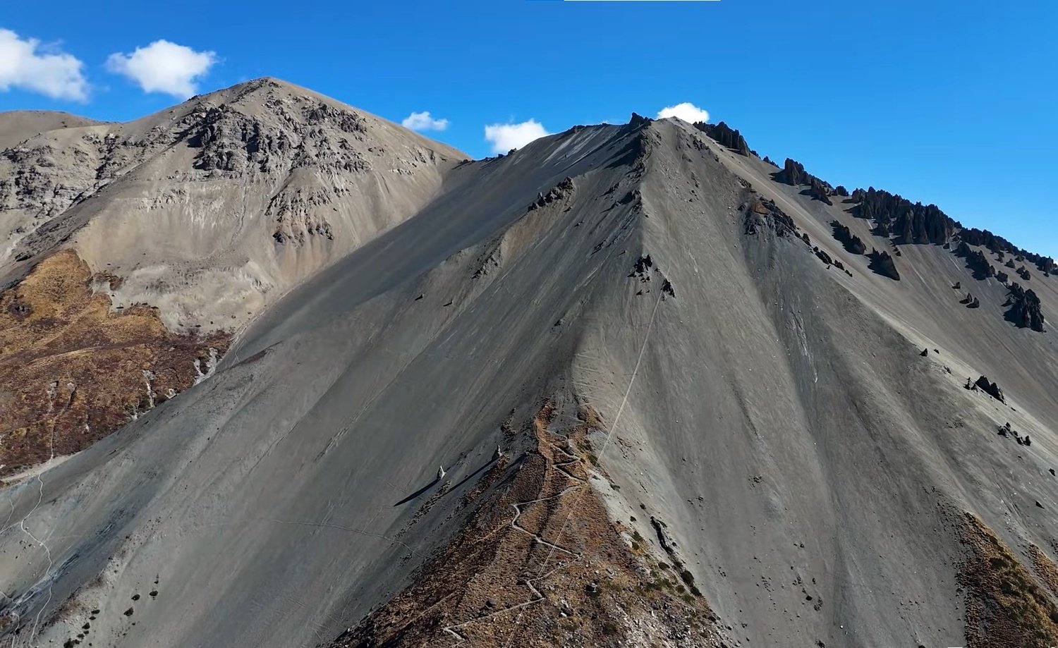
Above Chame the landscape opens into one of the most visually dramatic sections of the entire circuit.
The trail toward Pisang runs through a wide high valley with the Annapurna range beginning to assert itself on the southern wall and the Lamjung and Manaslu groups visible behind.
The curved rock face above Bhratang, a natural formation worn by the river over centuries, is the kind of feature that stops most trekkers midstride.
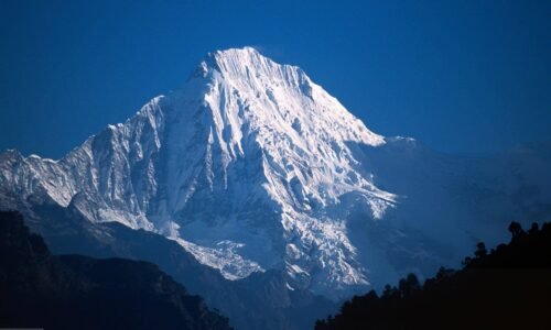
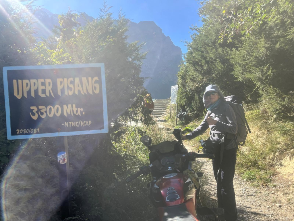
From Upper Pisang at 3,300 metres, Annapurna II at 7,937 metres appears on the southeastern horizon at a scale that photographs simply do not prepare you for. Most people stand there a few moments longer than they intended to.
The route between Pisang and Manang via Ngawal is one of the finest high altitude walks in the conservation area.
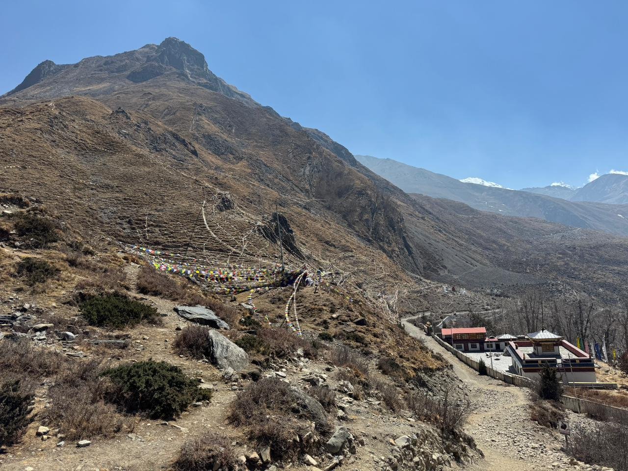
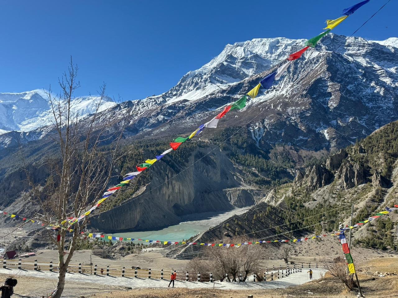
The high trail stays on the ridge above the valley floor and runs through the Tibetan influenced villages of Ghyaru and Ngawal, where the flat roofed white architecture, prayer wheels, and monastery walls signal clearly that the cultural world has shifted.
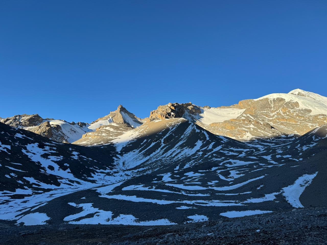
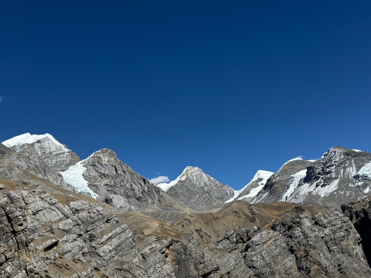
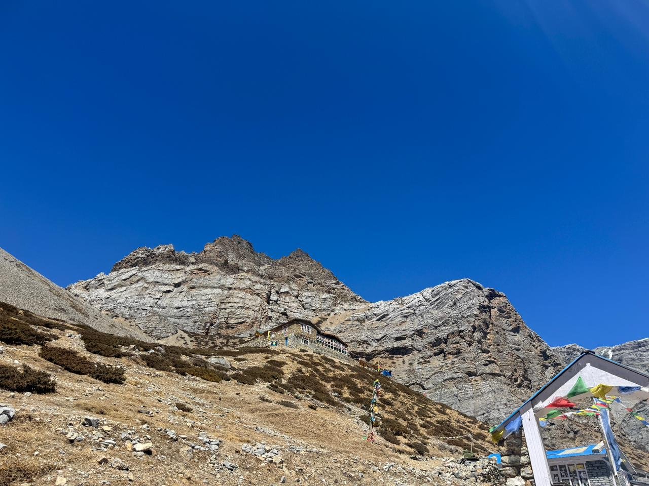
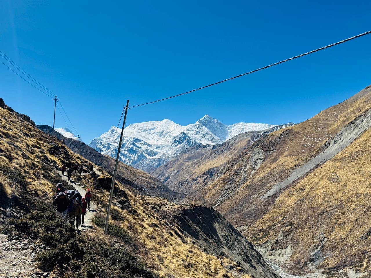
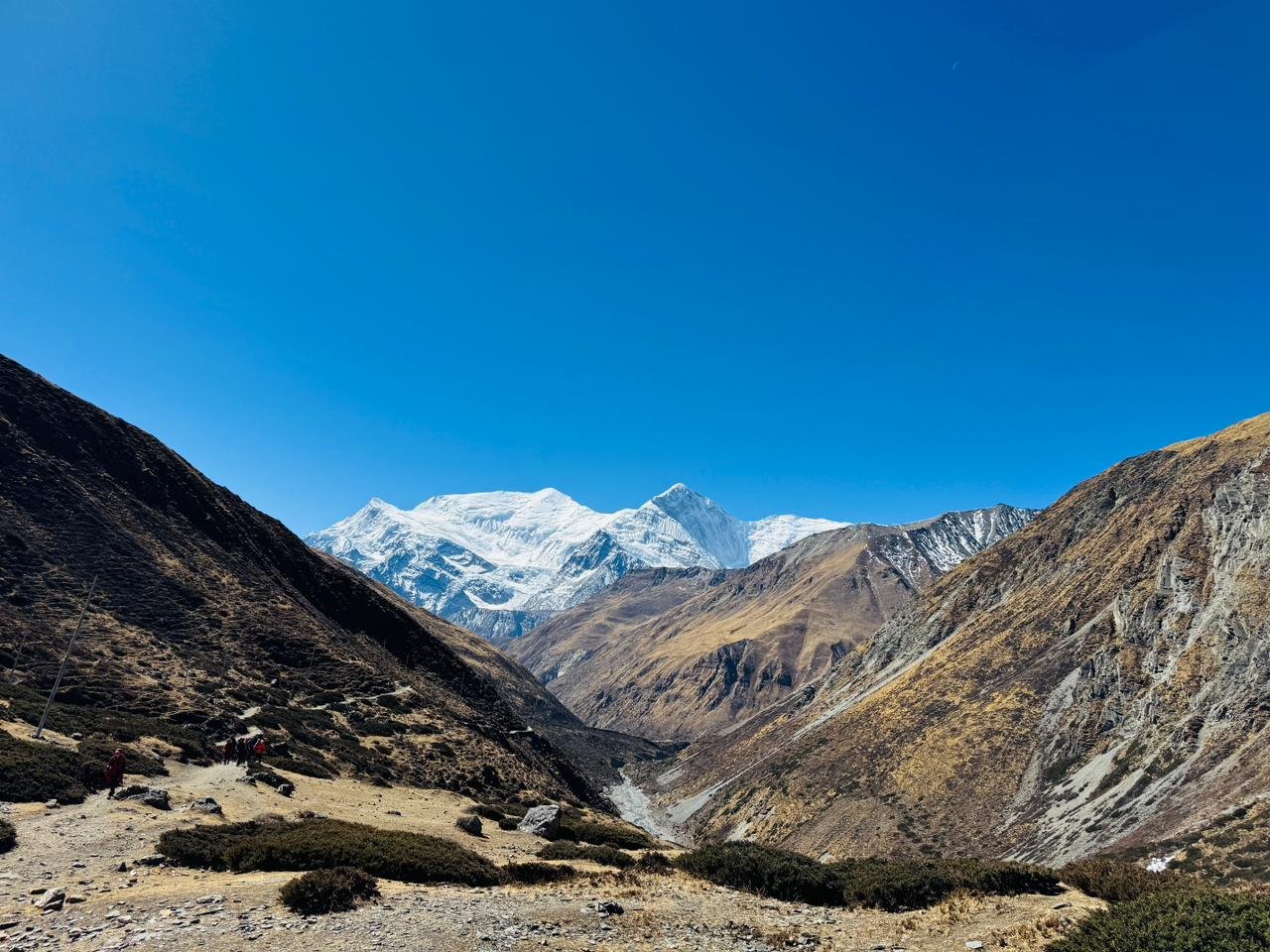
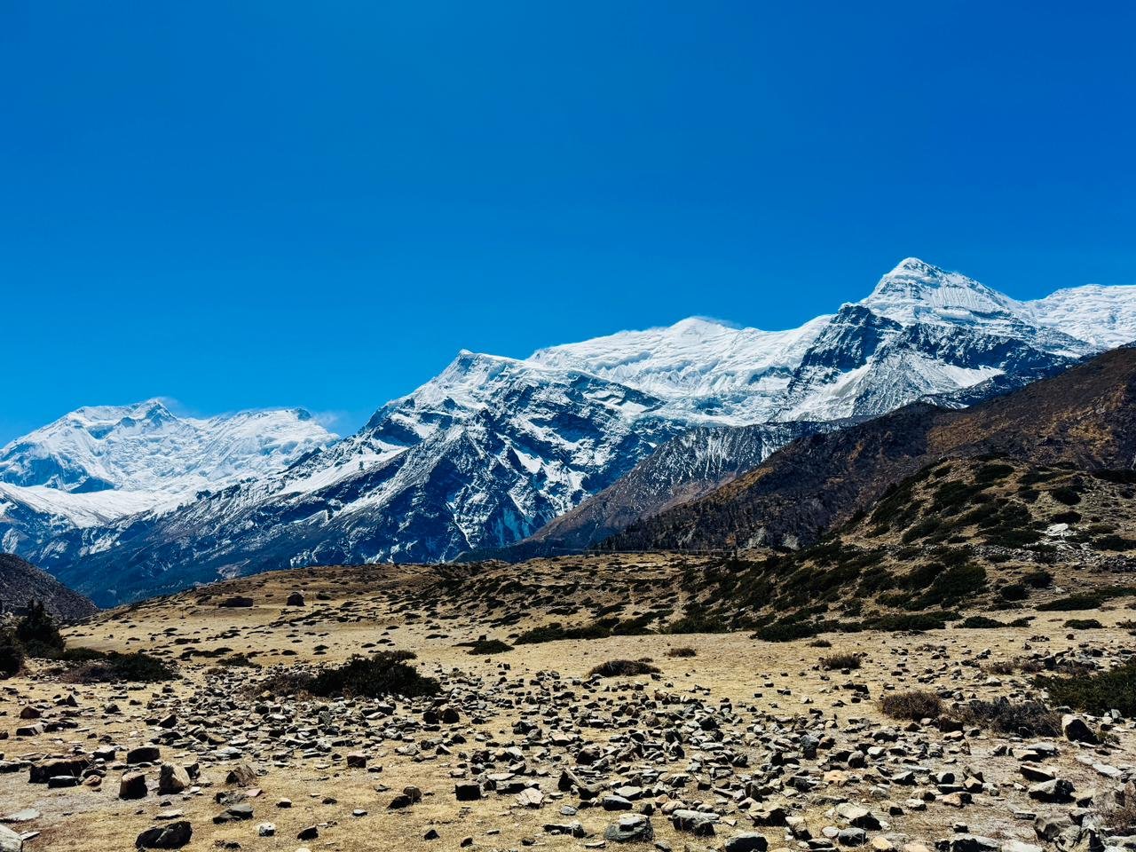
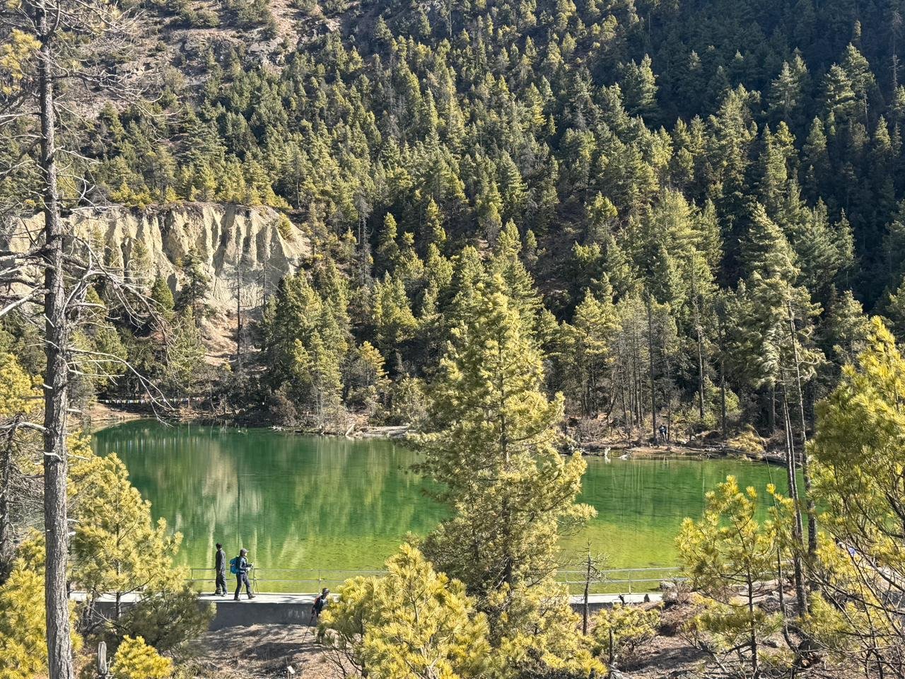
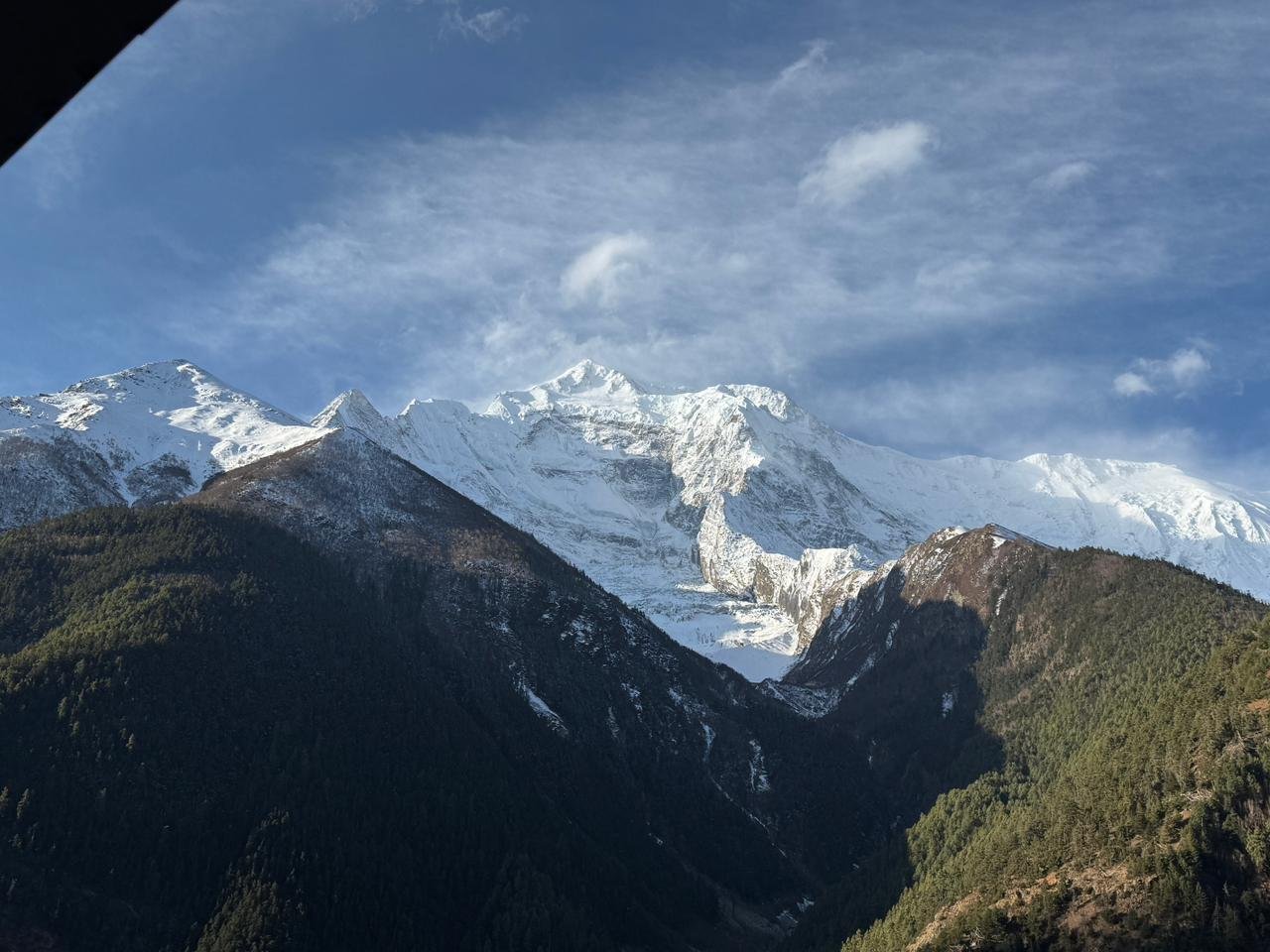
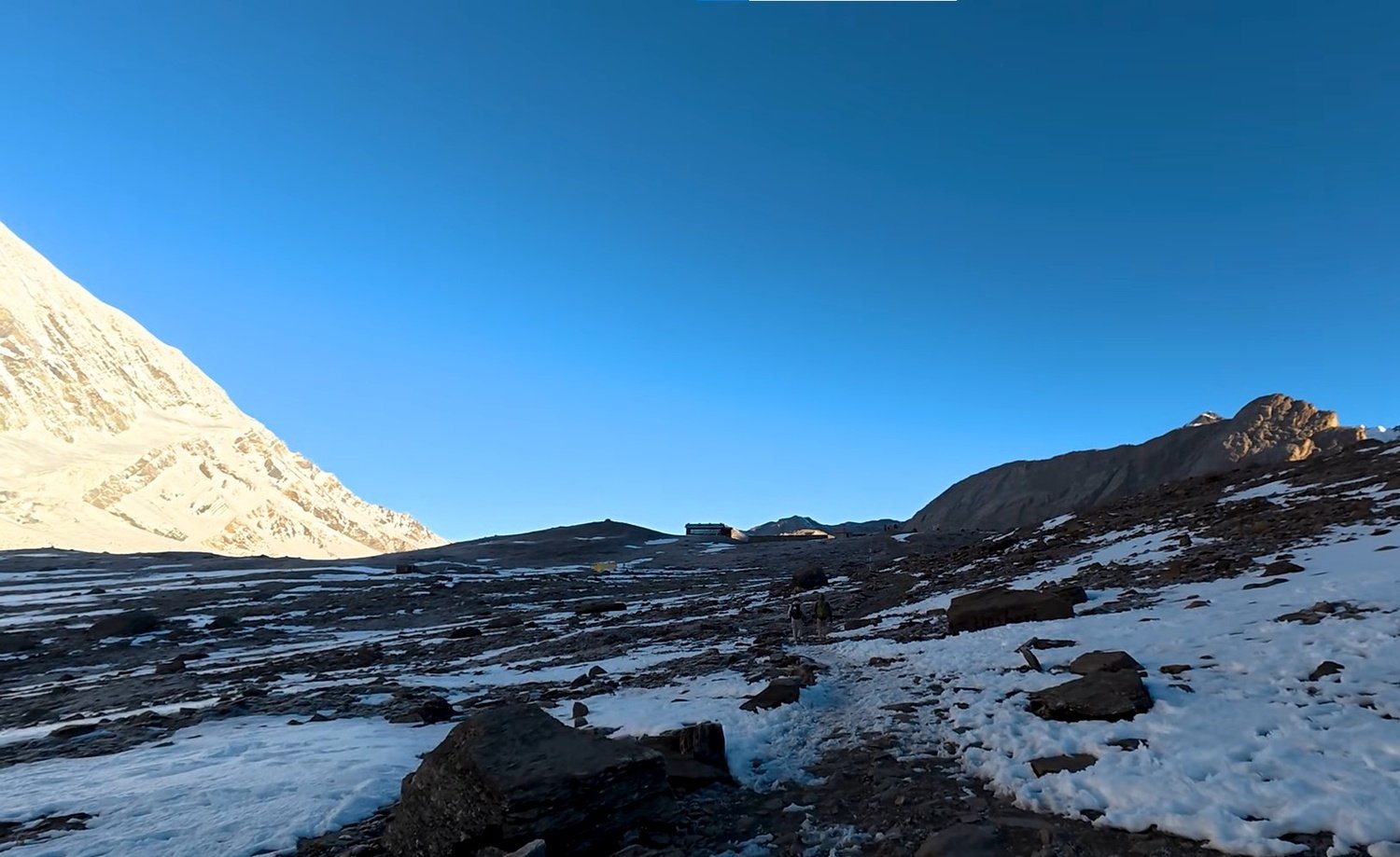
The Annapurna range fills the southern horizon the entire way. The trail continues to Manang via the Ice Lake at approximately 4,600 metres, a side ascent that climbs sharply above the main valley trail.
The location delivers views back down the full length of the Manang valley with Gangapurna and Annapurna III on the opposite wall.
The body is pushed to four thousand six hundred metres, then brought back down to sleep at Manang at 3,590 metres. That is the intended effect.
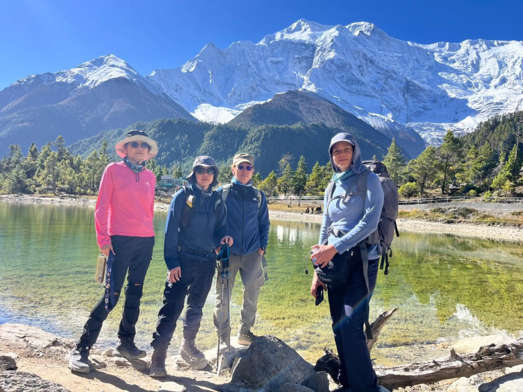
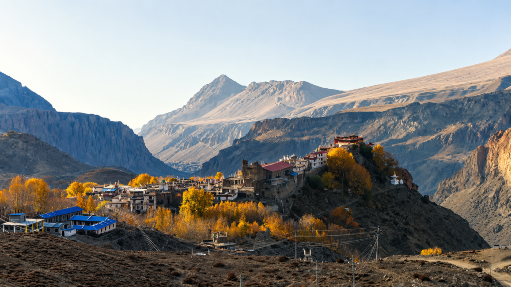
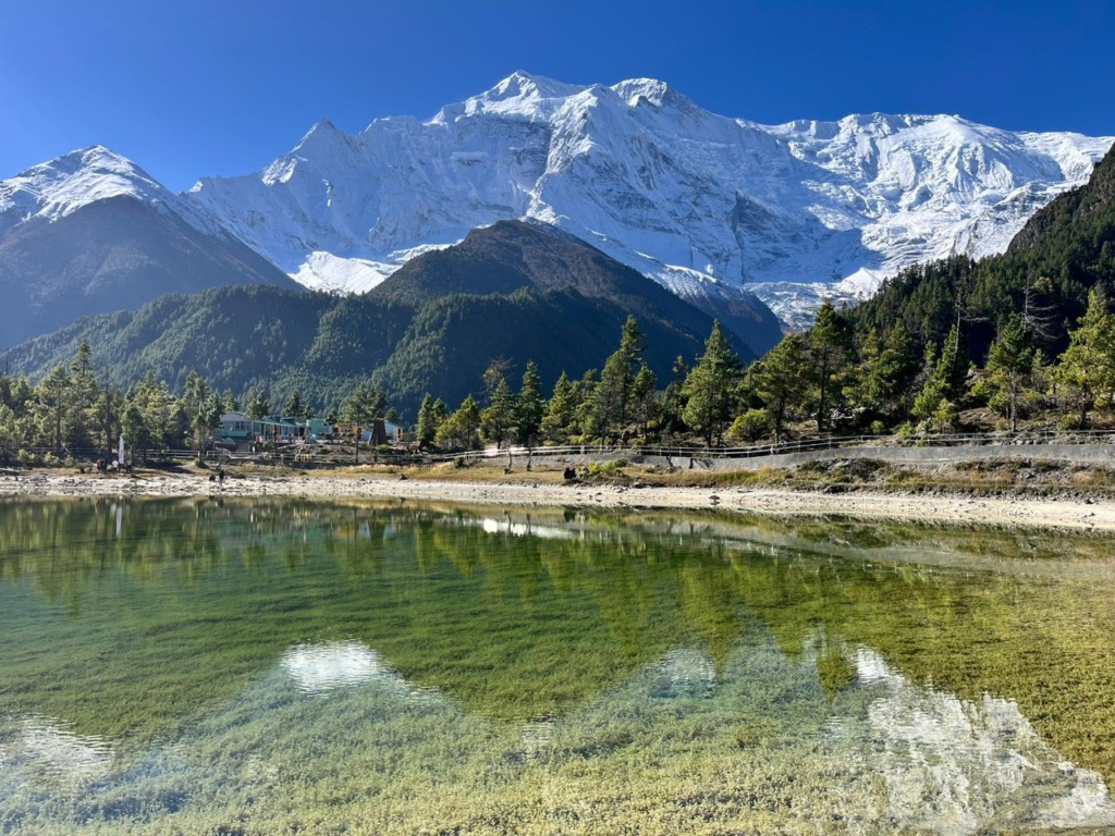
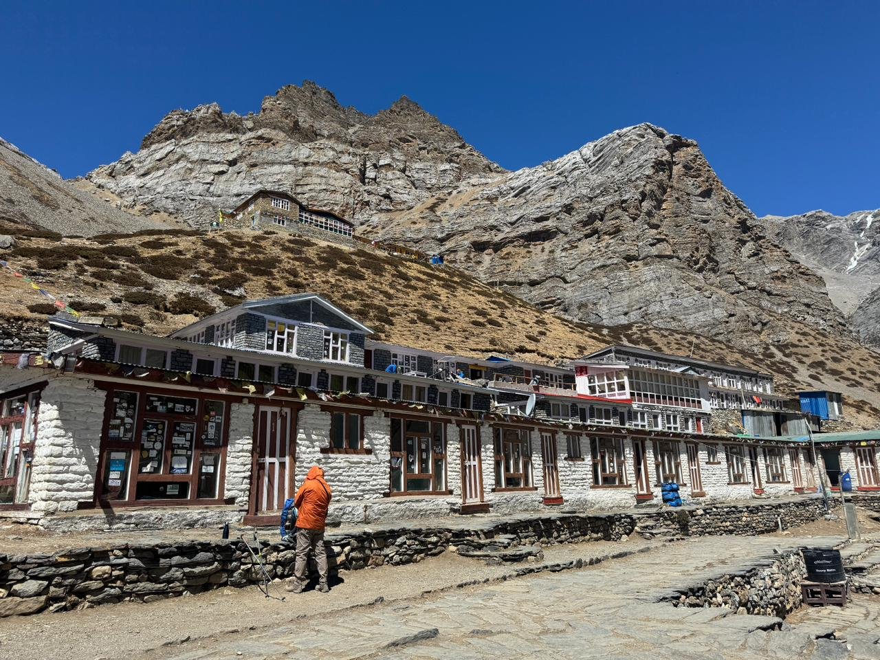
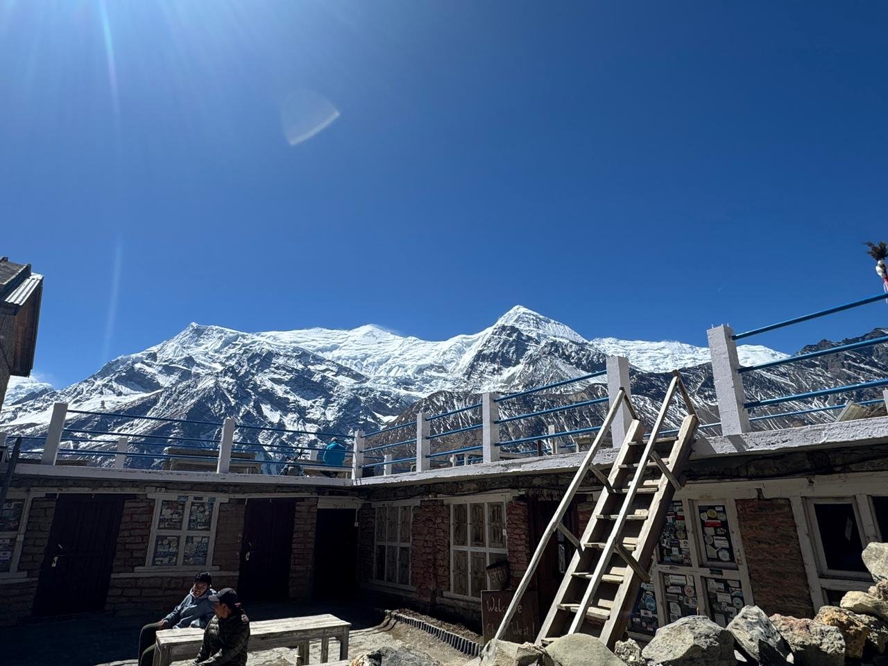
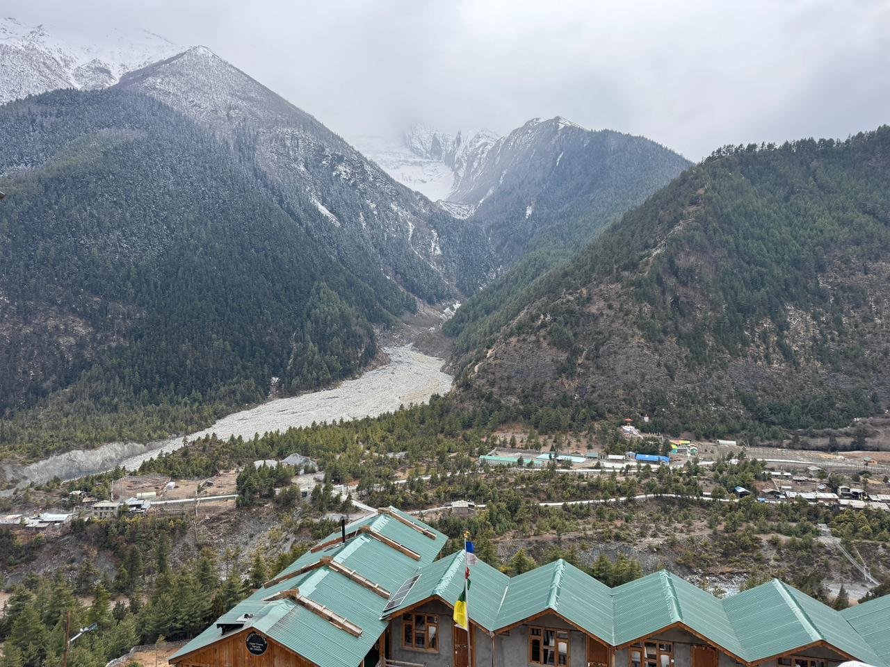
Manang is the emotional heart of the upper circuit and the place where the trek shifts from approach to arrival.
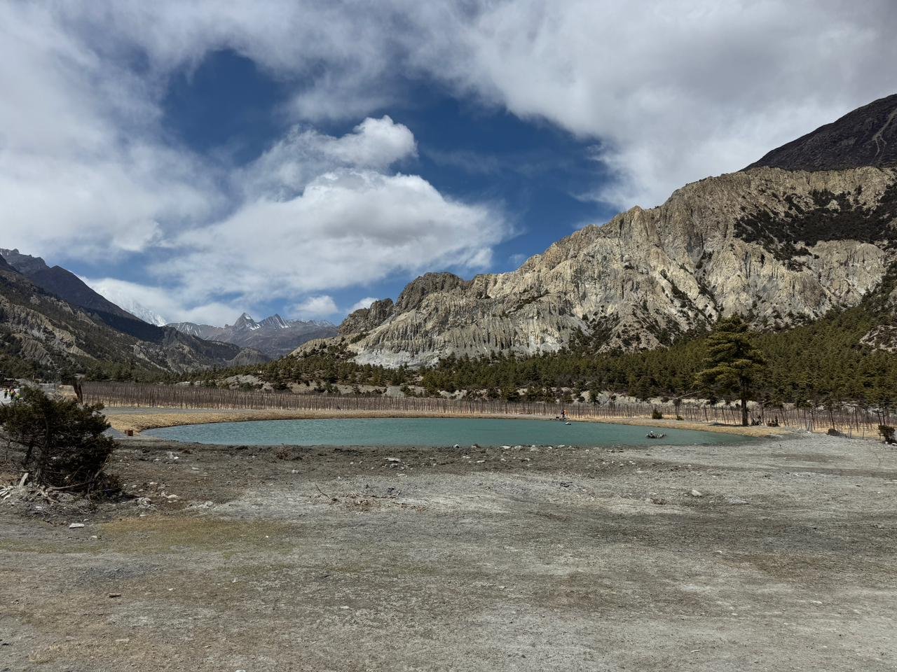
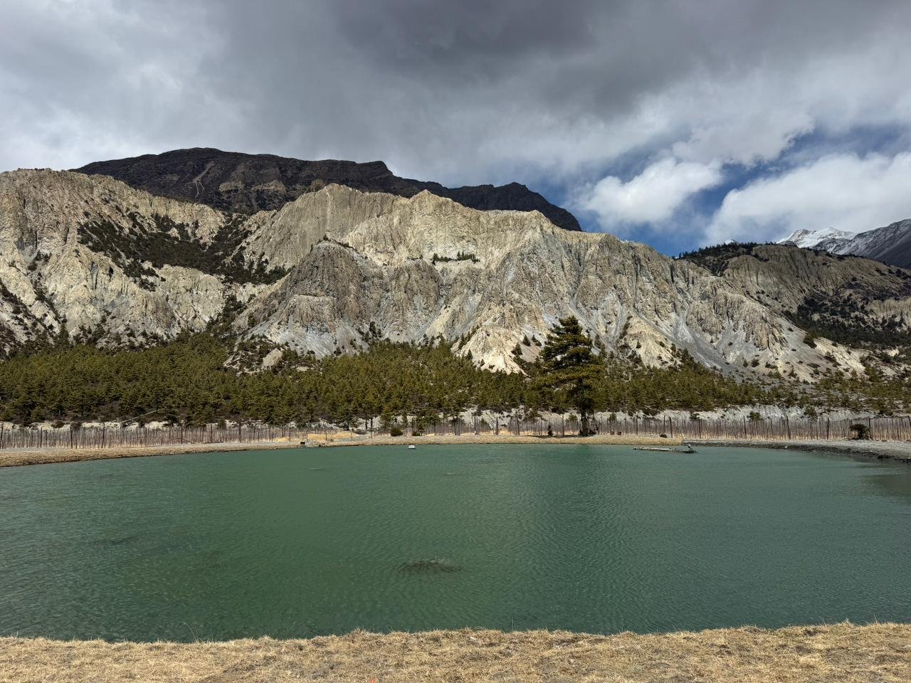
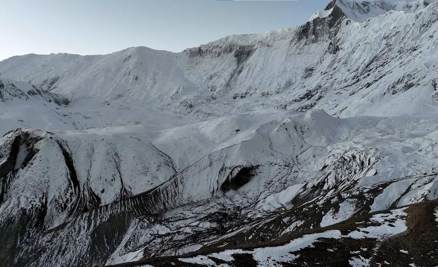
The Gangapurna Glacier sits at the head of the valley above the village rooftops, its moraine lake visible from the teahouse terraces, and the combination of glacier, high peaks, and stone village at the same sight line creates a scene unlike anything on the lower route.
The full acclimatization day in Manang is not passive rest, it is the single most important day of preparation for everything that comes above, and the village gives you enough to do and see to make use of it properly.
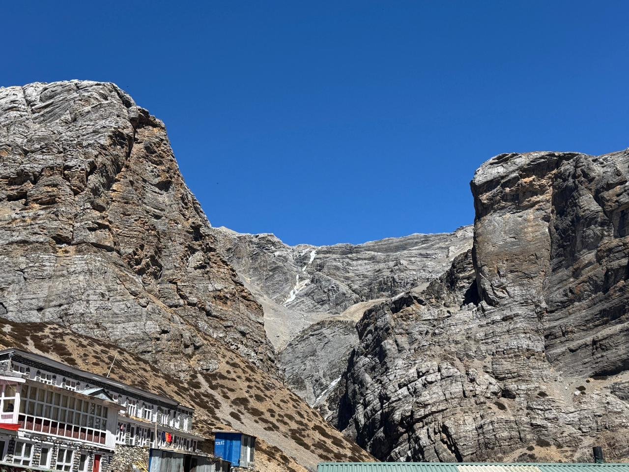
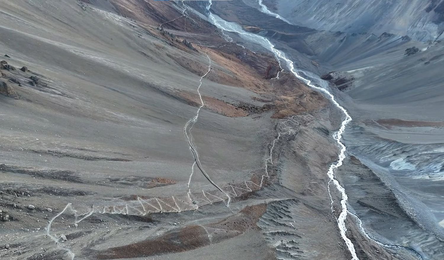
From Manang the route breaks away from the main Annapurna Circuit and heads west toward Tilicho Lake.
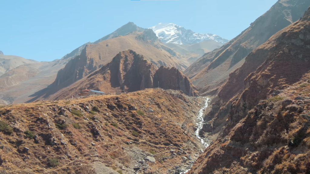
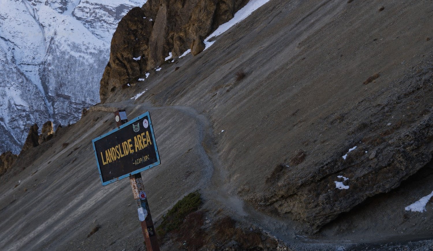
Khangsar at 3,734 metres is the last village before the trail enters genuinely exposed high terrain, and the path beyond it crosses a steep landslide section above a river gorge where loose rock and narrow trail demand consistent attention.
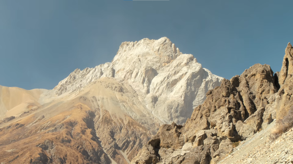
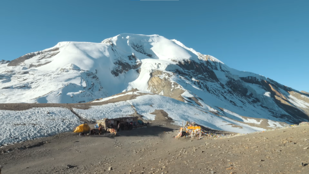
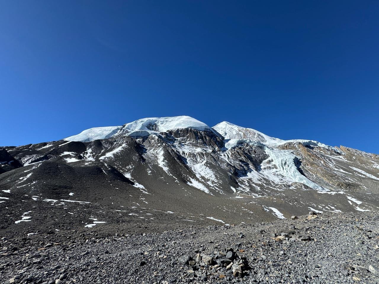
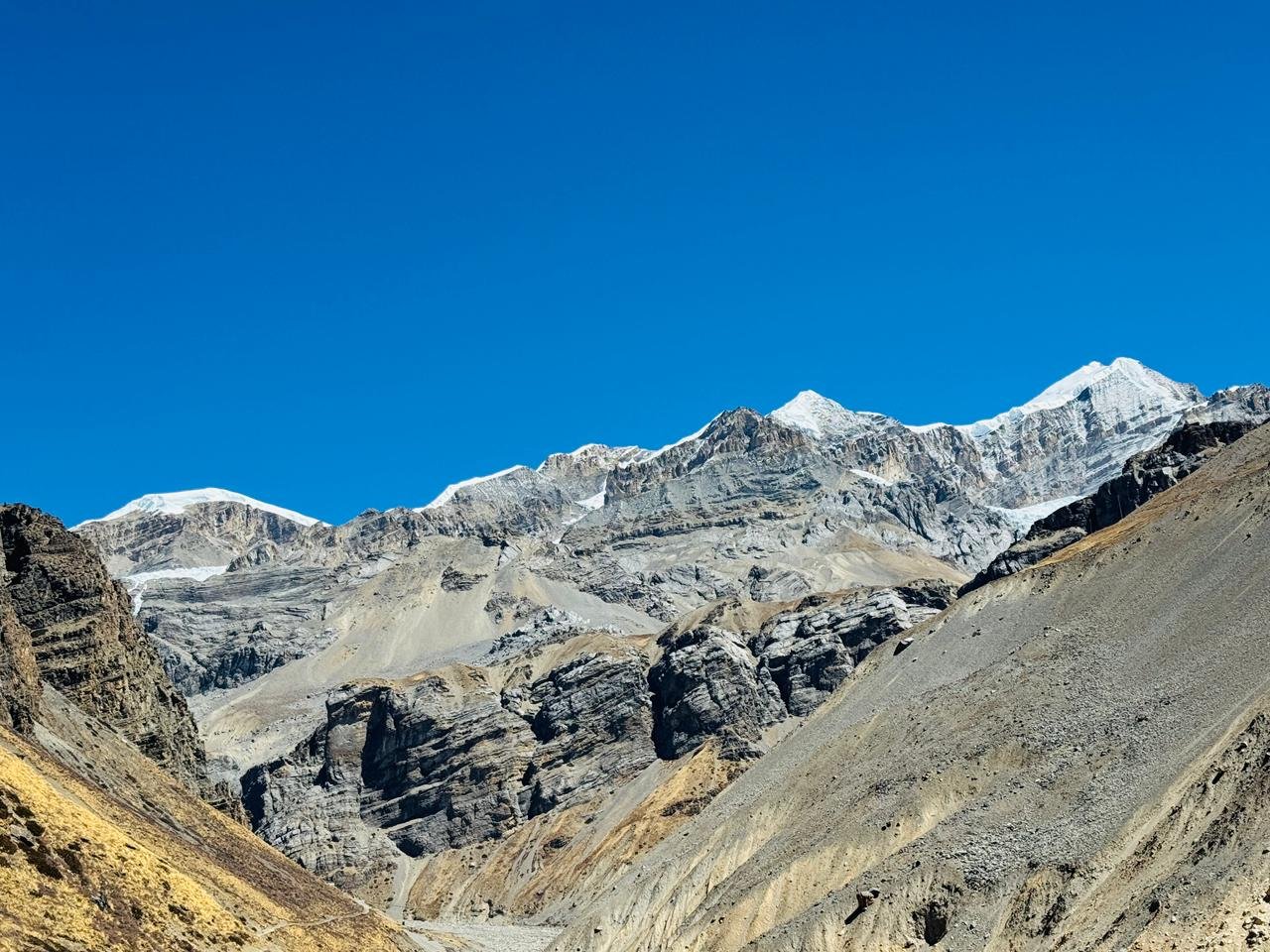
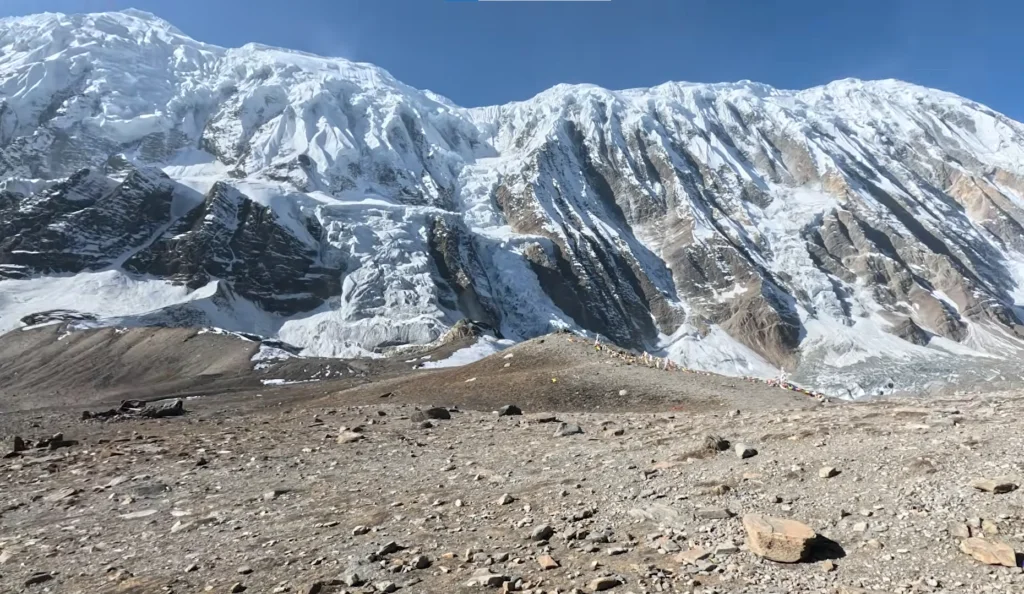
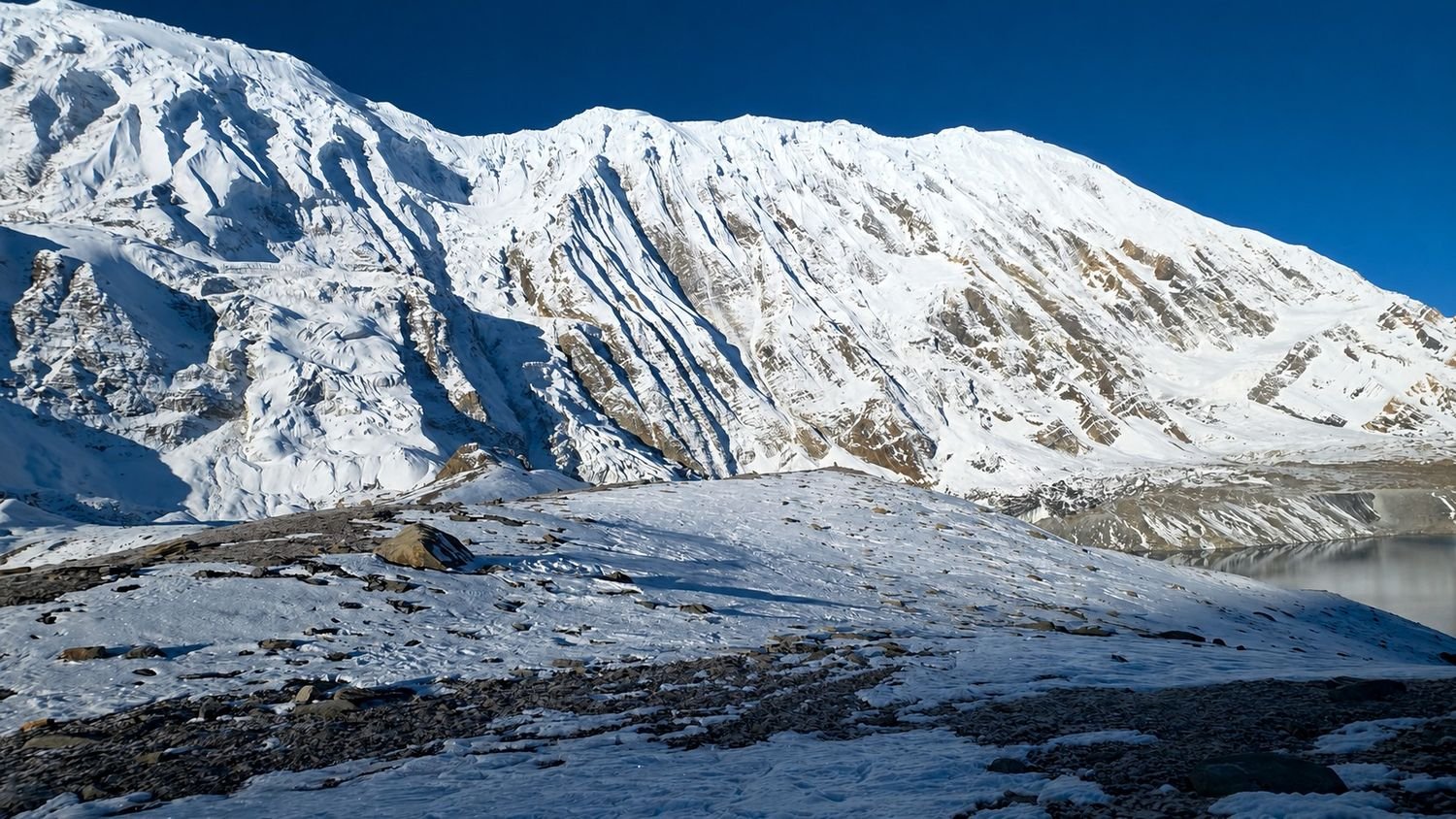
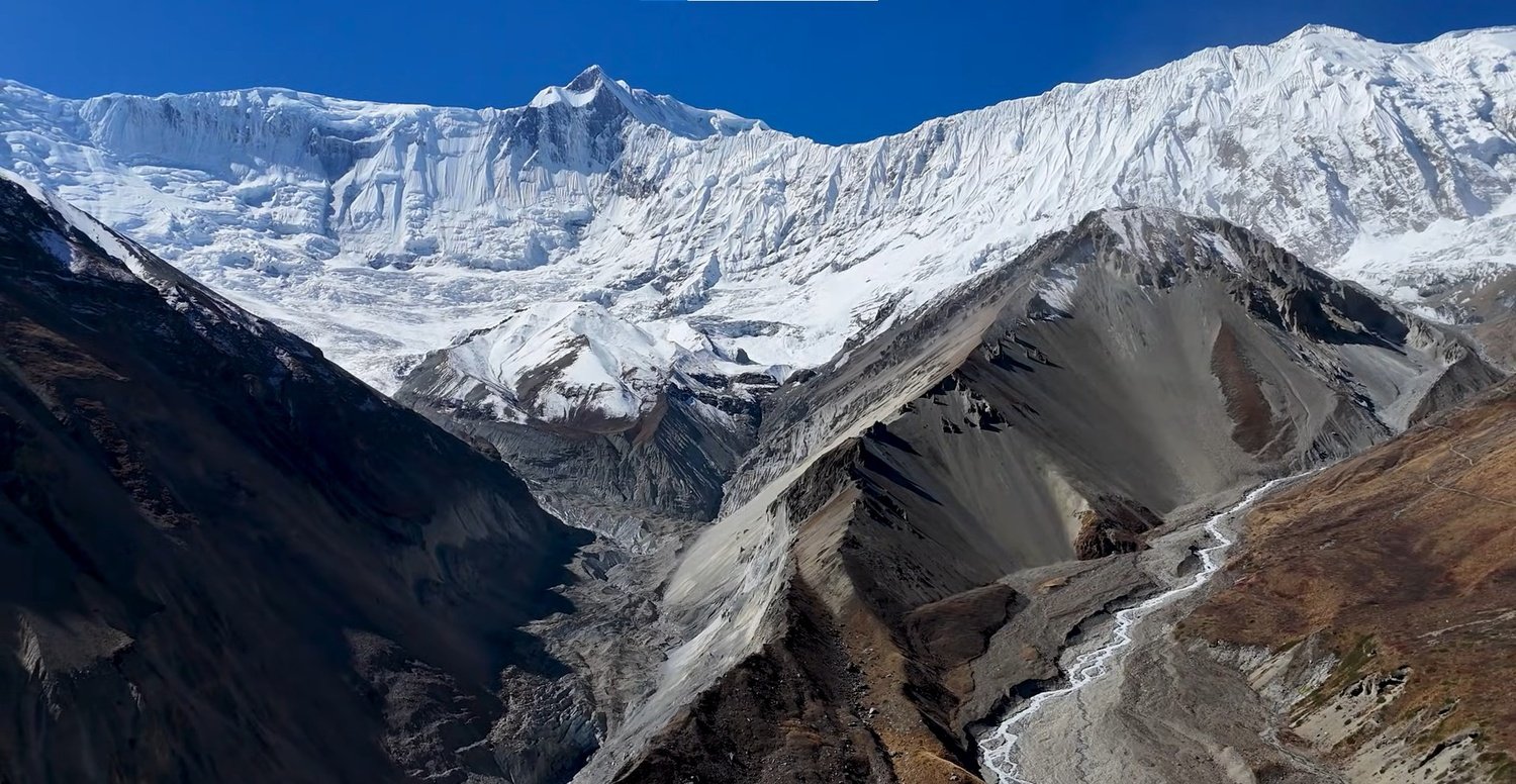
Tilicho Base Camp at around 4,200 metres sits on a rocky plateau with the first direct view of Tilicho Peak above the lake basin.
The light on the ice face of the peak in the late afternoon is the kind of thing people photograph more than once and fail to fully capture.
The base camp teahouse is basic and the night is cold. Start early the following morning.
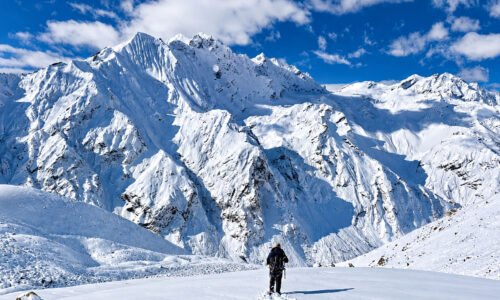
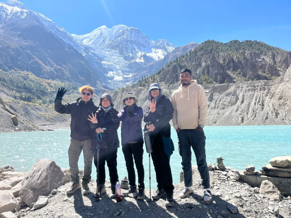
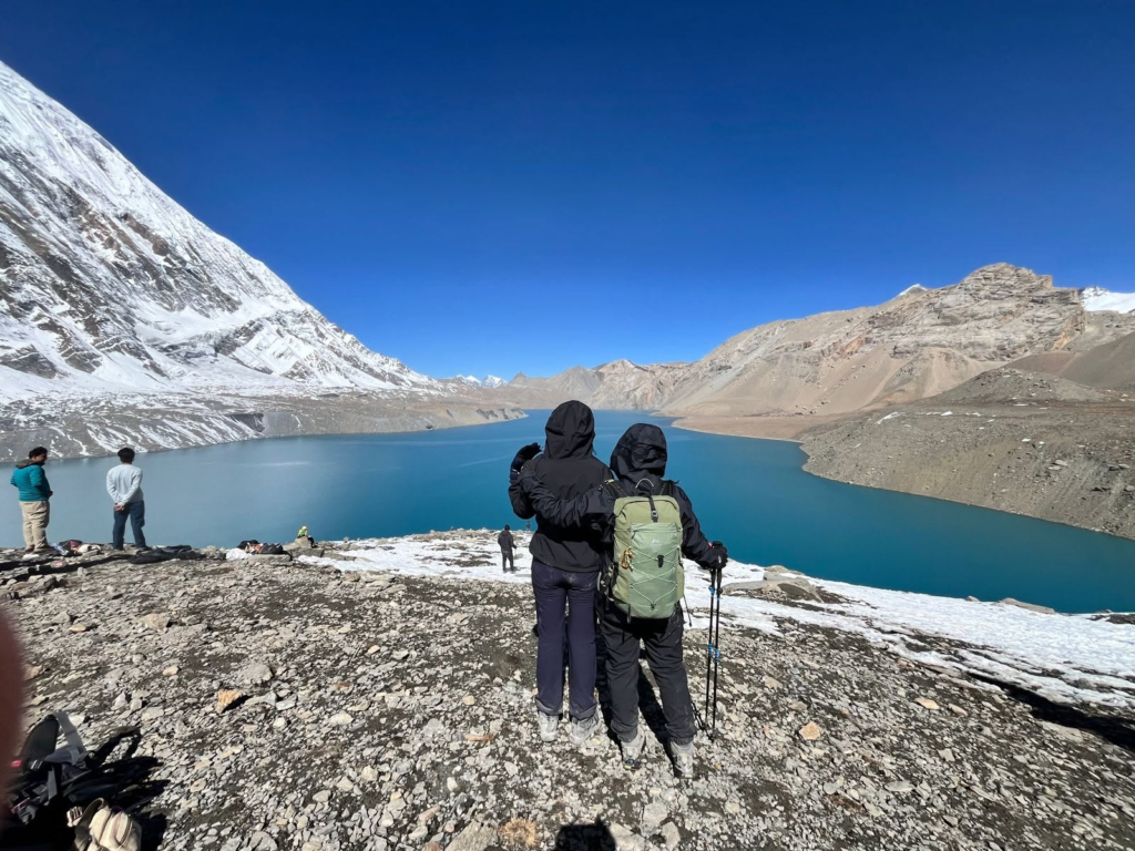
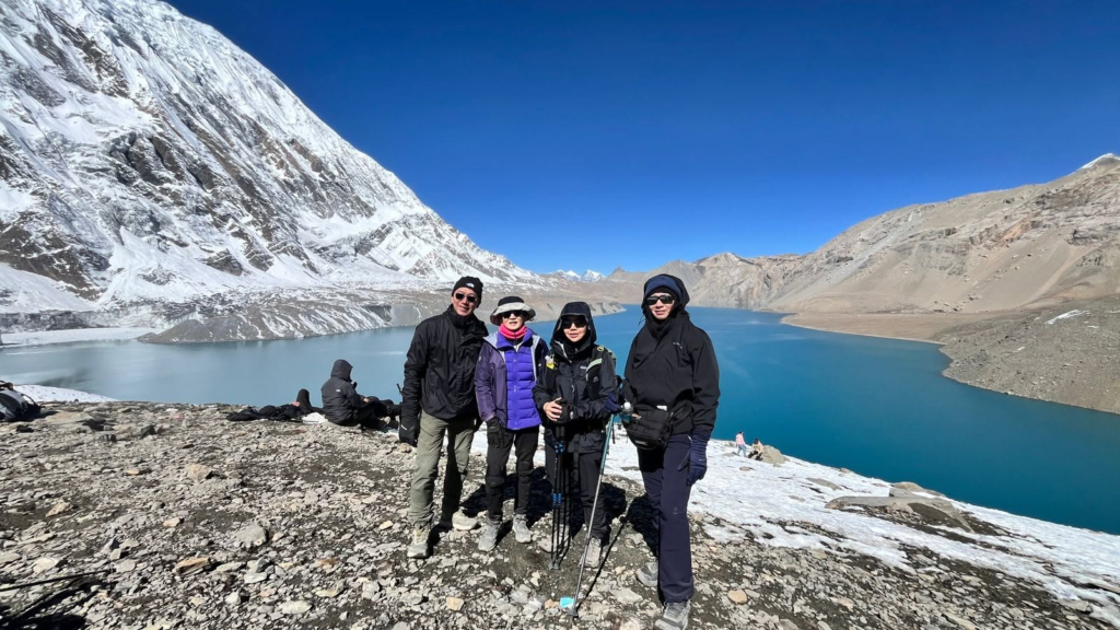
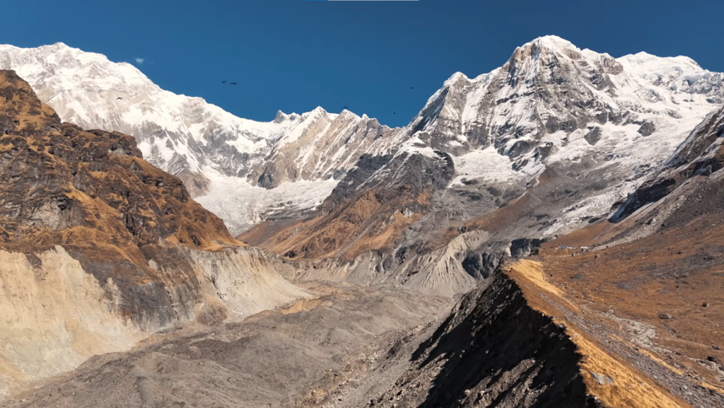
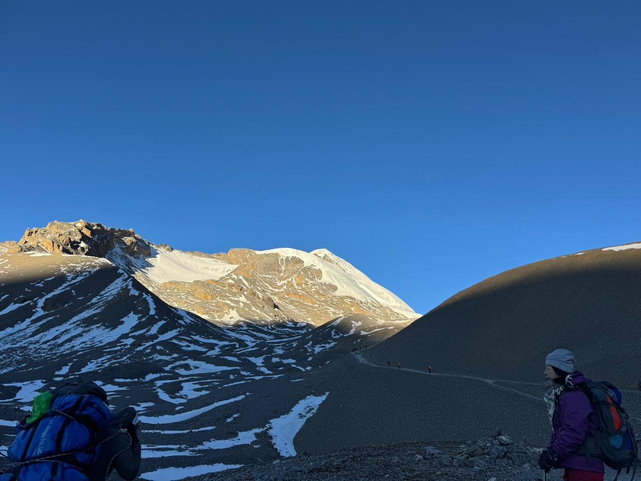
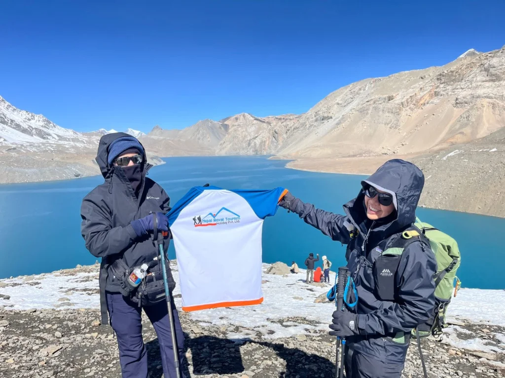
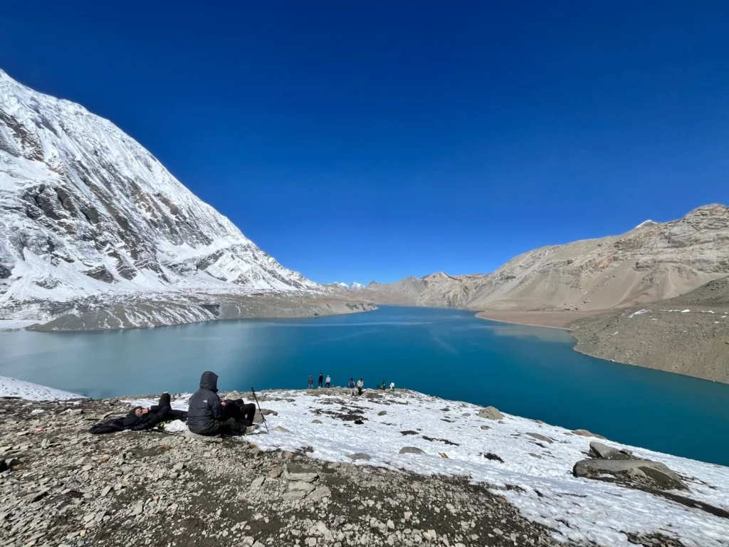
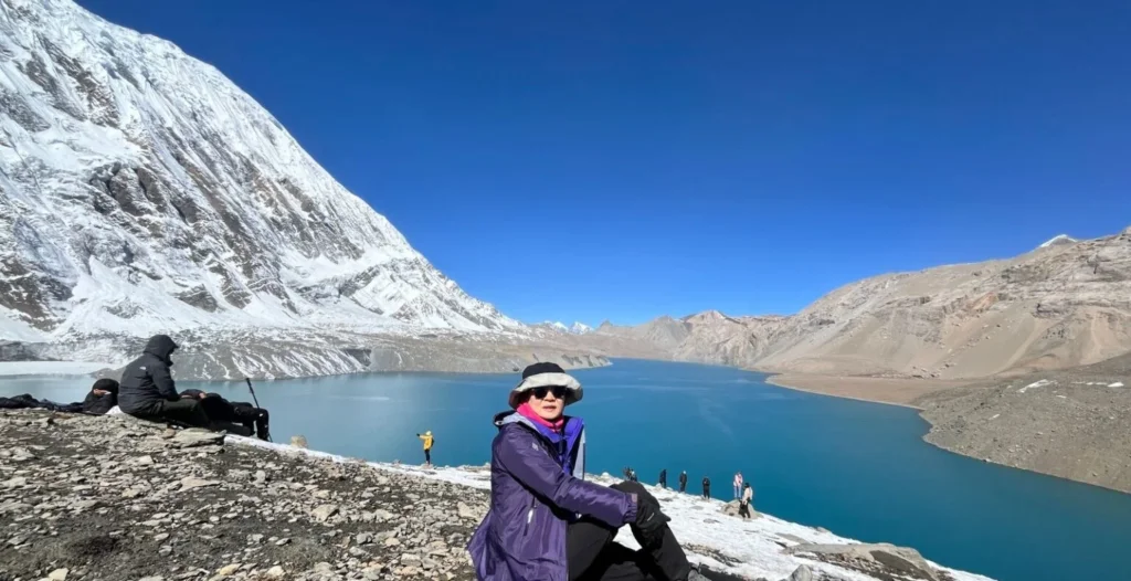
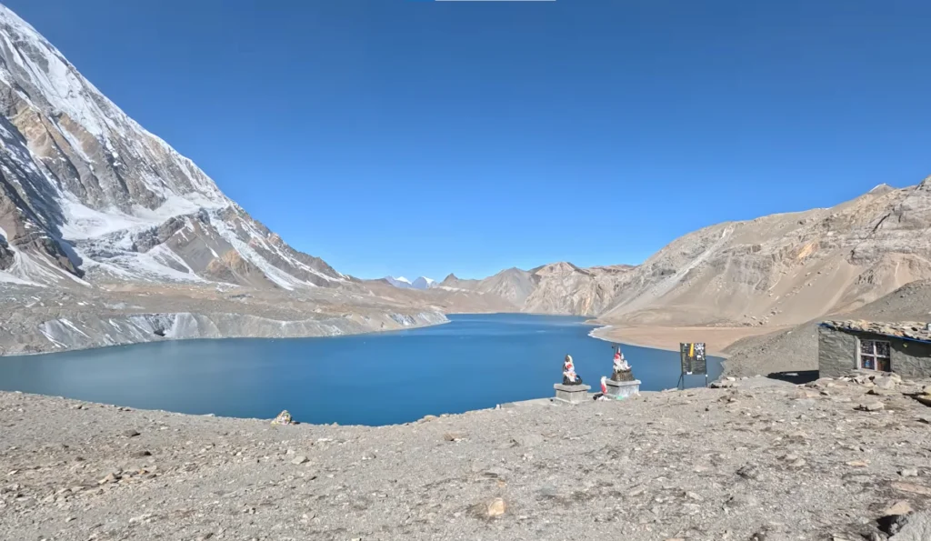
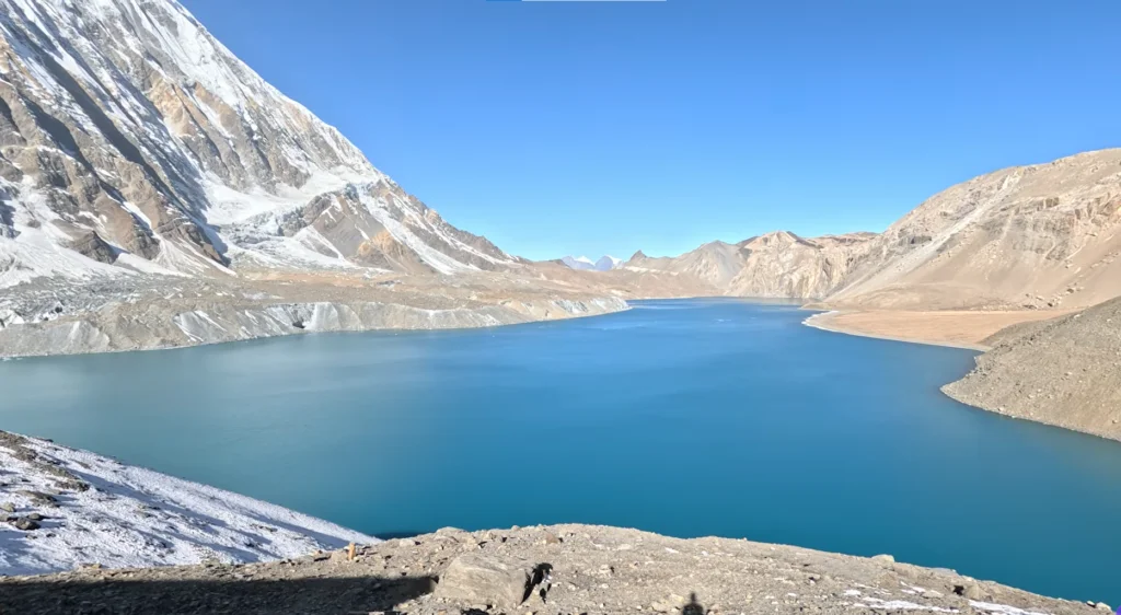
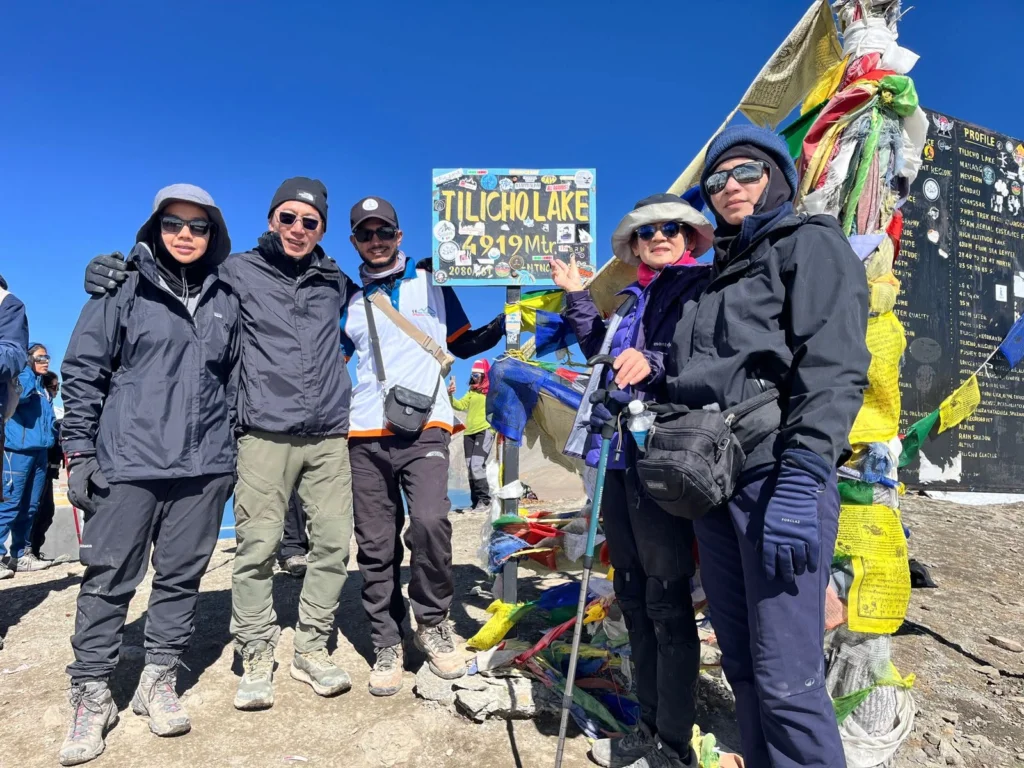
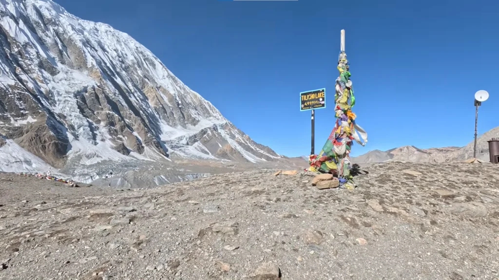
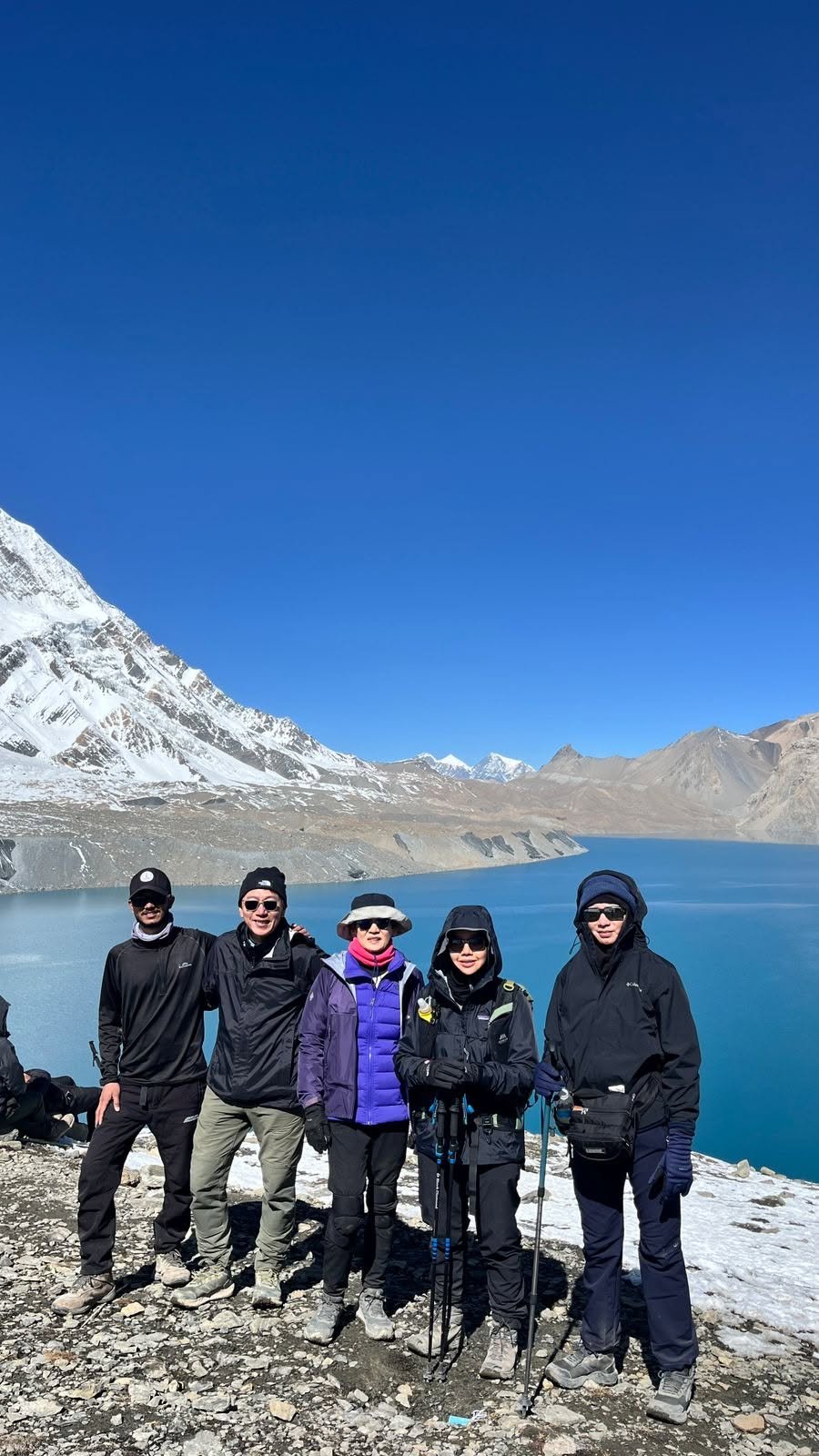
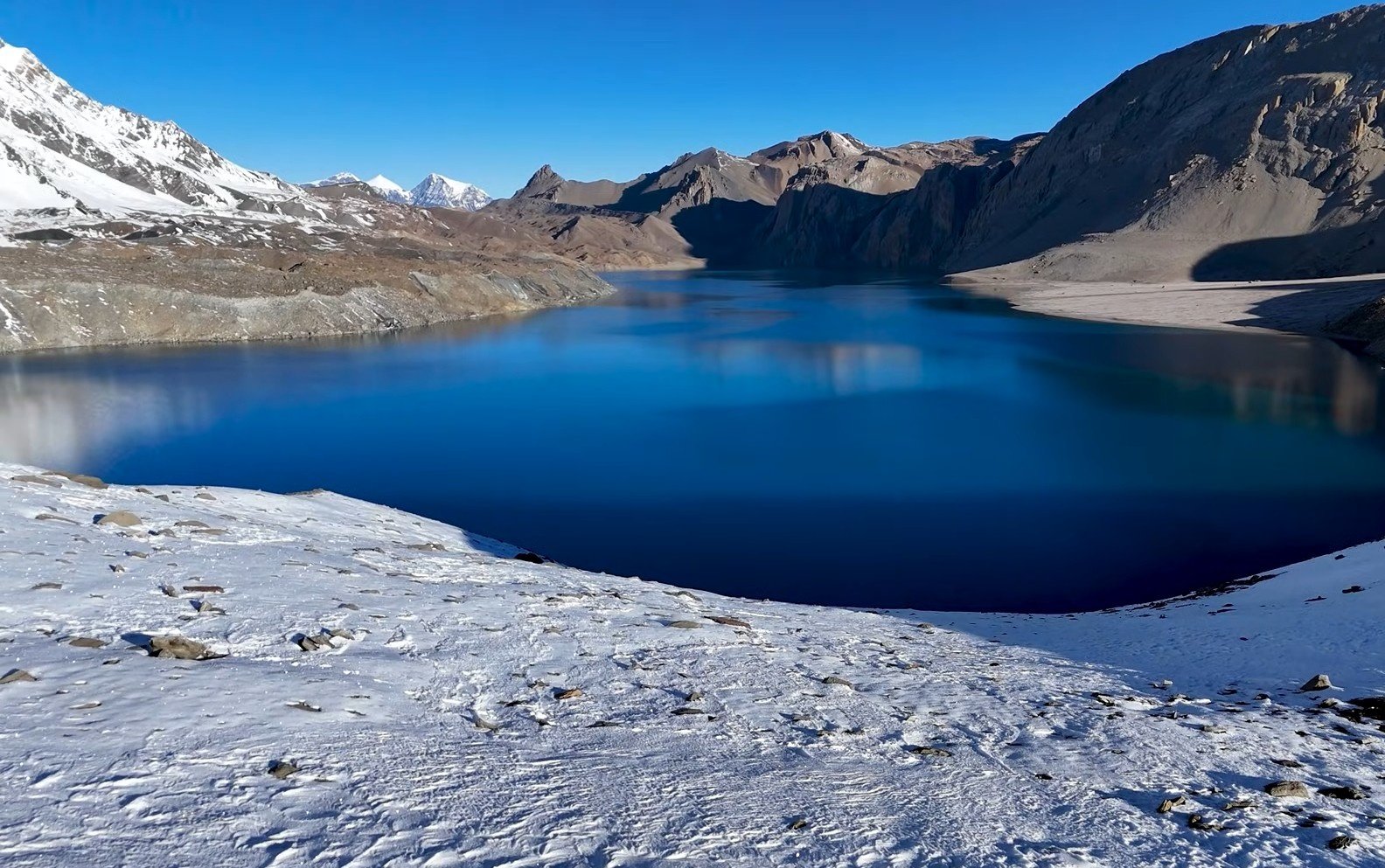
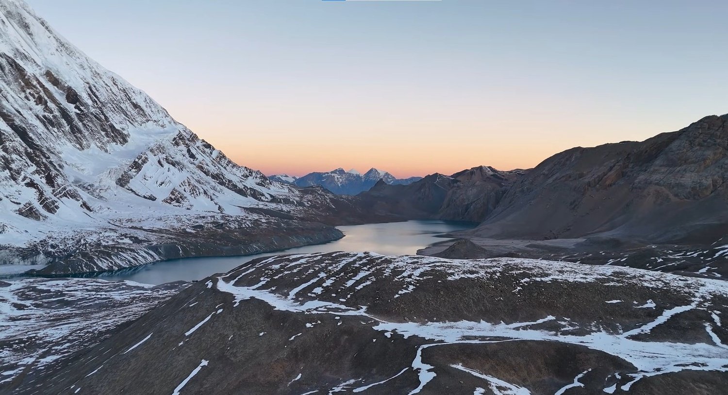
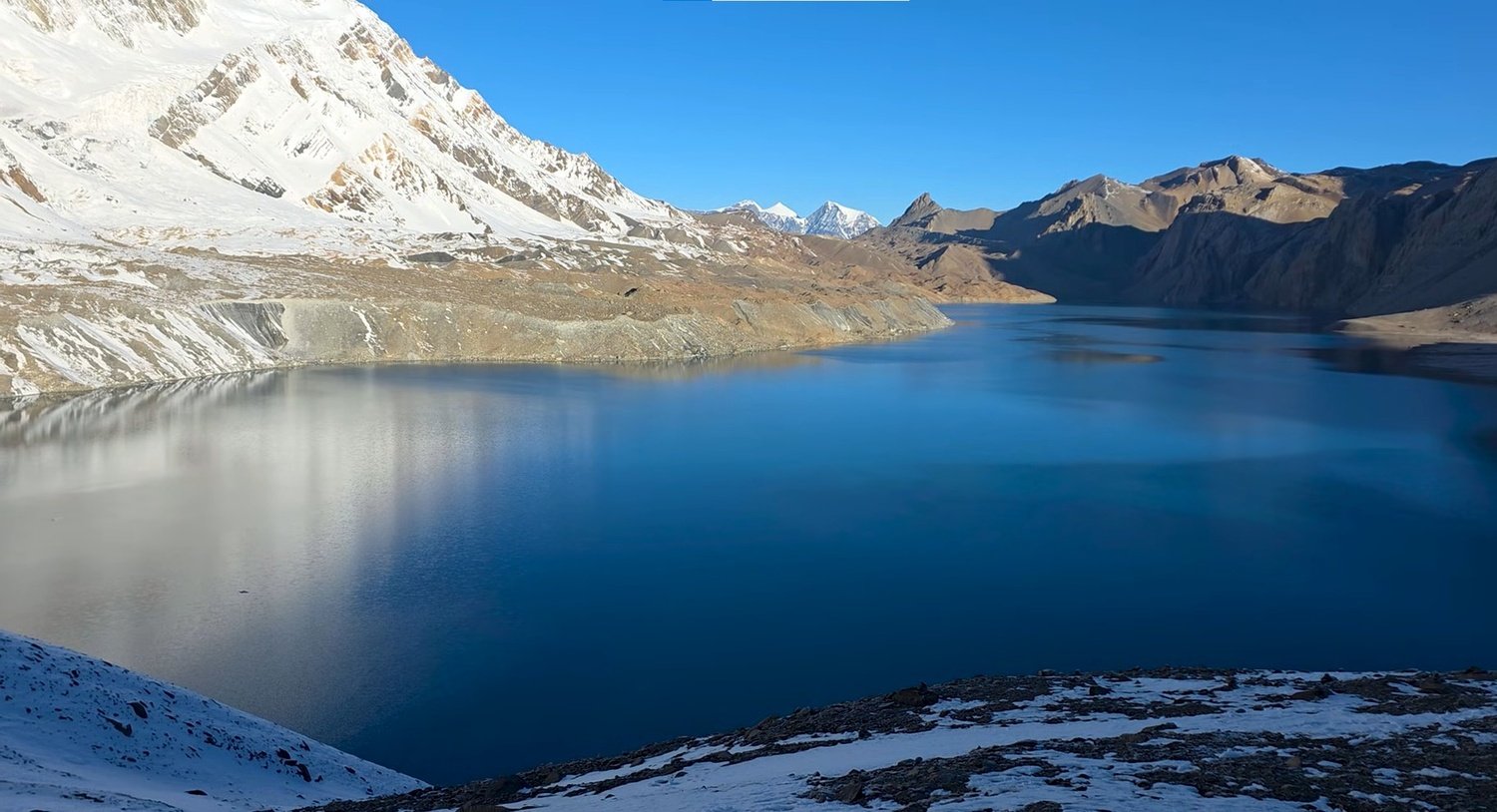
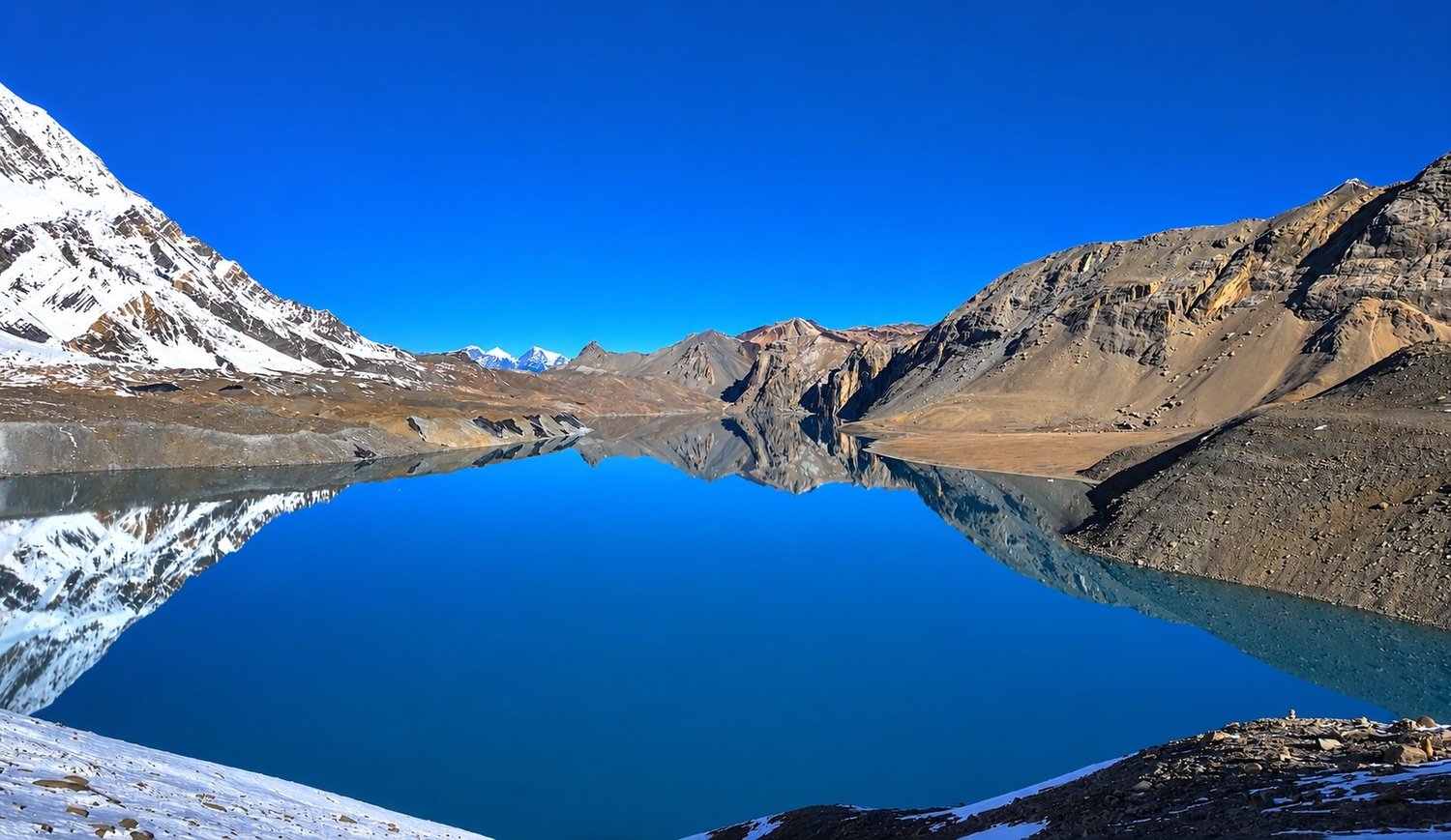
Tilicho Lake at 4,919 metres is one of the highest lakes in the world and the experience of reaching it earns that claim properly.
The final ascent from base camp crosses moraine and patches of snow in a two to three hour push where the thin air makes itself felt in the last stretch.
The lake appears gradually over the final rise, first a hint of color between the ridgelines, then the full basin at once.
The water is a blue green that does not look quite real against the surrounding snow and stone walls.
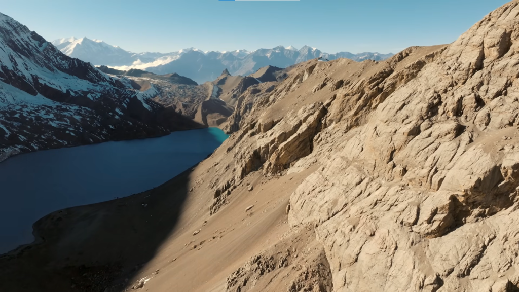
Tilicho Peak and Khangsar Kang at 7,485 metres define the skyline above. Make sure to spend few hours here.
The return to Siri Kharka that afternoon brings the body back to a healthier sleeping altitude before the main circuit resumes.
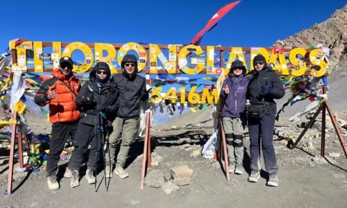
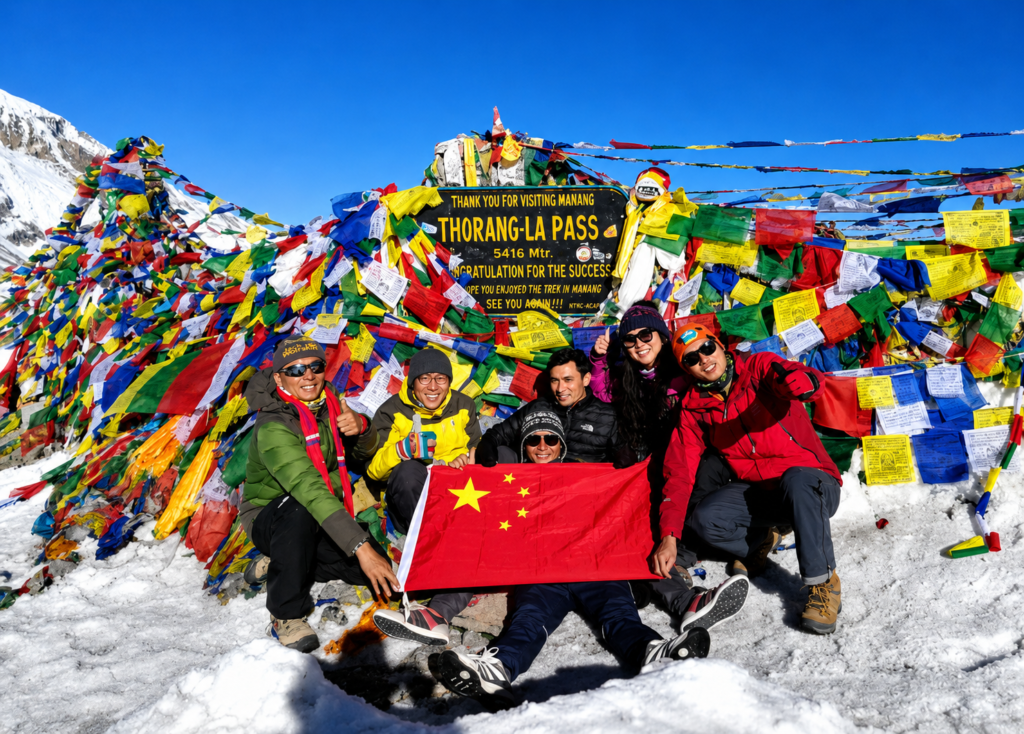
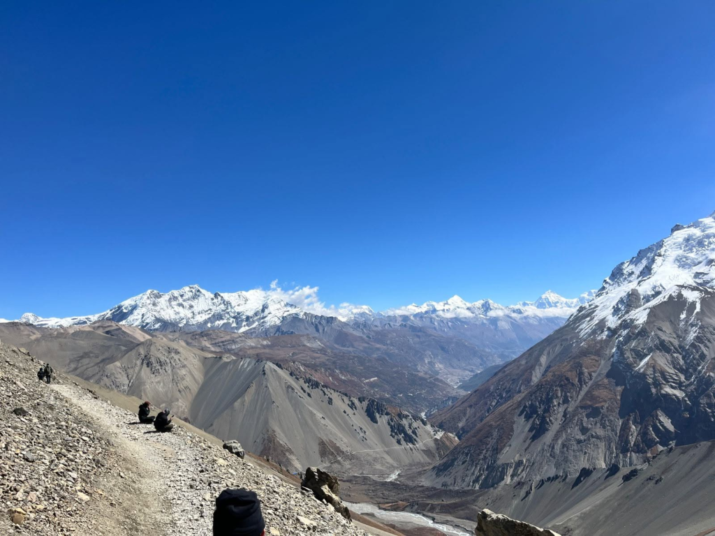
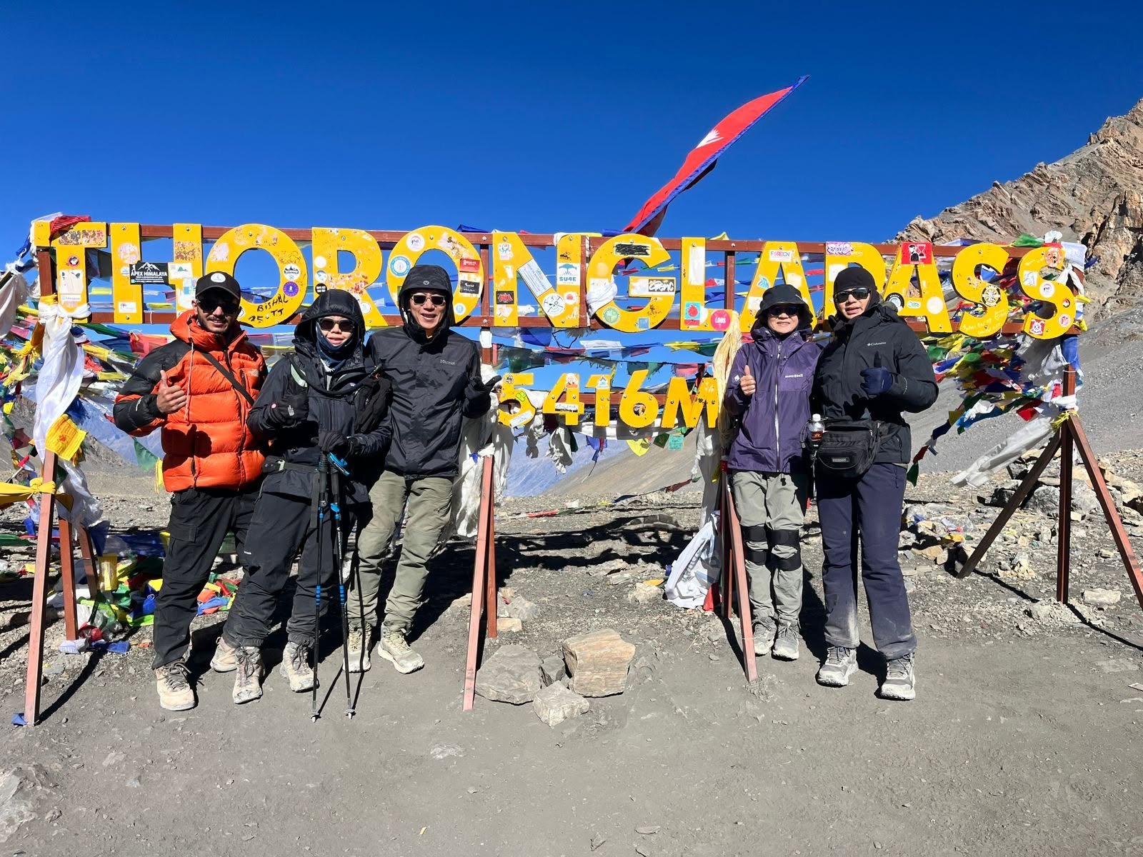
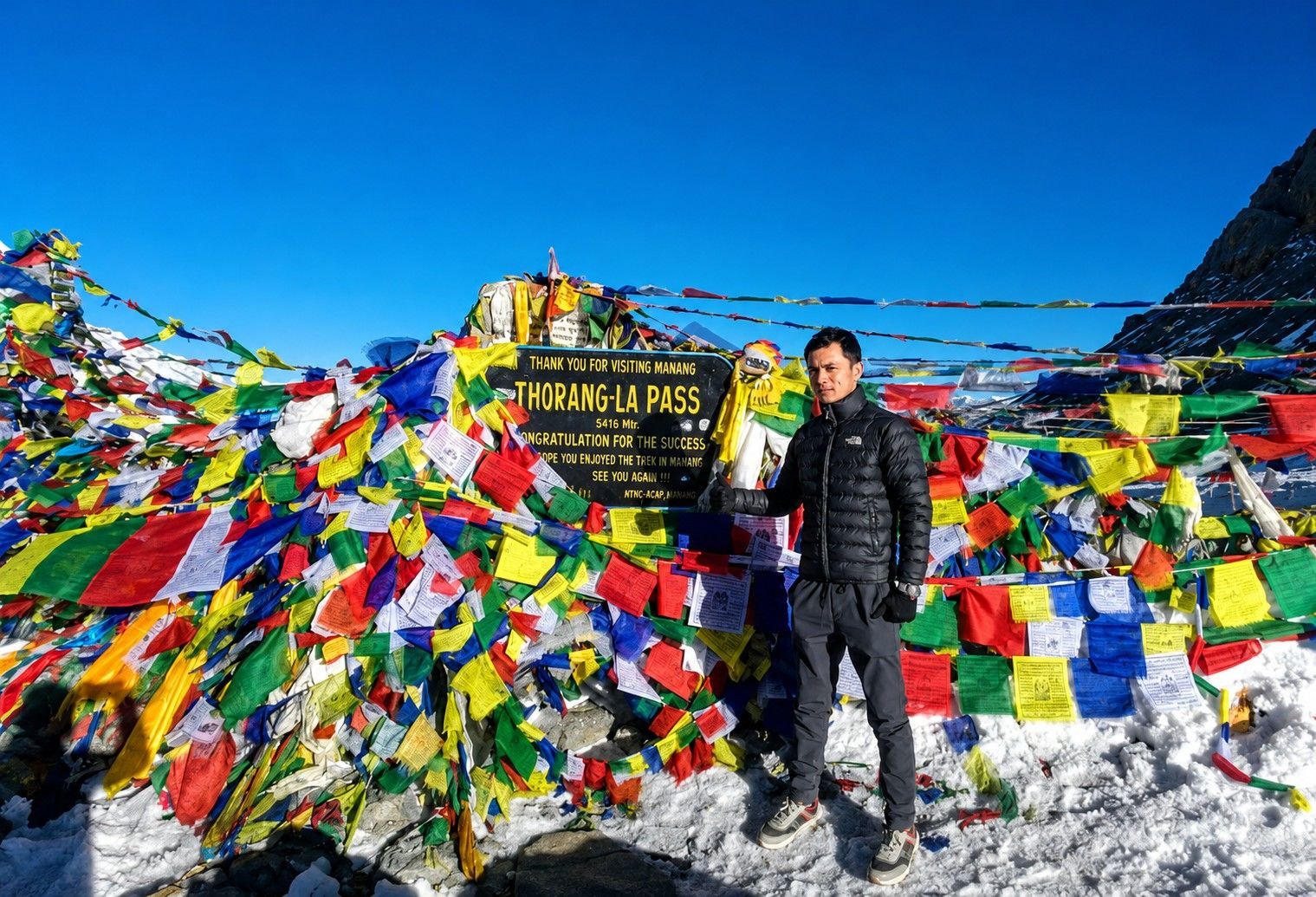
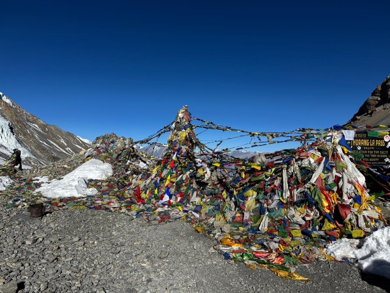
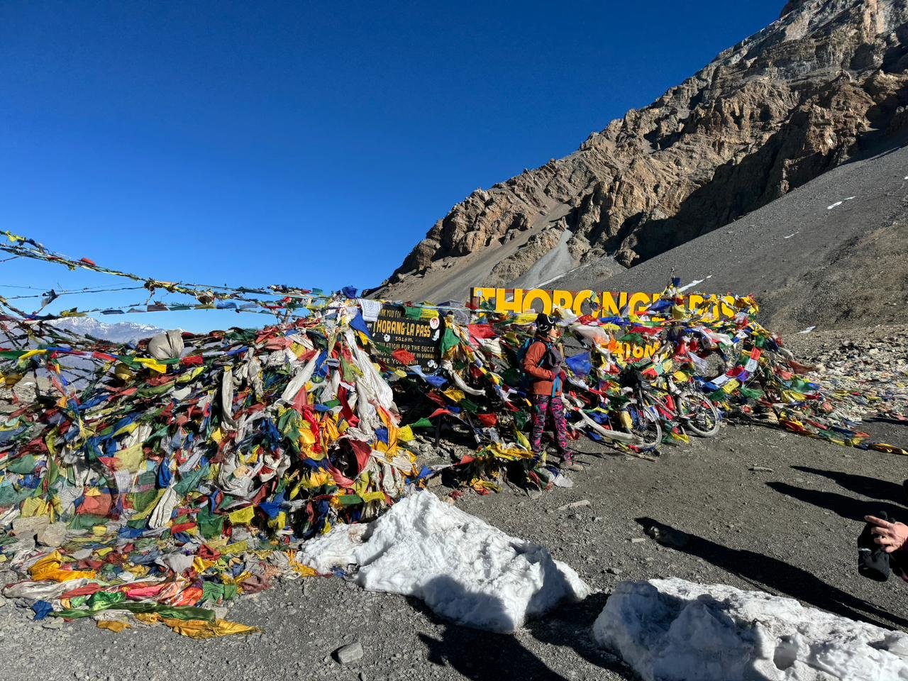
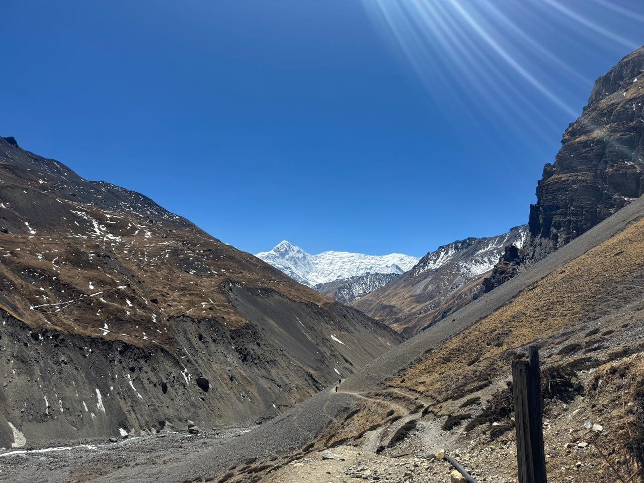
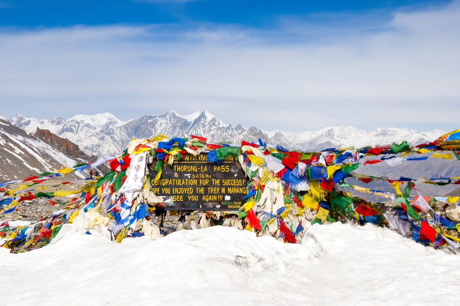
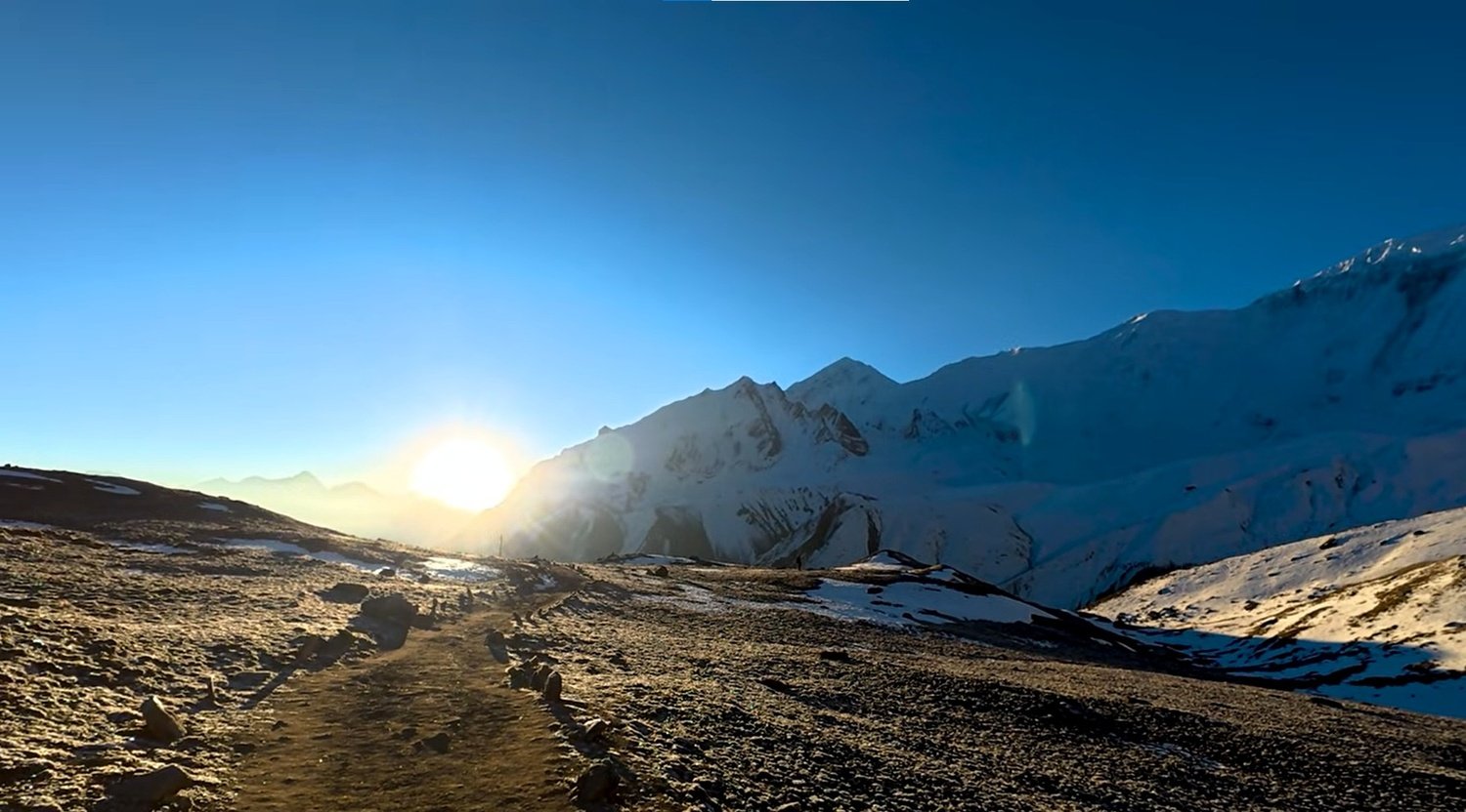
Rejoining the Annapurna Circuit at Yak Kharka, the route turns its attention toward the Thorong La Pass at 5,416 metres, the highest point of the trek and one of the highest trekking passes in the world.
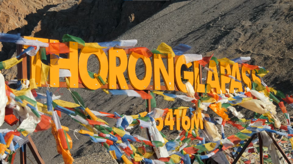
Thorang Phedi at 4,450 metres is the launch point for the crossing, and the early start the following morning puts the group on the pass before the afternoon winds arrive.
The ascent from Thorang Phedi to the pass takes four to five hours of sustained climbing at altitude where every hundred metres feels earned.
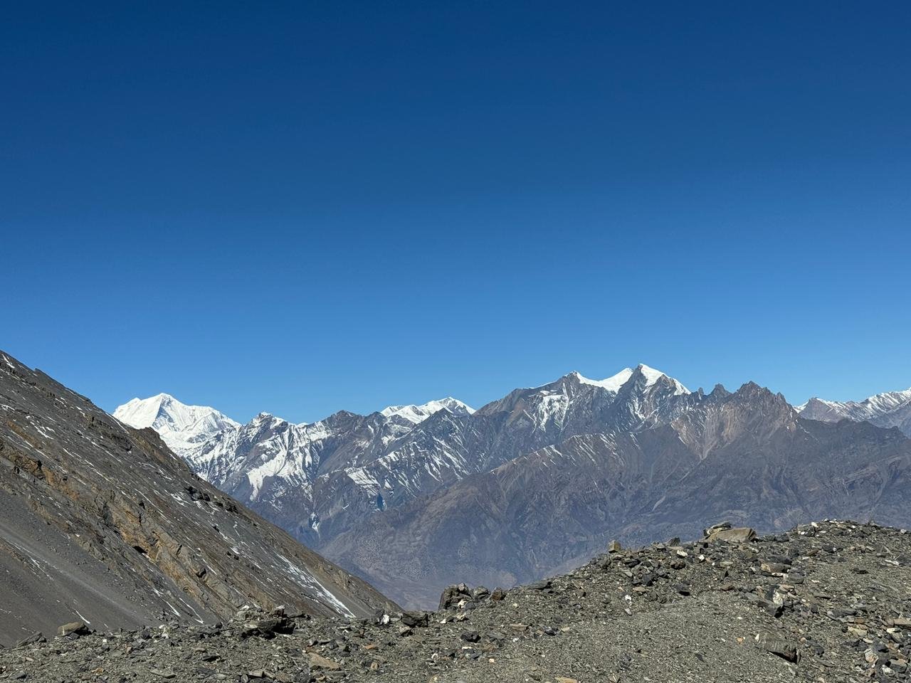
The view from the top is the kind of panoramic reward that the entire first half of the circuit has been building toward, with the Annapurna and Dhaulagiri groups visible on opposite horizons simultaneously. The descent to Muktinath takes another two hours.
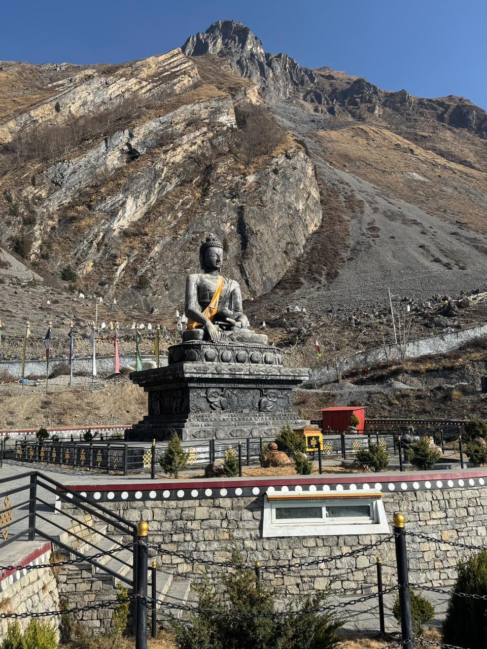
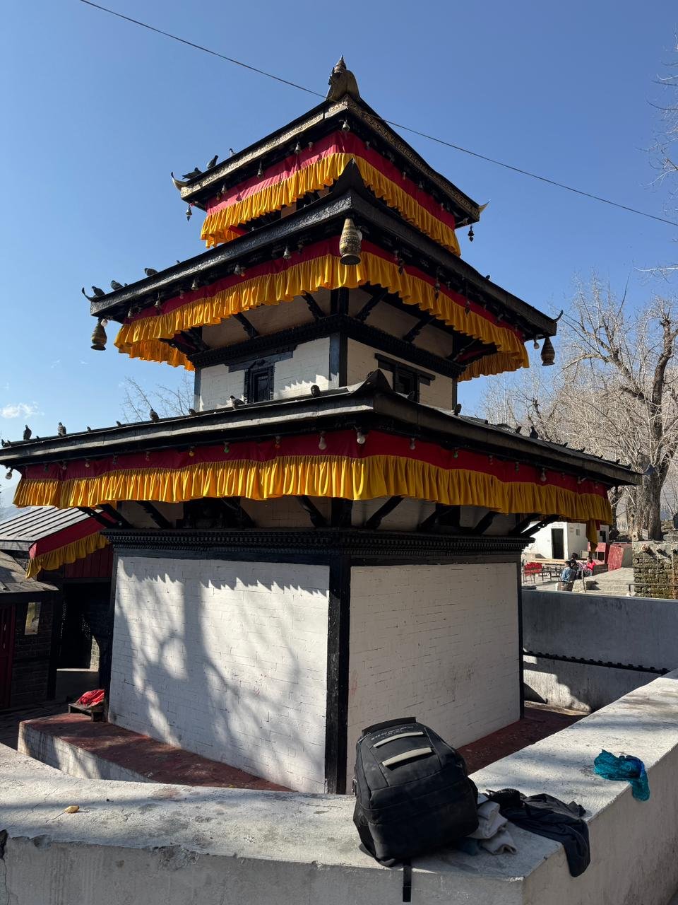
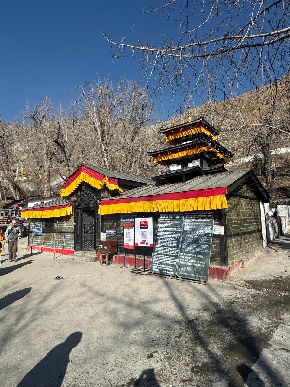
Muktinath at 3,710 metres is sacred to both Hindus and Buddhists, and the atmosphere of the temple complex, with its eternal flame, its water spouts, and the steady flow of pilgrims arriving by road and on foot, carries a completely different energy from anything on the approach side of the pass.
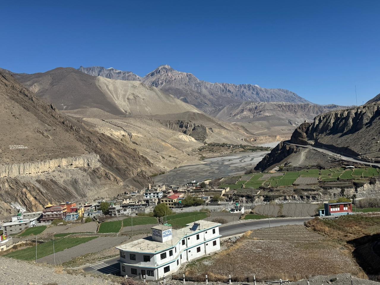
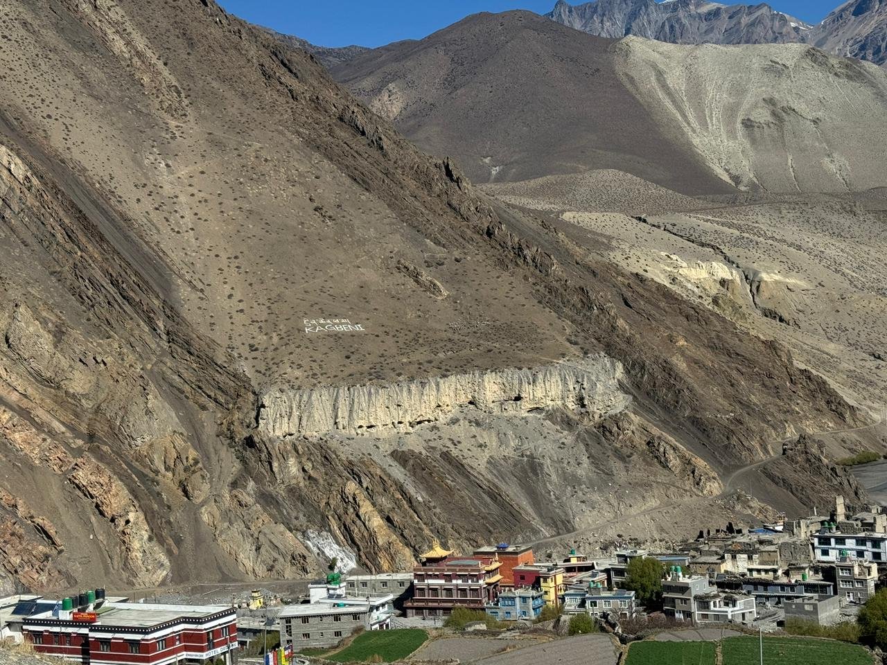
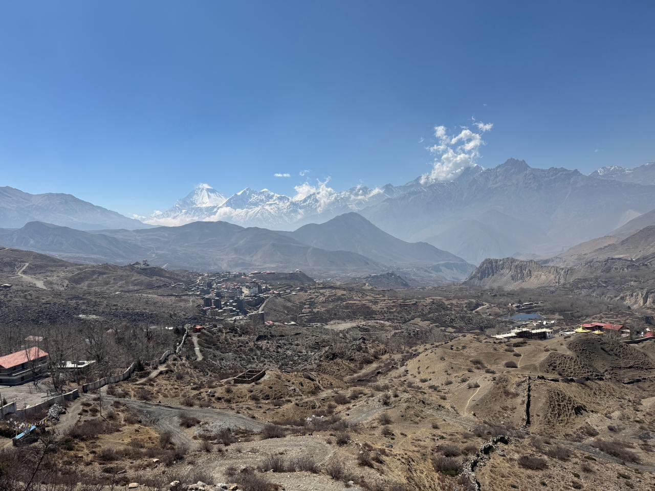
The Kali Gandaki gorge below Muktinath is the deepest gorge in the world and the shift from the high Tibetan plateau landscape of the north to the warmer.
Wider valleys of the Mustang and Myagdi districts is one of the most striking single day transitions in all of Himalayan trekking.
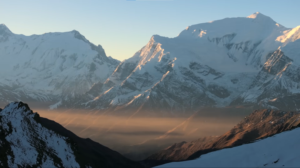
Jomsom and the lower valley mark the point where the route either continues south by road or on foot depending on the itinerary option chosen. The Annapurna range, Dhaulagiri, and Machhapuchhre are all visible simultaneously from the top in the first morning light.
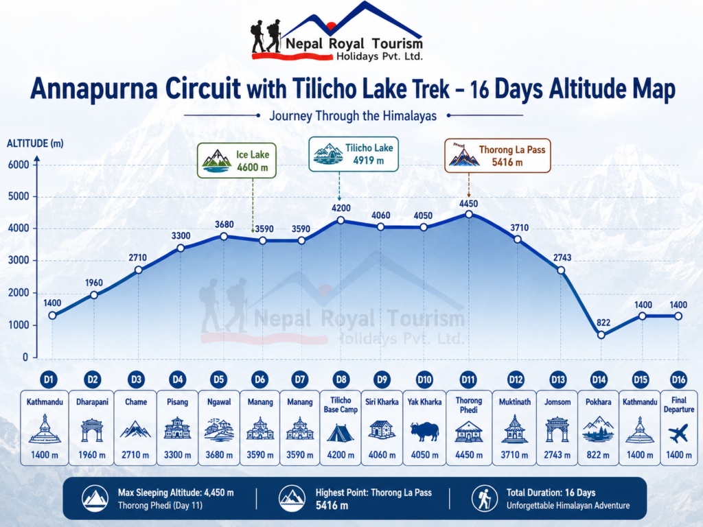
This trek is rated challenging as the maximum altitude at Tilicho Lake is 4,919 metres and the Thorong La Pass at 5,416 metres exceeds that significantly, making this the highest point on any standard trekking route in the Annapurna Conservation Area.
The days from Manang upward are where consistent fitness and proper acclimatization translate directly into how the body performs, and the itinerary is structured to give both in the right sequence.
Trekkers who have completed moderate trekking before and who train specifically for sustained high altitude effort will find the challenge well within reach.
For this combined trek, Spring and autumn are the two reliable seasons.
Autumn from September through November gives the clearest mountain visibility and the most stable crossing conditions on Thorong La.
Whereas, Spring from March through May brings rhododendron blooms through the lower valley sections and warmer temperatures on the approach.
In Winter, crossings of Thorong La are serious undertakings that require specific experience and equipment.
Monsoon season keeps the lower sections viable but the upper route becomes difficult and the pass crossing unreliable.
The Annapurna Circuit with Tilicho Lake is Nepal’s most complete single trekking experience.
It does not specialize in one environment or one kind of landscape. The trek covers all of them, and the sixteen days required to do that properly reflect the scale of what the route actually delivers.
Altitude Range and Character
| Section | Altitude Range | Terrain Character |
|---|---|---|
| Kathmandu and approach drive | 1,400 to 1,960 m | City arrival, road travel, Marsyangdi valley entry, first mountain settlements |
| Lower Annapurna Circuit trail | 1,960 to 3,300 m | Pine forest, river valley, waterfalls, cliffs, old villages, gradual altitude gain |
| Upper Manang approach | 3,300 to 4,600 m | High ridge trail, Ngawal village, Ice Lake climb, dry valley, wide mountain views |
| Tilicho Lake section | 4,060 to 4,919 m | Khangsar route, exposed slopes, landslide trail, Tilicho Base Camp, cold alpine lake basin |
| High circuit and Thorong La | 4,050 to 5,416 m | Yak Kharka, Thorong Phedi, high pass terrain, thin air, cold wind, long descent |
| Mustang and return section | 3,710 to 822 m | Muktinath, Jomsom, Kali Gandaki valley, dry Mustang landscape, flight to Pokhara |
| Kathmandu return and departure | 822 to 1,400 m | Pokhara recovery, road return to Kathmandu, final airport transfer |
Difficulty Overview
| Factor | Level | Notes |
|---|---|---|
| Physical demand | Challenging | Several long trekking days with steep climbs, long descents, and sustained walking at altitude |
| Maximum altitude | High | 5,416 m at Thorong La Pass, with Tilicho Lake reached at 4,919 m |
| Technical difficulty | Low to Moderate | No climbing gear is required, but the Tilicho trail and pass crossing need careful walking |
| Endurance requirement | High | Multiple trekking days above 3,500 m require strong stamina and steady pacing |
| Altitude risk | Moderate to High | Manang acclimatization and gradual walking pace are important before Tilicho Lake and Thorong La |
| Weather exposure | Moderate to High | Cold wind, snow, icy trail, and sudden weather changes are possible in the high sections |
Packing List Clothing Layers
| Layer | Items |
|---|---|
| Base layer | Moisture wicking T shirts, thermal tops, quick dry innerwear, spare trekking socks |
| Mid layer | Fleece jacket, light insulated layer, warm trekking shirt for cold mornings |
| Outer layer | Waterproof jacket, windproof shell, waterproof trousers or rain pants |
| Lower body | Trekking pants, thermal leggings, comfortable lower valley walking clothes |
| Warm layer | Down jacket or heavy insulated jacket for Manang, Tilicho, Thorong Phedi, and pass crossing |
| Accessories | Warm gloves, wool hat, buff or neck gaiter, sun hat, high UV sunglasses |
Essential Gear
| Category | Items |
|---|---|
| Footwear | Well broken in waterproof trekking boots, sandals or slippers for teahouses |
| Backpack | Daypack 30 to 40 litres, duffel bag for porter, backpack rain cover |
| Sleeping | Sleeping bag rated to minus 10°C or below for cold high altitude nights |
| Hydration | Reusable water bottles, purification tablets or filter, hydration bladder if preferred |
| Safety | Sunscreen, high UV sunglasses, lip balm, personal first aid kit, blister care |
| Extras | Trekking poles, headlamp with spare batteries, power bank, camera, quick dry towel |
Documents and Personal Items
| Category | Items |
|---|---|
| Travel documents | Passport, Nepal visa, travel insurance, flight details, emergency contact information |
| Trekking documents | Annapurna Conservation Area Permit and applicable trekking documents as per latest regulations |
| Money | Nepali cash for snacks, hot showers, charging, Wi Fi, drinks, and tips |
| Health items | Personal medicines, rehydration salts, stomach medicine, pain relief, altitude medicine if prescribed |
| Personal care | Toiletries, wet wipes, towel, hand sanitizer, moisturizer, lip balm |
| Electronics | Phone, charger, adapter, power bank, camera, memory card |
Trip Highlights
- Cross Thorong La Pass at 5,416 metres and experience the biggest challenge of the trek, where the route climbs through cold high mountain terrain before descending toward the sacred Mustang side.
- Visit Tilicho Lake at 4,919 metres and stand beside one of the most dramatic high altitude lakes in the Annapurna region, surrounded by Tilicho Peak, snowy slopes, and raw alpine scenery.
- Follow the classic Annapurna Circuit trail from Dharapani to Chame, Pisang, Manang, Thorong Phedi, and Muktinath while watching the landscape change from green river valleys to dry mountain desert.
- Take the scenic high route through Pisang, Ngawal, Ice Lake, and Manang village, a more rewarding section that offers wider mountain views and better acclimatization before the higher parts of the trek.
- Spend an important acclimatization day in Manang, where you can explore the village, enjoy views of Gangapurna, visit nearby viewpoints, and prepare your body for Tilicho Lake and Thorong La Pass.
- Experience one of Nepal’s most varied trekking landscapes, from pine forests, waterfalls, cliffs, and old villages to alpine slopes, landslide trails, windy valleys, and Mustang style dry terrain.
- Visit Muktinath, one of Nepal’s most respected pilgrimage sites for both Hindus and Buddhists, known for its temple area, 108 water spouts, eternal flame, and peaceful mountain setting.
- Travel through the Kali Gandaki valley after crossing the pass and experience Thakali villages, apple settlements, riverbeds, dry cliffs, and the cultural transition between Mustang and the lower Annapurna region.
- Spend a night in Jomsom, the main town of lower Mustang, where dry valley scenery, strong mountain winds, and views toward Nilgiri give the trek a memorable Mustang ending
- Take a scenic morning flight from Jomsom to Pokhara, following the Kali Gandaki valley with beautiful views of the Annapurna and Dhaulagiri region when the weather is clear
Annapurna Circuit with Tilicho Lake Trek – 16 Days ~ Itinerary
Day 1
Arrival in Kathmandu
- Altitude: 1,350 m
- Accommodation: Standard Three Star hotel in Thamel
Your journey begins after landing at Tribhuvan International Airport in Kathmandu. After completing airport formalities, our representative will receive you and transfer you to your hotel. The rest of the day is kept easy because most travellers arrive after a long international flight. You can rest, check your trekking gear, and prepare for the journey ahead. In the evening, you meet your guide for a short briefing about the route, altitude gain, road travel, trekking pace, permits, accommodation, meals, and safety during the Annapurna Circuit with Tilicho Lake Trek.
Day 2
Drive from Kathmandu to Dharapani
- Altitude: 1,960 m
- Travel Duration: 7 to 8 hours
- Travel Distance: 225 km
- Meal: Breakfast and Lunch
- Accommodation: Teahouse in Dharapani
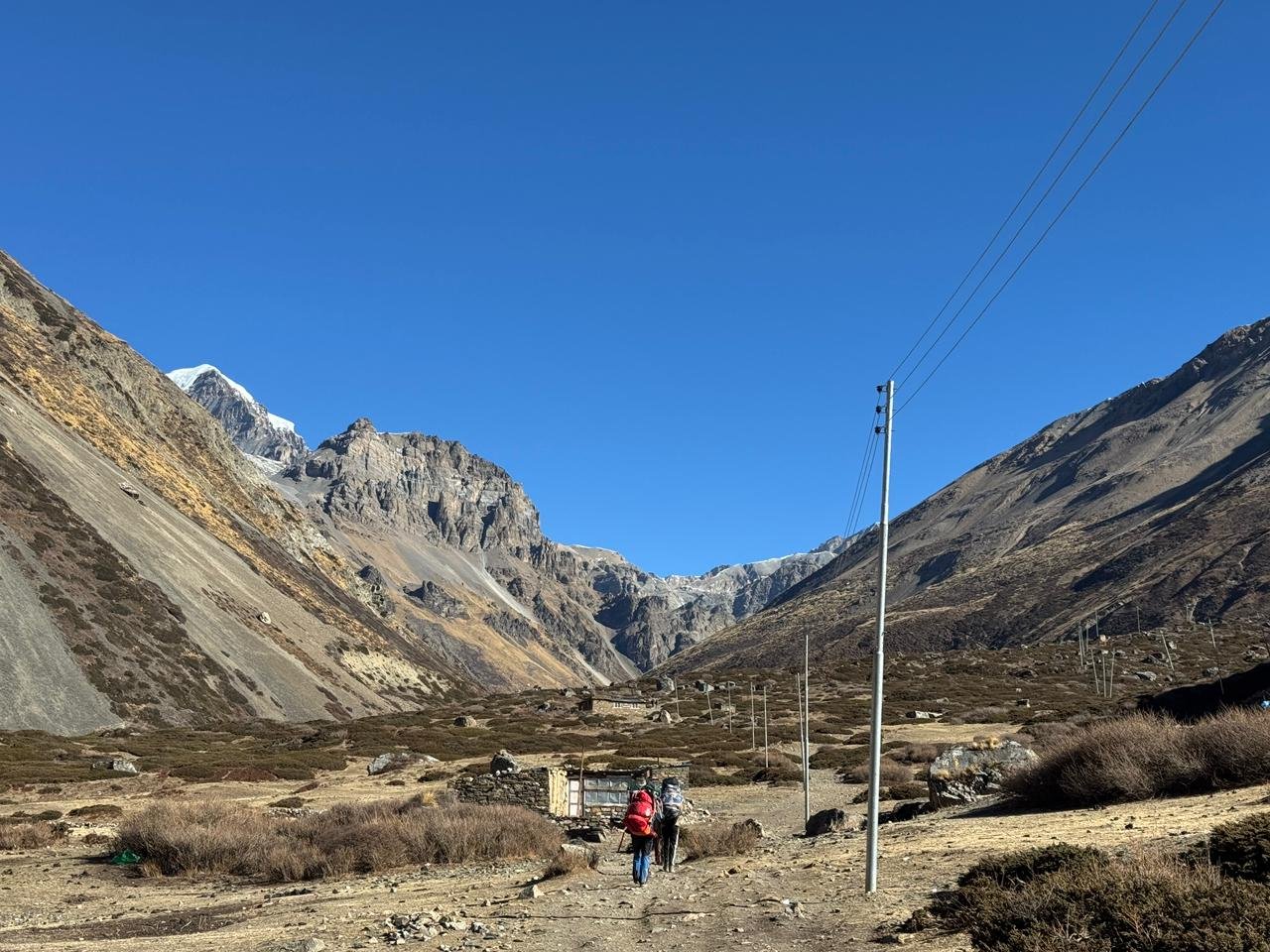
After breakfast, you leave Kathmandu and begin the long drive toward Dharapani, the starting point of the trek. The road follows busy highway sections at first, then gradually moves through river valleys, farmland, hill towns, and mountain roads. You drive through Besisahar and continue along the Marsyangdi valley, where the road becomes rougher and more scenic. This day is mainly about reaching the trailhead, but it also gives the first look at the changing landscape of central Nepal. Dharapani is a mountain village on the Annapurna Circuit route and marks the beginning of the walking journey.
Day 3
Trek from Dharapani to Chame
- Altitude: 2,170 m
- Trek Duration: 5 to 6 hours
- Trek Distance: 15 to 16 km
- Meal: Breakfast, Lunch and Dinner
- Accommodation: Teahouse in Chame
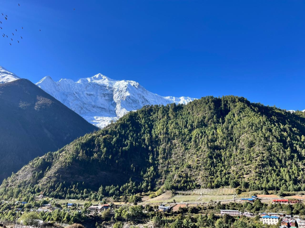
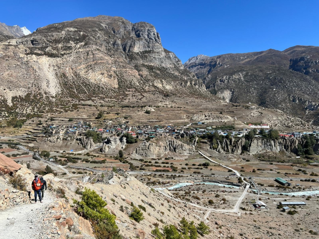
The first trekking day begins from Dharapani and follows the Marsyangdi valley toward Chame. The trail passes through pine forest, river sections, small settlements, and gradual uphill terrain. You walk through places such as Bagarchhap, Danaque, Timang, and Koto depending on the trail and road condition used by the guide. The route slowly gains altitude, and the air becomes cooler as you move deeper into the Annapurna region. On a clear day, views of Lamjung Himal, Annapurna II, and surrounding peaks begin to appear. Chame is the district headquarters of Manang and a comfortable overnight stop.
Day 4
Trek from Chame to Pisang
- Altitude: 3,300 m
- Trek Duration: 6 to 7 hours
- Trek Distance: Around 14 to 16 km
- Meal: Breakfast, Lunch and Dinner
- Accommodation: Teahouse in Pisang
Today the trail continues through the upper Marsyangdi valley, where the scenery becomes more dramatic with forest paths, river sections, cliffs, suspension bridges, and narrow valley turns. You may pass places such as Bhratang and Dhukur Pokhari before the route opens toward Pisang. The mountain views become stronger today, especially around Annapurna II and Pisang Peak, while the landscape slowly starts to feel drier as you enter the upper Manang region. Pisang is known for its mountain views, old village atmosphere, and position between the lower forested trail and the higher Annapurna landscape.
Day 5
Trek from Pisang to Ngawal
- Altitude: 3,680 m
- Trek Duration: 4 to 5 hours
- Trek Distance: Around 10 to 12 km
- Meal: Breakfast, Lunch and Dinner
- Accommodation: Teahouse in Ngawal
From Pisang, the trail climbs toward the high route to Ngawal, a quieter and more scenic alternative to the lower valley trail. The walk is not extremely long, but the altitude gain makes it an important day for acclimatization. The route offers wide views of Annapurna II, Annapurna III, Gangapurna, Pisang Peak, and the upper Manang valley. You pass dry slopes, chortens, prayer flags, traditional stone houses, and open mountain scenery before reaching Ngawal, an old village with strong Himalayan character and a peaceful overnight setting.
Day 6
Trek from Ngawal to Manang Village via Ice Lake
- Altitude: 3,590 m overnight and 4,600 m at Ice Lake area
- Trek Duration: 6 to 7 hours
- Trek Distance: Around 12 to 14 km
- Meal: Breakfast, Lunch and Dinner
- Accommodation: Teahouse in Manang
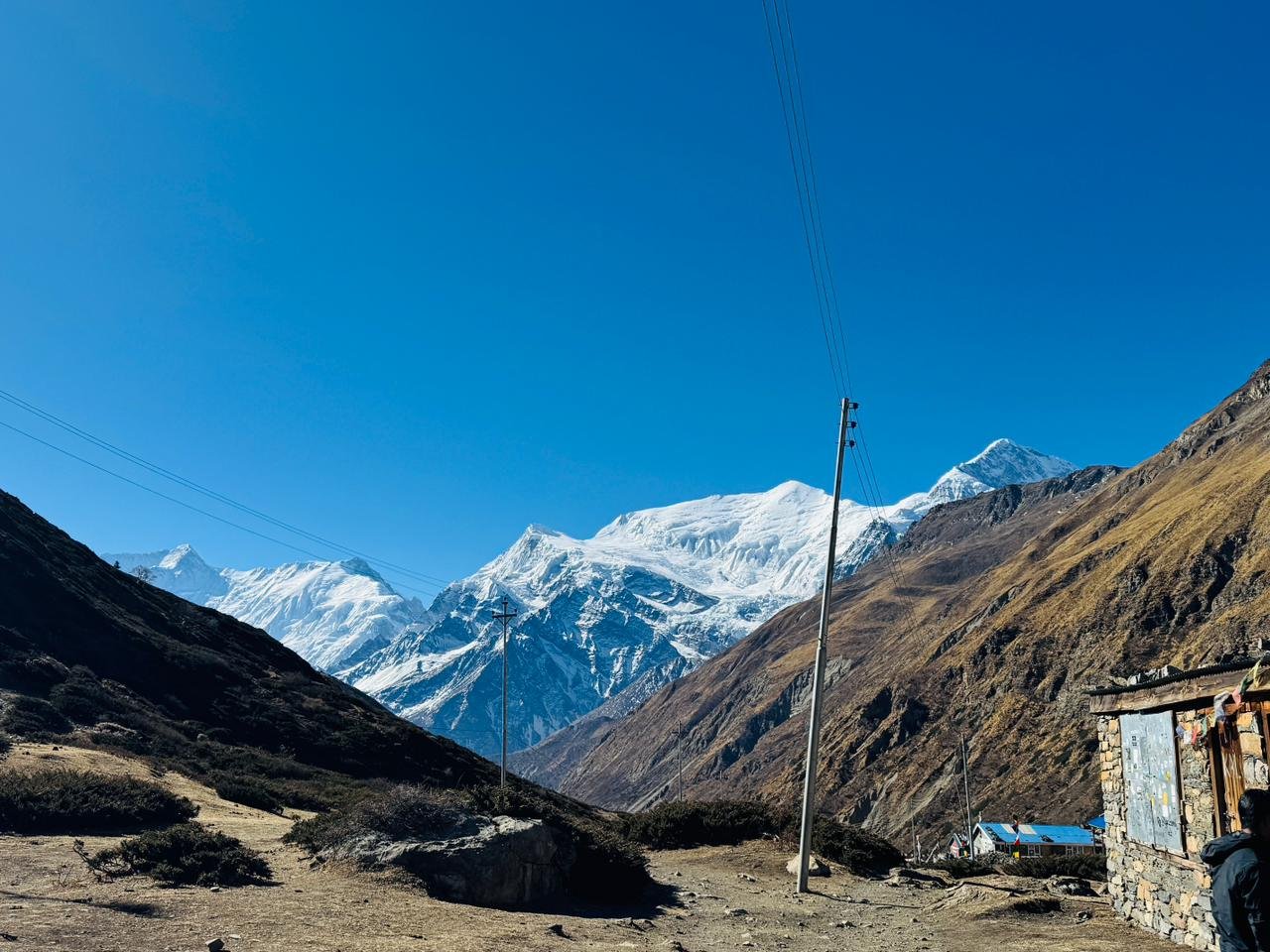
This is a demanding but rewarding acclimatization day as the route heads toward the Ice Lake area before descending to Manang. The climb reaches around 4,600 metres, so the walking can feel slow and tiring, but it helps the body adjust before Tilicho Lake and Thorong La Pass. From the higher slopes, the views of Annapurna, Gangapurna, Tilicho Peak, Chulu peaks, and the dry Manang valley are excellent. After enjoying the high viewpoint, you descend to Manang village for a safer overnight altitude.
Day 7
Rest and Acclimatization Day in Manang
- Altitude: 3,590 m
- Meal: Breakfast, Lunch and Dinner
- Accommodation: Teahouse in Manang
This day is kept for rest and acclimatization before moving into the higher sections of the trek. Manang is one of the most important villages on the Annapurna Circuit, with old houses, monasteries, bakeries, lodges, and beautiful views of Gangapurna and the surrounding peaks. You can explore the village, visit Gangapurna Lake, take a short acclimatization walk, or simply rest at the teahouse. This day helps reduce altitude risk before Tilicho Base Camp, Tilicho Lake, and Thorong La Pass.
Day 8
Trek from Manang to Tilicho Base Camp
- Altitude: 4,200 m
- Trek Duration: 5 to 6 hours
- Trek Distance: Around 12 to 14 km
- Meal: Breakfast, Lunch and Dinner
- Accommodation: Teahouse in Tilicho Base Camp
After breakfast, the trail leaves Manang and moves toward Tilicho Base Camp through Khangsar, Siri Kharka, and dry mountain slopes. This section feels more remote and rugged than the earlier Annapurna Circuit trail, with exposed terrain, landslide affected areas, and narrow trail sections in some places. The scenery becomes colder, drier, and more alpine as you approach the base camp area. Tilicho Base Camp is a simple overnight stop, but it is the key place for reaching Tilicho Lake the next morning.
Day 9
Hike from Tilicho Base Camp to Tilicho Lake and Trek Back to Siri Kharka
- Altitude: 4,919 m at Tilicho Lake and around 4,060 m at Siri Kharka
- Trek Duration: 4 to 5 hours
- Trek Distance: Around 10 to 12 km
- Meal: Breakfast, Lunch and Dinner
- Accommodation: Teahouse in Siri Kharka
You start early for the hike to Tilicho Lake, one of the most dramatic high altitude lake settings in the Annapurna region. The trail climbs through cold, open, and rocky terrain before reaching the lake at around 4,919 metres. Tilicho Lake sits below Tilicho Peak and surrounding snowy slopes, giving the area a raw and powerful mountain atmosphere. After spending time near the lake, you descend back toward Siri Kharka instead of sleeping too high. This gives a safer overnight altitude and better recovery before continuing toward Yak Kharka.
Day 10
Trek from Siri Kharka to Yak Kharka
- Altitude: 4,050 m
- Trek Duration: 5 to 6 hours
- Trek Distance: Around 10 to 12 km
- Meal: Breakfast, Lunch and Dinner
- Accommodation: Teahouse in Yak Kharka
The trail leaves Siri Kharka and reconnects with the main Annapurna Circuit route toward Yak Kharka. The landscape is dry, open, and high, with fewer trees and wider views across the surrounding slopes. You may pass small settlements, yak grazing areas, and quiet mountain ridges along the way. Since the trail remains above 4,000 metres, the walking pace should be slow and steady. Yak Kharka is a common overnight stop before moving closer to Thorong La Pass.
Day 11
Trek from Yak Kharka to Thorong Phedi
- Altitude: 4,450 m
- Trek Duration: 5 to 6 hours
- Trek Distance: Around 8 to 10 km
- Meal: Breakfast, Lunch and Dinner
- Accommodation: Teahouse in Thorong Phedi
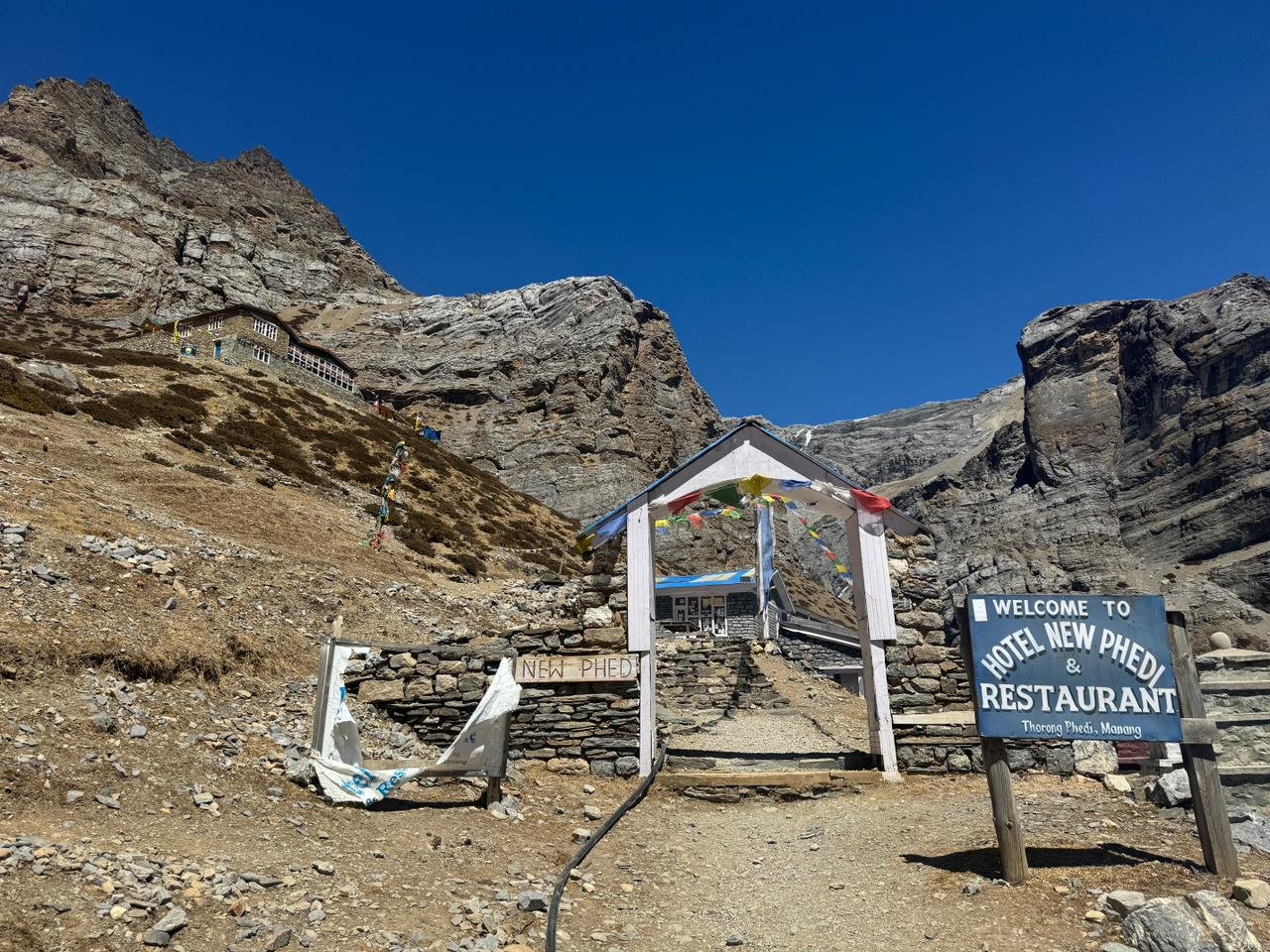
Today the route moves from Yak Kharka toward Thorong Phedi, the base settlement before crossing Thorong La Pass. The trail passes through Ledar and continues across high alpine terrain with open slopes, river sections, and landslide prone areas in some places. The distance is not very long, but the altitude makes the day serious. You should walk slowly, drink enough water, and conserve energy. Thorong Phedi is a basic but important stop for resting, eating well, packing warm layers, and preparing for the early pass crossing.
Day 12
Trek from Thorong Phedi to Muktinath via Thorong La Pass
- Altitude: 5,416 m at Thorong La Pass and around 3,710 m at Muktinath
- Trek Duration: 7 to 8 hours
- Trek Distance: Around 15 to 16 km
- Meal: Breakfast, Lunch and Dinner
- Accommodation: Teahouse in Muktinath
This is the highest and most demanding day of the trek. You start very early from Thorong Phedi and climb slowly toward Thorong La Pass at 5,416 metres. The trail is not technical, but the altitude, cold morning, wind, and long walking hours make it a serious high mountain crossing. After reaching the pass, you descend toward Muktinath on the Mustang side. Muktinath is a sacred pilgrimage site for both Hindus and Buddhists, known for its temple area, 108 water spouts, eternal flame, and dry mountain setting.
Day 13
Drive from Muktinath to Jomsom
- Altitude: 2,743 m
- Drive Duration: 2 to 3 hours
- Drive Distance: Around 20 to 25 km
- Meal: Breakfast, Lunch and Dinner
- Accommodation: Teahouse in Jomsom
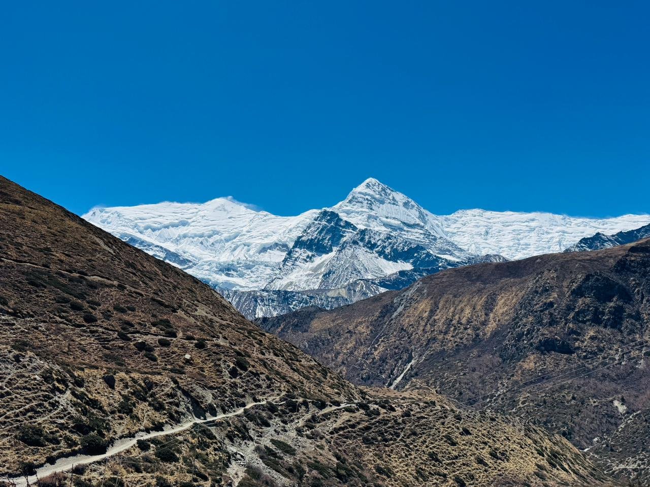
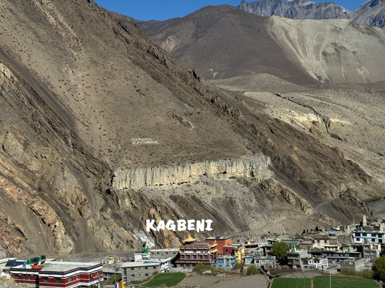
After breakfast, you drive from Muktinath down toward Jomsom through the dry and open landscape of lower Mustang. The route may pass through Jharkot, Kagbeni, Ekle Bhatti, and the wide Kali Gandaki valley depending on road conditions. This short drive gives time to enjoy the Mustang scenery without rushing after the long Thorong La crossing. Jomsom is the main town of lower Mustang and has lodges, shops, transport access, and strong views of the surrounding dry valley landscape.
Day 14
Fly from Jomsom to Pokhara
- Altitude: 822 m
- Flight Duration: Around 20 to 25 minutes
- Flight Distance: 70 km
- Meal: Breakfast
- Accommodation: Standard Three Star Hotel in Pokhara
Early in the morning, you take a short scenic flight from Jomsom to Pokhara. The flight follows the Kali Gandaki valley and offers views of the Annapurna and Dhaulagiri region when the weather is clear. Jomsom flights usually operate in the morning because the valley becomes windy later in the day. After arriving in Pokhara, the rest of the day is free to rest, enjoy Lakeside, and recover after the high altitude trekking section. Pokhara gives a comfortable ending to the mountain journey with lake views, restaurants, and hotel facilities.
Day 15
Drive from Pokhara to Kathmandu
- Altitude: 1,350 m
- Drive Duration: 6 to 7 hours
- Drive Distance: Around 200 km
- Meal: Breakfast and Lunch
- Accommodation: Standard Three Star Hotel in Kathmandu
After breakfast, you drive from Pokhara back to Kathmandu by tourist vehicle. The road follows the Prithvi Highway through river valleys, hill towns, terraced farmland, roadside settlements, and changing countryside scenery. After several days in the mountains, this travel day brings you back to the capital for the final night of the trip. Once in Kathmandu, you can rest at the hotel, explore Thamel, buy souvenirs, or enjoy a relaxed evening after completing the Annapurna Circuit with Tilicho Lake Trek.
Day 16
Final Departure from Kathmandu
- Meal: Breakfast
Your Annapurna Circuit with Tilicho Lake Trek ends today. Nepal Royal Tourism Holidays’ representative will transfer you to Tribhuvan International Airport according to your international flight schedule. If your flight is later in the day, you may have free time for packing, resting, or a short walk around Kathmandu. You leave Nepal with memories of Tilicho Lake, Thorong La Pass, Muktinath, Jomsom, Manang, the Marsyangdi valley, and the changing landscapes of the Annapurna region.
Annapurna Circuit with Tilicho Lake Trek – 16 Days Fixed Departures Dates
Trip Cost Includes/Excludes
Cost Includes
- Airport pick up and final drop off in Kathmandu by private vehicle
- 2 nights Three Star Hotel accommodation in Kathmandu on a twin sharing basis with breakfast
- 1 night Three Star Hotel accommodation in Pokhara on a twin sharing basis with breakfast
- Kathmandu to Dharapani ground transportation by tourist vehicle and local jeep as per road condition
- Muktinath to Jomsom ground transportation by local jeep or private vehicle as per road condition
- Jomsom to Pokhara domestic flight ticket as per itinerary
- Pokhara to Kathmandu tourist vehicle transportation as per itinerary
- Best available teahouse accommodation during the trekking days
- Three meals a day during the trek including breakfast, lunch, and dinner with a cup of Tea/Coffee.
- Experienced government licensed English speaking trekking guide
- Porter support during the trek with one porter for every two trekkers
- Food, accommodation, salary, insurance, transportation, and equipment for guide and porter
- Annapurna Conservation Area Permit and applicable trekking documents as per latest regulations
- Basic first aid kit carried by the trekking team
- Nepal Royal Tourism Holidays company T shirt as a trekking souvenir
- Trekking completion certificate and a Token of Love after successful completion of the trip
- All applicable government taxes and official service charges
Cost Excludes
- International airfare to and from Nepal
- Nepal entry visa fee
- Lunch and dinner while staying in Kathmandu and Pokhara
- Travel and medical insurance including emergency rescue and evacuation coverage
- Personal trekking equipment such as trekking boots, down jacket, warm clothing, gloves, backpack, and accessories
- Personal expenses such as bottled water, hot drinks, soft drinks, alcohol, snacks, laundry, phone calls, and internet
- Hot showers, battery charging, Wi Fi, and other extra services at mountain teahouses
- Extra costs caused by itinerary changes or other situations beyond company control
- Tips for guide, porter, driver, and trekking staff, which are not mandatory but highly appreciated
- Any service, meal, transport, or expense not clearly mentioned in the Cost Includes section
Trip Photo/Video Gallery


Frequently Asked Questions
This is a challenging trek because it includes high altitude, long walking days, Tilicho Lake, and Thorong La Pass. Trekkers should have good fitness and be ready for steep climbs, long descents, cold weather, and rough trail sections.
The highest altitude is Thorong La Pass at 5,416 metres. Tilicho Lake is another major high point at around 4,919 metres.
Previous high altitude trekking experience is helpful but not compulsory. However, this trek is not ideal for completely unprepared beginners. Good fitness, strong walking stamina, and proper acclimatization are important.
Yes, altitude sickness is a real concern because the route goes above 5,000 metres. The itinerary includes acclimatization in Manang and gradual altitude gain, but trekkers should walk slowly, drink enough water, and follow the guide’s advice.
You need the Annapurna Conservation Area Permit and applicable trekking documents as per the latest trekking regulations. Nepal Royal Tourism Holidays will help arrange the required permits before the trek begins.
Spring and autumn are the best seasons. Spring offers warmer conditions and blooming rhododendrons in the lower region, while autumn usually gives clear views, stable weather, and better pass crossing conditions.
You will stay in Three Star Hotels in Kathmandu and Pokhara. During trekking days, accommodation is in teahouses or guesthouses. Rooms are simple but suitable for mountain trekking.
Yes, breakfast, lunch, and dinner are included during trekking days. Common meals include dal bhat, noodles, soup, fried rice, potatoes, pasta, eggs, pancakes, tea, and coffee depending on the teahouse menu.
Thorong La Pass is not technical, but it is physically demanding because of altitude, cold, wind, and long walking hours. With proper acclimatization, an early start, good weather, and guide support, it can be crossed safely.
If the pass is unsafe due to snow, wind, or poor weather, the guide will adjust the itinerary and choose the safest available option. Safety comes first on high pass trekking days.
You may also like