

-
 Duration
11 Days
-
 Difficulty
Moderate to Challenging
-
 Max Elevation
5,357m
-
 Group Size
1 to 10 People Person
-
 Accommodation
Teahouse/Lodge
-
 Start/End
Kathmandu/Kathmandu
-
 Destination
Rolwaling Valley
-
 Best Season
Spring and Autumn
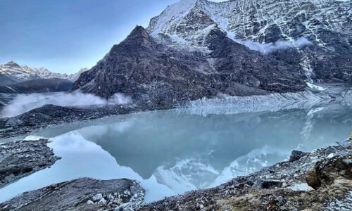
The Tsho Rolpa Lake Trek takes you into the remote Rolwaling Valley, where traditional Sherpa villages, forested trails and mountain rivers lead to one of Nepal’s remarkable glacial lakes.
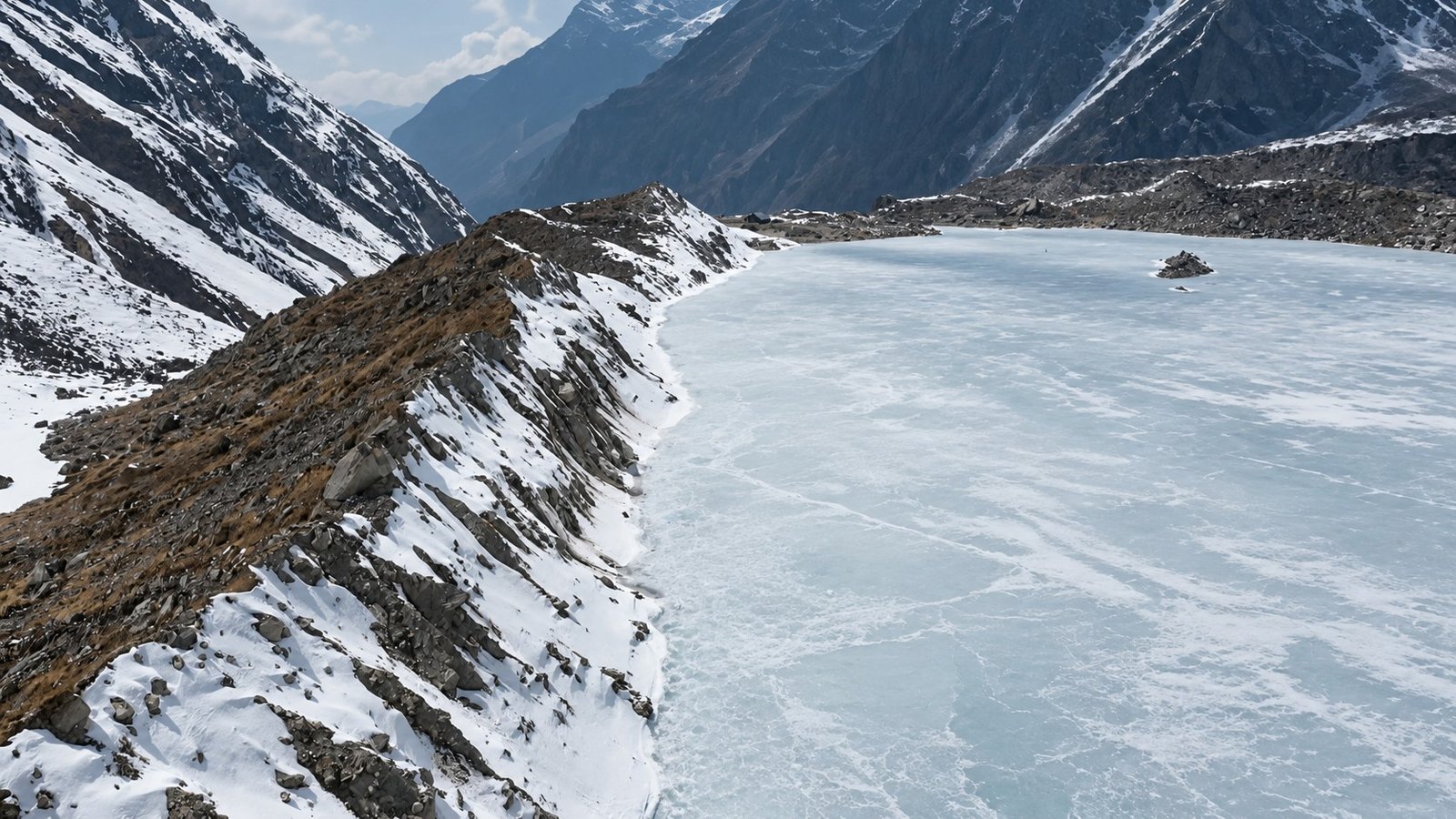
Located in the Gaurishankar Conservation Area of Dolakha, Tsho Rolpa Lake sits at approximately 4,580 metres (15,026 feet), surrounded by rugged Himalayan slopes and the glacial landscape of the upper Rolwaling Valley.
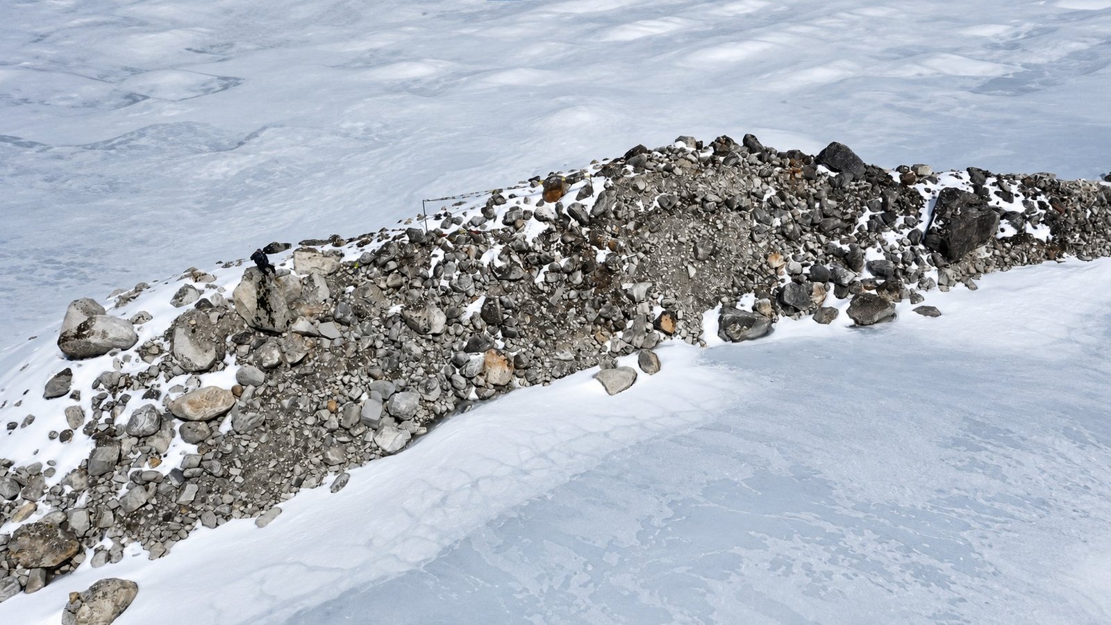
Compared with Nepal’s busier Everest and Annapurna trails, Rolwaling feels quieter and less developed.
The journey follows the Tama Koshi corridor toward Chhetchhet before climbing to Simigaon. Beyond the village, trails pass through rhododendron and pine forests, cross streams and follow the Rolwaling River toward Dongang and Beding.
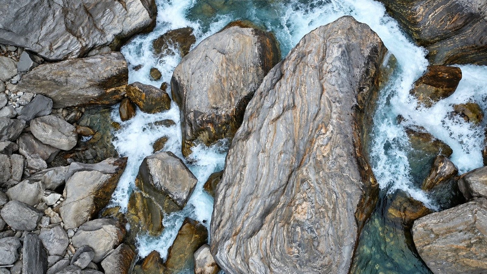
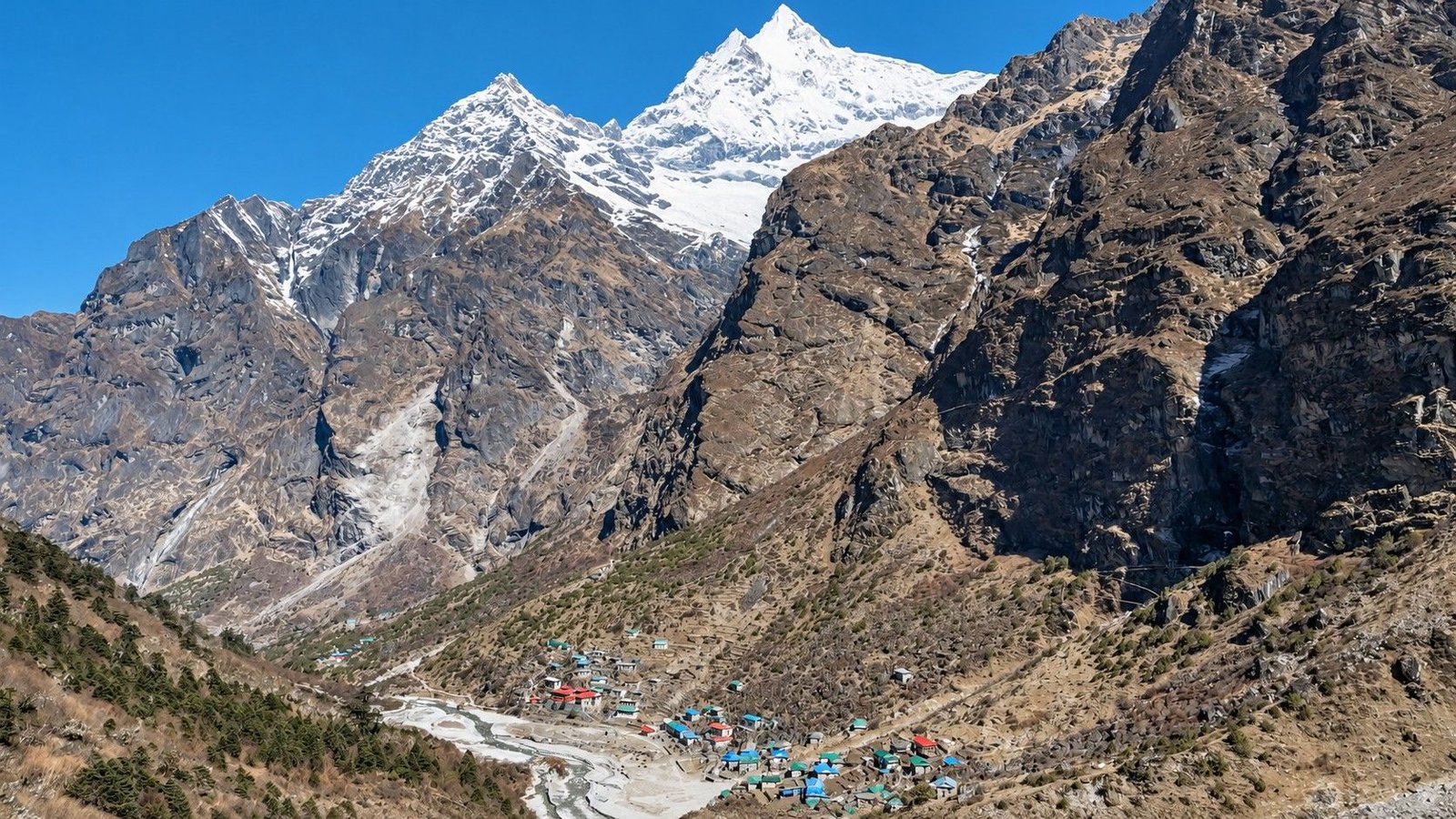
Farther uphill, the vegetation thins and the valley opens toward Na Gaon, with yak pastures, stone buildings and distant snowy peaks.
Beding is one of the cultural highlights of this route. Its local Sherpa community, Buddhist traditions and links to Himalayan mountaineering give the trek a character that goes beyond mountain scenery.
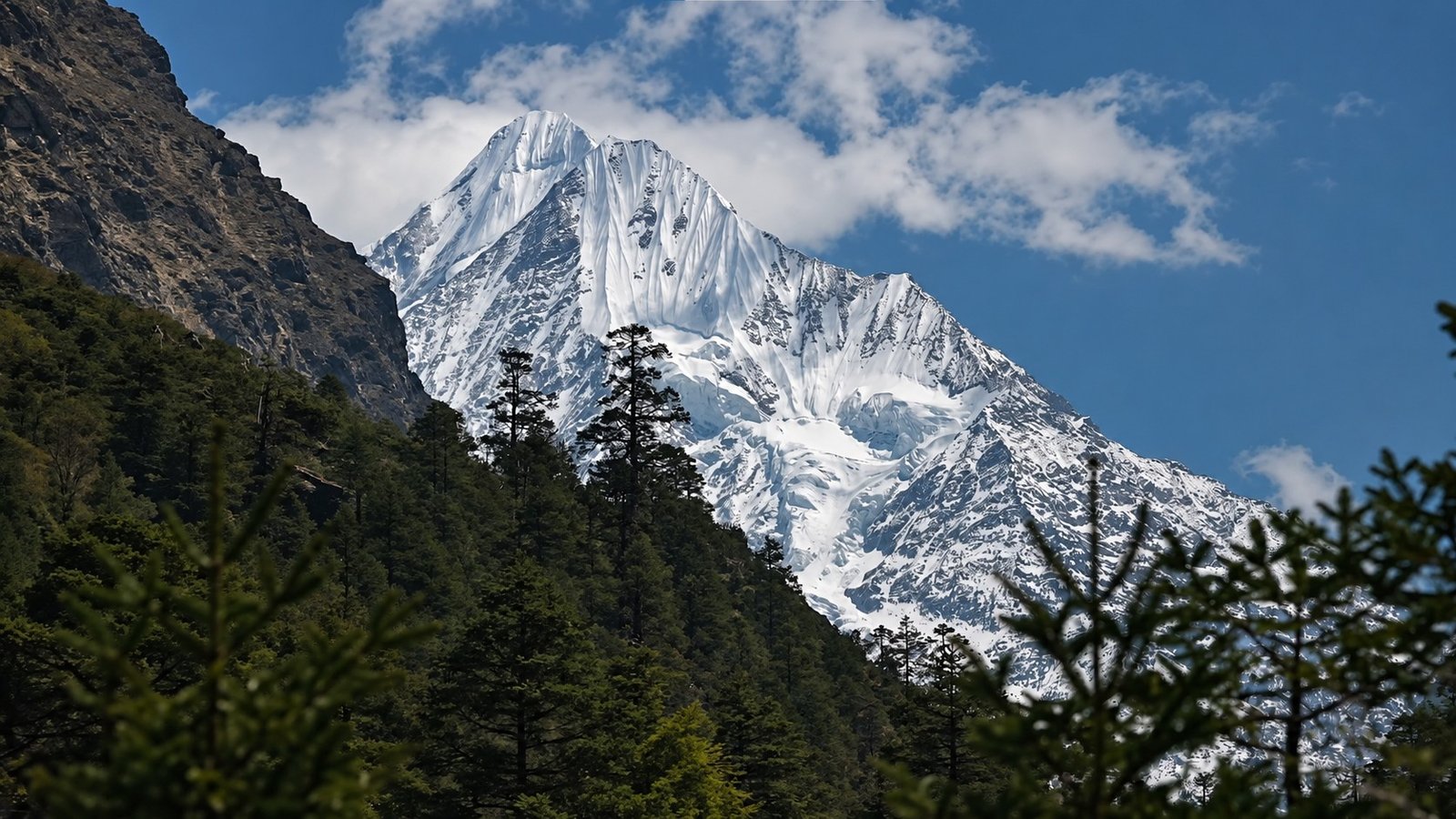
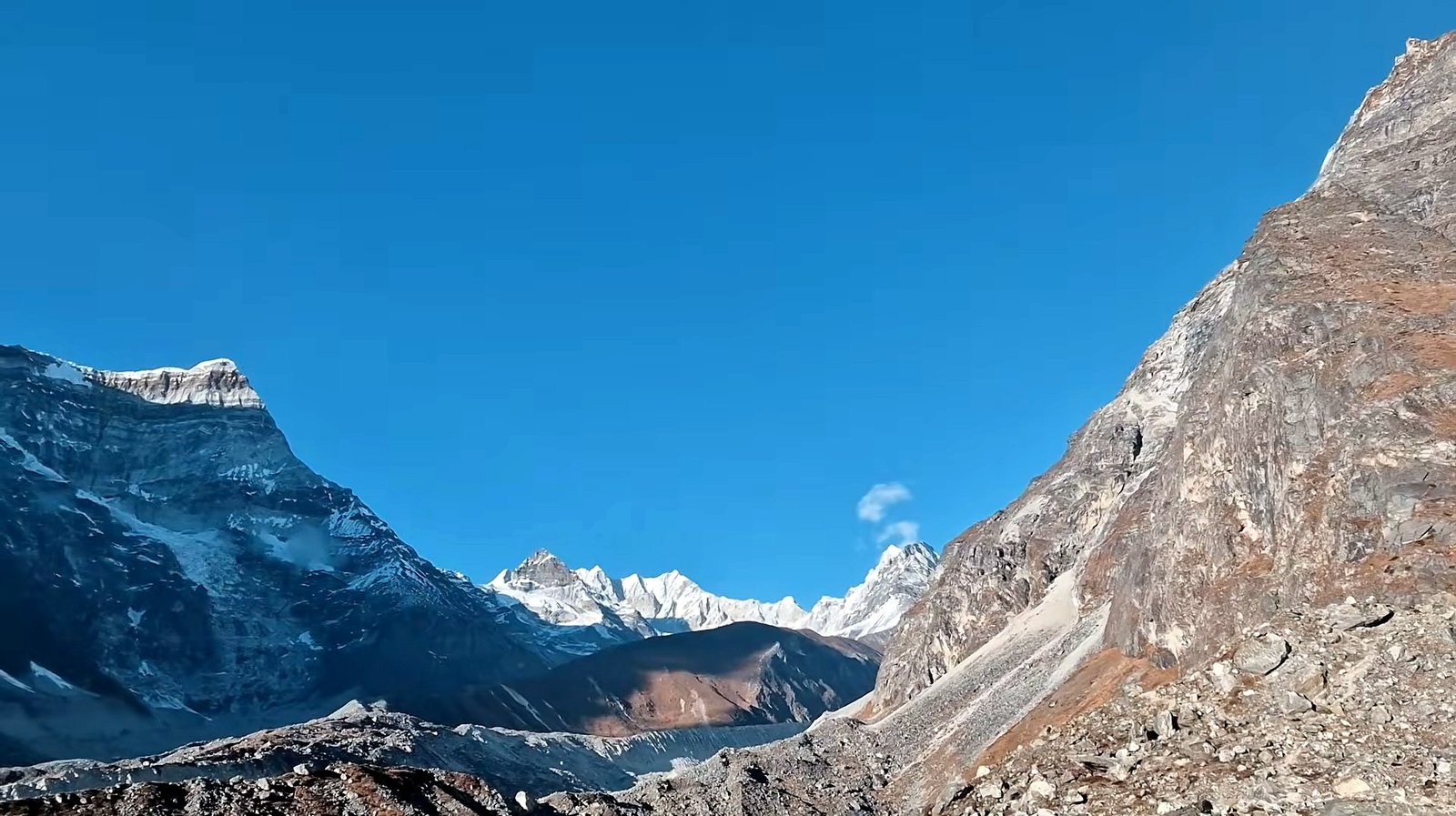
From Na Gaon, the path continues into an alpine landscape of rocks, moraine and powerful mountain walls before reaching Tsho Rolpa, a large glacial lake associated with the Trakarding Glacier system.
Our 11-day Tsho Rolpa Lake Trek includes arrival and departure in Kathmandu, a dedicated acclimatization day in Beding, a night at Na Gaon before visiting the lake and a return through the same Rolwaling corridor.
The program does not cross Tashi Lapcha Pass, a separate and considerably more demanding route toward the Khumbu region.
Despite requiring no technical climbing on the standard lake route, trekkers should be ready for long walking days, steep descents, cold weather and accommodation that is simpler than on Nepal’s main commercial trails.
Tsho Rolpa Lake Trek Details
| Trip Information | Details |
|---|---|
| Trip Name | Tsho Rolpa Lake Trek |
| Duration | 11 Days, including Kathmandu arrival and departure |
| Destination | Rolwaling Valley, Dolakha, Nepal |
| Maximum Altitude | Tsho Rolpa Lake – approximately 4,580 m / 15,026 ft |
| Highest Overnight Altitude | Na Gaon – approximately 4,180 m |
| Difficulty | Moderate to Challenging |
| Starting and Ending Point | Kathmandu |
| Main Trekking Trailhead | Chhetchhet / Gongar Khola area, depending on road access |
| Major Trekking Stops | Simigaon, Dongang, Beding, Na Gaon and Tsho Rolpa Lake |
| Protected Area | Gaurishankar Conservation Area |
| Accommodation | Hotel in Kathmandu; basic teahouses, local lodges or arranged camping where necessary on the trek |
| Typical Walking Duration | Around 4–7 hours on most trekking days, with longer return stages |
| Best Seasons | Spring (March–May) and Autumn (September–November) |
| Trekking Style | Guided high-altitude valley trek with a return along the same route |
| Tashi Lapcha Pass | Not included in the standard lake itinerary |
What Makes the Tsho Rolpa Lake Trek Special?
Rolwaling offers a different pace of trekking. Instead of busy accommodation hubs, the trail passes small settlements where local life is closely connected to agriculture, livestock and the surrounding mountains.
This quieter setting makes conversations in village lodges, walks past prayer flags and a simple meal after a long day memorable parts of the journey.
The change in scenery is equally rewarding. Near Simigaon the landscape is green, with terraced slopes, waterfalls and enclosed forest trails.
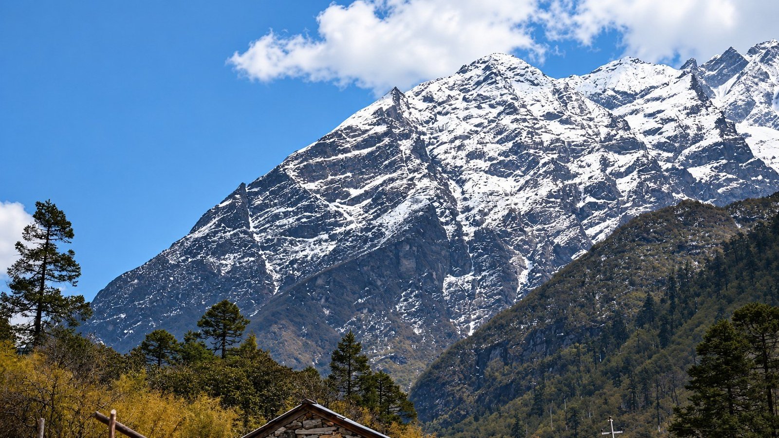
As the route moves beyond Dongang and Beding, the mountains begin to dominate the skyline and the forest gives way to an exposed alpine valley. On clear days, different stretches of the trek can offer views toward Gaurishankar and the peaks of the Rolwaling Himal.
The journey is not simply about reaching the highest point. It brings together a remote Himalayan valley, living Sherpa heritage and a glacial lake that feels distinctly different from the crowded viewpoints of better-known treks.
Tsho Rolpa Trek Route: Kathmandu to the Upper Rolwaling Valley
The drive from Kathmandu follows roads through Dolakha and the Tama Koshi Valley toward Chhetchhet or another usable trailhead nearby. From the road, trekkers cross the river and climb steeply to Simigaon, the first walking destination.
The following stage enters forested terrain and continues to Dongang, with river sounds, occasional waterfalls and repeated ascents and descents along the way.
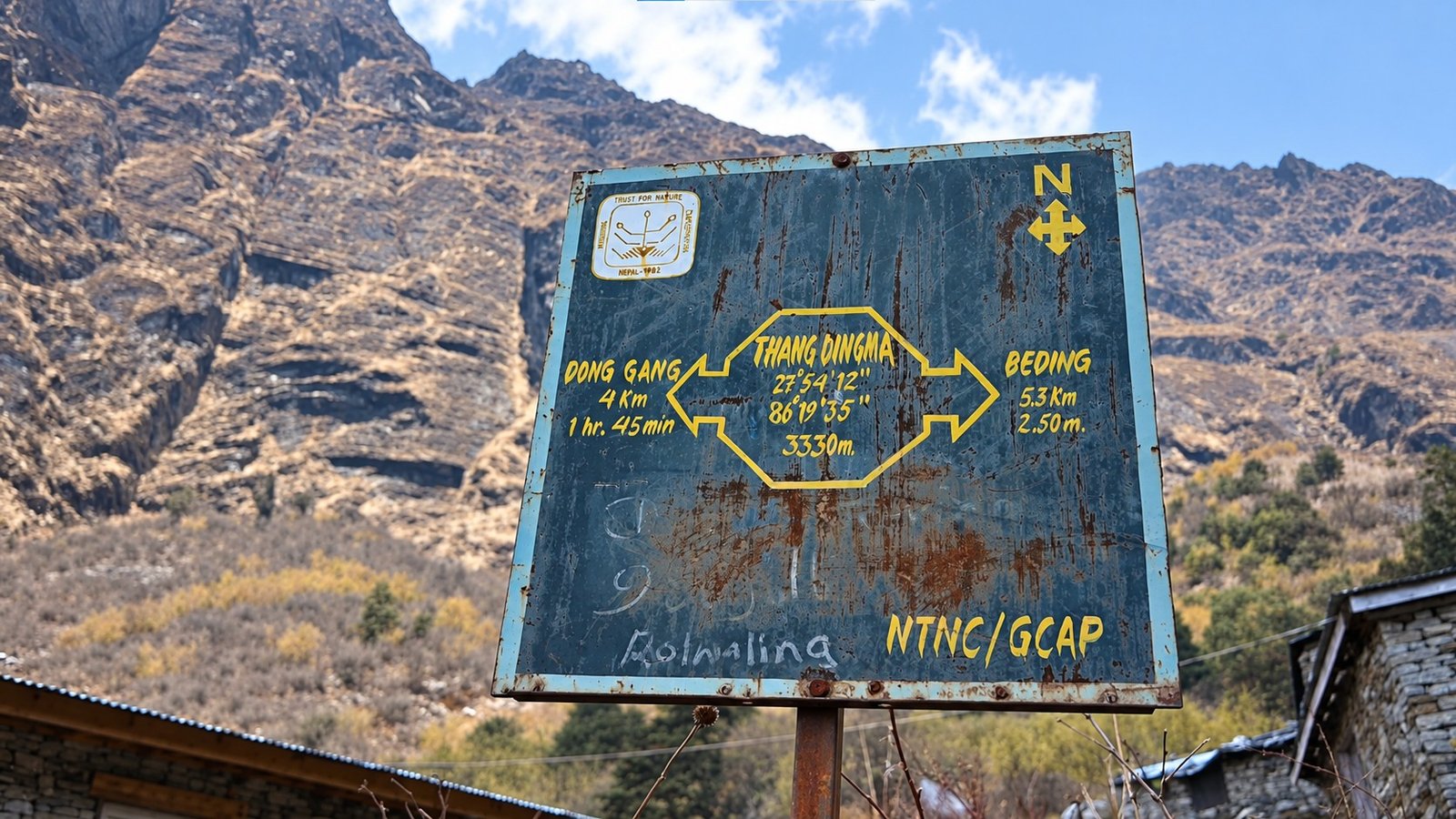
From Dongang, the trail climbs deeper into the Rolwaling Valley toward Beding at roughly 3,690 metres. A second night in Beding gives the group time to rest, explore the village and adjust before moving higher.
The route then leads to Na Gaon at around 4,180 metres, the principal overnight stop for the lake excursion.
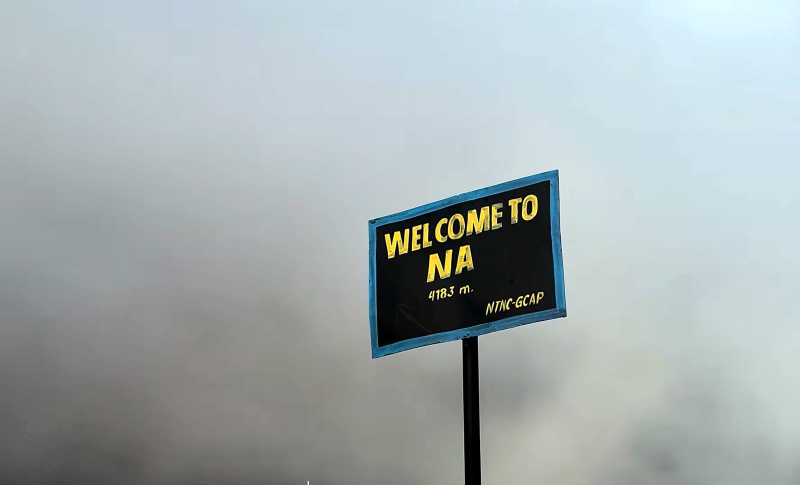
An early start from Na Gaon allows time to walk toward Tsho Rolpa, enjoy the glacial setting from safe viewpoints and return to Na for the night.
The way out retraces the valley through Beding, Dongang and Simigaon to the roadhead. Road access, lodge availability and the group’s pace can affect individual travel days, so the guide confirms practical arrangements before departure.
Altitude and Route Overview
| Destination | Approximate Altitude | Trail Character |
|---|---|---|
| Kathmandu | 1,350 m | Arrival, preparation and road transportation |
| Chhetchhet | 1,400–1,500 m | Roadhead, river crossing and beginning of the trek |
| Simigaon | 2,020 m | Steep hillside trails, farmland and village scenery |
| Dongang | 2,790 m | Forested river valley, waterfalls and narrow mountain paths |
| Beding | 3,690 m | Traditional Sherpa village and acclimatization stop |
| Na Gaon | 4,180 m | Alpine valley, seasonal settlement and high-altitude scenery |
| Tsho Rolpa Lake | 4,580 m | Glacial lake, rocky moraine and exposed alpine terrain |
Elevations are approximate and can vary by map source and the location of a lodge or campsite. Walking times and road access depend on the season and current trail conditions.
Tsho Rolpa Lake: The Heart of the Trek
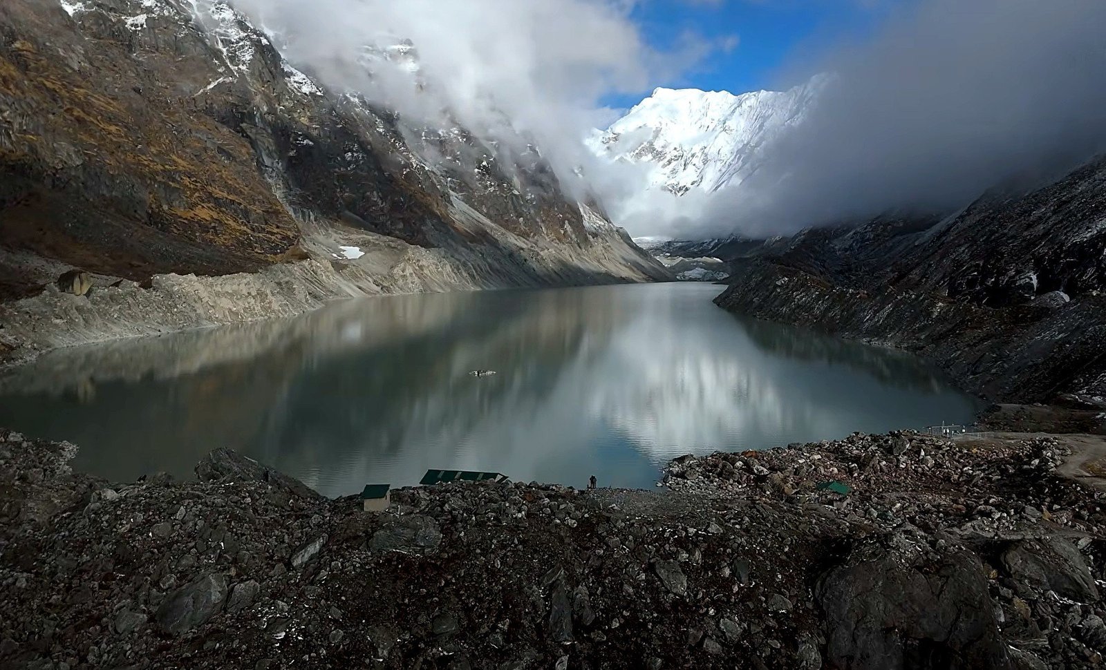
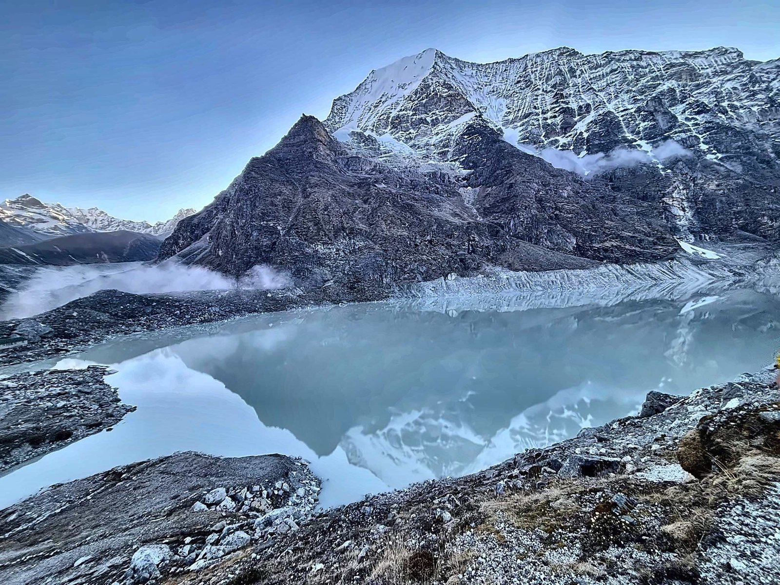
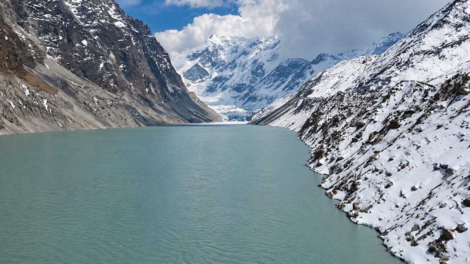
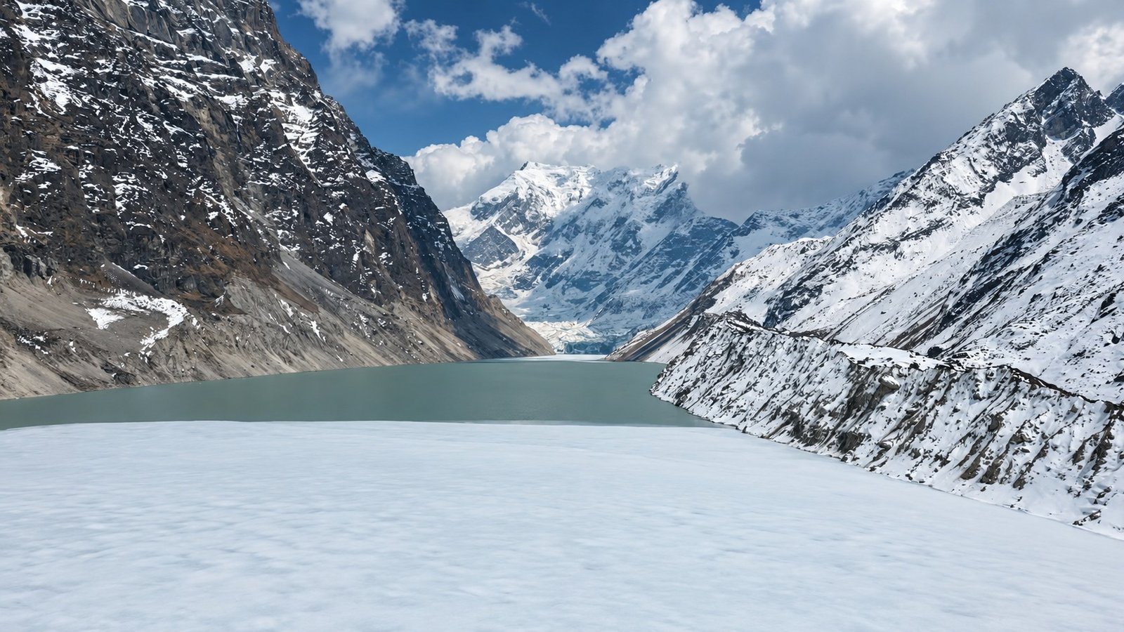
Tsho Rolpa sits in a dramatic glacial basin above Na Gaon. The final approach follows the upper valley through sparse vegetation and rocky ground, eventually reaching an area shaped by centuries of moving ice and meltwater.
The setting is striking due to wide water, moraine ridges and steep mountain slopes rising on several sides.
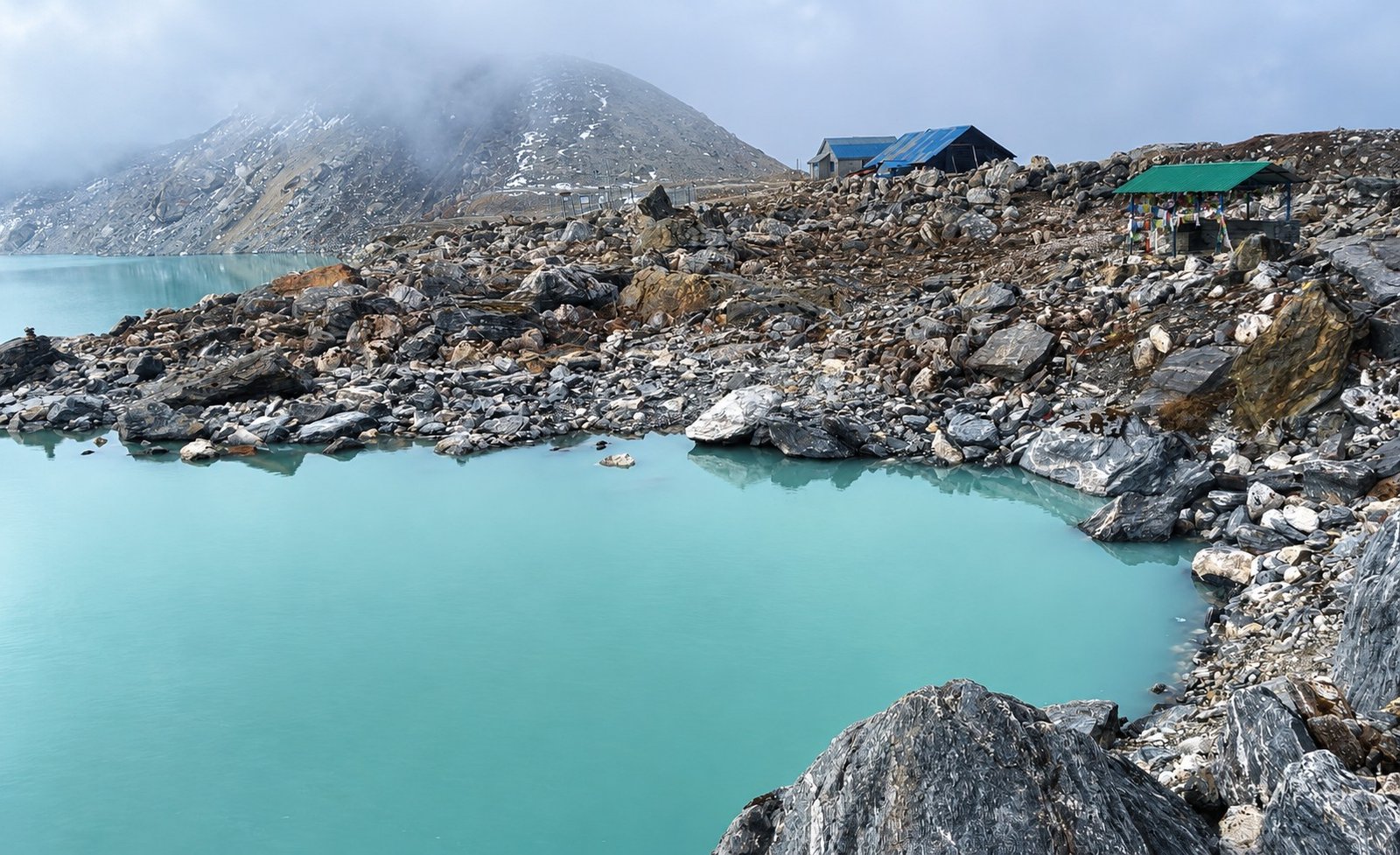
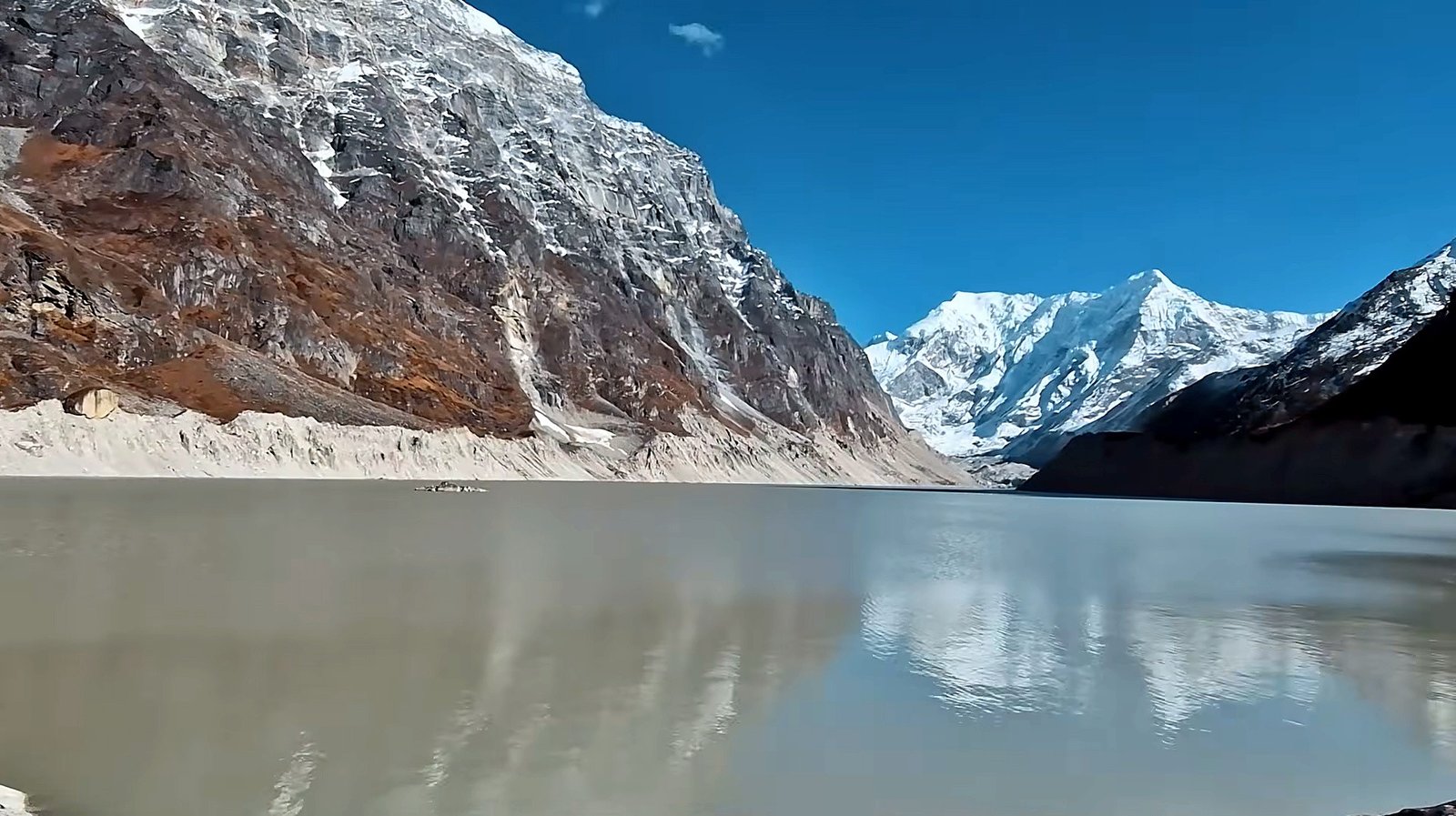
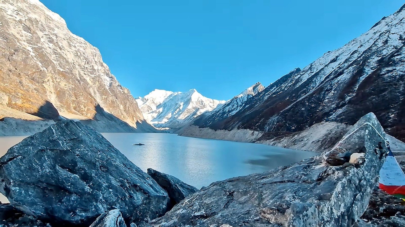
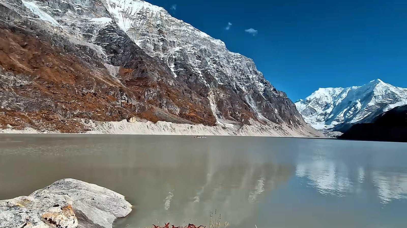
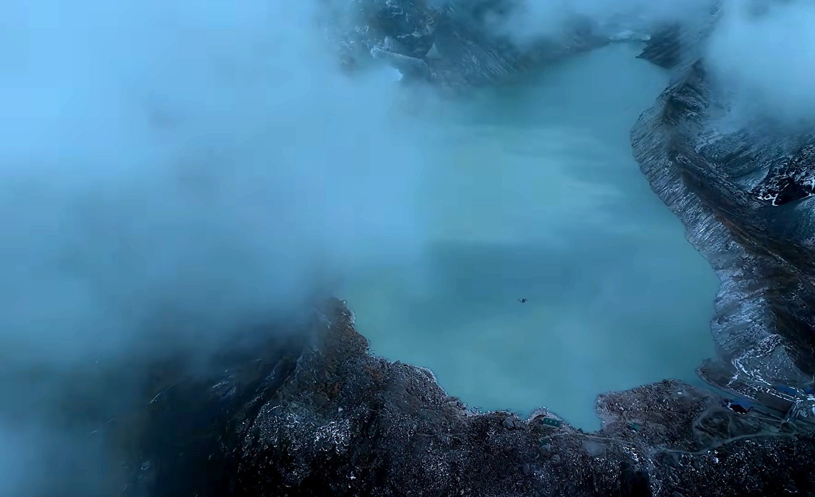
Depending on sunlight, weather and the amount of sediment in the water, the lake can appear blue, turquoise or grey. Calm weather may allow reflections; wind and cloud can change the view within minutes.
Photographers often find the changing atmosphere as interesting as the lake itself.
The lake is also an important part of Nepal’s glacial environment. Scientists have studied its development and the risk of glacial lake outburst flooding, making the landscape significant beyond its scenery.
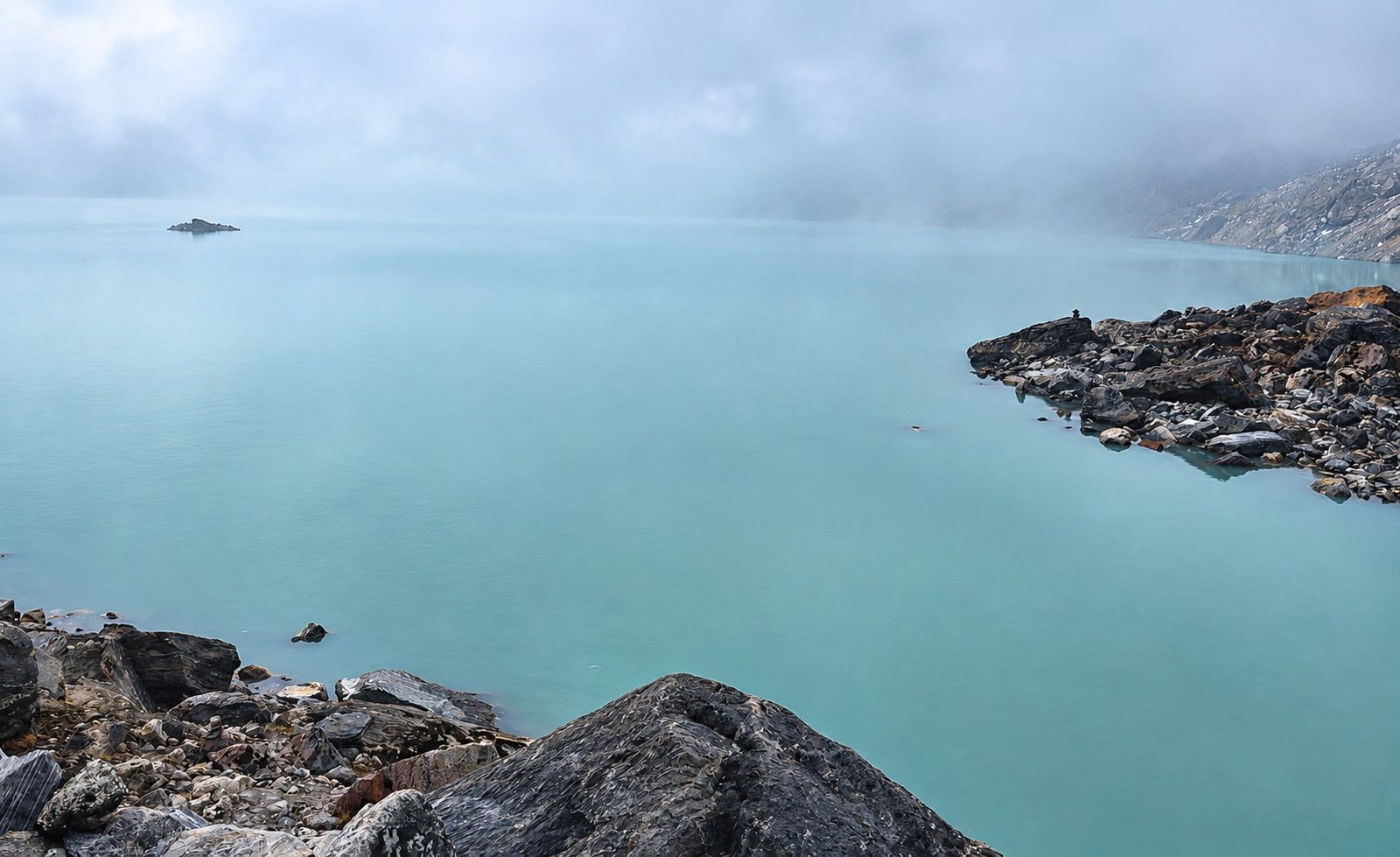
Visitors should stay on suitable ground and follow local guidance around unstable moraine, cold water and exposed sections near the lake.
A lake visit is rewarding even without walking onto the glacier or approaching unsafe edges.
How Difficult Is the Tsho Rolpa Lake Trek?
This is a moderate to challenging high-altitude trek, rather than a technical mountaineering expedition. The main difficulties are the steep first climb to Simigaon, uneven trails through the forested valley, the ascent toward Beding and the longer return stages.
Descending can be just as tiring as climbing, particularly on rocky steps or slippery ground.
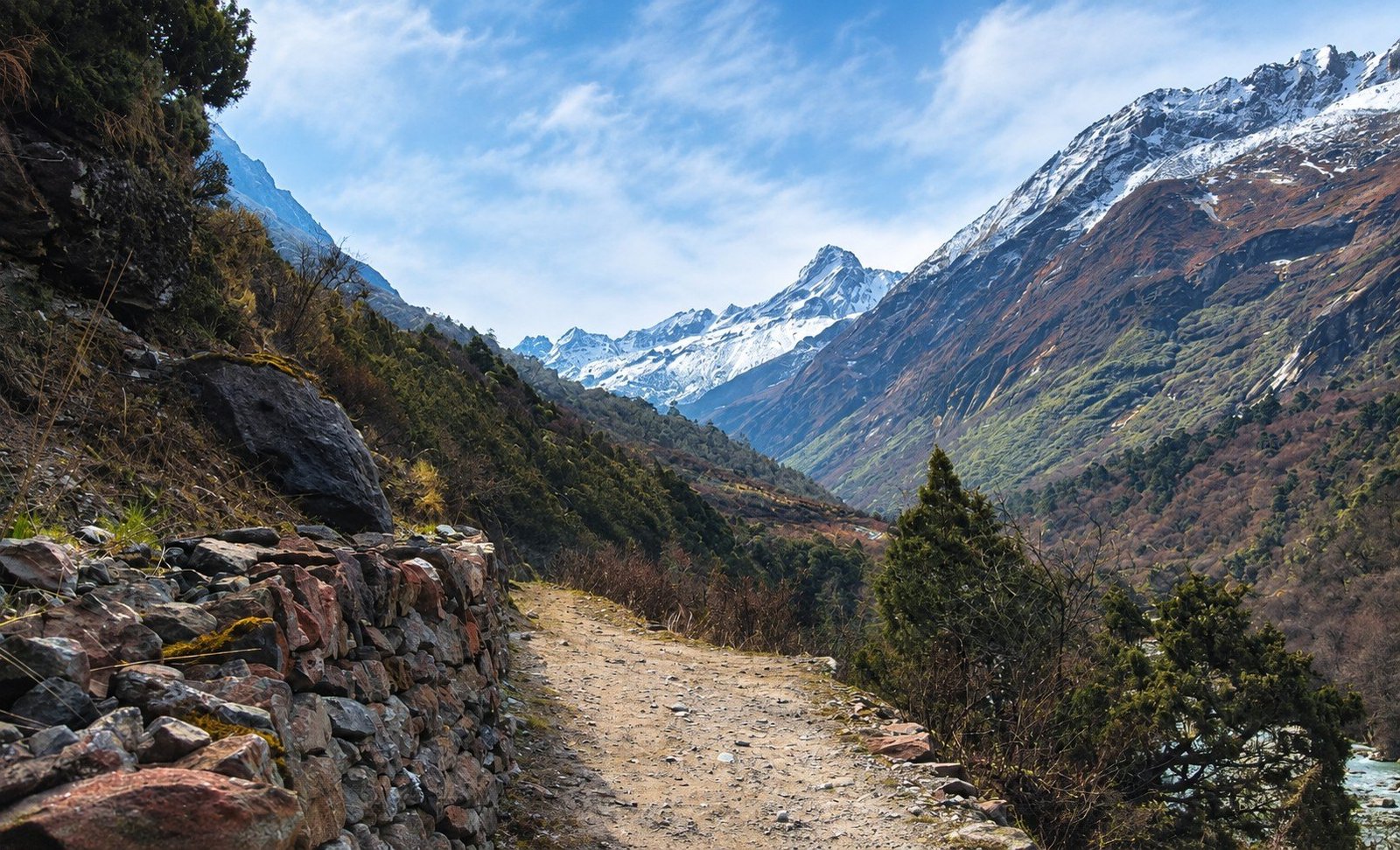
The route climbs well above 4,000 metres, where colder temperatures and thinner air make walking harder. A rest and acclimatization day at Beding is built into the itinerary before moving to Na Gaon.
Trekkers should report headaches, nausea or unusual fatigue early; if symptoms worsen, the sensible decision may be to stop ascending or descend. Good fitness supports endurance but cannot guarantee protection from altitude illness.
Tsho Rolpa Trek Difficulty Overview
| Challenge | Difficulty | What to Expect |
|---|---|---|
| Physical Endurance | Challenging | Long walking days with sustained climbs and descents |
| Maximum Altitude | High | Lake visit reaches approximately 4,580 metres |
| Technical Difficulty | Low in normal trail conditions | No planned rope climbing or glacier travel on the standard route |
| Trail Conditions | Moderate to Challenging | Steep paths, uneven stones, forest trails and possible landslide-affected sections |
| Accommodation | Basic | Simple lodges and possibly arranged camping in remote sections |
| Weather Exposure | Moderate to High | Cold temperatures, wind, rain or snow at higher elevations |
Best Time for the Tsho Rolpa Lake Trek
Spring and autumn generally provide the best opportunities for walking into the upper Rolwaling Valley. Spring offers flowering rhododendrons and fresh growth along the lower trail, although snow may remain on higher sections.
After the monsoon, autumn often brings clear mountain views and comparatively favourable trail conditions, especially in October and early November.
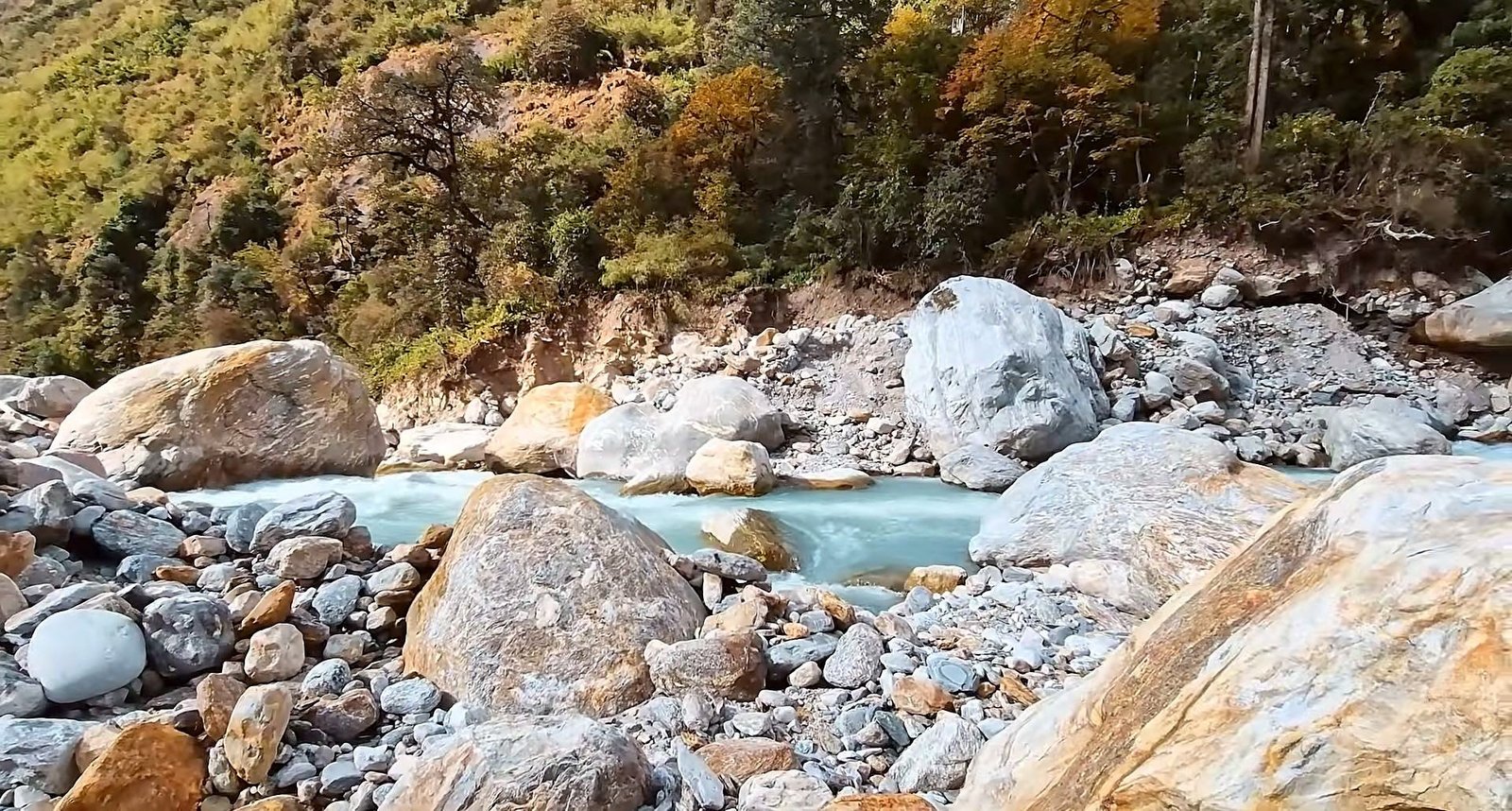
Monsoon rains can make the approach muddy and increase landslide or road disruption risks. Winter brings very cold nights and possible snow or ice above Beding.
Conditions are never guaranteed, so checking trail access, accommodation and the forecast shortly before departure matters more than choosing a date by season alone.
| Season | Months | Conditions |
|---|---|---|
| Spring | March–May | Flowering forests and generally suitable trekking conditions; snow may remain on upper trails early in the season |
| Summer / Monsoon | June–August | Frequent rain, slippery trails, leeches in lower areas and greater landslide and road-disruption risk |
| Autumn | September–November | Often clear mountain views and favourable walking weather, particularly in October and early November |
| Winter | December–February | Very cold higher elevations, possible snow and ice, shorter daylight and limited accommodation availability |
Permits Required for the Tsho Rolpa Lake Trek
The route lies within the Gaurishankar Conservation Area and enters the Rolwaling region of Dolakha. Foreign trekkers need the correct conservation and trekking documents, where a licensed guide and agency-issued TIMS documentation are required under its published guidance.
Designated wards in Dolakha, including Gaurishankar Rural Municipality Ward 9, also appear in Nepal’s restricted-area permit regulations.
| Permit | Published Reference Fee | Details |
|---|---|---|
| Gaurishankar Conservation Area Permit | NPR 3,000 for other foreign visitors; NPR 1,000 for SAARC visitors | Protected-area entry documentation |
| TIMS Card | NPR 2,000 for other foreign visitors; NPR 1,000 for SAARC visitors | Agency-issued trekking information and registration, subject to applicable permit rules |
| Dolakha Restricted-Area Permit | USD 20 per person per week under the published Dolakha category | Designated restricted wards include areas on the Rolwaling route; current permit-processing rules must be confirmed before departure |
Important: Permit fees and rules may change. Nepal Royal Tourism Holiday will reconfirm the requirements and advise travellers what passport information and documents must be supplied for the booking.
Accommodation in the Rolwaling Valley
Accommodation on the Tsho Rolpa route is simple compared with more developed trekking areas. Simigaon, Beding and other settlements may offer local teahouses or lodges with basic sleeping rooms, shared facilities and limited heating.
Dining areas are often the main places to warm up and meet fellow trekkers in the evening.
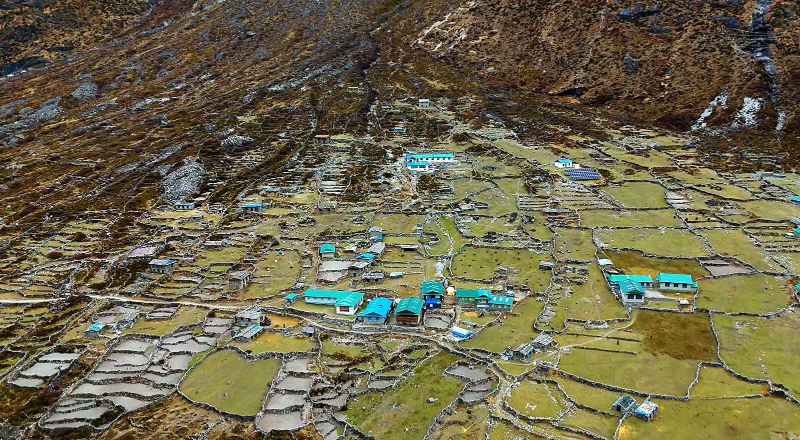
As the route climbs higher, electricity, hot water and phone coverage become less reliable. Carry a warm sleeping bag and do not expect every village to provide the same services.
Floods, landslides or seasonal closures can also affect local lodges, so the trekking team should reconfirm overnight options and arrange camping support when necessary. The flexibility is part of travelling responsibly in a remote valley.
Food and Drinking Water During the Trek
Meals are generally straightforward, filling Nepali and trekking dishes. Depending on local supplies, expect dal bhat with rice, lentils and vegetables, noodles, soups, potatoes, eggs, porridge, bread and hot drinks.
Choices become more limited farther into the valley because goods need to be carried or transported to the settlements.
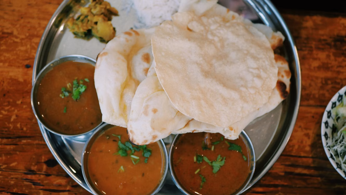
Regular meals and enough drinking water matter on long climbs, even when altitude reduces your appetite.
Bring some preferred trail snacks from Kathmandu. Use boiled, filtered or properly treated water rather than drinking directly from streams, and carry refillable bottles so you can reduce plastic waste along the route.
Getting to Tsho Rolpa from Kathmandu
The trek is reached by road; no domestic flight is required. The drive usually follows the Kathmandu–Dolakha corridor and continues along the Tama Koshi Valley toward Chhetchhet or the nearest accessible trailhead.
Allow roughly 7–9 hours or more for the journey, depending on road conditions, traffic and weather. The first walking stage to Simigaon begins from the roadhead.
The return uses the same general transport corridor. Because mountain roads are vulnerable to monsoon damage and delays, the exact pickup point and driving schedule should be verified before travelling.
Trekkers with international flights should avoid relying on an inflexible same-day connection after leaving the mountains.
Safety and Emergency Preparation
The main risks on the standard lake route include altitude illness, steep or slippery paths, loose rock, river crossings and sudden changes in weather.
Around Tsho Rolpa, glacial moraine may be unstable and the water remains dangerously cold. Follow the guide’s advice, remain on suitable trails and avoid climbing onto unsafe edges for photographs.

Medical care and mobile coverage can be limited in the upper valley, while poor visibility can delay a helicopter evacuation.
Travel insurance should cover trekking to at least 4,580 metres and emergency rescue, including helicopter evacuation where possible.
Carry essential personal medicines in your daypack and tell your guide promptly if you develop altitude symptoms or feel unusually unwell. Safety decisions may require changes to the planned route.
Essential Packing List for the Tsho Rolpa Trek
Pack for warmer lower-valley walking as well as freezing nights and exposed alpine weather above 4,000 metres.
Well-fitted trekking boots, layered clothing, a waterproof shell, insulated jacket, warm sleeping bag and trekking poles are especially useful. Keep rain protection, snacks, drinking water and personal medication accessible throughout the day.
| Category | Recommended Equipment |
|---|---|
| Trekking Clothing | Quick-drying shirts, trekking trousers, thermal base layers and fleece jacket |
| Warm and Waterproof Layers | Insulated down jacket, waterproof outer jacket, rain trousers, warm gloves and wool hat |
| Footwear | Comfortable waterproof trekking boots, warm socks and camp footwear |
| Sleeping Equipment | Warm sleeping bag suitable for cold mountain nights |
| Trekking Accessories | Trekking poles, headlamp, daypack, waterproof pack cover and reusable water bottles |
| Sun Protection | UV-protection sunglasses, sunscreen, lip balm and sun hat |
| Health and Personal Items | Personal medication, basic first-aid supplies, water treatment and toiletries |
| Documents and Electronics | Passport, insurance documents, emergency contacts, power bank and charging cables |
Who Is the Tsho Rolpa Trek For, and How Should You Prepare?
Tsho Rolpa is well suited to nature lovers, photographers and trekkers looking for a less-crowded Himalayan journey with both village encounters and high-altitude landscapes.
Previous multi-day hiking experience is helpful, particularly when you are comfortable with uneven trails, simple accommodation and walking for several hours on consecutive days.
Fit beginners may consider it with suitable preparation and professional guidance, but should not mistake a non-technical route for an easy walk.
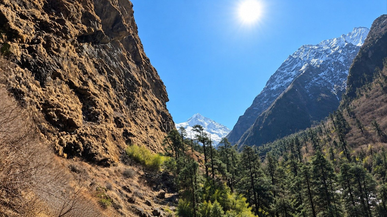
Build endurance before departure through regular hill walks, stair climbing or cycling, and practise with the daypack and boots you intend to use. Include longer training walks and strength work for the legs and core, which are especially useful on the long descent.
If you have limited experience above 3,500 metres, discuss a slower itinerary with the trekking team. The greatest reward of Rolwaling comes from enjoying the villages, forests and high mountain scenery without rushing to reach the lake.
Plan Your Tsho Rolpa Lake Trek with Nepal Royal Tourism Holiday
Discover the remote beauty of the Rolwaling Valley, explore traditional Sherpa settlements and experience the remarkable landscape surrounding Tsho Rolpa Lake at 4,580 metres.
Whether you are planning a private trek, travelling with friends or looking for a guided Himalayan adventure away from Nepal’s busier trekking routes, Nepal Royal Tourism Holiday can help you organise a suitable itinerary, transport, accommodation and trekking support.
Contact our team with your preferred travel dates and group size to discuss the latest trail conditions, permit requirements and available trekking arrangements.
Trip Highlights
- Discover Tsho Rolpa Lake (4,580 m), one of Nepal's most remarkable glacial lakes, surrounded by rugged Himalayan peaks and dramatic glacial landscapes
- Explore the remote Rolwaling Valley, a quieter trekking destination away from the crowded trails of Everest and Annapurna
- Trek through the Gaurishankar Conservation Area, experiencing beautiful forests, rushing rivers, waterfalls and changing mountain scenery
- Enjoy spectacular views of Mount Gaurishankar, Chobutse, Chekigo and the surrounding Rolwaling Himal when weather conditions are clear
- Experience the traditional Sherpa culture of Beding Village (3,690 m), known for its Buddhist heritage and strong mountaineering traditions
- Visit Na Gaon (4,180 m), a peaceful high-altitude settlement surrounded by alpine meadows, yak-grazing pastures and towering mountains
- Witness the fascinating transition from lush rhododendron and pine forests to rocky alpine valleys and glacial moraine
- Follow beautiful riverside trails along the Rolwaling River, crossing suspension bridges and passing traditional Himalayan settlements
- Admire the breathtaking glacial scenery associated with the Trakarding Glacier on the approach to Tsho Rolpa Lake
- Enjoy a carefully planned 11-day trekking journey, including an acclimatization day in Beding before ascending above 4,000 metres
- Capture unforgettable mountain landscapes, traditional village life and the striking waters of Tsho Rolpa Lake, one of the hidden treasures of Nepal's Himalayas
Tsho Rolpa Trek – 11 Days ~ Itinerary
Day 1
Arrival in Kathmandu
- Maximum Altitude: Kathmandu – 1,350 m
- Overnight Altitude: Kathmandu – 1,350 m
- Accommodation: Three Star Hotel in Kathmandu
Welcome to Nepal! Upon your arrival at Tribhuvan International Airport, a representative from Nepal Royal Tourism Holiday will welcome you and transfer you to your hotel in Kathmandu. After checking in, you can relax and recover from your journey or explore the nearby streets if time permits.
Depending on your arrival schedule, you will meet your trekking representative for a brief introduction to the upcoming Tsho Rolpa Lake Trek. The discussion covers the Rolwaling Valley route, weather conditions, equipment requirements and the travel arrangements for the following morning.
Take the evening to organise your trekking essentials, check your equipment and enjoy your first night in Kathmandu before beginning the journey toward the Rolwaling Himal.
Day 2
Drive from Kathmandu to Chhetchhet and Trek to Simigaon
- Maximum Altitude: Simigaon – approximately 2,020 m
- Overnight Altitude: Simigaon – approximately 2,020 m
- Driving Duration: Approximately 7–9 hours
- Trekking Duration: Approximately 2–3 hours
- Altitude Gain on Foot: Around 500–600 m from the trailhead
- Accommodation: Local teahouse or lodge in Simigaon
- Meals: Breakfast, Lunch and Dinner
The adventure begins early as you leave Kathmandu and drive toward Dolakha, passing through the hills and settlements of central Nepal. The road follows the mountain landscape through Charikot and continues toward the Tama Koshi Valley, offering views of terraced farmland, rivers and forested hillsides.
After several hours of driving, you reach Chhetchhet or the nearest accessible trailhead, depending on current road conditions. From here, the trekking portion begins with a river crossing followed by a steep uphill walk toward Simigaon.
The climb involves stone steps, hillside paths and sections passing through cultivated land. Although relatively short, the ascent can feel demanding after the long road journey. As you gain elevation, the valley opens below, and clear weather may reveal beautiful views toward Mount Gaurishankar.
By late afternoon or evening, you arrive in Simigaon, a traditional mountain settlement at approximately 2,020 metres. Settle into your accommodation, enjoy a warm meal and prepare for the first full day of trekking through the Rolwaling Valley.
Day 3
Trek from Simigaon to Dongang
- Maximum Altitude: Dongang area – approximately 2,790 m
- Overnight Altitude: Dongang – approximately 2,790 m
- Trekking Duration: Approximately 5–7 hours
- Walking Distance: Approximately 9–12 km, depending on the trail used
- Net Altitude Gain: Approximately 770 m
- Accommodation: Available local lodge or pre-arranged camping, depending on current conditions
- Meals: Breakfast, Lunch and Dinner
After breakfast in Simigaon, you begin the first full trekking day, following the trail deeper into the Rolwaling Valley. The route climbs above the village and enters forested hillsides, where rhododendron, pine and other mountain vegetation provide a peaceful setting.
Today’s walk includes several ascents and descents as the trail passes through wooded slopes, streams and small clearings. You travel through the Surmuche and Kyalche corridor, with occasional views of surrounding cliffs and distant Himalayan peaks. During spring, flowering rhododendrons can add beautiful colour to the forest.
As the day progresses, the sound of the Rolwaling River becomes a familiar companion. The route gradually leads toward Dongang, a remote riverside stopping point surrounded by forest and steep mountain slopes.
Upon arrival, you can rest and enjoy the quieter surroundings of the valley. Accommodation arrangements in Dongang may vary because of previous flood damage, so the trekking team will confirm the available facilities or organise camping support before departure.
Day 4
Trek from Dongang to Beding
- Maximum Altitude: Beding – approximately 3,690 m
- Overnight Altitude: Beding – approximately 3,690 m
- Trekking Duration: Approximately 6–7 hours
- Walking Distance: Approximately 10–12 km
- Net Altitude Gain: Approximately 900 m
- Accommodation: Local teahouse or lodge in Beding
- Meals: Breakfast, Lunch and Dinner
Leaving Dongang after breakfast, you continue along the Rolwaling River toward Beding, one of the most important settlements in the upper valley. The trail passes through forests, crosses mountain streams and gradually gains elevation as the surrounding landscape becomes increasingly rugged.
Along the way, you pass through the Ramding area, where the valley begins to reveal more of its impressive mountain scenery. Forests gradually give way to open hillsides, rocky terrain and distant snow-covered peaks. The sound of the river accompanies much of the journey.
Today’s trek involves a considerable increase in altitude, so maintaining a comfortable walking pace is important. Take regular breaks, drink enough water and avoid rushing through the steeper sections.
Eventually, you arrive in Beding at approximately 3,690 metres. This traditional Sherpa village is known for its Buddhist heritage, mountaineering history and impressive Himalayan surroundings. After settling into your accommodation, enjoy the peaceful atmosphere of the village and rest before the following day’s acclimatization activities.
Day 5
Acclimatization and Exploration Day in Beding
- Maximum Altitude: Approximately 3,690–3,900 m, depending on the optional acclimatization walk
- Overnight Altitude: Beding – approximately 3,690 m
- Activity: Acclimatization, short hike and village exploration
- Walking Duration: Optional 2–3 hours
- Accommodation: Local teahouse or lodge in Beding
- Meals: Breakfast, Lunch and Dinner
Today is dedicated to acclimatization and exploring Beding before continuing toward the higher elevations of the Rolwaling Valley. After several days of trekking and a substantial altitude gain from Dongang, an additional night in Beding provides valuable time for your body to adjust.
Depending on the weather and how everyone is feeling, your guide may organise a gentle walk to higher ground overlooking the village. This provides an opportunity to appreciate the surrounding mountain scenery before descending to Beding for another night.
The afternoon is also an opportunity to experience the village’s local culture. Beding has a long association with Himalayan mountaineering, and its traditional stone houses, prayer flags and Buddhist monastery reflect the heritage of the Rolwaling Sherpa community. A respectful visit to the monastery may be possible when it is open.
Spend the remainder of the day resting, eating well and preparing for the journey to Na Gaon. Your guide will monitor the group’s response to the altitude before moving higher.
Day 6
Trek from Beding to Na Gaon
- Maximum Altitude: Na Gaon – approximately 4,180 m
- Overnight Altitude: Na Gaon – approximately 4,180 m
- Trekking Duration: Approximately 3–4 hours
- Walking Distance: Approximately 5–6 km
- Net Altitude Gain: Approximately 490 m
- Accommodation: Basic teahouse, lodge or arranged camping in Na Gaon
- Meals: Breakfast, Lunch and Dinner
After breakfast, you leave Beding and continue toward Na Gaon, one of the highest settlements in the Rolwaling Valley. Although today’s walk is shorter than the previous trekking stages, the increasing altitude makes it important to maintain a steady and comfortable pace.
As you move farther into the upper valley, the landscape begins to change noticeably. The forested terrain gradually gives way to open alpine meadows, rocky slopes and broad views of the surrounding Himalayan peaks. The Rolwaling River continues through the valley, with mountain streams and traditional yak-grazing areas appearing along the route.
Na Gaon lies at approximately 4,180 metres and has traditionally served as a seasonal settlement for local herders. The village is surrounded by impressive mountain scenery and offers a peaceful setting for the final overnight stop before the excursion to Tsho Rolpa Lake.
After arriving, settle into your accommodation and spend the afternoon relaxing. Your guide will review the following day’s route, weather forecast and the conditions of the trail leading toward the lake.
Day 7
Hike from Na Gaon to Tsho Rolpa Lake (4,580 m) and Return to Na Gaon
- Maximum Altitude: Tsho Rolpa Lake – approximately 4,580 m
- Overnight Altitude: Na Gaon – approximately 4,180 m
- Hiking Duration: Approximately 5–7 hours, including the return
- Walking Distance: Approximately 8–10 km round trip, depending on the lake approach
- Altitude Gain: Approximately 400 m before descending to Na Gaon
- Accommodation: Basic teahouse, lodge or arranged camping in Na Gaon
- Meals: Breakfast, Lunch and Dinner
Today is the most anticipated day of your Tsho Rolpa Lake Trek. After an early breakfast, you leave Na Gaon and follow the upper Rolwaling Valley toward one of Nepal’s most remarkable glacial lakes.
The trail gradually ascends through increasingly rocky alpine terrain, passing mountain streams, open valleys and glacial deposits. With fewer signs of vegetation, the landscape becomes more dramatic, revealing the rugged beauty of the high Himalaya. The surrounding mountains and the Trakarding Glacier system provide an impressive backdrop as you approach the lake.
At approximately 4,580 metres, you finally reach Tsho Rolpa Lake. Its glacial waters, surrounded by enormous mountain slopes and rocky moraine, create a striking natural setting. Depending on the weather and light, the lake may appear in beautiful shades of blue or turquoise.
Spend time enjoying the scenery and taking photographs from safe viewpoints. Your guide will help you navigate the uneven terrain and avoid unstable sections around the lake. The altitude, cold winds and changing weather make it important to remain attentive even while enjoying the views.
After exploring the lake, retrace your steps toward Na Gaon. Descending to the lower sleeping altitude of approximately 4,180 metres provides a welcome opportunity to rest after completing the main objective of the trek.
Day 8
Trek from Na Gaon to Dongang via Beding (2,790 m)
- Maximum Altitude: Na Gaon – approximately 4,180 m
- Overnight Altitude: Dongang – approximately 2,790 m
- Trekking Duration: Approximately 7–9 hours or longer, depending on trail conditions
- Walking Distance: Approximately 16–18 km
- Net Altitude Loss: Approximately 1,390 m
- Accommodation: Available local lodge or pre-arranged camping in Dongang
- Meals: Breakfast, Lunch and Dinner
After successfully visiting Tsho Rolpa Lake, you begin the return journey through the Rolwaling Valley. Today’s trek is one of the longer walking days of the itinerary, so an early departure from Na Gaon is important.
The trail initially follows the open alpine valley toward Beding, gradually descending from the rocky mountain environment into greener surroundings. Along the way, you can enjoy another perspective of the Himalayan scenery that accompanied the ascent.
After reaching Beding, take a suitable break before continuing down the valley toward Dongang. The route passes through the forested slopes and riverside sections encountered earlier in the trek. Although the overall direction is downhill, the trail remains uneven in places, with occasional short ascents and sections requiring careful footing.
The substantial descent can be demanding on the knees and legs, particularly after several days at higher elevations. Trekking poles, a steady pace and regular rest stops are helpful throughout the day.
Arrive in Dongang and settle into the accommodation or camping arrangement organised for the group. Enjoy a warm meal and a well-earned rest after a long day of descending through the Rolwaling Valley.
Day 9
Trek from Dongang to Simigaon
- Maximum Altitude: Dongang area – approximately 2,790 m
- Overnight Altitude: Simigaon – approximately 2,020 m
- Trekking Duration: Approximately 5–7 hours
- Walking Distance: Approximately 9–12 km
- Net Altitude Loss: Approximately 770 m
- Accommodation: Local teahouse or lodge in Simigaon
- Meals: Breakfast, Lunch and Dinner
After breakfast, you continue descending through the lower Rolwaling Valley toward Simigaon. The trail retraces the forested route through Kyalche and Surmuche, passing mountain streams, waterfalls and stretches of rhododendron and pine forest.
Compared with the exposed alpine landscape near Tsho Rolpa, today’s surroundings feel noticeably greener. As you lose elevation, the air becomes warmer, and the mountain slopes gradually return to the scenery of the lower valley.
The walking route includes both downhill sections and short climbs, so the day still requires a reasonable amount of energy. Take time to enjoy the final forest trails and the occasional mountain views before arriving in Simigaon.
On reaching the village, settle into your local lodge and enjoy a relaxing evening. This is your final night on the trekking trail, with the return road journey to Kathmandu scheduled for the following day.
Day 10
Trek from Simigaon to Chhetchhet and Drive to Kathmandu
- Maximum Altitude: Simigaon – approximately 2,020 m
- Overnight Altitude: Kathmandu – 1,350 m
- Trekking Duration: Approximately 2–3 hours
- Driving Duration: Approximately 7–9 hours or longer, depending on road conditions
- Net Altitude Loss on Foot: Around 500–600 m
- Accommodation: Three Star Hotel in Kathmandu
- Meals: Breakfast and Lunch
Today marks the final walking stage of your Tsho Rolpa Lake Trek. After an early breakfast in Simigaon, you descend along the familiar hillside trail toward Chhetchhet and the Tama Koshi Valley.
The steep path passes through cultivated land, stone steps and small settlements before reaching the river crossing and roadhead. Take care on the downhill sections, especially if the ground is wet or slippery.
After reaching Chhetchhet, meet your vehicle and begin the drive back to Kathmandu. The journey follows the mountain roads through Dolakha and Charikot, with views of river valleys, terraced hillsides and rural villages along the way.
The drive can be lengthy, particularly when traffic, roadworks or weather affect the route. After arriving in Kathmandu, transfer to your hotel and enjoy some free time to rest, have dinner or explore the city.
Your trekking adventure through the Rolwaling Valley is now complete, leaving you with memories of traditional mountain villages, beautiful forests and the remarkable glacial landscape of Tsho Rolpa Lake.
Day 11
Final Departure from Kathmandu
- Maximum Altitude: Kathmandu – 1,350 m
- Meals: Breakfast
Your 11-day Tsho Rolpa Lake Trek comes to an end today. Depending on your international flight schedule, you may have some free time in Kathmandu before checking out of your hotel.
A representative from Nepal Royal Tourism Holiday will arrange your transfer to Tribhuvan International Airport for your onward journey.
After exploring the remote Rolwaling Valley, visiting traditional Sherpa settlements and reaching the beautiful Tsho Rolpa Lake at approximately 4,580 metres, you depart Nepal with unforgettable memories of your Himalayan adventure.
We thank you for travelling with Nepal Royal Tourism Holiday and hope to welcome you again for another journey through the mountains of Nepal.
Trip Cost Includes/Excludes
Cost Includes
- Airport pickup and drop-off by private tourist vehicle in Kathmandu.
- Two nights of hotel accommodation in Kathmandu on a twin-sharing basis with breakfast.
- Ground transportation from Kathmandu to Chhetchhet and return
- Gaurishankar Conservation Area entry permit and applicable trekking documentation, including required Rolwaling restricted-area authorization.
- Experienced, government-licensed English-speaking trekking guide throughout the trek.
- Porter assistance for carrying personal trekking luggage within the agreed weight allowance.
- Accommodation in available local teahouses and mountain lodges throughout the trekking route.
- Three meals daily (breakfast, lunch and dinner) during the trekking days
- Guide and porter salaries, meals, accommodation, transportation, insurance and necessary equipment
- Assistance with trekking arrangements, route coordination and emergency communication when required
- Basic first-aid kit carried by the trekking guide
- All applicable government taxes and company service charges included in the agreed package price
- Nepal Royal Tourism Holiday branded T-shirt as a souvenir of your Himalayan adventure
- Trek completion certificate from Nepal Royal Tourism Holiday upon completion of the Tsho Rolpa Lake Trek
Cost Excludes
- International airfare to and from Nepal
- Nepal entry visa fees
- Lunch, dinner and personal food expenses during your stay in Kathmandu, unless specifically included
- Personal travel insurance covering high-altitude trekking, medical treatment and emergency helicopter evacuation
- Emergency rescue, helicopter evacuation, hospitalisation and medical expenses
- Personal trekking equipment, including trekking boots, warm clothing, sleeping bags and trekking poles
- Personal expenses such as laundry, telephone calls, Wi-Fi, battery charging and hot showers
- Alcoholic beverages, soft drinks, bottled water, specialty coffee and additional snacks
- Additional transportation or accommodation costs arising from personal itinerary changes or early withdrawal
- Additional expenses caused by road closures, landslides, severe weather or other circumstances beyond the company's control
- Optional sightseeing, activities or services not mentioned in the itinerary
- Tips and gratuities for trekking guides, porters and drivers
- Any other expenses or services not specifically mentioned in the Cost Includes section
Trip Photo/Video Gallery
Frequently Asked Questions
Our Tsho Rolpa Lake Trek takes 11 days, including Kathmandu arrival and departure, an acclimatization day in Beding and the return journey through Rolwaling Valley.
Tsho Rolpa Lake lies at approximately 4,580 metres (15,026 feet) in the Rolwaling Valley of Dolakha District, within the Gaurishankar Conservation Area.
The trek is moderate to challenging, featuring steep climbs, rocky trails and high-altitude walking. Good physical fitness and previous hiking experience are recommended.
Physically fit beginners can join with proper preparation and professional guidance. However, previous hiking experience is recommended due to the demanding terrain and altitude.
Most trekking days involve 4–7 hours of walking. Longer sections, particularly the return from Na Gaon to Dongang, may take 7–9 hours or more.
Beding sits at approximately 3,690 metres. The additional day helps trekkers adjust to the elevation before continuing toward Na Gaon and Tsho Rolpa Lake.
Spring (March–May) and autumn (September–November) are the best seasons, offering generally favourable trekking conditions, beautiful landscapes and impressive Himalayan views.
Trekkers stay in basic local teahouses and mountain lodges. Camping may be arranged where accommodation is unavailable due to seasonal conditions or trail damage.
Required documentation includes the Gaurishankar Conservation Area Permit and applicable trekking and restricted-area permits. Nepal Royal Tourism Holiday arranges the necessary permits.
Essential items include trekking boots, warm clothing, a sleeping bag, waterproof layers, trekking poles, sunglasses, sunscreen and personal medication.
The trekking guide may adjust the route or schedule due to weather, landslides or damaged trails. Safety always takes priority over the planned itinerary.
You may also like
Menu
