-
 Difficulty
Strenuous
Difficulty
Strenuous
-
 Max Elevation
8,163 m
Max Elevation
8,163 m
-
 Group Size
1 to 10 People Person
Group Size
1 to 10 People Person
-
 Accommodation
Teahouse/Camping
Accommodation
Teahouse/Camping
-
 Start/End
Kathmandu/Kathmandu
Start/End
Kathmandu/Kathmandu
-
 Destination
Manaslu
Destination
Manaslu
-
 Best Season
Spring and Autumn
Best Season
Spring and Autumn
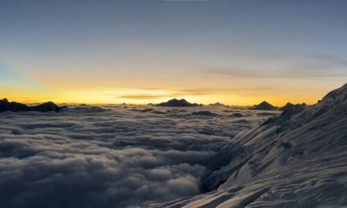
The Manaslu Expedition is a full-scale Himalayan climbing journey to the summit of Mount Manaslu at 8,163 m / 26,781 ft, the eighth-highest mountain in the world.
The mountain, located in the Manaslu Himal of north-central Nepal, combines a long trekking approach through the Budhi Gandaki Valley with glacier climbing, four high camps, fixed ropes, extreme altitude and a demanding summit push above 8,000 meters.
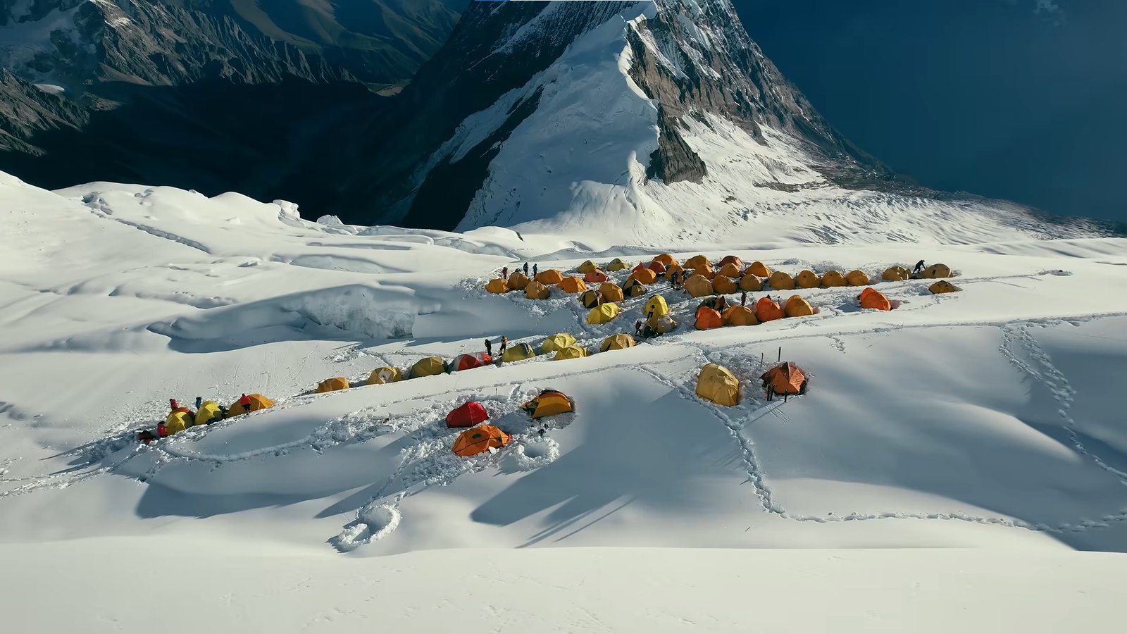
Unlike expeditions where climbers reach Base Camp quickly by road or helicopter, Manaslu develops gradually.
The journey begins in the lower hills of Gorkha and follows the Budhi Gandaki through Machha Khola, Jagat, Deng, Namrung and Lho before reaching the high settlement of Samagaon.

This approach is an important part of the expedition rather than simply a way of reaching the mountain.
Each stage brings a gradual increase in altitude, giving the body time to adapt while the surroundings change from subtropical river valleys and forest to dry alpine terrain beneath the Manaslu massif.

After reaching Samagaon at around 3,530 m, the expedition slows down for further acclimatization before moving to Manaslu Base Camp at approx. 4,800–4,900 m.
Base Camp then becomes the operational centre for the climbing phase, where the team prepares equipment, follows weather forecasts, completes technical training and begins a series of acclimatization rotations on the mountain.
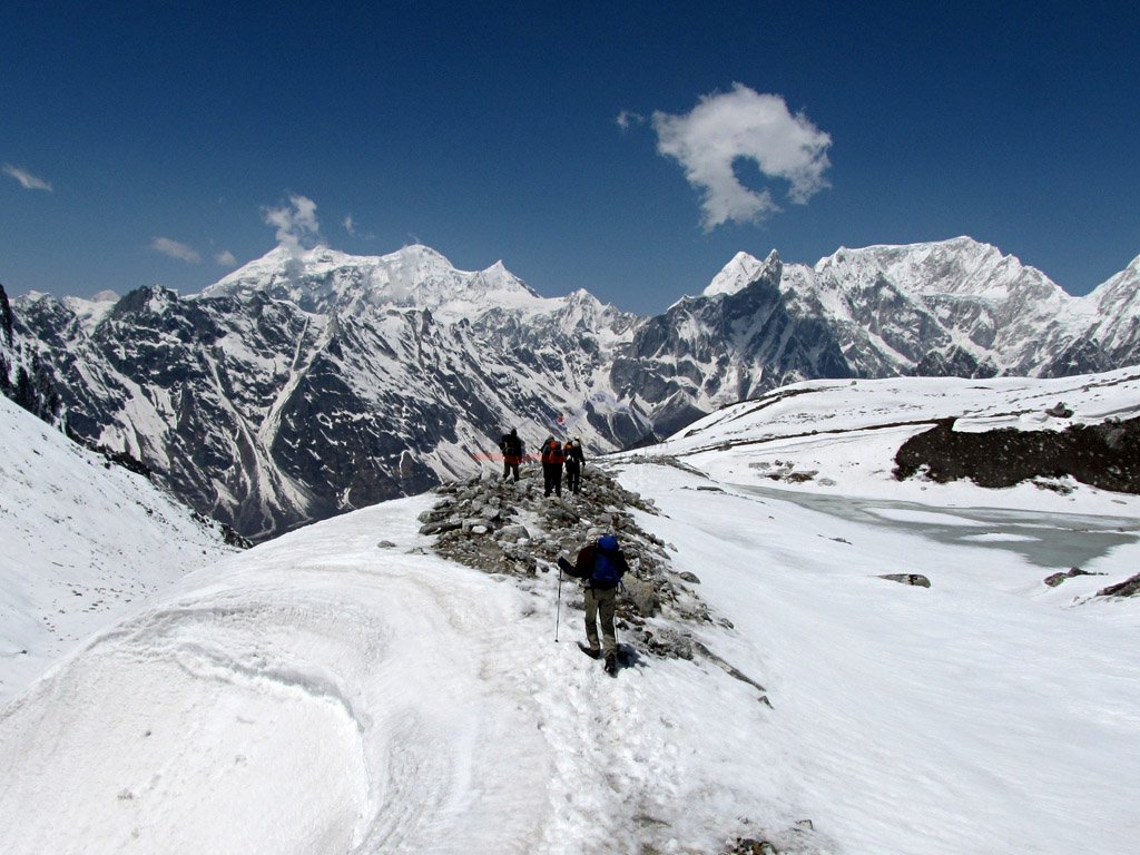
The standard commercial route normally uses four high camps above Base Camp. Camp I is established around approx. 5,600–5,700 m, Camp II around approx. 6,300–6,400 m, Camp III around approx. 6,800–6,900 m and Camp IV around approx. 7,300–7,450 m.
Exact positions can change from season to season because glacier movement, snow accumulation and route conditions affect where camps can be established safely.

Climbers gradually move through these camps during acclimatization before returning lower to recover.
Once the team has adapted sufficiently and a suitable weather window appears, the final summit rotation begins through Camp I, Camp II, Camp III and Camp IV before the summit attempt at 8,163 m.

Most Manaslu expedition programs are planned over roughly 40 to 45 days, depending on the approach, acclimatization plan and return route.
Nepal Royal Tourism Holiday keeps this program at 45 days to provide enough time for progressive acclimatization, high-camp rotations, weather contingency, a controlled descent and the return through the Manaslu Circuit rather than compressing an 8,000-meter climb into an unnecessarily tight schedule.
Manaslu Expedition Facts
| Expedition Detail | Information |
|---|---|
| Mountain | Mount Manaslu |
| Summit Altitude | 8,163 m / 26,781 ft |
| World Ranking | Eighth-highest mountain in the world |
| Mountain Range | Manaslu Himal / Mansiri Himal |
| Region | Gorkha, Manaslu Conservation Area |
| Typical Expedition Duration | Around 40–45 Days |
| Our Program | 45 Days Kathmandu to Kathmandu |
| Approach Route | Kathmandu – Machha Khola – Jagat – Deng – Namrung – Lho – Samagaon – Manaslu Base Camp |
| Base Camp | Approx. 4,800–4,900 m |
| High Camps | Four camps above Base Camp |
| Climbing Route | Standard Northeast Route |
| Main Terrain | Glacier, Snow, Ice, Crevasses and Fixed-Rope Sections |
| Difficulty | Advanced 8,000-Meter Mountaineering Expedition |
| Main Climbing Seasons | Spring and Autumn |
| First Ascent | 9 May 1956 – Toshio Imanishi and Gyaltsen Norbu Sherpa |
Route and Approach
The Manaslu Expedition begins with the drive from Kathmandu toward Machha Khola before the team starts trekking north through the Budhi Gandaki Valley.
The early stages pass through warm river valleys, forests, suspension bridges and hillside villages. Jagat marks the entrance into the restricted Manaslu region, after which the trail gradually gains elevation through Deng and Namrung.
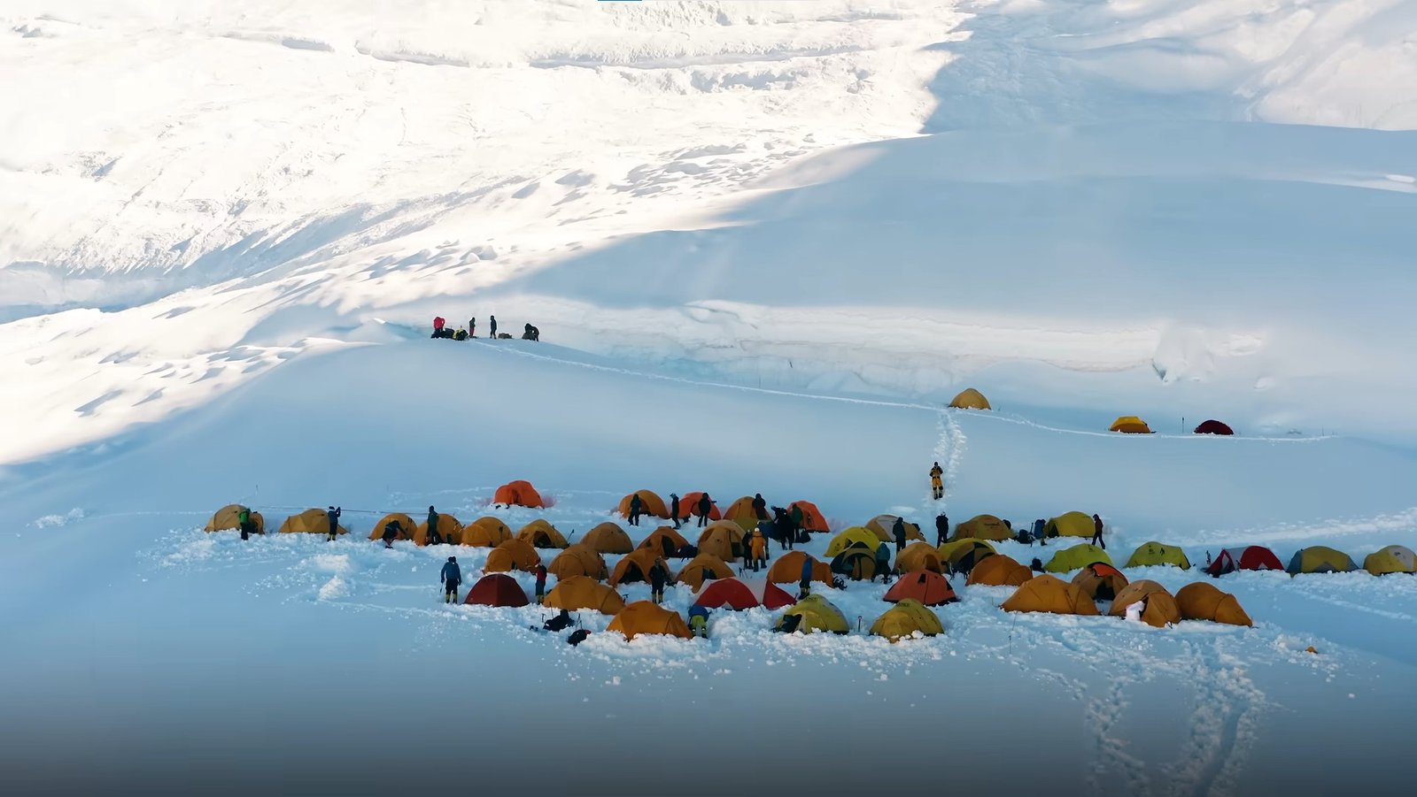
From Namrung onward, the landscape changes noticeably. Tibetan Buddhist influence becomes stronger, mani walls and monasteries appear more frequently and the views of Manaslu and neighbouring peaks grow increasingly dramatic.
Lho sits beneath some of the finest views of the Manaslu massif before the route continues to Samagaon. At roughly 3,530 m, Samagaon becomes the final major settlement before Base Camp and an important acclimatization stop.
| Approach Stage | Altitude | Accommodation |
|---|---|---|
| Machha Khola | Around 870–900 m | Teahouse / Lodge |
| Jagat | Around 1,340–1,410 m | Teahouse / Lodge |
| Deng | Around 1,860 m | Teahouse / Lodge |
| Namrung | Around 2,630 m | Teahouse / Lodge |
| Lho | Around 3,180 m | Teahouse / Lodge |
| Samagaon | Around 3,530 m | Teahouse / Lodge |
| Manaslu Base Camp | Approx. 4,800–4,900 m | Expedition Camp |
Manaslu Base Camp
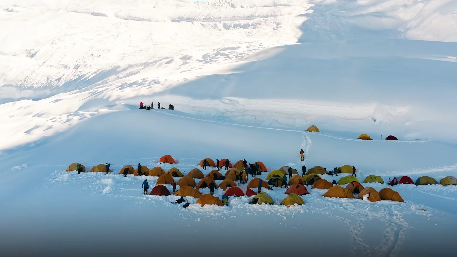
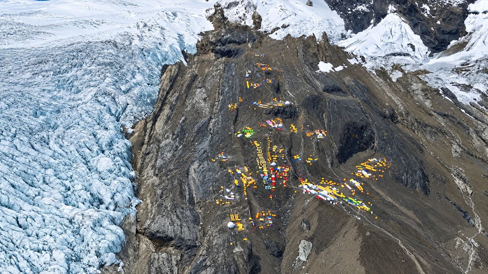
Manaslu Base Camp is established above Samagaon at approx. 4,800–4,900 m. Its precise location can vary slightly because glacier conditions, snow cover, access and the layout of the expedition camp change from season to season.
Base Camp is where the trekking approach ends and expedition life begins. Sleeping tents, dining and kitchen facilities, communication systems, medical equipment and climbing supplies are organised here for the weeks spent on the mountain.
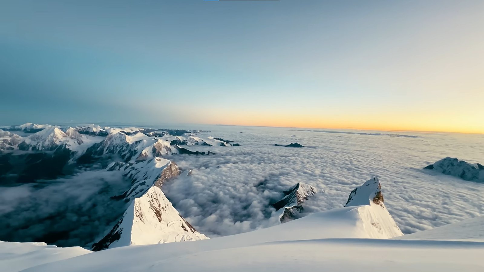
Climbers repeatedly return to Base Camp between rotations. These recovery periods are essential because the body needs time to absorb the altitude gained higher on the mountain before moving upward again.
Climbing Route and High Camps
The standard Manaslu climbing route generally follows the northeast side of the mountain through glacier and snow terrain.
Fixed ropes are installed where required, while the route between the camps can include crevasses, steeper snow sections and changing glacier features.

Four high camps are normally used. Their exact elevations should always be treated as approximate because campsite positions can move with the glacier and seasonal route conditions.
| Camp | Approx. Elevation | Main Purpose |
|---|---|---|
| Base Camp | Approx. 4,800–4,900 m | Main expedition headquarters, recovery and preparation |
| Camp I | Approx. 5,600–5,700 m | First high camp and early acclimatization |
| Camp II | Approx. 6,300–6,400 m | Major high-altitude rotation and upper-route staging |
| Camp III | Approx. 6,800–6,900 m | Final acclimatization and preparation for the summit rotation |
| Camp IV | Approx. 7,300–7,450 m | Final summit camp |
| Summit | 8,163 m | Highest point of the expedition |
Difficulty and Previous Experience
Manaslu should be treated as a serious 8,000-meter expedition. It is sometimes described as one of the more achievable 8,000-meter mountains by the standard route, but that comparison should never be confused with an easy climb.
Climbers have to manage glacier travel, fixed ropes, crevasse hazards, long snow slopes, severe cold and repeated exposure above 6,000 and 7,000 meters before even beginning the final summit push.
Previous high-altitude mountaineering experience is strongly recommended. Climbers should ideally have experience on 6,000- or 7,000-meter peaks and already be comfortable using crampons, an ice axe, harness, ascender and fixed-rope systems.
Physical fitness alone is not enough. The expedition also requires patience, efficient movement, good judgment and the ability to continue functioning after several weeks at altitude.
Acclimatization and Summit Plan
The approach through the Budhi Gandaki Valley provides the first stage of acclimatization, followed by additional time at Samagaon before the team moves to Base Camp.
Once on the mountain, climbers normally complete progressively higher rotations. The first rotation introduces the lower climbing route and Camp I.
A later rotation moves higher toward Camp II and Camp III, after which the team returns to Base Camp for a longer recovery period.

The exact rotation plan is not fixed months in advance. A stronger climber may adapt differently from another member of the team, while snowfall, wind or route work can also change the planned schedule.
The final summit rotation begins only when acclimatization is sufficient and the expedition leader identifies a suitable weather window. The team then progresses through the established high camps toward Camp IV before the summit attempt.
Summit Day
The summit attempt normally begins during the night from Camp IV. Climbers leave at extreme altitude wearing full expedition clothing and carrying the technical equipment, food, hydration and oxygen system required by the expedition plan.
Movement above 7,000 m is slow, and even simple tasks require considerable effort. Climbers follow the fixed-line system and maintain a controlled pace toward the upper slopes and summit ridge.
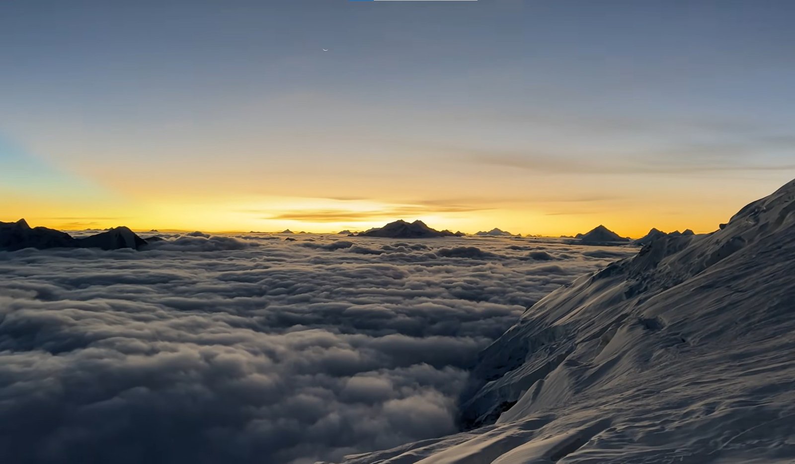
Reaching the 8,163-meter summit of Manaslu is only part of the objective. The team must still descend through the upper mountain while dealing with fatigue, cold and the effects of extreme altitude.
For this reason, turnaround times and the decision to continue are based on weather, climbing speed, route conditions and the condition of each climber rather than the desire to reach the summit at any cost.
Supplemental Oxygen
Supplemental oxygen is commonly used during commercial Manaslu expeditions, particularly during the highest stages of the summit rotation.
The exact oxygen strategy can vary according to the climber and expedition package. Some teams begin using oxygen around Camp III, while others adjust the starting point according to acclimatization, climbing speed and individual requirements.

Oxygen does not replace proper acclimatization. The expedition still depends on progressive rotations, adequate rest, hydration and careful pacing before the summit attempt.
Best Season for Manaslu
Spring and autumn are the principal climbing periods for Manaslu. Autumn is especially well established for commercial expeditions, while spring also provides a recognised climbing window.
| Season | General Expedition Conditions |
|---|---|
| Spring – March to May | Pre-monsoon climbing period with gradually improving temperatures and established expedition activity |
| Autumn – September to November | Major Manaslu expedition season with post-monsoon climbing operations and generally clearer conditions |
| Winter | Considerably colder conditions requiring specialised winter planning |
| Summer / Monsoon | Rain, cloud, unstable snow and difficult access make this unsuitable for a normal commercial expedition |
Permits and Government Fees
The Manaslu Expedition requires several permits because the route combines a regulated 8,000-meter mountaineering objective with a restricted trekking region and conservation area.
| Permit / Requirement | Current Information |
|---|---|
| Manaslu Climbing Royalty – Spring | USD 1,500 per foreign climber |
| Manaslu Climbing Royalty – Autumn | USD 3,000 per foreign climber |
| Winter / Summer Royalty | USD 1,500 per foreign climber |
| Manaslu Restricted Area Permit | Required for the restricted section of the approach |
| Restricted Area Fee – Sep to Nov | USD 100 per person for the first week, then USD 15 per additional day |
| Restricted Area Fee – Dec to Aug | USD 75 per person for the first week, then USD 10 per additional day |
| Manaslu Conservation Area Permit | Required for the conservation-area approach; current fee reconfirmed when permits are issued |
| Additional Expedition Documentation | Government expedition paperwork, staff documentation and other formalities applicable to the operating season |
Government rates and permit procedures can change, so Nepal Royal Tourism Holiday reconfirms the final permit costs and documentation requirements when the expedition is booked and processed.
Equipment for Manaslu
Manaslu requires a complete 8,000-meter equipment system. Ordinary trekking clothing and lightweight mountaineering gear are not sufficient for the temperatures and exposure encountered at Camp III, Camp IV and on summit day.
| Equipment | Use |
|---|---|
| 8,000 m Mountaineering Boots | Extreme-cold protection and crampon-compatible climbing |
| Crampons and Ice Axe | Snow, glacier and ice climbing |
| Harness, Ascender and Descender | Movement on fixed ropes |
| Climbing Helmet | Protection during technical sections |
| 8,000 m Down Suit | Primary insulation on the upper mountain and summit day |
| Extreme-Cold Sleeping Bag | Sleeping at Base Camp and high camps |
| High-Altitude Gloves and Goggles | Protection from severe cold, wind, snow and UV exposure |
| Headlamp | Night climbing during the summit push |
Safety and Insurance
An 8,000-meter expedition involves risks that cannot be removed entirely. Manaslu presents hazards including altitude illness, extreme cold, frostbite, crevasses, unstable snow, avalanches, exhaustion and rapidly changing weather.
Safety depends on progressive acclimatization, experienced leadership, communication between Base Camp and the climbing teams, conservative pacing and a willingness to change the plan when the mountain requires it.

Every climber should hold specialist insurance that explicitly covers mountaineering to at least 8,163 meters, together with emergency medical treatment and helicopter evacuation in Nepal.
Helicopter evacuation may be possible from lower areas when weather and operational conditions allow, but rescue from the upper mountain is considerably more complicated. Climbers should never assume that immediate helicopter evacuation is available from every camp.
Accommodation and Meals
Accommodation changes throughout the expedition. Kathmandu nights are spent in a hotel, while the Budhi Gandaki approach uses local teahouses and lodges. From Manaslu Base Camp onward, the expedition operates from tents.

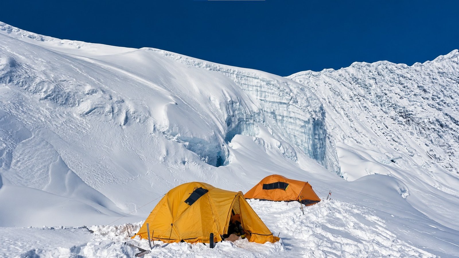
Base Camp provides the most complete expedition setup, including sleeping tents, dining facilities and a kitchen. High camps use lightweight climbing tents with much simpler living conditions.
Meals during the trekking approach are based on the food available in local lodges. At Base Camp, the expedition kitchen prepares more varied meals to support recovery and repeated climbing rotations. Food becomes progressively simpler at the higher camps, where weight, cold and limited cooking conditions become important considerations.
Why We Keep the Expedition at 45 Days
A shorter itinerary can look attractive on paper, but an 8,000-meter mountain is not a place where saving several days should become the main objective.
Our 45-day structure gives the team time to approach gradually through the Budhi Gandaki Valley, spend useful acclimatization time at Samagaon, complete proper high-camp rotations and recover at Base Camp before the summit attempt.

It also preserves contingency time for weather and route conditions. After the climbing phase, the program continues through Samdo and Larkya Phedi, crosses Larkya La and descends toward Bimthang and Dharapani rather than rushing directly out of the region.
The itinerary remains flexible throughout the mountain phase. High-camp movements, oxygen use, rest days and the summit date can all change according to acclimatization, snow conditions, wind, route safety and the expedition leader’s assessment.
Plan Your Manaslu Expedition
Climbing an 8,000-meter mountain requires more than selecting a departure date. Your previous high-altitude experience, technical background, climbing season, oxygen requirements and preferred level of Sherpa support all influence how the expedition should be organised.
Share your climbing history and preferred expedition season with Nepal Royal Tourism Holiday. Our team can confirm the current permit requirements, climbing support, Base Camp arrangements, oxygen plan and expedition quotation for Manaslu.
Trip Highlights
- Attempt the 8,163 m summit of Mount Manaslu, the world’s eighth-highest mountain
- Trek through the remote Budhi Gandaki Valley before reaching the climbing route
- Pass through Jagat, Deng, Namrung, Lho and the high-altitude village of Samagaon
- Spend valuable acclimatization time in Samagaon before moving to Manaslu Base Camp
- Operate from Manaslu Base Camp at approx. 4,800–4,900 m during the main climbing period
- Progress through four high camps before the final summit attempt
- Climb across glacier, snow and ice terrain using crampons and fixed-rope systems
- Complete progressive acclimatization rotations before beginning the summit campaign
- Experience genuine 8,000-meter expedition climbing, including extended time above 6,000 and 7,000 meters
- Descend from the mountain and continue through Samdo and Larkya La rather than simply retracing the approach
- Experience a complete Himalayan expedition from approach and Base Camp life to high camps, summit attempt and final mountain cleanup
Manaslu Expedition – 45 Days ~ Itinerary
Day 1
Arrival in Kathmandu
- Maximum Altitude: Kathmandu – 1,350 m
- Overnight Altitude: Kathmandu – 1,350 m
- Activity: Airport arrival and expedition introduction
- Accommodation: Hotel in Kathmandu
Your Manaslu Expedition begins with your arrival at Tribhuvan International Airport in Kathmandu. A representative from Nepal Royal Tourism Holiday will meet you at the airport and transfer you to your hotel.
The rest of the day is kept relaxed after your international journey. Depending on your arrival time, you can rest at the hotel, explore nearby Kathmandu or begin organising any equipment needed for the expedition.
You will also meet the expedition team and receive the first information about the days ahead, including preparation in Kathmandu, the approach through the Manaslu region and the general climbing schedule.
Day 2
Expedition Briefing and Equipment Preparation
- Maximum Altitude: Kathmandu – 1,350 m
- Overnight Altitude: Kathmandu – 1,350 m
- Activity: Expedition briefing, documentation and equipment check
- Meal: Breakfast
- Accommodation: Three Star Hotel in Kathmandu
Today is dedicated to final preparation for the Manaslu Expedition. Your climbing equipment, high-altitude clothing and personal expedition gear are checked carefully before leaving Kathmandu.
The expedition leader explains the approach route, acclimatization plan, high-camp system, communication procedures, oxygen strategy and the flexible nature of the summit schedule. Any last-minute gear adjustments or rentals can also be completed today.
Permit documentation and expedition formalities are finalised while the climbing and logistics teams prepare the equipment that will travel toward Manaslu Base Camp.
Day 3
Drive from Kathmandu to Machha Khola
- Maximum Altitude: Around 1,350 m during the journey
- Overnight Altitude: Machha Khola – around 900 m
- Drive Duration: Around 7–9 hours
- Drive Distance: Around 160–170 km
- Meal: Breakfast, Lunch and Dinner
- Accommodation: Teahouse / Lodge in Machha Khola
You leave Kathmandu and travel west toward the Gorkha region before continuing into the Budhi Gandaki Valley. The journey gradually leaves the busy highway and enters increasingly rural hill country.
Terraced farmland, river valleys, roadside settlements and forested hills accompany the drive as you move toward the starting point of the trekking approach.
The final sections can be rough and travel time depends heavily on road conditions. By evening, you reach Machha Khola and settle into a local lodge beside the lower Budhi Gandaki Valley.
Day 4
Trek from Machha Khola to Jagat
- Maximum Altitude: Jagat – around 1,340 m
- Overnight Altitude: Jagat – around 1,340 m
- Trek Duration: Around 6–8 hours
- Trek Distance: Around 20–22 km
- Altitude Gain: Around 440 m net gain
- Meal: Breakfast, Lunch and Dinner
- Accommodation: Teahouse / Lodge in Jagat
Your first trekking day follows the Budhi Gandaki upstream through a narrow valley of forest, cultivated slopes and small settlements.
The route crosses several bridges and passes sections where the trail rises above the river before descending again toward the valley floor. The day involves frequent short climbs rather than one continuous ascent.
By the time you reach Jagat, the surroundings already feel more remote than the lower trailhead. Jagat is an important checkpoint and gateway into the restricted Manaslu region.
Day 5
Trek from Jagat to Deng
- Maximum Altitude: Deng – around 1,860 m
- Overnight Altitude: Deng – around 1,860 m
- Trek Duration: Around 6–7 hours
- Trek Distance: Around 18–20 km
- Altitude Gain: Around 520 m net gain
- Meal: Breakfast, Lunch and Dinner
- Accommodation: Teahouse / Lodge in Deng
The trail continues north through the Budhi Gandaki Valley as the surrounding hills become steeper and the settlements more widely separated.
You pass through cultivated areas, forest and river crossings while gradually gaining altitude. The character of the valley also begins to change as you move closer to the high Himalayan region.
Deng is a relatively small settlement and marks another step toward the Tibetan-influenced communities of upper Manaslu.
Day 6
Trek from Deng to Namrung
- Maximum Altitude: Namrung – 2,630 m
- Overnight Altitude: Namrung – 2,630 m
- Trek Duration: Around 6–7 hours
- Trek Distance: Around 17–19 km
- Altitude Gain: Around 770 m net gain
- Meal: Breakfast, Lunch and Dinner
- Accommodation: Teahouse / Lodge in Namrung
You continue through forest and mountain villages while the trail steadily gains altitude toward Namrung.
The landscape becomes noticeably more Himalayan today. Cooler temperatures, pine and rhododendron forest and increasingly dramatic mountain scenery replace much of the warmer vegetation seen lower in the valley.
Namrung is an important upper-valley settlement and provides the first strong sense that the expedition is moving toward the high Manaslu massif.
Day 7
Trek from Namrung to Lho
- Maximum Altitude: Lho – 3,180 m
- Overnight Altitude: Lho – 3,180 m
- Trek Duration: Around 4–5 hours
- Trek Distance: Around 10–11 km
- Altitude Gain: Around 550 m
- Meal: Breakfast, Lunch and Dinner
- Accommodation: Teahouse / Lodge in Lho
The trail climbs through alpine forest and traditional settlements toward Lho. Mani walls, chortens, prayer flags and Tibetan Buddhist influence become much more prominent along this section of the route.
As you gain altitude, the Manaslu massif begins to dominate the landscape. Lho is particularly known for its open views toward Manaslu and the surrounding high peaks.
The shorter walking day also helps with the gradual acclimatization process before reaching Samagaon.
Day 8
Trek from Lho to Samagaon
- Maximum Altitude: Samagaon – 3,530 m
- Overnight Altitude: Samagaon – 3,530 m
- Trek Duration: Around 4–5 hours
- Trek Distance: Around 8–10 km
- Altitude Gain: Around 350 m
- Meal: Breakfast, Lunch and Dinner
- Accommodation: Teahouse / Lodge in Samagaon
You leave Lho and continue through the broadening upper valley toward Samagaon. Mountain views remain close throughout the walk as the vegetation becomes increasingly sparse.
The trail passes traditional settlements, cultivated highland fields and religious monuments before reaching Samagaon beneath the Manaslu massif.
At 3,530 m, Samagaon becomes an important staging point for the expedition. You will spend additional time here before moving directly to Base Camp.
Day 9
Acclimatization Day in Samagaon
- Maximum Altitude: Around 3,700–4,000 m depending on the acclimatization walk
- Overnight Altitude: Samagaon – 3,530 m
- Activity Duration: Around 3–5 hours
- Activity: Acclimatization hike and recovery
- Meal: Breakfast, Lunch and Dinner
- Accommodation: Teahouse / Lodge in Samagaon
Rather than remaining completely inactive, you use the day for a gradual acclimatization walk around the upper valley.
Depending on conditions and the expedition leader’s plan, the team may walk toward Birendra Tal, higher viewpoints or another suitable location above the village before returning to Samagaon.
The purpose is to gain moderate altitude during the day while sleeping lower again at 3,530 m.
Day 10
Rest and Expedition Preparation in Samagaon
- Maximum Altitude: Samagaon – 3,530 m unless a short acclimatization walk is made
- Overnight Altitude: Samagaon – 3,530 m
- Activity: Recovery, equipment preparation and Base Camp logistics
- Meal: Breakfast, Lunch and Dinner
- Accommodation: Teahouse / Lodge in Samagaon
A second day in Samagaon provides additional acclimatization before the move to Base Camp. After several consecutive trekking days, the quieter schedule also allows the body to recover.
Expedition equipment is checked and reorganised while the support team completes arrangements for Base Camp. Climbers prepare the clothing and equipment they will need once the trekking phase changes into the climbing phase.
A short walk can be taken if useful, but the main priority today is recovery and preparation.
Day 11
Trek from Samagaon to Manaslu Base Camp
- Maximum Altitude: Manaslu Base Camp – approx. 4,800–4,900 m
- Overnight Altitude: Manaslu Base Camp – approx. 4,800–4,900 m
- Trek Duration: Around 5–6 hours
- Trek Distance: Around 6–8 km, depending on the seasonal camp location
- Altitude Gain: Around 1,300 m
- Meal: Breakfast, Lunch and Dinner
- Accommodation: Expedition Tent at Base Camp
You leave Samagaon and begin the significant climb toward Manaslu Base Camp. Although the distance is not particularly long, the large altitude gain makes this a demanding day.
The route climbs through increasingly exposed moraine and high alpine terrain while the landscape becomes dominated by glacier, rock and snow.
Base Camp is generally established around approx. 4,800–4,900 m, although the precise position can vary according to glacier conditions and the season’s expedition setup.
Day 12
Base Camp Setup and Puja Ceremony
- Maximum Altitude: Manaslu Base Camp – approx. 4,800–4,900 m
- Overnight Altitude: Manaslu Base Camp – approx. 4,800–4,900 m
- Activity: Base Camp setup, recovery and puja ceremony
- Meal: Breakfast, Lunch and Dinner
- Accommodation: Expedition Tent at Base Camp
Your first full day at Base Camp is deliberately kept light. The support team completes the camp setup while climbers settle into their tents and adapt to sleeping close to 5,000 meters.
The traditional puja ceremony is held before the main climbing phase. Climbing equipment is blessed and the expedition team gathers together before beginning work on the upper mountain.
Communication equipment, medical supplies, oxygen systems and climbing loads are also organised for the rotations ahead.
Day 13
Technical Training and Base Camp Acclimatization
- Maximum Altitude: Around 5,000 m depending on the training area
- Overnight Altitude: Manaslu Base Camp – approx. 4,800–4,900 m
- Activity Duration: Around 4–5 hours
- Activity: Technical training and climbing-system review
- Meal: Breakfast, Lunch and Dinner
- Accommodation: Expedition Tent at Base Camp
The team reviews the technical systems that will be used above Base Camp, including crampon movement, fixed-rope ascending, descending, harness attachment and glacier procedures.
Even experienced climbers benefit from practising with the exact equipment and rope systems being used on the expedition.
The remainder of the day is used for rest, hydration and preparation for the first acclimatization rotation.
Day 14
Acclimatization Climb Toward Camp I and Return to Base Camp
- Maximum Altitude: Up to the Camp I approach – around 5,400–5,700 m depending on conditions
- Overnight Altitude: Manaslu Base Camp – approx. 4,800–4,900 m
- Climbing Duration: Around 5–7 hours round trip
- Climb Distance: Route-dependent and variable with glacier conditions
- Altitude Gain: Up to around 800–900 m
- Meal: Breakfast, Lunch and Dinner
- Accommodation: Expedition Tent at Base Camp
The first movement onto the mountain is intentionally controlled. You climb above Base Camp toward the Camp I route, gaining your first real exposure to the glaciated terrain.
The objective is acclimatization and familiarity rather than reaching a fixed point at all costs. Depending on conditions and how the team is adapting, you climb to the planned high point before returning to Base Camp.
Day 15
Climb from Base Camp to Camp I
- Maximum Altitude: Camp I – approx. 5,600–5,700 m
- Overnight Altitude: Camp I – approx. 5,600–5,700 m
- Climbing Duration: Around 4–6 hours
- Climb Distance: Route-dependent and variable with glacier conditions
- Altitude Gain: Around 800–900 m
- Meal: Breakfast, Lunch and High-Altitude Dinner
- Accommodation: High-Altitude Tent at Camp I
You leave Base Camp again and climb toward Camp I for the first overnight stay on the mountain.
The route crosses moraine and increasingly glaciated terrain, with crevasses and changing snow conditions requiring careful movement. Fixed ropes may be used where the seasonal route requires them.
At Camp I, the priority is to settle into the high camp, hydrate and rest rather than expend unnecessary energy.
Day 16
Climb Toward Camp II and Return to Camp I
- Maximum Altitude: Camp II area – approx. 6,300–6,400 m
- Overnight Altitude: Camp I – approx. 5,600–5,700 m
- Climbing Duration: Around 6–8 hours round trip
- Climb Distance: Route-dependent and variable with glacier conditions
- Altitude Gain: Around 700–800 m to Camp II
- Meal: High-Altitude Meals and Expedition Rations
- Accommodation: High-Altitude Tent at Camp I
The section between Camp I and Camp II is one of the more technical parts of the normal route. The terrain includes steeper snow and ice, glacier features and fixed-rope sections.
You climb toward Camp II or the day’s planned acclimatization high point before returning to Camp I. The purpose is to expose the body to a substantially higher altitude without immediately sleeping there.
Day 17
Descend from Camp I to Base Camp
- Maximum Altitude: Camp I – approx. 5,600–5,700 m
- Overnight Altitude: Manaslu Base Camp – approx. 4,800–4,900 m
- Climbing Duration: Around 3–4 hours
- Climb Distance: Route-dependent
- Altitude Loss: Around 800–900 m
- Meal: Breakfast, Lunch and Dinner
- Accommodation: Expedition Tent at Base Camp
After the first overnight rotation, you descend from Camp I to Base Camp.
Returning lower gives your body time to recover from the increased altitude. Once at Base Camp, the focus shifts to food, hydration, sleep and allowing the acclimatization gained during the rotation to take effect.
Day 18
IRest and Recovery at Base Camp
- Maximum Altitude: Manaslu Base Camp – approx. 4,800–4,900 m
- Overnight Altitude: Manaslu Base Camp – approx. 4,800–4,900 m
- Activity: Full recovery day
- Meal: Breakfast, Lunch and Dinner
- Accommodation: Expedition Tent at Base Camp
Today is reserved for recovery after the first rotation. You remain at Base Camp, eat well, hydrate and allow your legs and respiratory system to recover.
The expedition team also reviews route conditions and prepares supplies for the next, higher rotation.
Day 19
Base Camp Recovery and Rotation Preparation
- Maximum Altitude: Manaslu Base Camp – approx. 4,800–4,900 m
- Overnight Altitude: Manaslu Base Camp – approx. 4,800–4,900 m
- Activity: Rest, weather review and equipment preparation
- Meal: Breakfast, Lunch and Dinner
- Accommodation: Expedition Tent at Base Camp
A second lower-intensity day gives the team additional recovery before moving above 6,000 meters for the next rotation.
Weather information, route conditions and each climber’s acclimatization are reviewed. Equipment and high-altitude food are reorganised for the climb to Camp II.
Day 20
Second Rotation – Base Camp to Camp I
- Maximum Altitude: Camp I – approx. 5,600–5,700 m
- Overnight Altitude: Camp I – approx. 5,600–5,700 m
- Climbing Duration: Around 4–6 hours
- Climb Distance: Route-dependent and variable with glacier conditions
- Altitude Gain: Around 800–900 m
- Meal: Breakfast, Lunch and High-Altitude Dinner
- Accommodation: High-Altitude Tent at Camp I
You begin the second main acclimatization rotation and return to Camp I.
The route is now familiar, allowing you to concentrate on efficient movement and energy conservation rather than learning the terrain for the first time.
Day 21
Climb from Camp I to Camp II
- Maximum Altitude: Camp II – approx. 6,300–6,400 m
- Overnight Altitude: Camp II – approx. 6,300–6,400 m
- Climbing Duration: Around 4–6 hours
- Climb Distance: Route-dependent and variable with glacier conditions
- Altitude Gain: Around 700–800 m
- Meal: High-Altitude Meals and Expedition Rations
- Accommodation: High-Altitude Tent at Camp II
You climb from Camp I toward Camp II through one of the more demanding sections of the standard route.
Steeper snow slopes, glacier terrain and fixed ropes require steady technique and careful pacing. Reaching Camp II places you well above 6,000 meters for the first planned overnight stay at this altitude.
Day 22
Acclimatization Climb Toward Camp III and Return to Camp II
- Maximum Altitude: Up to Camp III area – approx. 6,800–6,900 m
- Overnight Altitude: Camp II – approx. 6,300–6,400 m
- Climbing Duration: Around 5–7 hours round trip
- Climb Distance: Route-dependent
- Altitude Gain: Up to around 500 m
- Meal: High-Altitude Meals and Expedition Rations
- Accommodation: High-Altitude Tent at Camp II
From Camp II, you climb higher toward Camp III or the acclimatization high point selected by the expedition leader.
The terrain generally becomes less technically complex than the section below Camp II, but the altitude now has a much stronger effect on climbing speed and recovery.
After reaching the planned high point, you descend to Camp II for another night.
Day 23
Descend from Camp II to Manaslu Base Camp
- Maximum Altitude: Camp II – approx. 6,300–6,400 m
- Overnight Altitude: Manaslu Base Camp – approx. 4,800–4,900 m
- Climbing Duration: Around 5–7 hours
- Climb Distance: Route-dependent
- Altitude Loss: Around 1,500 m
- Meal: Breakfast, Lunch and Dinner
- Accommodation: Expedition Tent at Base Camp
You descend through Camp I and continue toward Base Camp, completing the second major acclimatization rotation.
The return to lower altitude provides a substantial improvement in recovery. Once back at Base Camp, you begin a longer rest period before the summit phase.
Day 24
Rest and Recovery at Base Camp
- Maximum Altitude: Manaslu Base Camp – approx. 4,800–4,900 m
- Overnight Altitude: Manaslu Base Camp – approx. 4,800–4,900 m
- Activity: Full recovery day
- Meal: Breakfast, Lunch and Dinner
- Accommodation: Expedition Tent at Base Camp
After several nights on the upper mountain, your body now needs genuine recovery rather than additional altitude.
You spend the day eating, sleeping, hydrating and taking care of equipment while the climbing team continues monitoring the condition of the route.
Day 25
Weather Review and Summit Preparation
- Maximum Altitude: Manaslu Base Camp – approx. 4,800–4,900 m
- Overnight Altitude: Manaslu Base Camp – approx. 4,800–4,900 m
- Activity: Summit preparation, weather review and final equipment check
- Meal: Breakfast, Lunch and Dinner
- Accommodation: Expedition Tent at Base Camp
The expedition now begins looking seriously for the summit window. Forecast wind, snowfall, temperature and route conditions are compared with observations from the mountain.
Your down suit, summit gloves, goggles, headlamp, oxygen system, food and other essential equipment are prepared for the final rotation.
The following climbing days represent the planned summit sequence, but they may shift forward or backward depending on weather and the condition of the team.
Day 26
Begin Summit Rotation – Base Camp to Camp I
- Maximum Altitude: Camp I – approx. 5,600–5,700 m
- Overnight Altitude: Camp I – approx. 5,600–5,700 m
- Climbing Duration: Around 4–6 hours
- Climb Distance: Route-dependent
- Altitude Gain: Around 800–900 m
- Meal: Breakfast, Lunch and High-Altitude Dinner
- Accommodation: High-Altitude Tent at Camp I
With the summit window approaching, you leave Base Camp and begin the final climb through the established camps.
Because you have already travelled this route during the acclimatization rotations, the emphasis is now on moving efficiently while conserving as much energy as possible for the upper mountain.
Day 27
Climb from Camp I to Camp II
- Maximum Altitude: Camp II – approx. 6,300–6,400 m
- Overnight Altitude: Camp II – approx. 6,300–6,400 m
- Climbing Duration: Around 4–6 hours
- Climb Distance: Route-dependent
- Altitude Gain: Around 700–800 m
- Meal: High-Altitude Meals and Expedition Rations
- Accommodation: High-Altitude Tent at Camp II
You continue through the technically demanding section between Camp I and Camp II.
Fixed ropes and careful crampon movement are used where required. Once at Camp II, the priority is to eat, drink and recover for the higher stages rather than spend unnecessary time outside the tent.
Day 28
IClimb from Camp II to Camp III
- Maximum Altitude: Camp III – approx. 6,800–6,900 m
- Overnight Altitude: Camp III – approx. 6,800–6,900 m
- Climbing Duration: Around 3–4 hours
- Climb Distance: Route-dependent
- Altitude Gain: Around 400–600 m
- Meal: High-Altitude Meals and Expedition Rations
- Accommodation: High-Altitude Tent at Camp III
The climb from Camp II to Camp III takes you farther into the extreme-altitude environment of Manaslu.
Although the terrain may be less technical than the section below Camp II, movement becomes noticeably slower as you approach 7,000 meters.
Supplemental oxygen may begin around this stage according to the confirmed expedition plan and individual climbing strategy.
Day 29
Climb from Camp III to Camp IV
- Maximum Altitude: Camp IV – approx. 7,300–7,450 m
- Overnight Altitude: Camp IV – approx. 7,300–7,450 m
- Climbing Duration: Around 4–7 hours
- Climb Distance: Route-dependent
- Altitude Gain: Around 550–650 m
- Meal: High-Altitude Meals and Expedition Rations
- Accommodation: High-Altitude Tent at Camp IV
Today you climb from Camp III toward Camp IV, the final summit camp.
The combination of steep snow, fixed lines and extreme altitude makes this one of the most physically demanding stages of the expedition. Every movement takes more effort and recovery becomes increasingly limited.
Once you reach Camp IV, you rest, hydrate and prepare immediately for the summit attempt, which normally begins during the night.
Day 30
Summit Attempt – Manaslu 8,163 m
- Maximum Altitude: Manaslu Summit – 8,163 m
- Overnight Altitude: Camp III or Camp IV depending on descent progress
- Climbing Duration: Around 10–14 hours for the summit climb and descent, depending on conditions
- Climb Distance: Route-dependent and variable with the established summit line
- Altitude Gain: Around 700–850 m from Camp IV
- Meal: High-Altitude Expedition Rations
- Accommodation: High-Altitude Tent
The summit attempt begins during the night or very early morning from Camp IV. Wearing full high-altitude clothing and using supplemental oxygen according to the expedition strategy, you begin the final climb toward 8,163 meters.
The upper route follows snow slopes and fixed-line sections toward the summit ridge. Progress is slow at this altitude, and weather, wind and the condition of the route remain important throughout the climb.
Near the top, the route reaches the exposed summit area of Manaslu. The final approach is made carefully, with the expedition leader and climbing Sherpas managing spacing and movement according to the conditions.
After reaching the summit, the priority changes immediately to descent. You return toward Camp IV and, if conditions and energy permit, continue farther down toward Camp III.
The summit is never guaranteed. Turnaround decisions are based on weather, climbing speed, individual condition and the ability to descend safely.
Day 31
Summit Contingency or Upper-Mountain Descent
- Maximum Altitude: Up to Manaslu Summit – 8,163 m if required
- Overnight Altitude: Depends on the active summit schedule
- Activity: Weather contingency, summit attempt or descent
- Meal: Expedition Meals and High-Altitude Rations
- Accommodation: High-Altitude Tent or Base Camp depending on progress
This day provides flexibility within the summit window. If weather delayed the planned summit attempt, the climbing sequence can be shifted and today may become the summit day.
If the summit was completed as planned, the day is used to descend through the high camps and move toward safer, lower altitude.
The actual schedule is determined by mountain conditions rather than the printed day number.
Day 32
Final Summit Contingency and Return Toward Base Camp
- Maximum Altitude: Variable according to the summit schedule
- Overnight Altitude: Manaslu Base Camp – approx. 4,800–4,900 m when descent is completed
- Activity: Final summit contingency or mountain descent
- Meal: Breakfast, Lunch and Dinner according to location
- Accommodation: Expedition Tent
A further reserve day is kept available in case the summit schedule has been affected by wind, snowfall or slower-than-expected movement through the high camps.
If no additional summit time is required, you continue descending through Camp II and Camp I toward Base Camp.
The objective is to bring the climbing team safely back to lower altitude before beginning recovery and expedition cleanup.
Day 33
ItinRecovery at Manaslu Base Camp
- Maximum Altitude: Manaslu Base Camp – approx. 4,800–4,900 m
- Overnight Altitude: Manaslu Base Camp – approx. 4,800–4,900 m
- Activity: Recovery after summit rotation
- Meal: Breakfast, Lunch and Dinner
- Accommodation: Expedition Tent at Base Camp
After the final rotation, you spend the day recovering at Base Camp. Returning below 5,000 meters provides significant relief after several days high on the mountain.
Climbers rest while expedition staff begin consolidating equipment and organising the loads that will be taken down from Base Camp.
Day 34
Base Camp Cleanup and Expedition Packing
- Maximum Altitude: Manaslu Base Camp – approx. 4,800–4,900 m
- Overnight Altitude: Manaslu Base Camp – approx. 4,800–4,900 m
- Activity: Camp dismantling, cleanup and equipment packing
- Meal: Breakfast, Lunch and Dinner
- Accommodation: Expedition Tent at Base Camp
The expedition begins closing Base Camp and preparing for the journey out of the mountain.
Equipment is packed, remaining loads are organised and the campsite is cleaned according to expedition and environmental requirements.
The team also confirms the conditions of the return route through Samdo and Larkya La before leaving Base Camp.
Day 35
Descend from Manaslu Base Camp to Samagaon
- Maximum Altitude: Manaslu Base Camp – approx. 4,800–4,900 m
- Overnight Altitude: Samagaon – 3,530 m
- Trek Duration: Around 3–5 hours
- Trek Distance: Around 6–8 km depending on Base Camp location
- Altitude Loss: Around 1,300 m
- Meal: Breakfast, Lunch and Dinner
- Accommodation: Teahouse / Lodge in Samagaon
You leave Manaslu Base Camp and descend back toward Samagaon, exchanging glacier and moraine for the broader valley below.
The large loss in altitude is immediately noticeable after the weeks spent on the mountain. Back in Samagaon, you return to a lodge and begin the final trekking stage of the expedition.
Day 36
Trek from Samagaon to Samdo
- Maximum Altitude: Samdo – 3,860 m
- Overnight Altitude: Samdo – 3,860 m
- Trek Duration: Around 3–4 hours
- Trek Distance: Around 8 km
- Altitude Gain: Around 330 m
- Meal: Breakfast, Lunch and Dinner
- Accommodation: Teahouse / Lodge in Samdo
Instead of retracing the entire Budhi Gandaki approach, you continue north from Samagaon toward Samdo.
The trail follows a broad, increasingly dry high-altitude valley where Tibetan cultural influence remains strong. The walking day is relatively short after the expedition phase.
Samdo sits close to the Tibetan border region and serves as the final major settlement before the Larkya La crossing.
Day 37
Trek from Samdo to Larkya Phedi / Dharamsala
- Maximum Altitude: Larkya Phedi / Dharamsala – around 4,460 m
- Overnight Altitude: Larkya Phedi / Dharamsala – around 4,460 m
- Trek Duration: Around 4–5 hours
- Trek Distance: Around 6–8 km
- Altitude Gain: Around 600 m
- Meal: Breakfast, Lunch and Dinner
- Accommodation: Basic Teahouse / Lodge at Dharamsala
You leave Samdo and continue toward the base of Larkya La. The trail becomes more exposed as the route climbs away from the permanent settlements.
At Dharamsala, also known as Larkya Phedi, you prepare for the following day’s pass crossing. Accommodation is simple here, but the location allows an early start for the long journey over Larkya La.
Day 38
Cross Larkya La Pass and Trek to Bimthang
- Maximum Altitude: Larkya La Pass – around 5,160 m
- Overnight Altitude: Bimthang – around 3,590 m
- Trek Duration: Around 8–10 hours
- Trek Distance: Around 15–17 km
- Altitude Gain: Around 700 m to Larkya La
- Altitude Loss: Around 1,570 m from the pass to Bimthang
- Meal: Breakfast, Lunch and Dinner
- Accommodation: Teahouse / Lodge in Bimthang
You begin early for the crossing of Larkya La, the highest point of the Manaslu Circuit section of the journey.
The route climbs gradually across a cold, exposed landscape before reaching the pass at around 5,160 m. After weeks spent much higher on Manaslu, the altitude itself is familiar, but the day remains long and physically demanding.
From the pass, you descend toward Bimthang with broad views across the surrounding Himalayan terrain. Reaching the greener valley around Bimthang marks a clear transition away from the high expedition environment.
Day 39
Trek from Bimthang to Tilije
- Maximum Altitude: Bimthang – around 3,590 m
- Overnight Altitude: Tilije – around 2,300 m
- Trek Duration: Around 6–7 hours
- Trek Distance: Around 16–18 km
- Altitude Loss: Around 1,290 m
- Meal: Breakfast, Lunch and Dinner
- Accommodation: Teahouse / Lodge in Tilije
The trail leaves the open landscape around Bimthang and descends toward lower forests and river valleys.
After the dry, icy environment of the mountain and Larkya La, the return of dense vegetation and warmer air creates a noticeable change in the character of the journey.
You continue through settlements and forest before reaching Tilije for the night.
Day 40
Trek from Tilije to Dharapani
- Maximum Altitude: Tilije – around 2,300 m
- Overnight Altitude: Dharapani – around 1,960 m
- Trek Duration: Around 2–3 hours
- Trek Distance: Around 5–7 km
- Altitude Loss: Around 340 m
- Meal: Breakfast, Lunch and Dinner
- Accommodation: Teahouse / Lodge in Dharapani
The final walking day is relatively short after the long expedition and Larkya La crossing.
You descend through villages toward Dharapani, where the Manaslu Circuit joins the Annapurna trekking corridor.
Reaching Dharapani marks the end of the trekking section of the 45-day expedition.
Day 41
Drive from Dharapani to Besisahar
- Maximum Altitude: Dharapani – around 1,960 m
- Overnight Altitude: Besisahar – around 760 m
- Drive Duration: Around 4–6 hours
- Drive Distance: Around 65–70 km, depending on the road used
- Meal: Breakfast, Lunch and Dinner
- Accommodation: Hotel / Lodge in Besisahar
You leave Dharapani by road and follow the Marsyangdi corridor toward Besisahar.
The mountain road can be rough in sections, so actual travel time depends on weather, traffic and road conditions.
By the end of the day, you reach the lower hills and spend the night in Besisahar before returning to Kathmandu.
Day 42
Drive from Besisahar to Kathmandu
- Maximum Altitude: Kathmandu – 1,350 m
- Overnight Altitude: Kathmandu – 1,350 m
- Drive Duration: Around 6–8 hours
- Drive Distance: Around 175 km
- Meal: Breakfast and Lunch
- Accommodation: Hotel in Kathmandu
You continue by road from Besisahar toward Kathmandu, leaving the expedition region behind and returning to the capital.
After several weeks of trekking, high-altitude climbing and expedition camping, the return to Kathmandu marks the practical completion of the mountain journey.
Once you reach the city, you transfer to your hotel and have the evening free to rest.
Day 43
Recovery and Contingency Day in Kathmandu
- Maximum Altitude: Kathmandu – 1,350 m
- Overnight Altitude: Kathmandu – 1,350 m
- Activity: Recovery or contingency
- Meal: Breakfast
- Accommodation: Three Star Hotel in Kathmandu
This day is kept available as a recovery and schedule buffer after the expedition.
If weather, road conditions or the climbing program caused delays earlier in the journey, the day can absorb part of that change without immediately affecting your international departure.
If the expedition has remained on schedule, you can simply rest, organise your equipment or spend time in Kathmandu.
Day 44
Contigency Day in Kathmandu
- Maximum Altitude: Kathmandu – 1,350 m
- Overnight Altitude: Kathmandu – 1,350 m
- Activity: Final contingency and free time
- Meal: Breakfast
- Accommodation: Three Star Hotel in Kathmandu
A final reserve day remains in the itinerary before international departure. This provides additional flexibility after a long 8,000-meter expedition where summit timing and transport cannot always be predicted several weeks in advance.
If no contingency time is required, the day is free for rest, shopping, sightseeing or spending time with the expedition team in Kathmandu.
Day 45
Final Departure
- Maximum Altitude: Kathmandu – 1,350 m
- Activity: Airport transfer and international departure
Your 45-day Manaslu Expedition comes to an end today.
Depending on your international flight time, you may have some free time in Kathmandu before a Nepal Royal Tourism Holiday representative transfers you to Tribhuvan International Airport for your onward journey.
You leave Nepal after completing the full journey from the Budhi Gandaki Valley and Samagaon to Manaslu Base Camp, the high camps and the 8,163-meter summit attempt, followed by the return across Larkya La and back to Kathmandu.
Important Expedition Note: The climbing schedule above is a planned framework rather than a fixed calendar. Acclimatization rotations, camp movements, supplemental oxygen use, summit timing and contingency days may be adjusted according to weather, snow conditions, route safety, individual acclimatization and the expedition leader’s assessment. Camp elevations are approximate because seasonal glacier and snow conditions can change the exact positions used on the mountain.
Trip Cost Includes/Excludes
Cost Includes
- Manaslu Peak climbing permit and expedition administration
- Manaslu Restricted Area Permit
- Manaslu Conservation Area Permit
- Required expedition and route documentation
- Ground transportation according to the itinerary
- Hotel accommodation in Kathmandu as specified
- Teahouse and lodge accommodation during the approach
- Expedition accommodation at Manaslu Base Camp
- High-altitude tents at Camp I, Camp II, Camp III and Camp IV
- Breakfast, lunch and dinner during the included trekking and expedition period
- High-altitude meals and expedition rations
- Experienced expedition guides and climbing support
- Climbing Sherpa support according to the confirmed package
- Porters and expedition logistics staff
- Base Camp kitchen and support crew
- Dining, kitchen and common Base Camp facilities
- Base Camp sanitation arrangements
- Shared climbing ropes, anchors and route equipment
- Fixed-rope infrastructure where required
- Expedition communication equipment
- Weather and logistical communication support
- Supplemental oxygen and related equipment according to the confirmed package
- Base Camp and high-camp logistical management
- Expedition equipment and load coordination
- Nepal Royal Tourism Holiday Expedition completion certificate and T-shirt
Cost Excludes
- International airfare to and from Nepal
- Nepal tourist visa fee
- Personal high-altitude mountaineering insurance
- Helicopter rescue and emergency evacuation expenses
- Hospital and personal medical expenses
- Personal 8,000-meter mountaineering boots
- Personal crampons, harness and climbing helmet
- Personal ice axe, ascender and descender
- Personal down suit and high-altitude clothing
- Personal medications and medical supplies
- Personal sleeping bag and individual sleeping equipment
- Other personal technical climbing equipment
- Personal medications and medical supplies
- Laundry, Wi-Fi, charging and phone costs
- Snacks, bottled drinks and personal purchases
- Additional hotel or lodge nights outside the program
- Extra costs caused by personal itinerary changes
- Costs caused by unscheduled services or circumstances
- Tips for guides, Sherpas, porters and expedition staff
- - Services or expenses not mentioned in the inclusions
Trip Photo/Video Gallery





Frequently Asked Questions
Mount Manaslu rises to 8,163 m / 26,781 ft and is the eighth-highest mountain in the world. Reaching this altitude makes the expedition significantly more demanding than a 6,000- or 7,000-meter climbing objective.
Our Manaslu Expedition is planned as a 45-day Kathmandu-to-Kathmandu program. The longer schedule allows time for the trekking approach, acclimatization, high-camp rotations, summit-window flexibility, descent and the return through the Manaslu Circuit.
The approach follows the Budhi Gandaki Valley through Machha Khola, Jagat, Deng, Namrung, Lho and Samagaon before climbing to Manaslu Base Camp. The gradual approach provides useful altitude exposure before the technical climbing begins.
Previous 8,000-meter experience is not necessarily required, but Manaslu is not suitable for inexperienced climbers. Strong experience on 6,000- or 7,000-meter peaks, together with good technical skills and high-altitude endurance, is strongly recommended.
Manaslu is a serious high-altitude mountaineering expedition involving glacier travel, crevasses, steep snow and ice, fixed ropes, severe cold and prolonged exposure at extreme altitude. Climbers need both technical ability and the endurance to perform over several weeks.
The standard expedition plan uses four camps above Base Camp. Camp I is generally around approx. 5,600–5,700 m, Camp II around approx. 6,300–6,400 m, Camp III around approx. 6,800–6,900 m and Camp IV around approx. 7,300–7,450 m. Exact locations may change with seasonal route conditions.
Manaslu’s upper route crosses active glacier and snow terrain. Glacier movement, crevasses, snowfall and the line selected by the route-fixing team can all affect where a safe camp is established, so high-camp elevations should be treated as approximate.
Supplemental oxygen is commonly used during the upper stages of commercial Manaslu expeditions. The exact starting point and oxygen allocation depend on the confirmed expedition package, individual acclimatization and the climbing strategy.
Spring and autumn are the main expedition seasons. Autumn is particularly well established for Manaslu climbing, while spring also offers a recognised summit period. Final conditions still depend on wind, snowfall, temperature and route safety.
The climbing schedule can be changed and contingency days used while the team waits for a safer weather window. Summit rotations on an 8,000-meter mountain are never treated as fixed dates, and the expedition leader can change the plan according to mountain conditions.
Yes, our planned return continues from Samagaon toward Samdo and Larkya Phedi before crossing Larkya La and descending through Bimthang toward Dharapani. This makes the return journey part of the wider Manaslu Circuit rather than simply retracing the entire approach.
Climbers should have specialist insurance that explicitly covers mountaineering to at least 8,163 m, together with emergency medical treatment, helicopter evacuation and repatriation. Rescue possibilities still depend on weather, terrain, aircraft availability and the climber’s location on the mountain.
You may also like


Menu