-
 Duration
33 Days
Duration
33 Days
-
 Difficulty
Challenging to Strenuous
Difficulty
Challenging to Strenuous
-
 Max Elevation
7,246m
Max Elevation
7,246m
-
 Group Size
1 to 10 People Person
Group Size
1 to 10 People Person
-
 Accommodation
Teahouse/Camping
Accommodation
Teahouse/Camping
-
 Start/End
Kathmandu/Kathmandu
Start/End
Kathmandu/Kathmandu
-
 Destination
Dolpo
Destination
Dolpo
-
 Best Season
Spring and Autumn
Best Season
Spring and Autumn
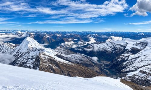
The Putha Hiunchuli Expedition takes you far beyond Nepal’s busy trekking corridors and into a part of the Himalaya where simply reaching the mountain feels like an expedition.
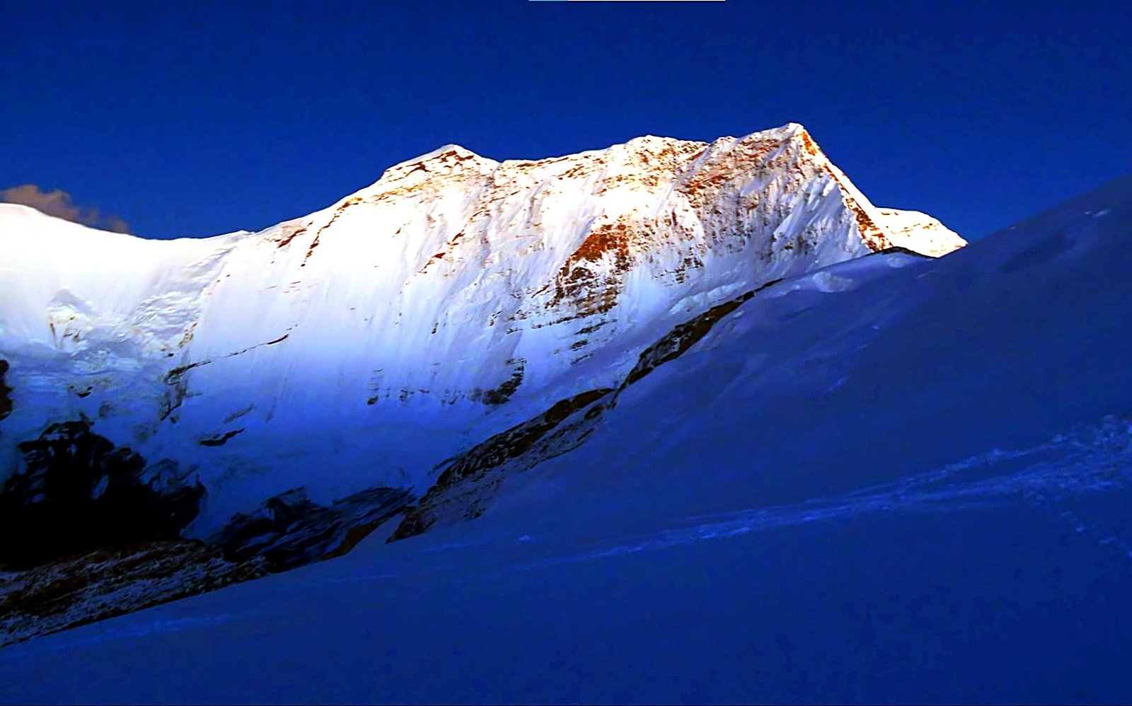
Rising to 7,246 m on the western side of the Dhaulagiri range, Putha Hiunchuli combines a remote Dolpo approach, weeks of expedition camping, glacier travel and a serious high-altitude summit climb.
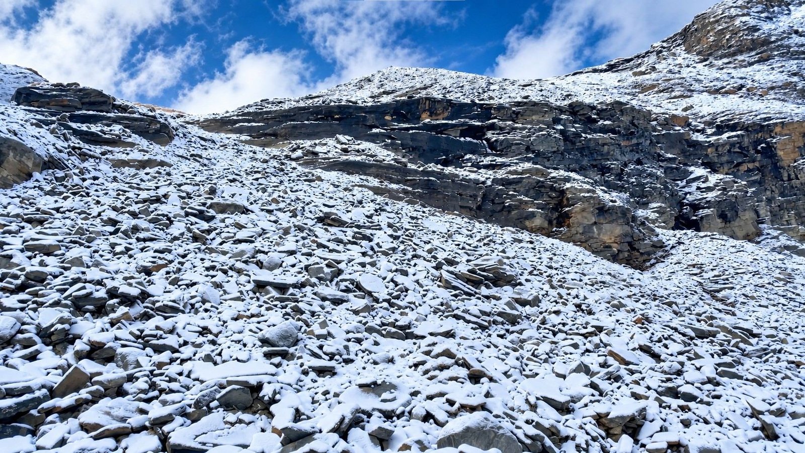
The journey begins in Kathmandu before you fly west to Nepalgunj and continue by mountain flight to Juphal.
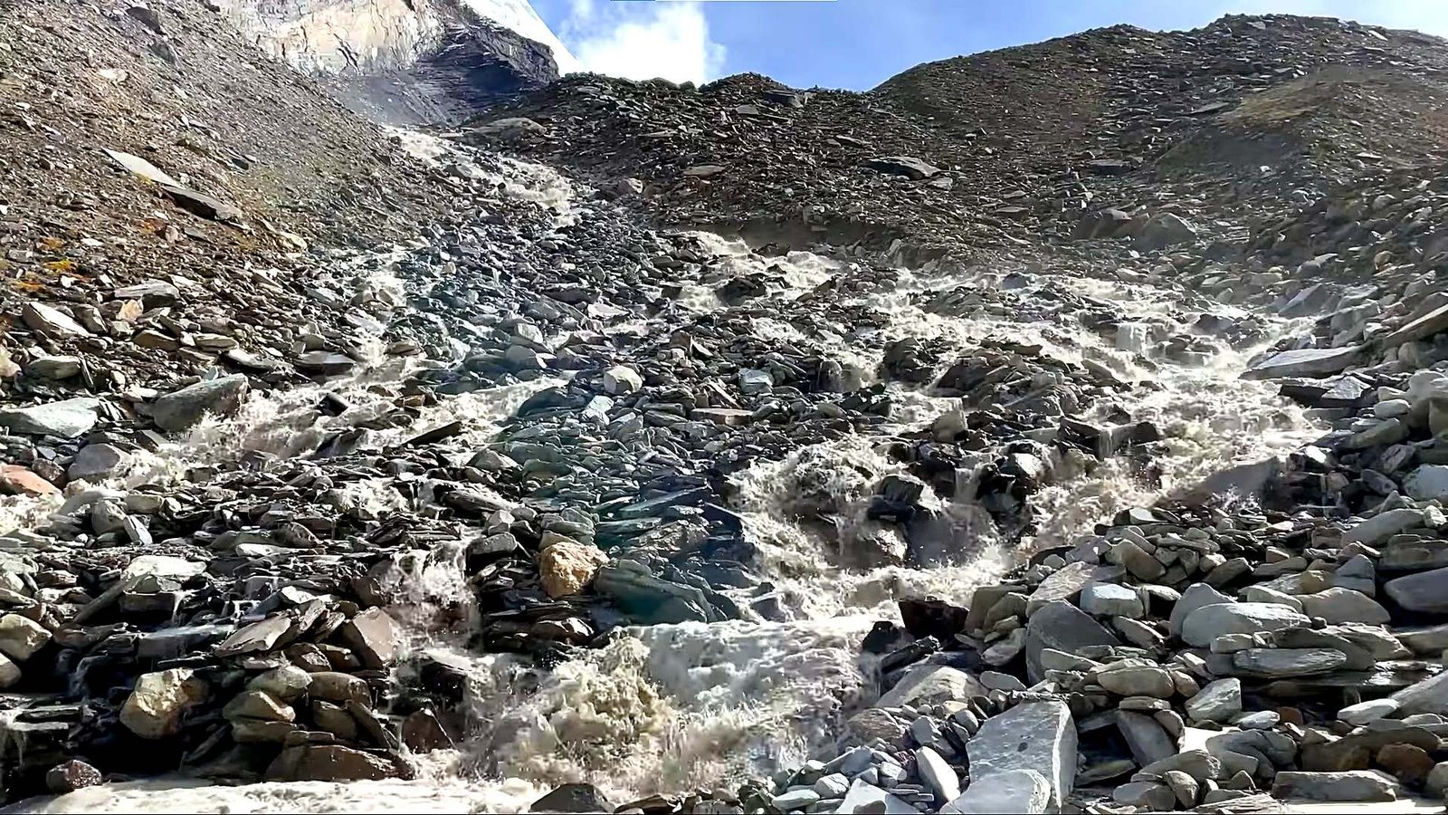
From here, the expedition moves on foot through the remote landscapes of Dolpo, following a route through places such as Dunai, Tarakot, Musi Khola, Kagkot, Yak Kharka and Putha Phedi before reaching Base Camp.

This long approach is not simply transportation to the mountain. You gradually leave roads and larger settlements behind, moving through river valleys, dry mountain terrain and increasingly high camps as your body begins adapting to altitude.
By the time you reach Base Camp at approximately 4,800–4,900 m, you have already spent several days living and walking in a remote Himalayan environment.
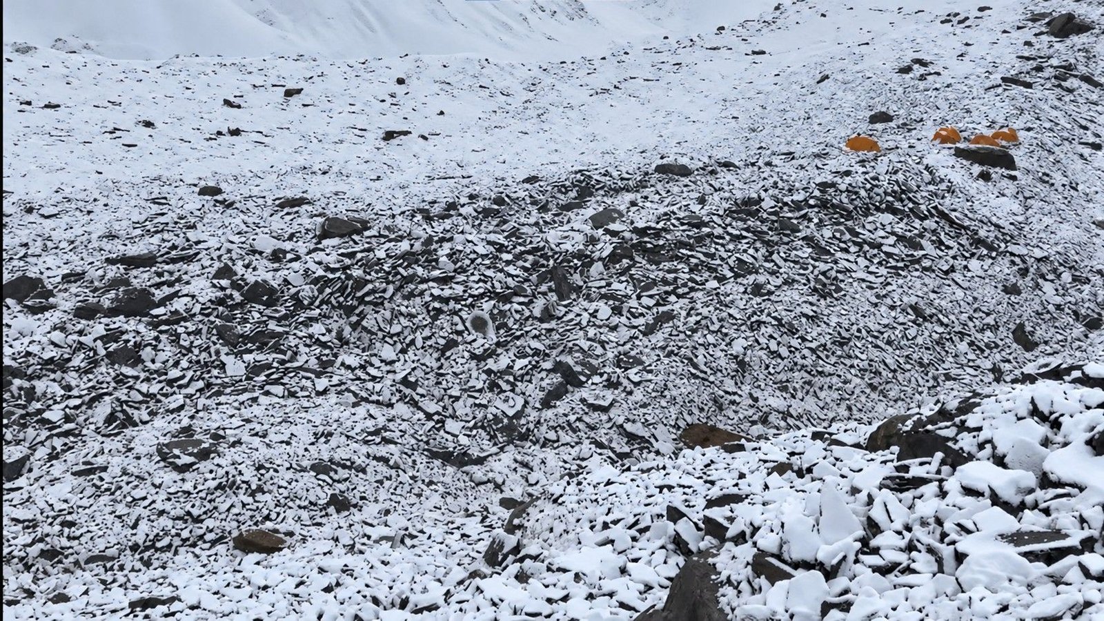
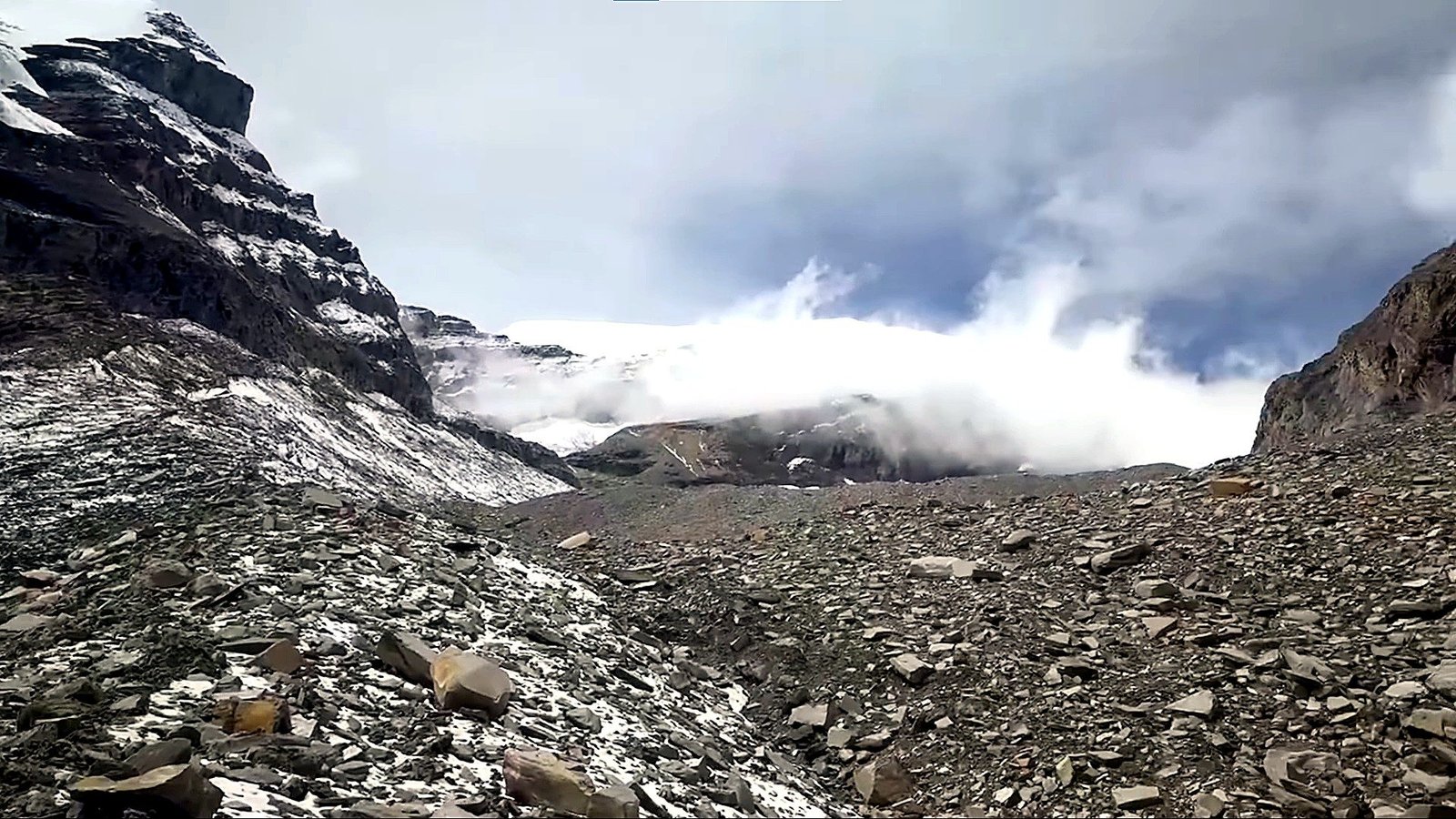
Above Base Camp, the character of the expedition changes. The trekking trail gives way to moraine, glacier, snowfields and high-altitude climbing.
The normal expedition route generally uses three progressively higher camps, although their exact elevations and positions can shift from season to season as snow levels, crevasses and glacier conditions change.

Putha Hiunchuli is often considered less technically concentrated than mountains such as Ama Dablam, but that should never be confused with an easy climb.
The real difficulty comes from the combination of 7,246 m altitude, sustained cold, glacier travel, crevasse exposure, long climbing days, remote logistics and the need to recover between successive high-altitude rotations.

Climbers should therefore arrive with previous mountaineering experience.
You should already be comfortable wearing crampons, using an ice axe, travelling on a rope team and working with fixed-line systems where required. Base Camp training is used to refresh and refine these skills rather than introduce them for the first time.

The expedition follows a structured acclimatization strategy. Instead of moving directly toward the summit, you climb progressively higher, spend time at altitude and then return to Base Camp to recover.
Rotations toward Camp I, Camp II and the upper mountain prepare the body before the final summit push.
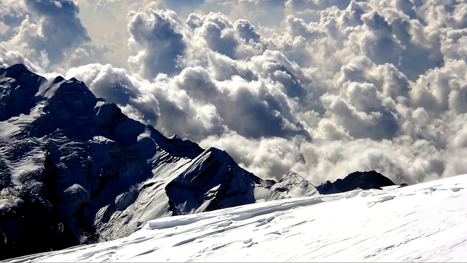
When the team is properly acclimatized and an appropriate weather window develops, you return to the high camps for the summit rotation.
The final climb usually begins during the night or very early morning, when temperatures are at their lowest but the snow may be firmer and the team has more daylight available for the descent.

Reaching the summit at 7,246 m is only half of the objective. You still need enough physical and mental reserve to descend through the upper mountain and return safely to the lower camps.
For this reason, the itinerary includes contingency time and keeps the climbing period flexible rather than promising one fixed summit date.
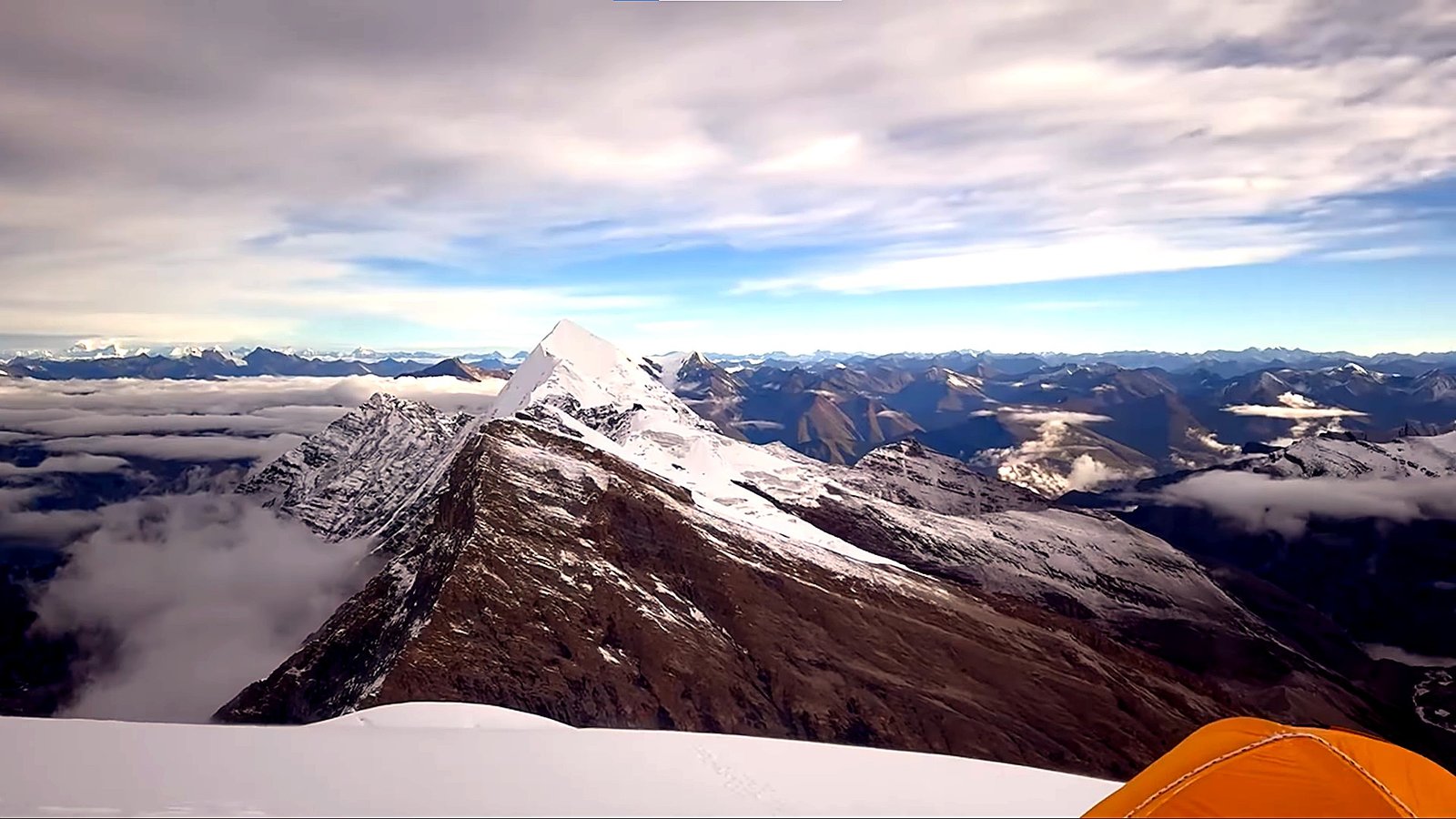
Putha Hiunchuli is particularly appealing to experienced climbers looking for their first or next major 7,000-meter Himalayan expedition.
It offers the systems and realities of a serious expedition, remote logistics, Base Camp life, high camps, glacier movement, acclimatization rotations and weather-dependent summit planning without following the heavily travelled routes of the Everest region.
Putha Hiunchuli Expedition
| Expedition Detail | Information |
|---|---|
| Mountain | Putha Hiunchuli |
| Elevation | 7,246 m / 23,773 ft |
| Mountain Range | Dhaulagiri Range, Western Nepal |
| Expedition Duration | 33 Days |
| Approach | Kathmandu → Nepalgunj → Juphal → Dolpo Approach Trek → Base Camp |
| Base Camp | Approximately 4,800–4,900 m |
| Normal Climbing Terrain | Moraine, Glacier, Snow Slopes, Crevassed Terrain and High-Altitude Ridge Sections |
| High Camps | Normally Camp I, Camp II and an Upper Camp / Camp III according to seasonal route conditions |
| Difficulty | Advanced High-Altitude Expedition |
| Main Climbing Seasons | Spring and Autumn |
| Accommodation | Hotels, Lodges where available and Expedition Camping |
| First Ascent | 1954 – J. O. M. Roberts and Ang Nyima Sherpa |
| Start / End | Kathmandu / Kathmandu |
A 7,000-Meter Expedition Far from the Main Himalayan Trails
Putha Hiunchuli feels very different from an expedition approached through the Everest or Annapurna trekking corridors.
Once you leave Juphal and move beyond the larger Dolpo settlements, infrastructure becomes limited and organised expedition support becomes increasingly important.

You travel through remote valleys and traditional settlements before the landscape opens into higher grazing areas and increasingly barren alpine terrain.
Equipment, food, fuel and expedition supplies must move with the team, making the approach an important part of the overall climbing experience rather than simply a trail to Base Camp.

This isolation is one of the mountain’s strongest attractions. There are fewer commercial trekking crowds, fewer established tourist facilities and a much stronger feeling of travelling as a self-contained expedition team.
Putha Hiunchuli Route and High Camps
The normal route climbs from Base Camp onto increasingly glaciated and snow-covered terrain. The exact line and camp placements depend on the condition of the glacier, snow accumulation and the route selected by the climbing team for that season.
For this reason, camp elevations should be treated as working figures rather than permanent locations. A typical expedition can use positions within the approximate ranges below.
| Mountain Stage | Approximate Elevation | Typical Terrain / Purpose |
|---|---|---|
| Base Camp | ~4,800–4,900 m | Main expedition camp, acclimatization, training, recovery and summit preparation |
| Camp I | ~5,400–5,600 m | Moraine and lower glacier terrain with the first overnight exposure above Base Camp |
| Camp II | ~6,000–6,200 m | Higher glacier and snow terrain with crevasse management and extended altitude exposure |
| Camp III / Upper Camp | ~6,300–6,500 m | Upper snow and ridge position used as a summit staging camp when conditions allow |
| Summit | 7,246 m | Final high-altitude ascent followed by a long descent to the upper camps |
The climbing team may move these camps higher or lower, combine stages or change the rotation plan if the glacier, weather or snow conditions make another strategy more appropriate.
How Difficult Is Putha Hiunchuli?
Putha Hiunchuli is not defined by one extremely technical obstacle. Instead, the difficulty builds through prolonged exposure to altitude, cold, snow and glacier terrain while living in a remote environment for several weeks.
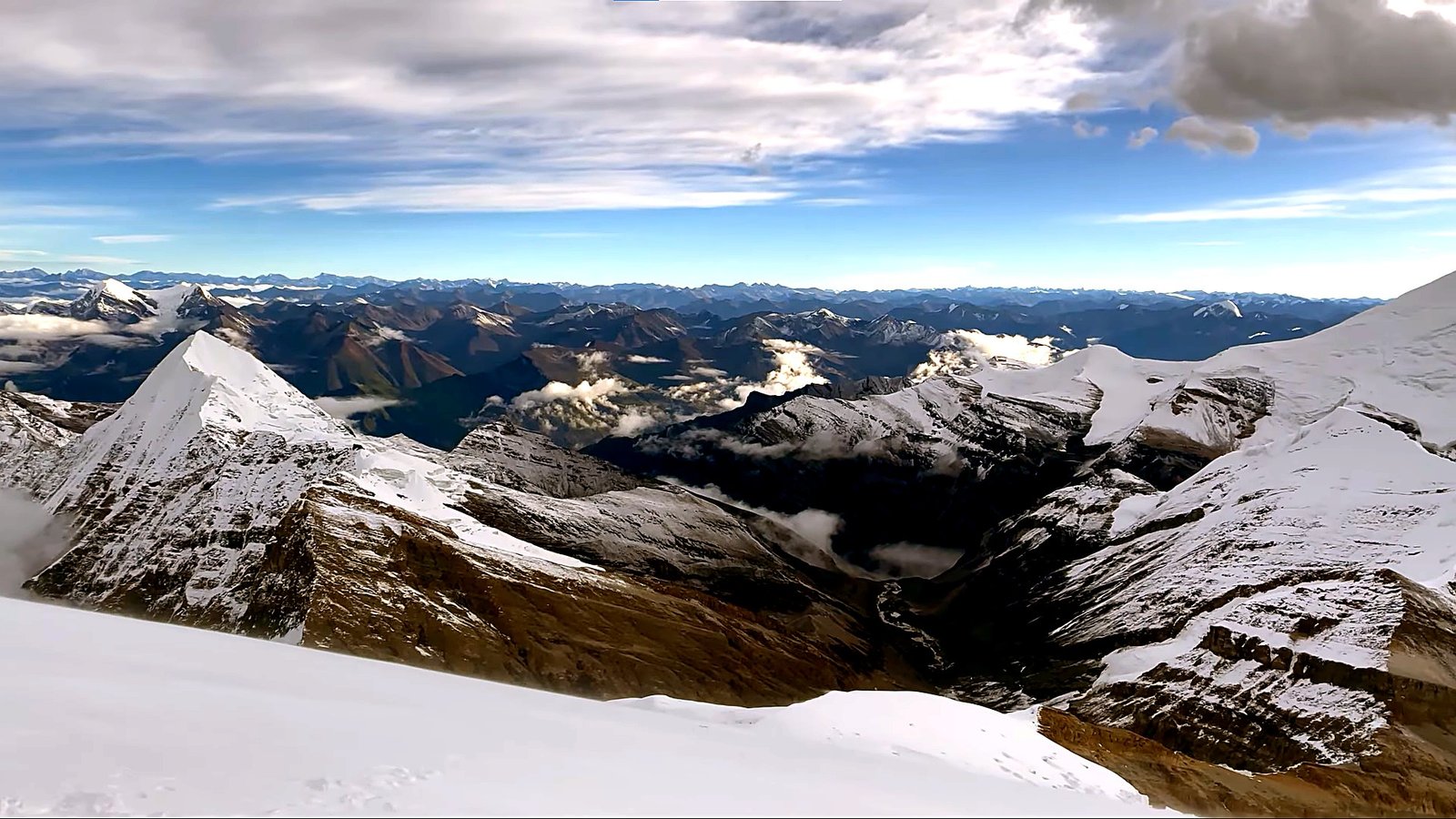
Much of the normal route is snow and glacier climbing, but crevasses and steeper sections can require roped travel and fixed-line protection.
Climbers need to move efficiently with crampons, manage their personal safety systems and continue making good decisions after several days above 5,000 and 6,000 meters.
| Challenge | What It Means on the Expedition |
|---|---|
| Extreme Altitude | The summit reaches 7,246 m, where movement becomes slower and recovery becomes increasingly difficult |
| Remote Approach | You spend several days away from major road access and developed tourism infrastructure |
| Glacier Travel | Roped movement, crevasse awareness and route selection may be necessary depending on glacier conditions |
| Snow and Ice | Crampon and ice-axe skills are required for efficient movement on the upper mountain |
| Cold and Wind | High camps and summit mornings can involve severe cold and significant wind exposure |
| Expedition Endurance | You need to recover repeatedly between long trekking days, rotations and the final summit push |
| Limited Rescue Access | Emergency evacuation and logistics are more complicated than in Nepal’s busiest trekking regions |
Experience Recommended Before Putha Hiunchuli
This expedition is intended for climbers who already understand basic mountaineering systems.
Strong trekking fitness is important, but fitness alone does not replace technical experience or previous exposure to altitude.

A previous expedition or climb around 6,000 m is highly useful because it gives you some understanding of how your body responds to cold, reduced oxygen, sleeping at altitude and consecutive climbing days.
| Skill / Experience | Why It Is Essential |
|---|---|
| Crampon Technique | Required for secure and efficient movement on snow and ice |
| Ice Axe Use | Important for balance, snow travel and appropriate self-arrest knowledge |
| Roped Glacier Travel | Needed for travelling safely through crevassed glacier terrain |
| Fixed-Rope Movement | Allows efficient movement on protected sections when fixed ropes are required |
| Ascender / Jumar Use | Important for ascending fixed lines without wasting unnecessary energy |
| Rappelling | Necessary for controlled descent where fixed-line systems are used |
| Crevasse Awareness | Important for understanding glacier hazards and rope-team procedures |
| Previous Altitude Experience | Helps you understand how your body performs and recovers above 5,000–6,000 m |
Acclimatization and Summit Strategy
You do not arrive at Base Camp and immediately begin the summit push. The expedition follows a progressive system of climbing higher, spending time at altitude and returning lower to recover.
The first rotation normally introduces you to the lower glacier and Camp I area.
Later rotations can move through Camp I toward Camp II and the upper mountain. Each stage gives your body additional altitude exposure while also allowing you to learn the route before the final summit rotation.
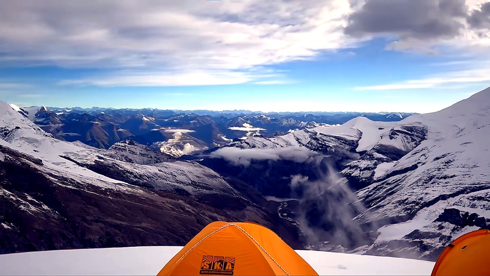
After the major acclimatization rotations, the team returns to Base Camp for meaningful recovery. Eating, sleeping and hydrating at a lower altitude can be just as important as another day of climbing.
The final summit push begins only when the team is sufficiently acclimatized and the weather, snow conditions and route are suitable. The printed itinerary therefore provides a framework rather than a guaranteed summit date.
Best Time for the Putha Hiunchuli Expedition
Spring and autumn provide the principal expedition windows for Putha Hiunchuli. Each season has its own character, and the final route conditions depend on recent snowfall, temperature and wind rather than the calendar alone.
| Season | General Conditions | Expedition Consideration |
|---|---|---|
| Spring April–May |
Established pre-monsoon climbing period with gradually longer days | Suitable major expedition window, although snowfall and wind remain important factors |
| Autumn September–November |
Generally drier conditions after the summer monsoon with good opportunities for clear mountain weather | A particularly popular period for Putha Hiunchuli expeditions |
| Winter | Significantly colder with stronger winter exposure and difficult high-camp conditions | Requires a specialized winter expedition plan |
| Summer / Monsoon | Cloud, rain and unstable flight conditions can complicate the approach through western Nepal | Not normally the preferred period for a standard expedition program |
Permits and Current Expedition Fees
Putha Hiunchuli is a regulated expedition mountain, and the approach through western Nepal also requires route-specific trekking and protected-area documentation.
Nepal Royal Tourism Holiday arranges the applicable permits according to the final expedition route, nationality and climbing season.
| Permit / Government Item | Current Published Rate | Notes |
|---|---|---|
| Putha Hiunchuli Royalty – Spring | USD 800 per foreign climber | 7,001–7,500 m government royalty category |
| Putha Hiunchuli Royalty – Autumn | USD 400 per foreign climber | Current post-monsoon seasonal royalty |
| Winter / Summer Royalty | USD 200 per foreign climber | Lower seasonal royalty outside spring and autumn |
| Garbage Management Deposit | USD 500 per expedition team | Team-level mountaineering waste-management deposit |
| Lower Dolpa Restricted-Area Permit | USD 20 per person for first week + USD 5 per person per day beyond one week | Applies where the confirmed approach travels through designated Lower Dolpa restricted areas |
| TIMS | NPR 2,000 non-SAARC / NPR 1,000 SAARC | Applicable trekking documentation for the Lower Dolpo route |
| Dhorpatan Hunting Reserve | NPR 3,000 foreign / NPR 1,500 SAARC / NPR 100 Nepali | Applicable where the confirmed expedition route enters the reserve |
Government royalties, restricted-area rules and protected-area fees can change. The final permit package is reconfirmed when the expedition documents are processed rather than relying permanently on the rates displayed on the website.
Technical Climbing Gear for Putha Hiunchuli
You should arrive with personal technical equipment that is already familiar and properly fitted. Base Camp is the place to confirm and refresh systems, not discover that your crampons do not fit your boots or that you have never used your ascender before.
| Technical Equipment | Recommended Personal Gear |
|---|---|
| Harness and Helmet | Adjustable climbing harness and certified mountaineering helmet |
| Crampons | 12-point steel mountaineering crampons fully compatible with high-altitude boots |
| Ice Axe | Mountaineering ice axe appropriate for snow and glacier travel |
| Mechanical Ascender | Jumar or equivalent ascender for fixed-line climbing |
| Belay / Rappel Device | Personal descent and belay device compatible with the expedition rope system |
| Carabiners and Safety System | Locking carabiners, appropriate non-locking carabiners, slings, safety lanyard and prusik cord |
| High-Altitude Boots | Insulated mountaineering boots suitable for a 7,000-meter expedition |
Personal Clothing and Packing List
Your clothing system needs to work across a very wide range of conditions, from warm lowland Nepalgunj and the lower Dolpo approach to sub-zero temperatures at the high camps.
| Category | Recommended Personal Equipment |
|---|---|
| Base Layers | Moisture-wicking thermal tops and bottoms for trekking, Base Camp and high-altitude use |
| Mid Layers | Fleece, softshell and insulated mid-layers suitable for active climbing |
| Weather Protection | Waterproof and windproof shell jacket and shell trousers |
| High-Altitude Insulation | Expedition down suit or suitable high-altitude down parka and insulated trouser system |
| Head and Face | Warm hat, balaclava, sun hat and face protection for wind and severe cold |
| Eyes | Glacier glasses and ski or expedition goggles |
| Hands | Liner gloves, technical climbing gloves, insulated gloves and high-altitude mittens |
| Approach Footwear | Comfortable trekking boots or shoes, warm socks and insulated camp footwear |
| Sleeping System | Expedition sleeping bag rated for severe cold, sleeping liner if preferred and personal sleeping pad where required |
| Climbing Pack | Approximately 45–60 L technical backpack for personal equipment on the mountain |
| Expedition Duffel | Durable duffel bags for porter or pack-animal transport during the approach |
| Hydration | Wide-mouth insulated bottles, bottle covers, thermos flask and personal water-treatment system |
| Lighting and Electronics | Powerful headlamp, spare batteries, power bank and cold-protected electronics |
| Personal and Medical | Prescription medication, personal first-aid supplies, blister care, sunscreen, lip protection and toiletries |
A detailed final gear checklist should be reviewed before departure. Climbers should arrive in Kathmandu early enough to replace, rent or adjust equipment before travelling west toward Dolpo.
Group Expedition Equipment and Support
Personal climbing equipment is separate from the shared expedition systems needed to operate the mountain safely and efficiently. The exact provision depends on the confirmed Nepal Royal Tourism Holiday expedition package.
| Expedition System | Typical Arrangement |
|---|---|
| Base Camp | Sleeping tents, dining tent, kitchen, tables, chairs and organised expedition living facilities |
| High Camps | High-altitude tents positioned according to the active route and camp strategy |
| Ropes and Route Equipment | Group ropes, route protection and fixed-line systems where required by mountain conditions |
| High-Camp Cooking | Stoves, fuel and essential cooking equipment for rotations and summit days |
| Food and Supplies | Base Camp meals and high-altitude expedition rations according to the program |
| Communication | Radio and/or satellite communication for expedition coordination and emergency use |
| Emergency Equipment | Shared first-aid and emergency systems maintained according to the expedition plan |
| Climbing Sherpa Support | High-altitude support, load movement and camp assistance according to the confirmed climber-to-Sherpa arrangement |
| Approach Logistics | Porters and/or pack animals used to move expedition food, fuel and equipment toward Base Camp |
| Supplemental Oxygen | Provided or arranged only when included in the confirmed expedition strategy and service package |
Travel Insurance and Emergency Planning
A Putha Hiunchuli Expedition requires insurance designed for serious high-altitude mountaineering. A normal trekking policy may exclude technical climbing or may stop providing coverage well below 7,246 m.
Your policy should clearly cover mountaineering to at least the maximum altitude of the expedition, together with emergency medical treatment and helicopter evacuation where such evacuation is possible and medically required.
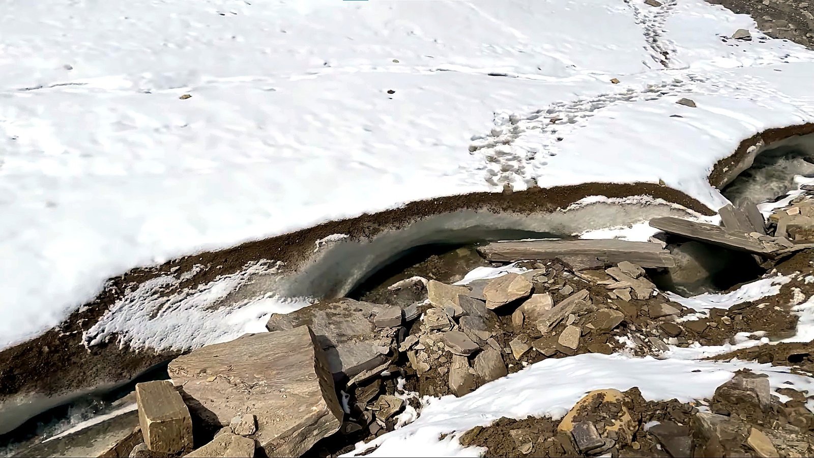
The remote location also needs to be understood realistically. Helicopter rescue is not guaranteed from every point on the mountain, particularly from the upper camps.
A climber may first need to descend to a location where evacuation is possible, and all aircraft operations remain dependent on weather, visibility and operational availability.
A Mountain Where Patience Matters as Much as Strength
Putha Hiunchuli rewards climbers who can remain patient over a long expedition.
There will be days when moving higher is the right decision, and days when remaining at Base Camp is more valuable than forcing another rotation.

Weather forecasts, the condition of the glacier, snowfall, wind, individual acclimatization and the progress of the climbing team all influence the final summit plan.
The itinerary is therefore designed around a clear expedition structure while preserving enough flexibility to make decisions according to the mountain rather than the calendar.
Plan Your Putha Hiunchuli Expedition
A 7,246 m expedition in remote western Nepal requires more planning than simply choosing a departure date. Your previous climbing experience, preferred season, equipment and high-altitude background all matter when building the right expedition arrangement.
Nepal Royal Tourism Holiday coordinates the domestic flights, Dolpo approach, permits, Base Camp logistics, climbing support, high camps and summit-period planning required for the expedition.
Send us your preferred climbing season, group size and previous mountaineering experience so our team can confirm the current expedition arrangement and quotation.
Trip Highlights
- Climb Putha Hiunchuli at 7,246 m, one of Nepal’s major 7,000-meter expedition peaks in the remote western Himalaya
- Travel through the Dolpo region of western Nepal, far from the busier trekking and climbing routes of Everest and Annapurna
- Fly from Kathmandu to Nepalgunj and Juphal before beginning the remote overland approach toward the mountain
- Trek through Dunai, Tarakot, Musi Khola, Kagkot, Yak Kharka and Putha Phedi on the way to Base Camp
- Experience a true expedition environment with remote camping, glacier travel, high camps and long periods away from developed infrastructure
- Spend several days acclimatizing at and above Putha Hiunchuli Base Camp around 4,800–4,900 m before the summit rotation
- Practice and use essential mountaineering skills including crampon movement, ice axe use, fixed-rope travel, ascender use and glacier procedures
- Progress through Camp I, Camp II and an upper high camp according to the route and snow conditions of the season
- Climb across snow, glacier and crevassed terrain while gradually moving higher toward the summit
- Attempt the 7,246 m summit during a suitable weather window rather than following a fixed summit date
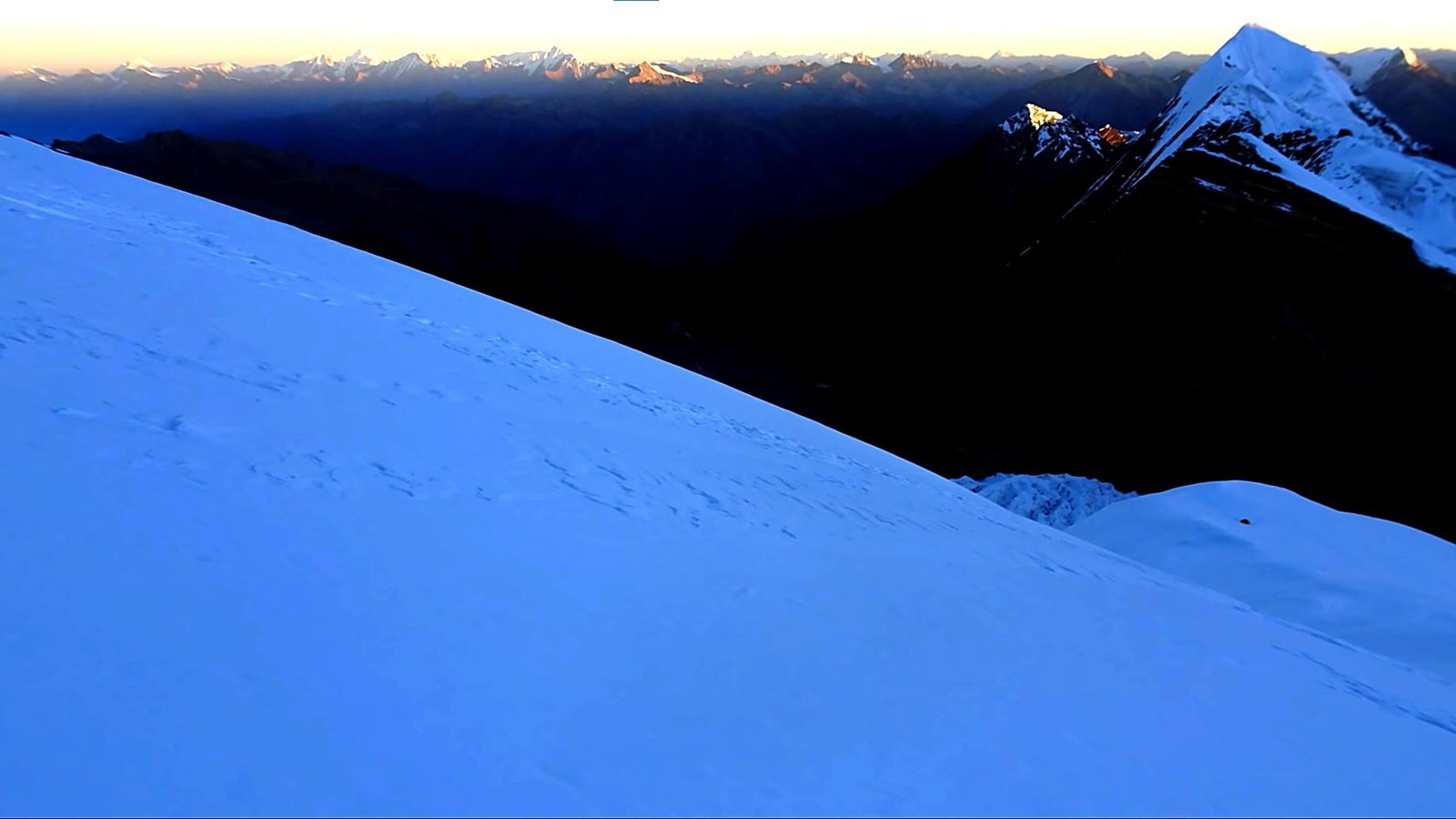
- Enjoy extensive views across the Dhaulagiri range and the remote western Himalayan landscape from the upper mountain
- - Build valuable experience for future higher 7,000-meter and 8,000-meter expeditions through a complete high-altitude expedition program
Putha Hiunchuli Expedition – 33 Days ~ Itinerary
Day 1
Arrival in Kathmandu
- Maximum Altitude: Kathmandu – 1,350 m
- Overnight Altitude: Kathmandu – 1,350 m
- Accommodation: Standard Three Star Hotel in Thamel
Your Putha Hiunchuli Expedition begins when you arrive at Tribhuvan International Airport in Kathmandu. A Nepal Royal Tourism Holiday representative will meet you at the airport and transfer you to your hotel in Thamel.
The remainder of the day is kept relaxed after your international journey. Once you have settled in, you can meet the expedition team and receive an initial introduction to the program ahead. Depending on your arrival time, the team may also begin reviewing your personal climbing equipment and the preparations required before travelling west toward Dolpo.
Day 2
Expedition Briefing, Gear Check and Permit Preparation
- Maximum Altitude: Kathmandu – 1,350 m
- Overnight Altitude: Kathmandu – 1,350 m
- Meal: Breakfast
- Accommodation: Standard Three Star Hotel in Thamel
You spend today preparing for the expedition before leaving Kathmandu. The climbing team takes you through the approach route, acclimatization strategy, high-camp plan, communication procedures and the general structure of the summit period.
Your personal climbing equipment is also checked carefully. Mountaineering boots, crampons, harness, helmet, ascender, ice axe, high-altitude clothing and sleeping equipment should all be ready before departure. The day also allows time for the remaining permit and expedition documentation to be completed.
Day 3
Fly from Kathmandu to Nepalgunj
- Maximum Altitude: Kathmandu – 1,350 m
- Overnight Altitude: Nepalgunj – approximately 150 m
- Flight Duration: Approximately 50 to 60 minutes
- Meal: Breakfast, Lunch and Dinner
- Accommodation: Hotel in Nepalgunj
You leave the Kathmandu Valley behind and fly west toward Nepalgunj in Nepal’s southern plains. The change is immediate, taking you from the hills surrounding Kathmandu to the warmer and much lower Terai region.
Nepalgunj serves as the main transit point for the onward mountain flight into Dolpo. After reaching your hotel, you have time to rest and reorganize your luggage before the early flight toward Juphal, which remains dependent on mountain weather and visibility.
Day 4
Fly to Juphal and Trek to Dunai
- Maximum Altitude: Juphal – approximately 2,475 m
- Overnight Altitude: Dunai – approximately 2,140 m
- Flight Duration: Approximately 35 to 45 minutes
- Trek Duration: Approximately 2 to 3 hours
- Trek Distance: Approximately 8 km
- Meal: Breakfast, Lunch and Dinner
- Accommodation: Lodge or Camp in Dunai
You take an early mountain flight from Nepalgunj toward Juphal, gaining your first aerial view of the rugged hills and valleys of western Nepal. The flight brings you rapidly from the lowlands into the mountain environment of Dolpo.
After landing at Juphal, you begin the first walking stage of the expedition. The trail descends from the airstrip and follows the valley toward Dunai, one of the principal settlements of the region. The relatively short trek allows you to settle gradually into the rhythm of the remote approach.
Day 5
Trek from Dunai to Tarakot
- Maximum Altitude: Tarakot – approximately 2,540 m
- Overnight Altitude: Tarakot – approximately 2,540 m
- Trek Duration: Approximately 5 to 6 hours
- Trek Distance: Approximately 15 km
- Meal: Breakfast, Lunch and Dinner
- Accommodation: Expedition Camp in Tarakot
You leave Dunai and follow the river corridor deeper into Dolpo. The route passes through rugged hillsides, cultivated sections and scattered settlements while the busier surroundings of Dunai gradually disappear behind you.
As you approach Tarakot, the journey begins to feel noticeably more remote. The altitude is still relatively moderate, but the long walking day helps prepare your legs and establishes the steady expedition pace required for the higher stages ahead.
Day 6
Trek from Tarakot to Musi Khola
- Maximum Altitude: Musi Khola – approximately 2,890 m
- Overnight Altitude: Musi Khola – approximately 2,890 m
- Trek Duration: Approximately 5 to 6 hours
- Trek Distance: Approximately 12 km
- Meal: Breakfast, Lunch and Dinner
- Accommodation: Expedition Camp at Musi Khola
You continue deeper into the valley today, following the river system through increasingly isolated mountain terrain. Permanent settlements become less frequent and organised expedition camping starts to become a more important part of the journey.
The trail gradually gains altitude toward Musi Khola. By evening, you settle into camp and begin becoming accustomed to the routine of early starts, organised meals, remote camps and consecutive days of walking.
Day 7
Trek from Musi Khola to Kagkot
- Maximum Altitude: Kagkot – approximately 3,295 m
- Overnight Altitude: Kagkot – approximately 3,295 m
- Trek Duration: Approximately 5 to 6 hours
- Trek Distance: Approximately 11 km
- Meal: Breakfast, Lunch and Dinner
- Accommodation: Lodge or Expedition Camp at Kagkot
You continue toward Kagkot as the surrounding landscape becomes drier and increasingly rugged. The route follows the mountain valley while steadily gaining altitude, with fewer permanent settlements appearing along the way.
Reaching Kagkot takes you above 3,000 m for the first time on the approach. From here onward, altitude becomes a more noticeable part of each day, so you maintain a controlled walking pace and give your body time to adjust gradually.
Day 8
Trek from Kagkot to Yak Kharka
- Maximum Altitude: Yak Kharka – approximately 3,950 to 3,960 m
- Overnight Altitude: Yak Kharka – approximately 3,950 to 3,960 m
- Trek Duration: Approximately 6 hours
- Trek Distance: Approximately 10 km
- Meal: Breakfast, Lunch and Dinner
- Accommodation: Expedition Camp at Yak Kharka
Your journey now moves into distinctly higher Himalayan terrain as you leave Kagkot and climb toward Yak Kharka. Vegetation becomes thinner, the valley opens and the surrounding slopes feel increasingly exposed as you approach 4,000 m.
The altitude gain makes today an important acclimatization stage. You walk steadily rather than pushing for speed, reaching Yak Kharka with enough time to eat, hydrate and recover before continuing higher the following morning.
Day 9
Trek from Yak Kharka to Putha Phedi
- Maximum Altitude: Putha Phedi – approximately 4,430 m
- Overnight Altitude: Putha Phedi – approximately 4,430 m
- Trek Duration: Approximately 5 to 6 hours
- Trek Distance: Approximately 8 km
- Meal: Breakfast, Lunch and Dinner
- Accommodation: Expedition Camp at Putha Phedi
You leave Yak Kharka and continue upward toward Putha Phedi, moving through increasingly barren alpine terrain beneath the higher mountains. The thinner air becomes more noticeable now, and maintaining an even pace is more important than covering ground quickly.
Putha Phedi provides a useful staging camp before Base Camp. Spending the night above 4,400 m gives your body another opportunity to adjust before you move into the main expedition camp the following day.
Day 10
Trek to Putha Hiunchuli Base Camp
- Maximum Altitude: Putha Hiunchuli Base Camp – approximately 4,800 to 4,900 m
- Overnight Altitude: Putha Hiunchuli Base Camp – approximately 4,800 to 4,900 m
- Trek Duration: Approximately 5 to 6 hours
- Trek Distance: Approximately 7 km
- Meal: Breakfast, Lunch and Dinner
- Accommodation: Expedition Tent at Putha Hiunchuli Base Camp
You make the final approach toward Putha Hiunchuli Base Camp, gradually leaving the trekking phase of the journey behind. The surrounding terrain becomes increasingly open, rocky and glacial as you move closer to the mountain.
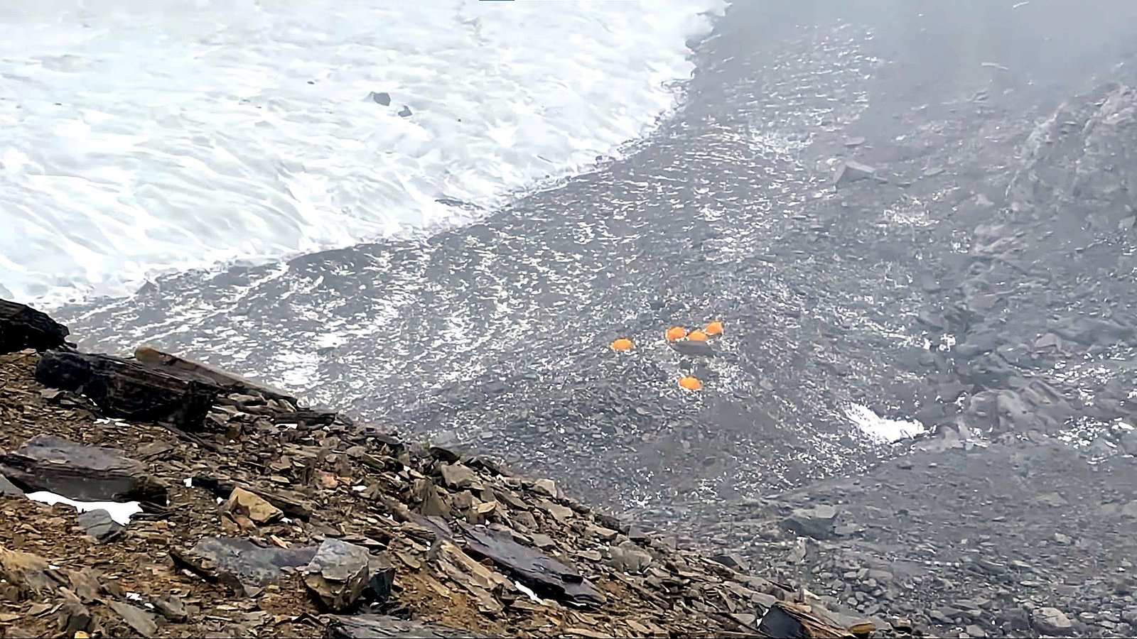
Reaching Base Camp marks a major change in the expedition. You settle into your sleeping tent, organise personal climbing equipment and become familiar with the dining, kitchen, communication and mountain-support systems that will serve as your home during the climbing period.
Day 11
Base Camp Acclimatization and Expedition Setup
- Maximum Altitude: Putha Hiunchuli Base Camp – approximately 4,800 to 4,900 m
- Overnight Altitude: Putha Hiunchuli Base Camp – approximately 4,800 to 4,900 m
- Activity Duration: Light activity and local acclimatization
- Meal: Breakfast, Lunch and Dinner
- Accommodation: Expedition Tent at Putha Hiunchuli Base Camp
Your first full day at Base Camp is intentionally kept relatively easy. After the long approach through Dolpo, your body needs time to settle close to 4,900 m before you begin making significant moves higher on the mountain.
You organise personal equipment, become familiar with the surrounding route and review communication and camp procedures with the climbing team. Rest, hydration and proper meals are the main priorities as you prepare for the first technical days above Base Camp.
Day 12
Puja Ceremony and Technical Training at Base Camp
- Maximum Altitude: Putha Hiunchuli Base Camp – approximately 4,800 to 4,900 m
- Overnight Altitude: Putha Hiunchuli Base Camp – approximately 4,800 to 4,900 m
- Activity Duration: Approximately 3 to 5 hours
- Meal: Breakfast, Lunch and Dinner
- Accommodation: Expedition Tent at Putha Hiunchuli Base Camp
You take part in the traditional climbing puja before the team begins moving seriously onto the mountain. The ceremony remains an important part of Himalayan expedition culture and is normally completed before the main climbing equipment and team progress higher.
You also spend part of the day refreshing the technical systems required above Base Camp. Crampon movement, ice axe use, rope-team procedures, ascender technique, fixed-line movement, rappelling and glacier safety are reviewed so everyone is working with familiar systems before entering more serious terrain.
Day 13
Acclimatization Climb toward Camp I and Return to Base Camp
- Maximum Altitude: Camp I Area – approximately 5,400 to 5,500 m
- Overnight Altitude: Putha Hiunchuli Base Camp – approximately 4,800 to 4,900 m
- Altitude Gain: Approximately 500 to 700 m
- Climbing Duration: Approximately 7 to 9 hours round trip
- Climb Distance: Route-dependent and variable with glacier conditions
- Meal: Breakfast, Lunch and Dinner
- Accommodation: Expedition Tent at Putha Hiunchuli Base Camp
You make your first meaningful climb above Base Camp and begin becoming familiar with the lower mountain. The route can involve moraine, broken glacier and progressively more continuous snow as you work toward the Camp I area.
The purpose of today’s climb is altitude exposure rather than speed. After gaining height and spending some time around the first high-camp zone, you descend again to Base Camp. Sleeping lower allows your body to recover while retaining the acclimatization benefit of climbing higher during the day.
Day 14
- Maximum Altitude: Putha Hiunchuli Base Camp – approximately 4,800 to 4,900 m
- Overnight Altitude: Putha Hiunchuli Base Camp – approximately 4,800 to 4,900 m
- Meal: Breakfast, Lunch and Dinner
- Accommodation: Expedition Tent at Putha Hiunchuli Base Camp
You spend today recovering from the first major altitude exposure above Base Camp. A proper rest day gives your body time to respond to the previous climb while you focus on eating well, hydrating and getting sufficient sleep.
The climbing team uses the day to assess the route, move supplies where necessary and make any adjustments before you begin the first overnight rotation on the mountain.
- Maximum Altitude: Putha Hiunchuli Base Camp – approximately 4,800 to 4,900 m
- Overnight Altitude: Putha Hiunchuli Base Camp – approximately 4,800 to 4,900 m
- Meal: Breakfast, Lunch and Dinner
- Accommodation: Expedition Tent at Putha Hiunchuli Base Camp
You spend today recovering from the first major altitude exposure above Base Camp. A proper rest day gives your body time to respond to the previous climb while you focus on eating well, hydrating and getting sufficient sleep.
The climbing team uses the day to assess the route, move supplies where necessary and make any adjustments before you begin the first overnight rotation on the mountain.
Day 15
Climb from Base Camp to Camp I
- Maximum Altitude: Camp I – approximately 5,400 to 5,500 m
- Overnight Altitude: Camp I – approximately 5,400 to 5,500 m
- Altitude Gain: Approximately 500 to 700 m
- Climbing Duration: Approximately 4 to 6 hours
- Climb Distance: Route-dependent and variable with glacier conditions
- Meal: Breakfast, Lunch and High Camp Dinner
- Accommodation: High-Altitude Tent at Camp I
You leave the relative comfort of Base Camp and follow the now-familiar route toward Camp I. The climb moves progressively from moraine and glacial terrain onto more sustained snow, with rope systems used where the condition of the glacier requires them.
Tonight is your first planned sleep around 5,500 m. Once at Camp I, you organise your tent, prepare food and water and keep unnecessary movement to a minimum while your body adapts to sleeping considerably higher than Base Camp.
Day 16
Climb toward Camp II and Return to Camp I
- Maximum Altitude: Camp II – approximately 6,100 to 6,150 m
- Overnight Altitude: Camp I – approximately 5,400 to 5,500 m
- Altitude Gain: Approximately 600 to 750 m to Camp II
- Climbing Duration: Approximately 8 to 11 hours round trip
- Climb Distance: Route-dependent and variable with crevasses and glacier conditions
- Meal: High-Altitude Meals and Expedition Rations
- Accommodation: High-Altitude Tent at Camp I
You climb above Camp I toward the Camp II area, entering more sustained glacier and snow terrain. Crevasses become a greater consideration at this altitude, and you follow the safest active line established by the climbing team.
Reaching approximately 6,100 m gives you your first major exposure above 6,000 m. After spending time at or near Camp II, you descend to Camp I for the night. This climb-high, sleep-lower strategy provides valuable acclimatization before returning to Base Camp.
Day 17
Descend from Camp I to Base Camp
- Maximum Altitude: Camp I – approximately 5,400 to 5,500 m
- Overnight Altitude: Putha Hiunchuli Base Camp – approximately 4,800 to 4,900 m
- Altitude Loss: Approximately 500 to 700 m
- Descent Duration: Approximately 3 to 5 hours
- Climb Distance: Route-dependent and variable with glacier conditions
- Meal: Breakfast, Lunch and Dinner
- Accommodation: Expedition Tent at Putha Hiunchuli Base Camp
You descend from Camp I after completing the first overnight rotation. The movement back through the lower glacier still requires concentration, particularly around crevassed or uneven sections of the route.
Returning to Base Camp brings you into thicker air and a far more comfortable camp environment. The remainder of the day is spent eating, rehydrating and beginning the recovery period before the final summit rotation.
Day 18
Rest and Recovery at Base Camp
- Maximum Altitude: Putha Hiunchuli Base Camp – approximately 4,800 to 4,900 m
- Overnight Altitude: Putha Hiunchuli Base Camp – approximately 4,800 to 4,900 m
- Meal: Breakfast, Lunch and Dinner
- Accommodation: Expedition Tent at Putha Hiunchuli Base Camp
You take a full recovery day after spending time above 5,000 and 6,000 m. Rather than adding unnecessary climbing, today gives your body the opportunity to absorb the acclimatization gained during the previous rotation.
Personal equipment can be dried and checked, while the climbing team continues monitoring the mountain and positioning supplies required for the upcoming summit period.
Day 19
Weather Review and Summit Preparation
- Maximum Altitude: Putha Hiunchuli Base Camp – approximately 4,800 to 4,900 m
- Overnight Altitude: Putha Hiunchuli Base Camp – approximately 4,800 to 4,900 m
- Activity: Rest, Weather Monitoring and Summit Preparation
- Meal: Breakfast, Lunch and Dinner
- Accommodation: Expedition Tent at Putha Hiunchuli Base Camp
You remain at Base Camp while the expedition team studies the latest weather information and the actual condition of the route. Wind, snowfall, temperatures and glacier conditions all influence whether the planned summit rotation should begin.
Your summit clothing, personal climbing equipment, food and essential high-altitude supplies are checked again. The aim is to leave Base Camp properly rested and organised rather than moving simply because a summit date has been printed in the itinerary.
Day 20
Summit Rotation: Base Camp to Camp I
- Maximum Altitude: Camp I – approximately 5,400 to 5,500 m
- Overnight Altitude: Camp I – approximately 5,400 to 5,500 m
- Altitude Gain: Approximately 500 to 700 m
- Climbing Duration: Approximately 4 to 6 hours
- Climb Distance: Route-dependent and variable with glacier conditions
- Meal: Breakfast, Lunch and High Camp Dinner
- Accommodation: High-Altitude Tent at Camp I
You begin the main summit rotation by climbing once again from Base Camp toward Camp I. The lower section is now familiar, allowing you to move more efficiently and conserve as much energy as possible for the higher days ahead.
After reaching Camp I, you focus on hydration, food and rest. From this point onward, energy management becomes increasingly important because the team will remain high on the mountain until the summit attempt and initial descent are complete.
Day 21
Climb from Camp I to Camp II
- Maximum Altitude: Camp II – approximately 6,100 to 6,150 m
- Overnight Altitude: Camp II – approximately 6,100 to 6,150 m
- Altitude Gain: Approximately 600 to 750 m
- Climbing Duration: Approximately 6 to 8 hours
- Climb Distance: Route-dependent and variable with glacier and crevasse conditions
- Meal: Expedition Rations
- Accommodation: High-Altitude Tent at Camp II
You leave Camp I and continue into the higher glacier toward Camp II. The terrain becomes more serious as you gain altitude, with crevasses, snow conditions and occasional steeper sections influencing the exact line taken by the climbing team.
Camp II places you well above 6,000 m, where routine tasks such as melting water, changing clothes and organising equipment require considerably more effort. Once inside the tent, you concentrate on eating, drinking and resting before moving farther onto the upper mountain.
Day 22
Climb from Camp II to Camp III / Upper Camp
- Maximum Altitude: Camp III / Upper Camp – approximately 6,350 to 6,500 m
- Overnight Altitude: Camp III / Upper Camp – approximately 6,350 to 6,500 m
- Altitude Gain: Approximately 200 to 400 m
- Climbing Duration: Approximately 3 to 5 hours
- Climb Distance: Route-dependent and variable with seasonal snow and glacier conditions
- Meal: Expedition Rations
- Accommodation: High-Altitude Tent at Camp III / Upper Camp
You move farther onto the upper mountain today, climbing from Camp II toward the final high camp. The route continues across snow and glaciated terrain, with the exact line influenced by seasonal snow accumulation, crevasses and wind exposure.
Camp III or the upper camp becomes the planned staging position for the summit attempt. Once you arrive, activity is kept to a minimum. You organise equipment for the night departure, prepare food and water and try to rest before the most demanding day of the expedition.
Day 23
Summit Putha Hiunchuli – 7,246 m
- Maximum Altitude: Putha Hiunchuli Summit – 7,246 m
- Overnight Altitude: Camp II – approximately 6,100 to 6,150 m, depending on descent progress
- Altitude Gain: Approximately 750 to 900 m from the upper camp to the summit
- Climbing Duration: Approximately 11 to 14 hours for the summit climb and descent
- Climb Distance: Route-dependent and variable with the active summit line
- Meal: Expedition Rations
- Accommodation: High-Altitude Tent at Camp II or another safe high camp according to descent progress
You begin the summit climb during the night or very early morning, leaving the upper camp under headlamps while the surrounding mountains remain in darkness. The early departure provides the longest possible window for both the ascent and the descent.
You continue across the upper snow and glacier terrain at a deliberate pace, managing clothing, hydration and energy carefully as you move beyond 7,000 m. Every movement becomes slower in the thin air, making patience and an efficient climbing rhythm far more important than speed.
If the weather, route and your physical condition remain suitable, you reach the summit of Putha Hiunchuli at 7,246 m. After a short period at the top, you begin the long descent and continue toward Camp II or another safe high camp according to the team’s progress and conditions.
Day 24
Descend from the High Camps to Base Camp
- Maximum Altitude: Camp II Area – approximately 6,100 to 6,150 m
- Overnight Altitude: Putha Hiunchuli Base Camp – approximately 4,800 to 4,900 m
- Altitude Loss: Approximately 1,200 to 1,350 m
- Descent Duration: Approximately 5 to 7 hours depending on starting camp
- Climb Distance: Route-dependent and variable with glacier conditions
- Meal: Breakfast, Lunch and Dinner
- Accommodation: Expedition Tent at Putha Hiunchuli Base Camp
You continue descending from the high camps and make your way back toward Base Camp. Although much of the movement is downhill, tired legs, altitude and glacier hazards mean the descent still demands concentration.
Returning to approximately 4,800–4,900 m feels noticeably different after several nights high on the mountain. Once at Base Camp, you can finally eat a full meal, rehydrate properly and begin recovering from the summit rotation.
Day 25
Contingency, Recovery and Base Camp Pack-Up
- Maximum Altitude: Variable up to Putha Hiunchuli Summit – 7,246 m if required
- Overnight Altitude: Putha Hiunchuli Base Camp – approximately 4,800 to 4,900 m when summit activity is complete
- Activity: Weather Reserve, Recovery and Expedition Pack-Up
- Meal: Breakfast, Lunch and Dinner or Expedition Rations according to location
- Accommodation: Expedition Tent at Base Camp or High Camp if required
This day remains deliberately flexible. If weather, acclimatization or route conditions delayed the planned summit attempt, the climbing schedule can move into this reserve period instead of forcing the team onto the mountain in unsuitable conditions.
When the climbing phase has already been completed, you use the day to recover while the expedition team begins dismantling unnecessary camp equipment, organising loads and preparing for the journey back through Dolpo.
Day 26
Trek from Putha Hiunchuli Base Camp to Yak Kharka
- Maximum Altitude: Putha Hiunchuli Base Camp – approximately 4,800 to 4,900 m
- Overnight Altitude: Yak Kharka – approximately 3,950 to 3,960 m
- Trek Duration: Approximately 6 to 7 hours
- Trek Distance: Approximately 15 km via Putha Phedi
- Meal: Breakfast, Lunch and Dinner
- Accommodation: Expedition Camp at Yak Kharka
You leave Putha Hiunchuli Base Camp and begin the long journey back through Dolpo. After several weeks focused on the mountain, descending below 4,000 m brings noticeably denser air and gradually warmer conditions.
You retrace the high approach through Putha Phedi and continue toward Yak Kharka. The terrain is familiar now, but the effects of the climbing period can still be felt in tired legs, so you maintain a steady pace rather than rushing the descent.
Day 27
Trek from Yak Kharka to Kagkot
- Maximum Altitude: Yak Kharka – approximately 3,950 to 3,960 m
- Overnight Altitude: Kagkot – approximately 3,295 m
- Trek Duration: Approximately 5 to 6 hours
- Trek Distance: Approximately 10 km
- Meal: Breakfast, Lunch and Dinner
- Accommodation: Lodge or Expedition Camp at Kagkot
You continue descending from Yak Kharka toward Kagkot, watching the high alpine environment gradually give way to the drier valleys and more settled landscapes below.
As you lose altitude, breathing and sleeping generally become more comfortable. Reaching Kagkot also brings you back toward the villages that marked the earlier stages of your expedition approach.
Day 28
Trek from Kagkot to Musi Khola
- Maximum Altitude: Kagkot – approximately 3,295 m
- Overnight Altitude: Musi Khola – approximately 2,890 m
- Trek Duration: Approximately 5 to 6 hours
- Trek Distance: Approximately 11 km
- Meal: Breakfast, Lunch and Dinner
- Accommodation: Expedition Camp at Musi Khola
You leave Kagkot and follow the valley back toward Musi Khola. The surroundings gradually become greener as you descend, while the air feels considerably denser than it did during the days around Base Camp and the high camps.
The day is mainly about making steady progress through the remote valley while giving your body time to recover from the expedition. You reach Musi Khola for another night of organised camping.
Day 29
Trek from Musi Khola to Tarakot
- Maximum Altitude: Musi Khola – approximately 2,890 m
- Overnight Altitude: Tarakot – approximately 2,540 m
- Trek Duration: Approximately 5 to 6 hours
- Trek Distance: Approximately 12 km
- Meal: Breakfast, Lunch and Dinner
- Accommodation: Expedition Camp in Tarakot
You continue following the river corridor toward Tarakot as the expedition gradually reconnects with larger settlements and the lower valleys of Dolpo.
After so many days spent in alpine and glacial terrain, the warmer air and increasing vegetation make the return journey feel very different from the approach. You reach Tarakot for the final stages of the trek toward Dunai and Juphal.
Day 30
Trek from Tarakot to Dunai
- Maximum Altitude: Tarakot – approximately 2,540 m
- Overnight Altitude: Dunai – approximately 2,140 m
- Trek Duration: Approximately 5 to 6 hours
- Trek Distance: Approximately 15 km
- Meal: Breakfast, Lunch and Dinner
- Accommodation: Lodge or Camp in Dunai
You retrace the lower valley route from Tarakot toward Dunai, following the river through the more populated landscape that you first crossed during the outward journey.
Reaching Dunai marks the end of the most remote wilderness section of the expedition. You can rest in the settlement while the team begins organising the final luggage and flight arrangements for the return through Juphal.
Day 31
Trek from Dunai to Juphal
- Maximum Altitude: Juphal – approximately 2,475 m
- Overnight Altitude: Juphal – approximately 2,475 m
- Trek Duration: Approximately 3 to 4 hours
- Trek Distance: Approximately 8 km
- Meal: Breakfast, Lunch and Dinner
- Accommodation: Lodge in Juphal
You leave Dunai for the final walking stage of the expedition and make your way back toward Juphal. Unlike the mostly descending stages of the previous days, today’s route involves gaining height again as you return toward the mountain airstrip.
Once in Juphal, you reorganise your luggage and prepare for the return flight to Nepalgunj. Because flights from Juphal are weather dependent, the team checks the latest aviation conditions before the following morning’s departure.
Day 32
Fly from Juphal to Nepalgunj and Kathmandu
- Maximum Altitude: Juphal – approximately 2,475 m
- Overnight Altitude: Kathmandu – 1,350 m
- Flight Duration: Approximately 35 to 45 minutes from Juphal to Nepalgunj and approximately 50 to 60 minutes from Nepalgunj to Kathmandu
- Meal: Breakfast and Lunch
- Accommodation: Standard Three Star Hotel in Thamel
You take the morning mountain flight from Juphal back to Nepalgunj, subject to weather, visibility and aircraft operations. After returning to the Terai, you connect with the onward flight across Nepal to Kathmandu.
Arriving back in the capital brings the expedition full circle after weeks spent travelling through Dolpo and climbing on Putha Hiunchuli. After the airport transfer, you can enjoy a comfortable hotel, a hot shower and a well-earned rest in Kathmandu.
Day 33
Final Departure
- Maximum Altitude: Kathmandu – 1,350 m
- Meal: Breakfast
Your Putha Hiunchuli Expedition comes to an end today. After breakfast, you have time to prepare your luggage and complete any final arrangements before leaving the hotel.
A Nepal Royal Tourism Holiday representative will transfer you to Tribhuvan International Airport according to your international flight schedule, completing the journey after the remote Dolpo approach, Base Camp acclimatization, high-altitude rotations and summit period on Putha Hiunchuli.
Trip Cost Includes/Excludes
Cost Includes
- Airport pickup on arrival and final airport transfer in Kathmandu
- Standard three-star hotel accommodation in Kathmandu according to the itinerary
- Hotel accommodation in Nepalgunj according to the expedition schedule
- Putha Hiunchuli climbing permit and applicable government expedition royalty
- Required restricted-area, trekking and protected-area permits for the confirmed expedition route
- Expedition permit processing and necessary government documentation
- Kathmandu–Nepalgunj domestic flights and return
- Nepalgunj–Juphal mountain flights and return, subject to weather and flight operations
- Necessary airport and ground transfers associated with the domestic flights
- Lodge accommodation where available during the Dolpo approach
- Full organised camping during remote sections of the approach
- Breakfast, lunch and dinner during the included trekking and expedition period
- Putha Hiunchuli Base Camp accommodation in expedition tents
- Base Camp dining tent, kitchen tent, tables, chairs and common expedition facilities
- Toilet and basic sanitation arrangements at Base Camp
- High-altitude tents at Camp I, Camp II and the upper camp according to the expedition plan
- High-camp meals, expedition rations, cooking fuel and group cooking equipment
- Experienced expedition leader and climbing guides
- High-altitude Climbing Sherpa support according to the confirmed expedition arrangement
- Base Camp cook, kitchen team and required expedition support staff
- Porter and/or pack-animal support for transporting expedition equipment, food and supplies during the remote approach
- Group climbing ropes and common technical equipment required for the expedition route
- Fixed-rope arrangements where required by the condition of the mountain
- Radio and/or satellite communication for expedition coordination and emergency purposes
- Weather monitoring during acclimatization rotations and the summit period
- Technical training and climbing-system review at Base Camp
- Shared emergency oxygen and first-aid equipment carried by the expedition team
- Staff insurance and required expedition staff arrangements according to applicable regulations
- Expedition logistics, Base Camp management and operational support from Nepal Royal Tourism Holiday
- Nepal Royal Tourism Holiday expedition completion certificate and T-shirt
Cost Excludes
- International airfare to and from Nepal
- Nepal tourist visa fee
- Personal travel and high-altitude mountaineering insurance
- Emergency helicopter evacuation, hospital treatment and other medical expenses
- Personal climbing equipment including high-altitude mountaineering boots, crampons, harness, helmet, ice axe, ascender, rappel device, carabiners and related personal hardware
- Personal expedition clothing, down suit or high-altitude down system
- Personal sleeping bag and other individual sleeping equipment
- Supplemental oxygen for personal climbing use
- Personal satellite phone calls, international calls or data usage
- Extra baggage charges on domestic flights
- Personal expenses including laundry, charging, Wi-Fi, snacks, bottled beverages and other personal purchases
- Meals that are not specifically mentioned in the itinerary
- Alcoholic and other personal beverages
- Personal climbing equipment rental unless arranged separately
- Additional hotel, lodge, food or transportation expenses caused by personal itinerary changes
- Costs resulting from early withdrawal or voluntary departure from the expedition
- Additional expedition services requested beyond the confirmed package
- Tips and gratuities for guides, Climbing Sherpas, cooks, porters and other expedition staff
- Additional expenses caused by prolonged flight delays, weather disruption or circumstances beyond the included expedition schedule
- - Any service or expense not specifically mentioned under the package inclusions
Trip Photo/Video Gallery



Frequently Asked Questions
Putha Hiunchuli rises to 7,246 m above sea level and is also known as Dhaulagiri VII. It is located in the remote western Himalaya of Nepal.
Our planned itinerary is 33 days from arrival in Kathmandu to final departure. This includes the journey through Dolpo, Base Camp acclimatization, climbing rotations, summit period, contingency time and return to Kathmandu.
No. Putha Hiunchuli is a serious 7,000-meter expedition and should not be treated as an introductory climbing peak. Previous mountaineering experience, strong physical preparation and experience at altitude are strongly recommended.
Previous experience on a 6,000-meter mountain is highly valuable. Climbers should already be comfortable using crampons, an ice axe, harness, fixed ropes and an ascender, and should understand basic glacier and rope-team procedures.
The normal route is generally less technically concentrated than highly technical peaks such as Ama Dablam, but the expedition remains very demanding. The major challenges are the 7,246 m altitude, glacier and crevasse terrain, cold, long climbing days, remote logistics and several weeks of continuous expedition activity.
The expedition normally flies from Kathmandu to Nepalgunj and then to Juphal. From Juphal, you trek through the Dolpo region via places such as Dunai, Tarakot, Musi Khola, Kagkot, Yak Kharka and Putha Phedi before reaching Base Camp.
The operating Base Camp is generally around 4,800 to 4,900 m. The exact position can vary slightly according to the expedition season and the campsite selected by the climbing team.
The planned expedition normally uses Camp I, Camp II and an upper Camp III or summit staging camp. Their precise locations and elevations can change according to glacier conditions, snow accumulation and the climbing strategy used during that season.
Spring and autumn are the principal expedition seasons. April and May are commonly used during spring, while September to November provides the main post-monsoon climbing period. Actual summit conditions still depend on snowfall, wind, temperature and the condition of the route.
Supplemental oxygen is not automatically used by every climber on Putha Hiunchuli. The oxygen arrangement depends on the expedition strategy and individual requirements.
The mountain schedule is adjusted rather than forcing the summit on a predetermined date. Contingency time is included so the team can respond to high winds, snowfall, poor visibility, route conditions, acclimatization needs or other delays. The expedition leader has the final decision on when it is appropriate to move higher.
Your insurance should specifically cover high-altitude mountaineering to at least 7,246 m, along with emergency medical treatment and helicopter evacuation where evacuation is operationally possible. Standard trekking or ordinary travel insurance may not provide sufficient coverage for a 7,000-meter expedition.
You may also like
Menu