


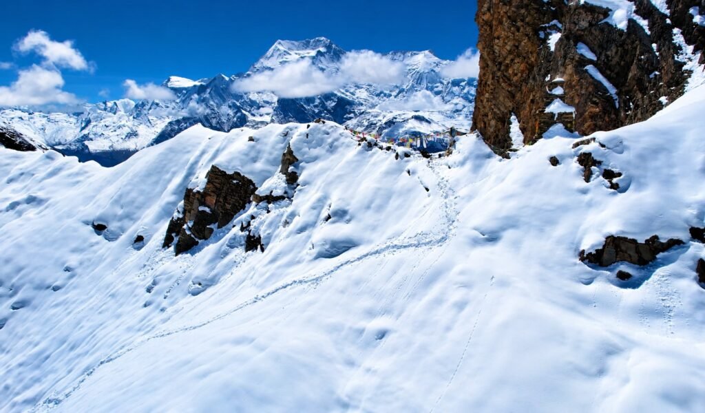
Nar Phu Valley Trek: A Complete Journey into Nepal’s Hidden Himalayan Valley
There are trekking routes in Nepal where the mountains are only one part of the experience. Nar Phu Valley is one of them.
Hidden north of the main Annapurna Circuit in Manang, the valleys of Nar and Phu sit beyond Koto in a landscape of narrow gorges, dry cliffs, high pastures and old stone settlements.
The trail is quieter than Nepal’s most famous trekking routes, the accommodation is simpler, and the villages still feel like places where people live first and receive trekkers second. That is a large part of the appeal.

One of the most rewarding ways to experience Nar Phu is to continue beyond the hidden valley instead of simply retracing the same trail.
The route can cross Kang La at 5,322 m, join the upper Annapurna side around Ngawal and Manang, and then continue over Thorong La at 5,416 m toward Muktinath and Jomsom. That is also the way our 17-day Nar Phu journey is designed.

So although Nar and Phu give the trek its name, the full journey is really a passage through several different versions of the Himalayas, the green Marshyangdi Valley, the dry restricted valleys of Nar Phu, the high country around Manang, the exposed Thorong La crossing and finally the wind-shaped landscape of Mustang.
What makes this version of Nar Phu different?
It combines the restricted Nar Phu Valley with two major Himalayan passes and the upper Annapurna Circuit. You get the cultural depth of Nar and Phu, the high-pass challenge of Kang La and Thorong La, and a finish through Muktinath and Jomsom rather than simply turning around after the hidden valley.
Nar Phu Valley Trek Highlights
| Trek Detail | What to Expect |
|---|---|
| Region | Annapurna / Manang |
| Duration | Around 17 days for the full Kathmandu-to-Kathmandu journey used on our route |
| Highest point | Thorong La – 5,416 m |
| Other major pass | Kang La – 5,322 m |
| Approx. walking distance | Roughly 145–151 km for the full route via Kang La and Thorong La, depending on side walks and exact trail use |
| Difficulty | Challenging high-altitude trek |
| Accommodation | Hotels in Kathmandu/Pokhara and teahouses or lodges during the trek |
| Best seasons | March–May and September–November |
| Restricted area? | Yes. A restricted-area permit and licensed guide are required. |
Distance note: mountain trail distances are approximate. Lodge locations, small route variations, acclimatization walks and GPS tracking can all change the final number slightly.
Where Is Nar Phu Valley?
Nar Phu lies in the northern part of Manang district, inside the wider Annapurna region. The journey initially follows the same mountain corridor used by the Annapurna Circuit, travelling toward Jagat, Dharapani and Koto.
Koto is the important turning point. Instead of remaining on the main Annapurna trail, the route follows the Nar Khola and Phu Khola into the restricted valley.

The change is surprisingly quick. Forested slopes and busier trekking villages give way to narrower gorges, tall rock walls and a drier mountain environment. Settlements become smaller, the trail feels quieter and the landscape begins to show the trans-Himalayan character for which Nar Phu is known.
Nar and Phu were opened to foreign trekking only in the early 2000s, much later than the classic Annapurna routes.
Access is still controlled through Nepal’s restricted-area permit system, which is one reason visitor numbers and tourism infrastructure remain lower than on the main circuit.

Calling Nar Phu a “hidden valley” can sound like travel-marketing language, but in this case the geography really does create that feeling.
You do not see the villages from the main Annapurna trail. You have to leave the busy route, enter a side valley and walk deeper into the mountains before Nar and Phu reveal themselves.
Why Nar Phu Feels Different from the Main Annapurna Circuit
The first difference is the amount of tourism infrastructure. The main Annapurna Circuit has been receiving trekkers for decades, and larger villages can have a surprisingly broad choice of lodges, bakeries, shops, charging and internet services. Nar Phu is simpler.
Once you move beyond Koto, teahouses are fewer and the villages feel much less organised around visitors. That does not mean the area is frozen in time or untouched by the modern world.

People here use phones, travel, trade and adapt like communities everywhere else. But agriculture, livestock, Buddhism and the seasonal rhythm of high-altitude life remain much more visible than tourism.
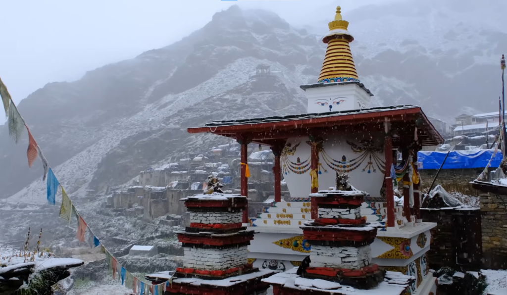
The architecture also changes. In Nar and Phu you see tightly grouped stone houses, flat roofs, prayer flags, mani walls, chortens and monasteries woven into the villages rather than standing apart as isolated attractions.

This is worth remembering while walking through the settlements: Nar and Phu are not open-air museums. They are living communities.
The best way to experience them is to slow down, follow local etiquette and let your guide explain what you are seeing rather than treating every doorway, monastery or resident as a photograph.
From Koto to Meta: Entering the Restricted Valley
The trek begins to feel like Nar Phu after Koto. Koto to Meta is roughly 12 km and 7 to 8 hours on the route we use. It is a substantial day because the trail is not simply covering distance; it is also gaining altitude while moving through narrow mountain terrain.
The trail follows the river through forest and gorge sections, crossing bridges and passing beneath high cliffs. Some stretches feel enclosed by rock, while others suddenly open toward dry slopes and distant snow peaks.

By the time you reach Meta at around 3,650 m, the greener lower valley already feels far away. The landscape is more exposed, the air is noticeably thinner and the sense of remoteness becomes much stronger.
This is also where pacing begins to matter. Moving from Koto at 2,610 m to a sleeping altitude well above 3,500 m is a meaningful gain, so there is little value in racing the trail simply because the distance looks manageable on paper.
Phu Gaon: The Cultural Heart of the Upper Valley
The trail then continues from Meta toward Phu Gaon, which sits at around 4,250 m on the route.
The approach is one of the most memorable parts of the route. The valley repeatedly narrows and opens, old paths run beside cliffs and river gorges, and the dry upper landscape begins to dominate everything around you. Then Phu appears.

The village is compact rather than spread across the valley. Stone and earth-coloured houses sit close together beneath a huge mountain backdrop, and the settlement feels shaped by the terrain itself.
Buddhist culture is visible everywhere: prayer flags, chortens, mani walls, prayer wheels and monasteries remain part of daily village life. Livestock and high-altitude agriculture are equally important.
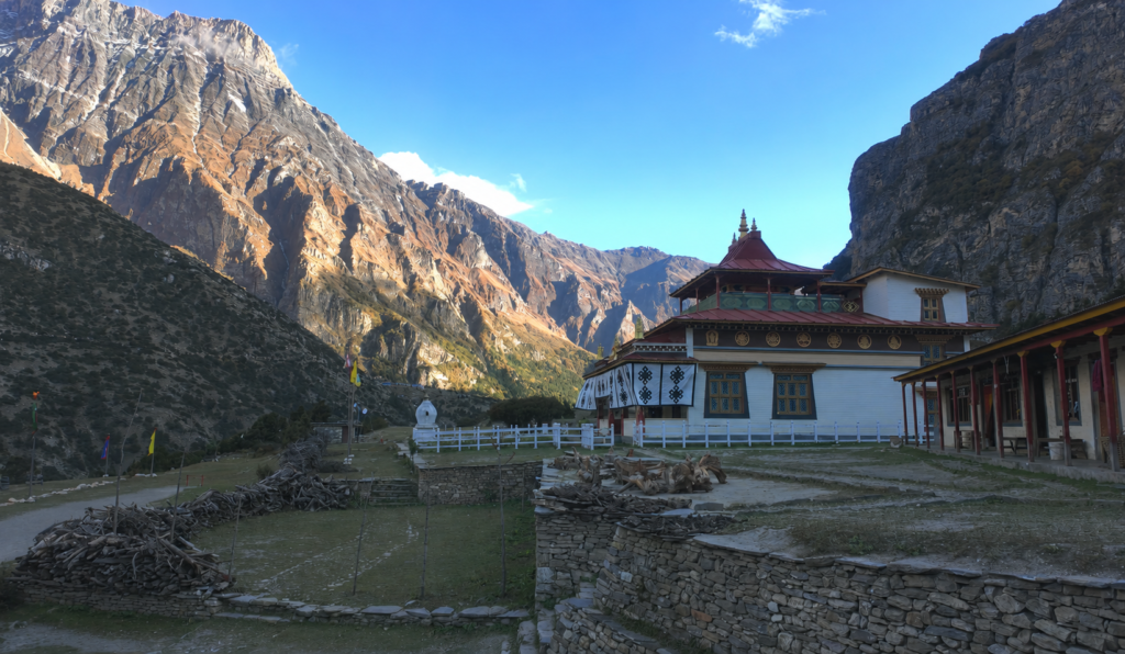
The short growing season and difficult climate have shaped how people build, farm and move through the valley for generations.
Tashi Lhakhang Monastery, above Phu, is one of the best-known religious sites in the valley. Its exact age is described differently by different locals.
So it is safer to think of it simply as a long-established and culturally important monastery rather than reducing its value to one disputed number of years.
Monastery etiquette
Dress respectfully, speak quietly and ask before photographing interiors, religious objects or ceremonies. Around mani walls, chortens and similar Buddhist structures, follow your guide and local custom rather than assuming every site should be approached in the same way.
Nar Village and the Acclimatization Day
From Phu, the route turns back through the upper valley before crossing toward Nar Village at 4,110 m.
Nar feels different from Phu. The surroundings are broader and more open, with stone houses, prayer wheels and monastery structures set against high grazing land and mountain ridges.
Spending an additional day here before Kang La makes a lot of sense. Nar is already above 4,000 m, while the pass rises more than 1,200 vertical metres above the village.

The acclimatization day includes a short walk of roughly 3 to 5 km rather than complete inactivity. The idea is to gain some elevation, return to the village, eat well, rest and give the body another night around 4,100 m before climbing above 5,300 m the following day.
It is also a useful day to explore Nar without arriving exhausted in the evening and leaving again at dawn. There is time to walk through the village, visit local religious sites, organise gear and prepare for an early start.
Do not treat acclimatization as a spare day
Feeling strong at Nar does not guarantee that your body is ready for Kang La. The pass is more than 1,200 vertical metres above the village. A slower day before the crossing is part of the trek, not time taken away from it.
Crossing Kang La Pass to Ngawal
Kang La is the defining mountain day of the Nar Phu section. The crossing from Nar to Ngawal is roughly 14 to 16 km and 7 to 9 hours, reaching 5,322 m at the pass.
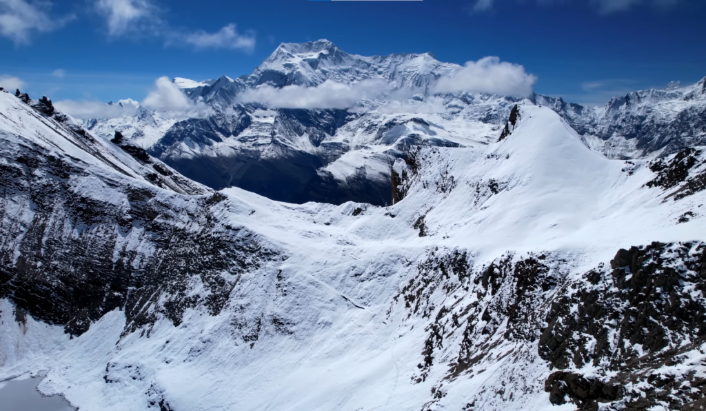
The day normally starts early. The climb leaves the village behind and moves through increasingly open, exposed terrain. As you gain height, the landscape becomes almost entirely about rock, snow, wind and sky.
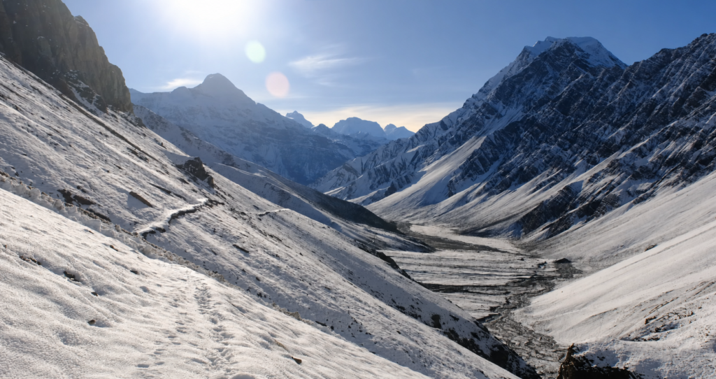
On a clear day, Kang La opens wide views toward the Annapurna side, including peaks around Annapurna II, Gangapurna, Tilicho and the Chulu group, with Manaslu visible from parts of the high route when conditions are clear.
Reaching the pass is only half the work. The descent toward Ngawal is long, and tired legs often make the downhill section feel harder than expected.
When Ngawal finally appears, the change is obvious. You have crossed out of the restricted valley and returned to a more established Annapurna trekking environment. There are more lodges, more services and usually more trekkers on the trail.
Manang, Thorong La and the Second Half of the Trek
One of the strongest parts of this journey is that Kang La does not feel like the end.
From Ngawal, the route continues to Manang at 3,540 m. After the simplicity of Nar and Phu, Manang can feel surprisingly busy. There are more lodges, shops and bakeries, and the village is an important meeting point for trekkers coming from different parts of the Annapurna region.
The easier access to food, charging and other services is welcome, but the trek is still far from finished.
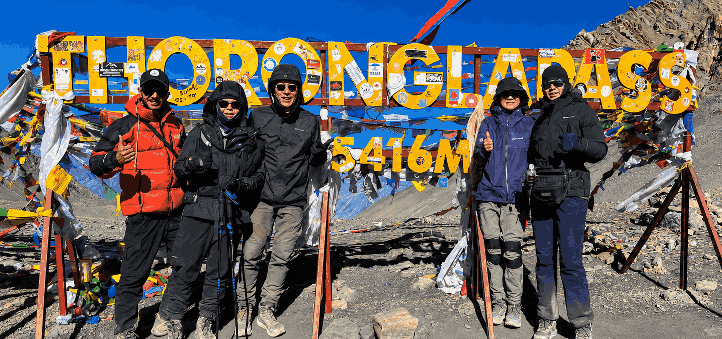
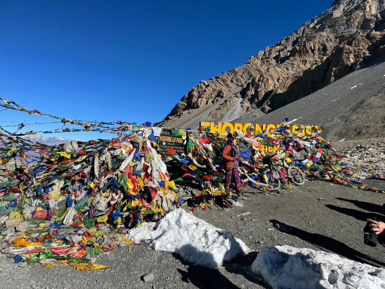
The route climbs next to Yak Kharka at 4,110 m and then Thorong Phedi at 4,600 m. These stages are shorter than the pass days, which helps maintain a gradual rhythm before the second major crossing. Later in the trek comes Thorong La at 5,416 m, the highest point of the entire journey.
Thorong Phedi to Muktinath via the pass is around 19 km and 7 to 9 hours. It is another early start and another day where distance alone does not tell the story. Cold, altitude, wind and the long descent all add to the effort.
Crossing the pass brings you into a completely different landscape. The trail drops toward Muktinath on the Mustang side, where the high alpine terrain gives way to dry hills, eroded cliffs and the broad Kali Gandaki environment.
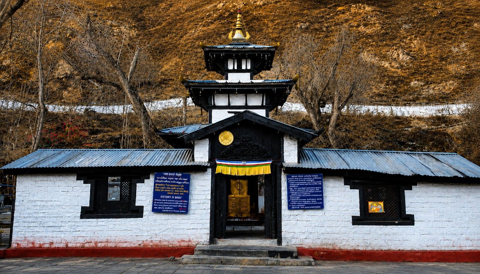
Muktinath also adds a cultural contrast to the trek. After days in small Buddhist mountain villages, you arrive at one of Nepal’s best-known pilgrimage destinations, sacred to both Hindus and Buddhists.
From Muktinath, the trail continues through the Mustang side toward Jomsom, passing through the wider Kali Gandaki corridor before the long walking section comes to an end. A short flight to Pokhara is a convenient way to exit the mountains from here.
A practical note about the Jomsom flight
Flights from mountain airports are weather-dependent. If your trip uses the Jomsom to Pokhara flight, keep some flexibility in your wider Nepal plans in case mountain weather affects the schedule.
How the Nar Phu Route Flows
Nar Phu can be combined with the Annapurna region in different ways. The route described in this guide follows a particularly satisfying line.
Enter the hidden valley through Koto, spend time in Phu and Nar, cross Kang La to Ngawal, continue through Manang and then finish by crossing Thorong La toward Muktinath and Jomsom.
| Section | Route | Why It Matters |
|---|---|---|
| Approach | Jagat → Dharapani → Koto | A gradual transition from the lower Marshyangdi Valley toward the entrance of the restricted area. |
| Hidden valley | Koto → Meta → Phu → Nar | The most remote and culturally distinctive part of the journey. |
| First high pass | Nar → Kang La → Ngawal | The dramatic crossing that reconnects Nar Phu with the upper Annapurna side. |
| Upper Annapurna | Ngawal → Manang → Yak Kharka → Thorong Phedi | A return to the classic Annapurna landscape and a gradual build-up to the second pass. |
| Second high pass and exit | Thorong La → Muktinath → Jomsom | The route crosses into Mustang and finishes in a completely different landscape from where it began. |
Our 17-day Nar Phu trek follows this broader line, but the point of the journey is not the day number attached to each place. What makes it memorable is the progression from one environment to the next.
How Difficult Is the Nar Phu Valley Trek?
Nar Phu with Kang La and Thorong La is a challenging high-altitude trek, and that description is fair.
It is not a technical climbing expedition. On the normal trekking route you are not using ropes, ice screws or mountaineering techniques.
The difficulty comes from something different whch is repeated days on foot, large changes in elevation, rough trail, simple accommodation, cold mornings and two crossings above 5,300 m.

Kang La and Thorong La are the obvious hard days, but they are not the only challenge. The Koto–Meta and Meta–Phu stages happen while the body is still adapting to altitude, and the remote section offers fewer easy comforts than the main Annapurna trail.
A strong trekker who is comfortable walking for several consecutive days has a much better starting point than someone whose preparation is limited to occasional short hikes.
Training should focus on steady cardiovascular endurance, long uphill walking, controlled descents and back-to-back hiking days. If possible, train with the daypack and footwear you intend to use in Nepal.
Altitude adds the uncertainty that fitness alone cannot remove. A very fit person can still develop altitude illness, which is why pacing, hydration, acclimatization and communication with the guide matter as much as physical strength.
Permits and Guide Rules for Nar Phu in 2026
Nar Phu is a restricted trekking area, so the permit situation is different from a normal open trekking route.
For this route, foreign trekkers need the applicable Nar Phu Restricted Area Permit, the Annapurna Conservation Area Permit (ACAP) and the TIMS arrangement required for the Nar Phu–Annapurna Circuit route.
There was an important rule change in March 2026. A foreign traveller no longer needs to find a second foreign trekker simply to qualify for a restricted-area permit. One traveller can now hold the permit.
That change does not make Nar Phu an independent, self-guided trek. The restricted-area permit still has to be arranged through a registered trekking agency and a licensed Nepali guide remains mandatory.
On an organised Nar Phu trek, the agency normally handles the permit process before entry into the restricted area. That removes the need to arrive in Kathmandu and try to organise the paperwork independently.
The restricted area permit for the Nar Phu Valley costs USD 100 per person for the first 7 days during peak season (September to November) and USD 75 per person for the first 7 days during the rest of the year (December to August), with an additional USD 15 per person for each extra day.
What Is Accommodation Like?
Nar Phu is a teahouse trek, but the word “teahouse” covers a wide range of comfort.
The lower Annapurna approach through places such as Jagat, Dharapani and Koto has established trekking lodges with the basic facilities most trekkers expect. Kathmandu and Pokhara, of course, offer normal hotel accommodation before and after the mountain section.
Inside the Nar Phu section, things become more rustic. Rooms are simple, shared bathrooms are common and choices are limited. Meta, Phu and Nar are places where you should value warmth, a meal and a bed more than hotel-style comfort.
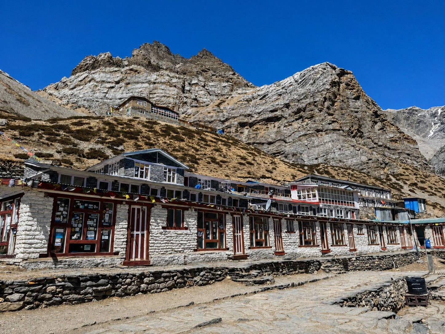
After Kang La, facilities generally improve again around Ngawal and Manang. They become basic once more as you climb to Yak Kharka and Thorong Phedi, then broaden again around Muktinath and Jomsom.
Hot showers, charging and WiFi may be available at some lodges for an additional charge, but none of those services should be treated as guaranteed in the restricted valley or at the highest stops.
Food, Water, Charging and Internet
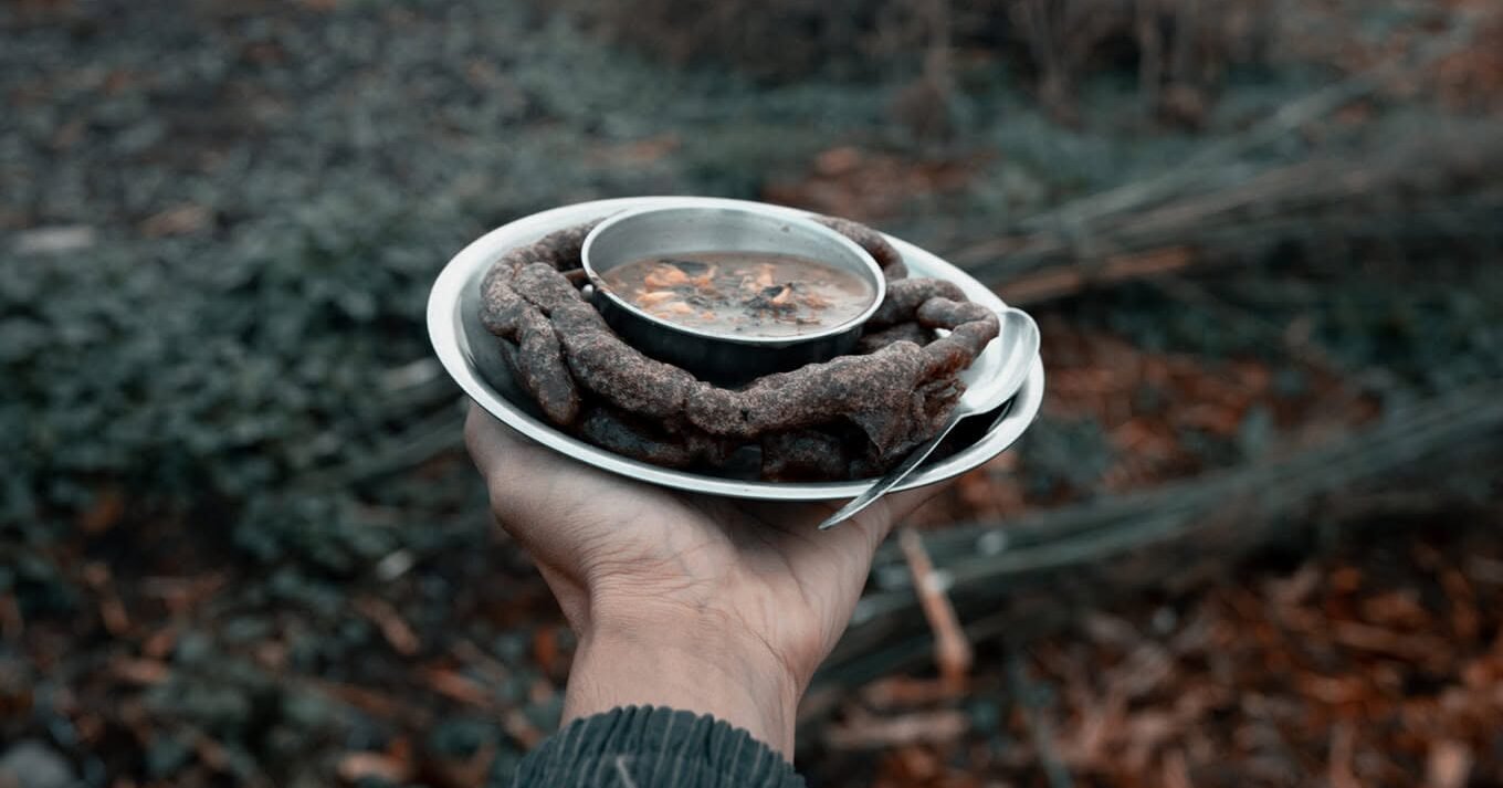
Meals are simple but generally suitable for trekking. Dal bhat, noodles, fried rice, soups, potatoes, eggs, Tibetan-style breads and similar dishes are common choices. Larger villages such as Manang naturally offer more variety than the remote Nar Phu section.
At altitude, the most important thing is not finding a huge menu. It is eating enough, drinking regularly and choosing food your stomach handles well.
Electricity and internet should be viewed in the same way as lodge comfort. They are useful when available, but not something to build the trek around.
A power bank is worth carrying, and important maps, bookings, insurance documents and contact details should be available offline before leaving the stronger network areas.
For drinking water, follow the system used by your guide and lodge. Refillable bottles plus an appropriate purification method are more practical than depending on buying disposable plastic bottles every day.
When Is the Best Time to Trek Nar Phu Valley?
For the complete Nar Phu–Thorong La journey, the most practical seasons are spring from March to May and autumn from September to November.
| Season | What It Is Usually Like | For This Trek |
|---|---|---|
| Spring March–May |
Warmer lower sections, longer days and generally suitable high-pass conditions. | One of the strongest periods for the full route. |
| Summer / Monsoon June–August |
The upper valley sits partly in the rain shadow, but the lower approach, roads and flights can still be affected by monsoon weather. | Possible, but less straightforward for the complete route. |
| Autumn September–November |
Often clearer skies, dry trails and strong mountain visibility after the monsoon. | Another excellent period for Kang La and Thorong La. |
| Winter December–February |
Very cold conditions with a greater chance of snow and difficult pass crossings. | Requires careful condition checks and is not the easiest time for this two-pass route. |
Nar Phu’s drier upper climate sometimes leads people to think the trek is automatically easy during the monsoon. That is too simple. The lower approach, road conditions, two high passes and any mountain flight used at the end can all be affected by weather elsewhere on the journey.
What Should You Pack?
Packing needs to work for both the warmer lower valley and mornings above 5,000 m.
A good layering system is more useful than relying on one huge jacket. You need reliable trekking boots, warm base and mid layers, an insulated jacket, waterproof and windproof outer clothing, gloves, a warm hat, sun protection and comfortable trekking trousers.

Trekking poles are particularly useful on the long descents from Kang La and Thorong La. A headlamp is important because pass days can start before sunrise.
Carry a power bank, refillable water bottles, personal medication, basic foot-care items and offline copies of important travel documents.
Do not pack as though you are going on a climbing expedition. This is a trekking route. But do not pack as though you are staying on a warm low-altitude trail either.
Who Is the Nar Phu Valley Trek Best For?
Nar Phu works best for travellers who enjoy the journey as much as the destination.
If your only goal is to reach one famous viewpoint in the shortest possible time, there are easier treks in Nepal. This route makes more sense for somebody who wants several different landscapes, living mountain villages, Buddhist culture, remote trails and serious high-altitude walking in the same trip.
It is an especially good fit for trekkers who have already completed another multi-day route and now want something quieter and more varied.
A very fit first-time Himalayan trekker can potentially complete it with proper preparation, a sensible pace and good acclimatization, but Nar Phu is not what we would call an easy first trek. The two 5,000-metre passes and the remote section deserve respect.
It is also not the best choice for someone whose priority is luxury accommodation, continuous internet or the ability to change plans independently from day to day. The restricted-area structure and the remote villages make this a more organised mountain journey.
Is the Nar Phu Valley Trek Worth It?
There are easier ways to see the Annapurna range. There are shorter routes to high viewpoints, and there are treks with more comfortable lodges.
Nar Phu is worth the extra effort because the journey keeps changing.
You begin beside the Marshyangdi, leave the main circuit at Koto, walk into a narrow gorge, reach stone villages above 4,000 m, spend time in Nar and Phu, cross Kang La and suddenly return to the open Annapurna landscape. Then the trek asks you to start climbing again.
Manang leads to Yak Kharka and Thorong Phedi, Thorong La carries you into Mustang, Muktinath introduces a completely different religious landscape and Jomsom marks the end of the long walk.
That is what gives the journey a sense of completion. It does not feel like a trek built around one photo stop. It feels like a crossing of the Himalayas.
Frequently Asked Questions About Nar Phu Valley Trek
How long is the Nar Phu Valley Trek?
A full Nar Phu journey that continues over Kang La and Thorong La commonly needs around 17 days when arrival, mountain travel and the return through Pokhara are included. Shorter Nar Phu-only versions also exist.
What is the highest point?
The highest point is Thorong La at 5,416 m. Kang La, crossed earlier in the trek, reaches 5,322 m.
How much walking is involved?
For the full route through Nar Phu, Kang La, Manang and Thorong La, a practical walking estimate is roughly 145–151 km. Actual GPS totals can differ slightly because of lodge locations, side walks and local trail variations.
Do I need a guide for Nar Phu?
Yes. Nar Phu remains a restricted area. The 2026 rule change allows one foreign traveller to obtain a restricted-area permit without a second trekker, but the permit still has to be arranged through a registered agency and a licensed guide remains mandatory.
Which permits are required?
The route requires the applicable Nar Phu Restricted Area Permit, Annapurna Conservation Area Permit and the TIMS arrangement for the Nar Phu–Annapurna Circuit route. When booking through a trekking company, confirm that these are included in the package rather than assuming every operator handles them the same way.
Is Nar Phu harder than a normal Annapurna Circuit trek?
A Nar Phu route that continues over Kang La and Thorong La is especially demanding because it combines the remote valley with two major high-pass crossings. The difficulty comes from the combination of altitude, long days, rugged terrain and two major passes rather than technical climbing.
Can a beginner do the trek?
A well-prepared first-time Himalayan trekker can potentially complete it, but this is not an easy beginner route. Previous multi-day hiking experience, good fitness and realistic expectations are strongly helpful.
When is the best time to go?
The main seasons are March to May and September to November. These periods generally provide the most practical combination of trail conditions, visibility and high-pass access.
What is accommodation like in Nar and Phu?
Expect simple teahouses with basic rooms and commonly shared bathrooms. Facilities are more limited than in Manang or the lower Annapurna villages, which is part of the character of the restricted valley.
Does the trek include both Kang La and Thorong La?
On the route described here, yes. Kang La takes you from Nar toward Ngawal, and Thorong La later carries the journey from the upper Annapurna side toward Muktinath and Mustang.
Planning the Nar Phu Valley Trek?
Nar Phu combines remote Himalayan villages, Tibetan-influenced culture and serious high-altitude trekking. Our 17-day route continues beyond the hidden valley through Kang La, Manang, Thorong La, Muktinath and Jomsom.